
Where Flight Simulation Enthusiasts Gather from Around the World!
AVSIM Library - Search Results

| Category: Flight Simulator X - Scenery | |
| Mesh South America / MeSA B06 |

|
File Description:
FSX Mesh South America Project:
This terrain mesh file is a part of a whole project covering all the Continent of South America and some islands, divided in tiles identified in a map by its column (letters) and rows (numbers).
Those files were multi-LOD compiled from 90m SRTM2 source data, reprocessed with 3DEM to remove voids and spikes, providing a 76.4m (LOD9) horizontal resolution topography intended for use only in FSX updated with SP1.
Although not well documented, to improve performance, the updated FSX loads DEM files in threads and only the closer terrain (about 5-10 NM from the point of view) is rendered in high detail, while at far distances FSX shows up its default low resolution mesh, when there is not a third part terrain mesh compiled in all others intermediate level of details (multi-LOD).
THIS FILE:
FSX_MeSA_B06 (Column B x Row 06)
This file covers the area inside the boundaries:
N = 11º 15' S; S = 16º 52,5' S;
W = 82º 30' W; E = 75º 0' W;
AUTHORS:
Hely Heck Junior - Magrao ( [email protected] )
and Jose Lobo ( [email protected] )
TerraBrasilis: www.terra-brasilis.org
| Filename: | Mesh_South_America__MeSA_B06.zip |
| License: | Freeware |
| Added: | 11th June 2007, 22:10:10 |
| Downloads: | 1,422 |
| Author: | Hely Heck Jr. and José Lôbo |
| Size: | 12.99 MB |
| Category: Flight Simulator X - Scenery | |
| Mesh South America / MeSA D09 |
|
File Description:
FSX Mesh South America Project:
This terrain mesh file is a part of a whole project covering all the Continent
of South America and some islands, divided in tiles identified in a map by its
column (letters) and rows (numbers).
Those files were multi-LOD compiled from 90m SRTM2 source data, reprocessed
with 3DEM to remove voids and spikes, providing a 76.4m (LOD9) horizontal
resolution topography intended for use only in FSX updated with SP1.
Although not well documented, to improve performance, the updated FSX loads DEM
files in threads and only the closer terrain (about 5-10 NM from the point of view)
is rendered in high detail, while at far distances FSX shows up its default low
resolution mesh, when there is not a third part terrain mesh compiled in all
others intermediate level of details (multi-LOD).
THIS FILE:
FSX_MeSA_D09 (Column D x Row 09)
covers the area inside the boundaries:
N = 33º 45' S; S = 39º 22.5' S;
W = 67º 30' W; E = 60º 0' W;
AUTHORS:
Hely Heck Junior - Magrao ( [email protected] )
and Jose Lobo ( [email protected] )
TerraBrasilis: www.terra-brasilis.org
| Filename: | Mesh_South_America__MeSA_D09.zip |
| License: | Freeware |
| Added: | 13th June 2007, 12:36:59 |
| Downloads: | 1,259 |
| Author: | Hely Heck Jr. and José Lôbo |
| Size: | 52.3 MB |
| Category: Flight Simulator X - Scenery | |
| Mesh South America / MeSA D13 |
|
File Description:
FSX Mesh South America Project:
This terrain mesh file is a part of a whole project covering all the Continent
of South America and some islands, divided in tiles identified in a map by its
column (letters) and rows (numbers).
Those files were multi-LOD compiled from 90m SRTM2 source data, reprocessed
with 3DEM to remove voids and spikes, providing a 76.4m (LOD9) horizontal
resolution topography intended for use only in FSX updated with SP1.
Although not well documented, to improve performance, the updated FSX loads DEM
files in threads and only the closer terrain (about 5-10 NM from the point of view)
is rendered in high detail, while at far distances FSX shows up its default low
resolution mesh, when there is not a third part terrain mesh compiled in all
others intermediate level of details (multi-LOD).
THIS FILE:
FSX_MeSA_D13 (Column D x Row 13)
covers the area inside the boundaries:
N = 50º 37.5' S; S = 56º 15' S;
W = 67º 30' W; E = 60º 0' W;
AUTHORS:
Hely Heck Junior - Magrao ( [email protected] )
and Jose Lobo ( [email protected] )
TerraBrasilis: www.terra-brasilis.org
| Filename: | Mesh_South_America__MeSA_D13.zip |
| License: | Freeware |
| Added: | 13th June 2007, 16:38:14 |
| Downloads: | 1,124 |
| Author: | Hely Heck Jr. and José Lôbo |
| Size: | 4.79 MB |
| Category: Flight Simulator X - Scenery | |
| Mesh South America / MeSA D12 |
|
File Description:
FSX Mesh South America Project:
This terrain mesh file is a part of a whole project covering all the Continent
of South America and some islands, divided in tiles identified in a map by its
column (letters) and rows (numbers).
Those files were multi-LOD compiled from 90m SRTM2 source data, reprocessed
with 3DEM to remove voids and spikes, providing a 76.4m (LOD9) horizontal
resolution topography intended for use only in FSX updated with SP1.
Although not well documented, to improve performance, the updated FSX loads DEM
files in threads and only the closer terrain (about 5-10 NM from the point of view)
is rendered in high detail, while at far distances FSX shows up its default low
resolution mesh, when there is not a third part terrain mesh compiled in all
others intermediate level of details (multi-LOD).
THIS FILE:
FSX_MeSA_D12 (Column D x Row 12)
covers the area inside the boundaries:
N = 45º 0' S; S = 50º 37.5' S;
W = 67º 30' W; E = 60º 0' W;
AUTHORS:
Hely Heck Junior - Magrao ( [email protected] )
and Jose Lobo ( [email protected] )
TerraBrasilis: www.terra-brasilis.org
| Filename: | Mesh_South_America__MeSA_D12.zip |
| License: | Freeware |
| Added: | 13th June 2007, 15:28:04 |
| Downloads: | 1,146 |
| Author: | Hely Heck Jr. and José Lôbo |
| Size: | 5.54 MB |
| Category: Flight Simulator X - Scenery | |
| Mesh South America / MeSA A02 |
|
File Description:
FSX Mesh South America Project:
This terrain mesh file is a part of a whole project covering all the Continent of South America and some islands, divided in tiles identified in a map by its column (letters) and rows (numbers).
Those files were multi-LOD compiled from 90m SRTM2 source data, reprocessed with 3DEM to remove voids and spikes, providing a 76.4m (LOD9) horizontal resolution topography intended for use only in FSX updated with SP1.
Although not well documented, to improve performance, the updated FSX loads DEM files in threads and only the closer terrain (about 5 NM from the point of view) is rendered in high detail, while at far distances FSX shows up its default low resolution mesh, when there is not a third part terrain mesh compiled in all others intermediate level of details (multi-LOD).
THIS FILE:
FSX_MeSA_A02
Column A x Row 02
This file covers the area inside the boundaries:
N = 11º 15' N; S = 5º 37,5' N;
W = 90º 0' W; E = 82º 30' W;
AUTHORS:
Hely Heck Junior - Magrao ( [email protected] )
and Jose Lobo ( [email protected] )
TerraBrasilis: www.terra-brasilis.org
| Filename: | Mesh_South_America__MeSA_A02.zip |
| License: | Freeware |
| Added: | 11th June 2007, 00:02:15 |
| Downloads: | 1,592 |
| Author: | Hely Heck Jr. and José Lôbo |
| Size: | 10.95 MB |
| Category: Flight Simulator 2004 - Scenery | |
| Camden Field in Trinidad |
|
File Description:
Camden Field was once a wartime American airfield, which shows up in the wide east-west runway that has more recently been partly resurfaced. There are no runway markings beyond a centre line, and it just sort of tapers off at the sides and the eastern end into the bush. In contrast to the renovated hangar to the north of the western end of the runway the buildings to the south haven't been touched by any recent tender-loving-care. There is a wonderful patched-together shed and a small control tower, which was built on the edge of the existing runway. This makes it appear rather close to the edge of the resurfaced runway area. Do not be fooled, this is not an illusion; it IS close to the edge of the runway. Just take comfort in the thought that the prevailing southeast winds (for much of the year) will tend to blow you away from it as you approach for a landing from the west. And I kept the pre-renovation version of the old hangar when I found some old pics of the crop dusting operation from five years ago.
| Filename: | Camden_Field_in_Trinidad.zip |
| License: | Freeware |
| Added: | 14th December 2008, 01:32:05 |
| Downloads: | 536 |
| Author: | Roger Wensley |
| Size: | 2.73 MB |
| Category: Flight Simulator X - Scenery | |
| NZWV - Waihi Beach Airfield, New Zealand |
|
Images related to this file:
File Description:
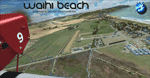
Waihi Beach (ICAO: NZWV) is a small airstrip north of Tauranga and near the small beach settlement of the same name, in the Bay of Plenty of New Zealand. It is a grass strip with offset thresholds giving usable landing lengths of 640m and 517m for RWY 13 and 31 respectively, a width of 55m and a group rating of 5. No night lighting or fuel is available. A very basic airstrip, there is only one recently built hanger and the airstrip is slowly being encroached on by
new housing developments. The airstrip itself is usually very sodden due to its low elevation but is a nice stop over for sightseeing from Tauranga and up the Coromandel peninsula.
The FSX model includes custom textures and models placed on a high resolution aerial image and a 15m mesh. It makes extensive use of items from the free VLC object libraries which are required to be installed (Available from www.vectorlandclass.co.nz Downloads menu). This scenery and
the VLC libraries have been funded by sales of VectorLandClass and although you do not need VLC to use it, your purchase helps further development.
| Filename: | NZWV__Waihi_Beach_Airfield_New_Zealand.zip |
| License: | Freeware, limited distribution |
| Added: | 1st November 2012, 10:01:38 |
| Downloads: | 1,006 |
| Author: | Tim Barnes / VectorLandClass |
| Size: | 11.13 MB |
| Category: Flight Simulator X - Missions | |
| Lindbergh's Flight to Paris |
|
File Description:
Mission: Lindbergh's flight across the Atlantic for FSX. I got inspired by watching the movie "The Spirit of St Louis" with James Stewart. Good movie. When FS9 was released, many historical aircraft were released along with it. Many of these aircraft were flown manually with no autopilot or way to speed up the flight process. No one was going to sit at the computer for 34 hours to fly to Paris in the Spirit of St Louis. The Spirit is still difficult to fly because of the weight of the fuel. I have provided the necessary panel.cfg and aircraft.cfg along with this mission to make it easier to cross the Atlantic. In order to have the full affect you will need some additional files which are not provided with this package. They are provided in other packages as well as some payware packages. You will need the Roosevelt field scenery from AVSIM ( http://library.avsim.net/download.php?DLID=54574). You will need the Spirit of St Louis from FS9 with the attached upgraded panel.cfg and aircraft.cfg. You should have the simicons1024 package in your gauges directory. You should have the concord gauges in your gauges directory. (concord.gau)
.
| Filename: | Lindberghs_Flight_to_Paris.zip |
| License: | Freeware |
| Added: | 28th April 2007, 21:47:59 |
| Downloads: | 1,796 |
| Author: | William K. Jibby |
| Size: | 1.44 MB |
| Category: Flight Simulator X - Scenery | |
| Chicago Midway Airport V2 |
|
File Description:
This is my second version of Chicago Midway Airport in Chicago IL for FSX. This version was created with Airport Design Editor 1.30, which was designed exclusively for use with FSX. The following improvements have been made: 1. All commercial and GA aircraft will park at their assigned spots. All gates for all airlines are included. 2. The vehicle paths have been redesigned, which should eliminate the problem of airport vehicles using taxiways, which can cause taxiing airplanes to come to a standstill and cause traffic to back up. 3. When in tower view, the view will be from the roof of the control tower, thanks to Airport Design Editor. 4. Crosswind runways have been activated, which will open more runways to airline traffic. This is an optional feature, and will be explained in the Readme file. 5. Several fuel trucks have been added, and should serve departing aircraft quickly. 6. Settings have been changed in ADE so that all jetways will display as long as Scenery Density in FSX is set at Normal or higher. Please be aware that this scenery is for use with FSX only. It will not work with FS9.
| Filename: | Chicago_Midway_Airport__V2.zip |
| License: | Freeware, limited distribution |
| Added: | 30th June 2008, 08:50:03 |
| Downloads: | 4,811 |
| Author: | Patrick Finch |
| Size: | 39.13 KB |
| Category: Flight Simulator X - AI Flight Plans | |
| Mount Everest Expedition |
|
File Description:
Two flightplans for an expedition to Mount Everest (8852 m). The first flightplan takes you from Lukla (VNLK) airfield at 10000 ft to Mount Everest Climb North: Base Camp. A distance of about 40 km. The recommended inbuilt aircraft for this trip is the "Maule Orion on skis". Be aware that you must climb to about 15000 ft before entering the GPS-path. Also, you should try to land across the slope. Otherwise it could be difficult to stop the aircraft from skiing down the inclined ground!
The second flightplan takes you from Base Camp to Yak Camp* (at about 19000 ft MSL) sitting at a bend of the East Rongbuk Glacier. This is the first camp on the North Route. You should use a helicopter able to climb to about 20000 ft for this route. For example, the inbuilt Bell 206B JetRanger. Though, it will indeed be a challenge with this aircraft!
*= It is called the Yak Camp because it is the point at which the yak herders overnight their yaks on the route up to Advance Base Camp (ABC) at 21300 ft.
| Filename: | Mount_Everest_Expedition.zip |
| License: | Freeware |
| Added: | 1st May 2007, 23:20:13 |
| Downloads: | 1,671 |
| Author: | Ulf Norlinger |
| Size: | 127.04 KB |


© 2001-2026 AVSIM Online
All Rights Reserved
Privacy Policy |