
Where Flight Simulation Enthusiasts Gather from Around the World!
AVSIM Library - Search Results

| Category: Flight Simulator 2002 - AFCAD Files | |
| EDDF Run & Taxiways for Airport 2000 v1 (AFCAD) |

|
File Description:
Provides accurate run and taxiways for Frankfurt Main/Germany (EDDF).
For specific use with Airport 2000 V1 by Wilco Publishing.
Also includes an FSSE (LAGO) enhancement file for EDDF, to make the airport come alive.
Again this will only work correctly with Airport 2000.
| Filename: | EDDF_Run__Taxiways_for_Airport_2000_v1_AFCAD.zip |
| License: | Freeware |
| Added: | 7th October 2002, 22:18:59 |
| Downloads: | 650 |
| Author: | J. Both |
| Size: | 18.17 KB |
| Category: Fly! II - Scenery | |
| Homer Airport (PAHO) |
|
File Description:
TerraModels Scenery Development System by Allen Kriesman and Biber Salsa models were used to create the scenery for Homer Airport (PAHO), Alaska. The taxiways were added by Pieter Miller. The FAA ID for this airport is HOM. No custom models were created for this airport.
| Filename: | Homer_Airport_PAHO.zip |
| License: | Freeware |
| Added: | 10th December 2003, 04:49:49 |
| Downloads: | 105 |
| Author: | Wayne Roberts |
| Size: | 88.12 KB |
| Category: Fly! II - Scenery | |
| Ketchikan International Airport (PAKT) |
|
File Description:
TerraModels Scenery Development System by Allen Kriesman and Biber Salsa models were used to create the scenery for Ketchikan International Airport (PAKT), Alaska. The taxiways were by Pieter Miller. The FAA ID for this airport is KTN. No custom models were created for this airport.
| Filename: | Ketchikan_International_Airport_PAKT.zip |
| License: | Freeware |
| Added: | 11th December 2003, 01:15:44 |
| Downloads: | 145 |
| Author: | Wayne Roberts |
| Size: | 28.37 KB |
| Category: Flight Simulator 2004 - Scenery | |
| Maputo International Airport (FQMA) V1 |
|
Images related to this file:
File Description:
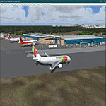
Thanks for downloading Maputo International Airport V1. This is Main International Airport of The Republic of Mozambique. The Airport scenery was built from Sketchup, Instant Scenery,tropical trees macros by Gerrish Gray, SBUILDER and ADE. Needs RWY12 Object library for objects. . See README for install.
| Filename: | Maputo_International_Airport_FQMA_V1.zip |
| License: | Freeware |
| Added: | 12th July 2021, 05:07:00 |
| Downloads: | 636 |
| Author: | Emmanuel Mwandosya |
| Size: | 23.29 MB |
| Category: Flight Simulator X - Scenery | |
| Santa Lucia airport (MMSM) in Mexico |
|
Images related to this file:
File Description:
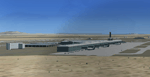
Santa Lucia airport is a new facility serving Mexico City, opened in 2022. The FSX scenery of this airport was built with the Airport Design Editor program, based on satellite images from Google Earth and on actual Jeppesen charts. The buildings are made with GMAX.
| Filename: | Santa_Lucia_airport_MMSM_in_Mexico.zip |
| License: | Freeware |
| Added: | 23rd December 2022, 21:34:40 |
| Downloads: | 766 |
| Author: | Winfried Orthmann |
| Size: | 5.49 MB |
| Category: Flight Simulator 2004 - Scenery | |
| Guaymaral Airport SKGY 2011 |
|
File Description:
Guaymaral Airport (IATA: GAA, ICAO: SKGY) is an airport located in Bogota, Colombia, in the area from which its name was taken, which is located to the north-west of the city, and limits with the towns of Cota and Chia. The airport handles primarily general aviation traffic, type A and B, only VFR. It's the base for private and commercial pilot training schools like Aeroandes and Aeroclub de Colombia.
This file has the right coordinates, with the apron and characteristics of the airport. The runways were reoriented to the correct direction, runway were resized the gates placed on correct location, Colombia National Police was
assigned a correct apron. All the airport charts required to navigate in and out of this airport which are courtesy of: Areonatica Civil de Colombia can be found at www.aerocivil.gov.co/ under Informacion Aeronautica click AIP; on AIP
click Aerodromos then click at SKGY.
| Filename: | Guaymaral_Airport__SKGY_2011.zip |
| License: | Freeware |
| Added: | 6th November 2011, 21:14:52 |
| Downloads: | 565 |
| Author: | Anwar Gonzalez |
| Size: | 12.07 KB |
| Category: Flight Simulator X - Scenery | |
| Guaymaral Airport SKGY 2011 |
|
File Description:
Guaymaral Airport (IATA: GAA, ICAO: SKGY) is an airport located in Bogota, Colombia, in the area from which its name was taken, which is located to the north-west of the city, and limits with the towns of Cota and Chia. The airport
handles primarily general aviation traffic, type A and B, only VFR. It's the base for private and commercial pilot training schools like Aeroandes and Aeroclub de Colombia.
This file has the right coordinates, with the apron and characteristics of the airport. The runways were reoriented to the correct direction, runway were resized the gates placed on correct location, Colombia National Police was assigned a correct apron. All the airport charts required to navigate in and out of this airport which are courtesy of: Areonatica Civil de Colombia can be found at www.aerocivil.gov.co/ under Informacion Aeronautica click AIP; on AIP click Aerodromos then click at SKGY.
| Filename: | Guaymaral_Airport__SKGY_2011.zip |
| License: | Freeware |
| Added: | 6th November 2011, 21:15:42 |
| Downloads: | 1,773 |
| Author: | Anwar Gonzalez |
| Size: | 12.06 KB |
| Category: Flight Simulator X - AFCAD Files | |
| MZBZ - Philip S. W. Goldson International Airport / Belize City, Belize (v2.0) |
|
Images related to this file:
File Description:
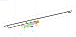
This airport update was made with the latest version of ADE (Airport Design Editor) and made for FSX as a replacement for the stock (default) airport. I've made several changes to the airport which are listed below. All these enchancements are as close to the real airport as I can get with stock library objects. I've used satellite images, terminal photos and maps throughout the whole process so building locations are as accurate as possible. Happy landings in Belize, scuba diving heaven!
Features:
*Expanded parking apron
*Terminal building with parking for commercial aircraft
*Assigned parking for Maya Island Air flights
*Ramp extension construction
*Runway 7/25 expanded to 9,695ft
*Taxiway corrections
*Autogen exclusion for trees that occupy field in stock scenery (no other files needed)
*Palm trees and vegetation
*Airport hangars and static aircraft
*Airport vehicles and objects
*Parking lot with static vehicles
*Birds in proximity to airfield
(For more information on Endeavourai please visit our site at endeavourai.com or our forums at http://endeavourai.boards.net/)
| Filename: | MZBZ__Philip_S_W_Goldson_International_Airport__Be.zip |
| License: | Freeware |
| Added: | 21st August 2012, 23:13:12 |
| Downloads: | 1,176 |
| Author: | Jaison Diaz / Endeavour ai |
| Size: | 96.25 KB |
| Category: Flight Simulator X - Scenery | |
| KVC - King Cove Airport - Alaska, USA |
|
Images related to this file:
File Description:
King Cove Airport (IATA: KVC, ICAO: PAVC, FAA LID: KVC) is a state-owned public-use airport located four miles (6 km) northeast of the central business district of King Cove, a city in the Aleutians East Borough of the U.S. state of Alaska.
King Cove Airport has one runway (7/25) with a gravel surface measuring 3,500 x 75 ft. (1,067 x 23 m). For the 12-month period ending December 31, 2005, the airport had 1,030 aircraft operations: 71% air taxi and 29% general aviation.
Changes: Increased parking apron and turn arounds at both ends of the runway. Also added additional parking and custom models. Changes were based on 2014 construction plans.Created with Airport Design Editor 9x by ScruffyDuck Software using current FAA documentation and Google Earth measurements, this package offers a replacement for FSX's stock airport. All these enhancements are as close to the real airport as I can get with stock library objects and custom buildings.
| Filename: | KVC__King_Cove_Airport__Alaska_USA.zip |
| License: | Freeware |
| Added: | 20th December 2014, 00:02:03 |
| Downloads: | 850 |
| Author: | Wayne Roberts |
| Size: | 446.46 KB |
| Category: Flight Simulator 2004 - Scenery | |
| Lucknow Airport, India [ VILK ] |
|
Images related to this file:
File Description:
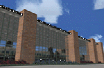
Lucknow,also Famous as 'City of Nawabs' and is capital of Uttar Pradesh,also called a political Sate of India. The Airport is 230 Nm SE of new Delhi.From previous experience I've learned a great deal of file size management to yield maximum frame rate.Now this Airport has a new Apron , which is actually not new, but lets call it new .i.e. 4-6 years old along with Taxiway Delta and echo.I just Found that theirs are no resources available in our virtual aviation community that has information in any form for this Airport scenery, afcads/afxs This ironically 'new' apron and taxiway is why,this airport has been developed.The airport has ADVANCED hanger....and many other things that will make you fly for at least one time in/out of this Place. The airport name is 'Chaudhary Charan Singh Airport" and has all basic navigational tools with CAT II ILS .how about some pics ? ..........will work in FSX.
| Filename: | Lucknow_Airport_India__VILK_.zip |
| License: | Freeware |
| Added: | 16th August 2010, 20:49:50 |
| Downloads: | 1,552 |
| Author: | Ashish Singh |
| Size: | 23.85 MB |


© 2001-2026 AVSIM Online
All Rights Reserved
Privacy Policy |