
Where Flight Simulation Enthusiasts Gather from Around the World!
AVSIM Library - Search Results

| Category: Flight Simulator X - Scenery | |
| Shahjalal International Airport (Zia) v1.1 |

|
Images related to this file:
File Description:
Updates and Fixed Issues:
**The "VGZR_ADEX_FSX.bgl" is re-edited;
**Some other minor bugs where fixed.
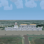
The biggest Shahjalal International Airport (Zia). Meticulously detailed and realistically depicted Flight Simulator X scenery for Shahjalal International Airport (Zia). Created with 3ds max from scratch, the scenery includes accurate buildings, hangars, parking bays, night texturing and illumination effects. The scenery contains variety of static aircraft and animations and photo real terrain texture. This a complete scenery for FSX. The ZIA_Shahjalal International Airport is the busiest airport in Bangladesh and provides access to 4,6 Mio. million passengers a year.
| Filename: | Shahjalal_International_Airport_Zia_v11.zip |
| License: | Freeware |
| Added: | 8th January 2012, 07:38:28 |
| Downloads: | 4,620 |
| Author: | Huseyin Buharali |
| Size: | 14.01 MB |
| Category: Flight Simulator 2004 - Scenery | |
| Julius Nyerere International Airport (HTDA) V1.1 |
|
Images related to this file:
File Description:
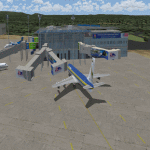
Update to my "julius_nyerere_international_airport_v1" which had some errors in the static objects and other Afcad issues, Delete old version and use this one.
Julius Nyerere International Airport (HTDA) is the largest Airport in Tanzania. It was formerly called Dar-es-salaam International Airport. I used sketchup to build the scenery and ADE v1.70 for the afcad and object positioning.The scenery consists of Terminal 2 (Main International and Domestic terminal) and Terminal 1 which is the old colonial airport now used as the VIP/ General Aviation Domestic Terminal). The scenery utilizes accurate parking positions based on current charts. Hope you enjoy.
| Filename: | Julius_Nyerere_International_Airport_HTDA_V11.zip |
| License: | Freeware |
| Added: | 1st January 2018, 03:11:58 |
| Downloads: | 689 |
| Author: | Emmanuel Mwandosya |
| Size: | 31.76 MB |
| Category: Flight Simulator X - Scenery | |
| SKOC Aguas Claras Airport |
|
File Description:
SKOC
Aguas Claras Airport (Spanish: Aeropuerto Aguas Claras) (IATA: OCV, ICAO: SKOC) is an airport serving Oca�±a, a municipality of the Norte de Santander Department of Colombia.
This file has the right coordenates, with the apron and characteristics of the airport.
| Filename: | SKOC_Aguas_Claras_Airport.zip |
| License: | Freeware |
| Added: | 6th February 2011, 01:59:55 |
| Downloads: | 976 |
| Author: | Anwar Gonzalez |
| Size: | 3.55 KB |
| Category: Prepar3D V1-4 - Scenery | |
| Fort Wayne International Airport (KFWA) |
|
Images related to this file:
File Description:
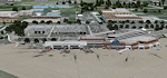
Detailed scenery of Fort Wayne International Airport, Indiana, USA. This is a regional airport served by most of the US major airlines or their feeders. The airport is also home to the USAF Indiana ANG 122nd Fighter Wing and numerous GA/Bizjets (P3DV3 version).
| Filename: | Fort_Wayne_International_Airport_KFWA.zip |
| License: | Freeware, limited distribution |
| Added: | 8th April 2017, 18:04:16 |
| Downloads: | 1,212 |
| Author: | Shehryar Ansari |
| Size: | 215.86 MB |
| Category: Prepar3D V1-4 - AFCAD Files | |
| Vladivostok International Airport Russia UHWW |
|
File Description:
This is an update to the default Vladivostok Airport in Russia's Far East (UHWW). Includes new terminal updated taxiways etc. Looks very nice with the Rex Worldwide Airport HD, but not required. Buildings and objects located in the same locations as the real airport. Enjoy!
| Filename: | Vladivostok_International_Airport_Russia_UHWW.zip |
| License: | Freeware |
| Added: | 7th February 2020, 17:33:28 |
| Downloads: | 573 |
| Author: | Wendell Melton |
| Size: | 17.02 MB |
| Category: Flight Simulator 2004 - Scenery | |
| Salida, Colorado - Harriet Alexander Field - KANK |
|
File Description:
The airport has been very a little change airport but the airport code has been revised from 0V2. Now, KANK is a new code. The two scenery enclosed KANK and 0V2. If without 0V2 ADE9 will cause view overlap from stock 0V2 old ones.
| Filename: | Salida_Colorado__Harriet_Alexander_Field__KANK.zip |
| License: | Freeware |
| Added: | 24th June 2020, 18:02:25 |
| Downloads: | 125 |
| Author: | Stuart John Gilbert II |
| Size: | 3.86 MB |
| Category: Fly! II - Miscellaneous Files | |
| KMIA to KATL Flight Plan |
|
File Description:
This flight plan is from the Miami International Airport (KMIA) to the Atlanta International Airport (KATL). Included are waypoints, navaids and arrival plates. The flight plan is 518 NM. Also included is a metar file. Web links are provided to download the airport diagrams.
| Filename: | KMIA_to_KATL_Flight_Plan.zip |
| License: | Freeware |
| Added: | 4th December 2004, 05:19:57 |
| Downloads: | 417 |
| Author: | Wayne Roberts |
| Size: | 376.43 KB |
| Category: Fly! II - Miscellaneous Files | |
| KRIC to KCLT Flight Plan |
|
File Description:
This flight plan is from the Richmond International Airport (KRIC) to the Charlotte/Douglas Airport (KCLT). Included are waypoints, navaids and arrival plate. The flight plan is 243 NM. Also included is a metar file. Web links are provided to download the airport diagrams.
| Filename: | KRIC_to_KCLT_Flight_Plan.zip |
| License: | Freeware |
| Added: | 26th December 2004, 04:46:39 |
| Downloads: | 64 |
| Author: | Wayne Roberts |
| Size: | 342.3 KB |
| Category: Fly! II - Miscellaneous Files | |
| KSEA to CYEG Flight Plan |
|
File Description:
This flight plan is from the Seattle-Tacoma International Airport (KSEA) to the Edmonton International Airport in Canada (CYEG). Included are waypoints and navaids. The flight plan is 488 NM. Also included is a metar file . Web links are provided to download the airport diagrams.
| Filename: | KSEA_to_CYEG_Flight_Plan.zip |
| License: | Freeware |
| Added: | 9th January 2005, 04:21:13 |
| Downloads: | 280 |
| Author: | Wayne Roberts |
| Size: | 13.44 KB |
| Category: Fly! II - Miscellaneous Files | |
| KBOS to KMVY Flight Plan |
|
File Description:
This flight plan is from the General Edward Lawrence Logan International Airport (KBOS) to the Martha's Vineyard Airport (KLAS). Included are waypoints and navaids. The flight plan is 65 NM. Also included is a metar file . Web links are provided to download the airport diagrams.
| Filename: | KBOS_to_KMVY_Flight_Plan.zip |
| License: | Freeware |
| Added: | 5th February 2005, 14:21:59 |
| Downloads: | 62 |
| Author: | Wayne Roberts |
| Size: | 12.23 KB |


© 2001-2026 AVSIM Online
All Rights Reserved
Privacy Policy |