
Where Flight Simulation Enthusiasts Gather from Around the World!
AVSIM Library - Search Results

| Category: Flight Simulator 2004 - Scenery | |
| FMEE Roland Garros and Reunion Island for FS2004 |

|
Images related to this file:
File Description:
Roland Garros Airport (ICAO: FMEE) is the principal airport of the French Overseas Region of Reunion Island. This scenery is a representation of the airport for FS2004, and integrated into a scenery for the entire Reunion island by France VFR. The combination of FMEE airport and Reunion Island is by permission of France VFR. Conditions of use of this scenery package are contained in the Release Notes. The starting point of FMEE airport scenery is the FS2002 FMEE scenery by Yannick Mille. Static aircraft in this scenery are courtesy of David Rawlins. Some GSE models used in this scenery are by permission of Harry Urben.
This is an update to the FMEE scenery previously released. Some minor revisions are included to the airport scenery in addition to the integration with Reunion Island.
| Filename: | FMEE_Roland_Garros_and_Reunion_Island_for_FS2004.zip |
| License: | Freeware, limited distribution |
| Added: | 31st July 2022, 17:21:37 |
| Downloads: | 856 |
| Author: | Gregory Putz / France VFR |
| Size: | 109.28 MB |
| Category: Flight Simulator X - Scenery | |
| Southern California Navy Outlying Fields |
|
File Description:
Two unique WWII-era Navy outlying fields.
Hourglass Field:
This is a very simple representation of a satellite field of Kearny NAAS, later Miramar NAS. Hourglass field was originally built in the 1930s and was retained by the navy until 1962 when the site was sold to the San Diego Community College district.
Miramar Community College was built on the site in 1967.
The site was popular with drag racers during the 1950s.
Mile Square:
This is a very simple representation of what was originally a satellite field of Los Alamitos NAAS during WWII and the 1950s and was later reassigned as a helicopter practice field to Tustin MCAS, until it was abandoned in the 1980s.
The airfield was covered by a golf course in the early 2000s.
| Filename: | Southern_California_Navy_Outlying_Fields.zip |
| License: | Freeware |
| Added: | 17th December 2023, 20:00:45 |
| Downloads: | 35 |
| Author: | Aris Lazerson |
| Size: | 535.85 KB |
| Category: Prepar3D V5 - AI Aircraft | |
| AI Mexicana Link Conexion Aerea AIM Embraer ERJ-145LR XA-AFH |
|
Images related to this file:
File Description:

This is the Newest mexican airlines, Mexicana Link Conexion Aerea Aerea, "AerolÃnea del Estado Mexicano", leased from TAR Airlines, this is the Embraer ERJ-145LR were from TAR Airlines, with the next registration: XA-AFH. Because the certifications have another aircraft leased from TAR Aerolineas (Transportes Aereos Regionales) a Embraer ERJ-145 with the registration XA-VGQ. For the 100th Anniversary I´ll upload all the fleet, since 1940´s with the DC-2 to the last fleet that had when it flies, the Mark and Airline still exists, BUT It doesn´t fly since 2011. The model is AI Malcontent (AIM) Embraer ERJ-145 Basepack. This is my website: https://el-mundo-de-los-aviones-ai-traffic.jimdosite.com. I you hope enjoy it!.
P3Dv1-5, FSX, and FS2004 compatible
| Filename: | AI_Mexicana_Link_Conexion_Aerea_AIM_Embraer_ERJ145.zip |
| License: | Freeware |
| Added: | 30th December 2023, 23:52:55 |
| Downloads: | 47 |
| Author: | Jesús Gibran Soriano Solleiro |
| Size: | 6.8 MB |
| Category: Prepar3D V5 - AI Aircraft | |
| AI Mexicana Link Conexion Aerea AIM Embraer ERJ-145EP XA-VGQ |
|
Images related to this file:
File Description:
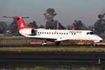
This is the Newest mexican airlines, Mexicana Link Conexion Aerea Aerea, "AerolÃnea del Estado Mexicano", leased from TAR Airlines, this is the Embraer ERJ-145EP were from TAR Airlines, with the next registration: XA-VGQ. Because the certifications have another aircraft leased from TAR Aerolineas (Transportes Aereos Regionales) a Embraer ERJ-145 with the registration XA-AFH. For the 100th Anniversary I´ll upload all the fleet, since 1940´s with the DC-2 to the last fleet that had when it flies, the Mark and Airline still exists, BUT It doesn´t fly since 2011. The model is AI Malcontent (AIM) Embraer ERJ-145 Basepack. This is my website: https://el-mundo-de-los-aviones-ai-traffic.jimdosite.com. I you hope enjoy it!. P3Dv1-5, FSX, and FS2004 compatible
| Filename: | AI_Mexicana_Link_Conexion_Aerea_AIM_Embraer_ERJ145.zip |
| License: | Freeware |
| Added: | 2nd January 2024, 19:30:35 |
| Downloads: | 66 |
| Author: | Jesús Gibran Soriano Solleiro |
| Size: | 6.82 MB |
| Category: Microsoft Flight Simulator (2020) - Aircraft Repaints, Textures and Modifications | |
| Supermarine Spitfire Mk.IX (N74138) US Air Attaché |
|
Images related to this file:
File Description:
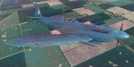
This folder contains a repaint for the Spitfire Mk.IX by FlyingIron, in the colors of Spitfire PR.XI (PL983) N74138. It originally flew with the RAF as a reconaissance aircraft, but in 1948 was given to the US Air Attaché in London, Tony Satterthwaite, as his personal aircraft. It received the US civil registration N74138. He often let Lettice Curtis fly his aircraft, and she used it in 1948 to take part in an air race with #4. Lettice Curtis was one of the first women to fly with the ATA, the Air Transport Auxilary, and flew no less than 1467 aircraft during the war, including many Spitfires and 4-engined bombers. The aircraft is still airworthy after several restorations, and recently flew as the 'Thank U NHS' Spitfire. Repaint by Jan Kees Blom.
| Filename: | Supermarine_Spitfire_MkIX_N74138_US_Air_Attach.zip |
| License: | Freeware |
| Added: | 31st March 2021, 17:24:06 |
| Downloads: | 17 |
| Author: | Jan Kees Blom |
| Size: | 75.47 MB |
| Category: Flight Simulator X - Scenery | |
| ENFG_Fagernes/Leirin, Norway for FSX |
|
Images related to this file:
File Description: The airport ENFG is situated about 4 kilometers northeast of the city of Fagernes in the municipal of Nord-Aurdal, Oppland, about 120 miles northeast from Oslo.
The altitude of ENFG is 822 m / 2,697 ft. The airport is very close to the important rocks of Jutunheimen. The senery has a photo background that covers all four seasons: spring, summer, autumn and winter. The surroundings are made via new landclasses which fit mostly the reality. Also all lakes and rivers are updated. The buildings in this scenery are mostly taken from the fantastic XPlane scenery made by Hans Kristian Braaten Olsen, who kindly gave me permission to use his buildings in this scenery. I prepared them for FSX and partly reworked them a bit.
| Filename: | ENFG_FagernesLeirin_Norway_for_FSX.zip |
| License: | Freeware |
| Added: | 5th October 2019, 18:01:05 |
| Downloads: | 482 |
| Author: | Wolfgang Allers |
| Size: | 245.88 MB |
| Category: Prepar3D V1-4 - Scenery | |
| ENFG_Fagernes/Leirin, Norway for P3DV4 |
|
Images related to this file:
File Description: The airport ENFG is situated about 4 kilometers northeast of the city of Fagernes in the municipal of Nord-Aurdal, Oppland, about 120 miles northeast from Oslo.
The altitude of ENFG is 822 m / 2,697 ft. The airport is very close to the imposant rocks of Jutunheimen. The senery has a photo background that covers all four seasons: spring, summer, autumn and winter. The surroundings are made via new landclasses which fit mostly the reality. Also all lakes and rivers are updated. The buildings in this scenery are mostly taken from the fantastic XPlane scenery made by Hans Kristian Braaten Olsen, who kindly gave me permission to use his buildings in this scenery. I prepared them for FSX and partly reworked them a bit.
| Filename: | ENFG_FagernesLeirin_Norway_for_P3DV4.zip |
| License: | Freeware |
| Added: | 5th October 2019, 18:03:21 |
| Downloads: | 477 |
| Author: | Wolfgang Allers |
| Size: | 245.14 MB |
| Category: Miscellaneous Files - Demos from Commercial Vendors | |
| Latin VFR Cuzco Photo and Airport Scenery |
|
File Description:
Cuzco or how is also formally known today as “Cusco” is one of the most important cities of Peru and is the historic capital of the Inca empire, it is also the historical capital of Peru designated by its constitution. The city is located in the Andes mountains and its elevation is above 3310 metres or 10860 feet above sea level. The city is nearby the ancient historical symbol of the Incas, Machu Picchu which is about 80 kilometers from Cusco, which became one of the New seven wonders of the world back in 2007.
This airport (SPZO) or (CUZ) has a visibility restriction and only operates during daylight due to the requirement of a visual approach to land. The aircraft operate mainly in one direction of flight in and out of this airport, they land on runway 28 and depart on runway 10. During weather situations in which no visual approach can be made the airport is closed until the weather gets better. No pilot dares to land with an overcast sky into an airport completely surrounded by mountains and no precision guidance navaid in order to assist for the landing. Therefore all landings conducted are SOLELY visual, and strict VFR rules apply. American Airlines (AA) briefly operated in this airport in the late 90’s and the word out there was that they kept doing miss approaches having difficulties with the approach, so it is widely known to be an airport dominated by veterans of the Cuzco approach, mainly Peruvian pilots or Andean pilots that know how difficult it is to have such restrictions. This is certainly the Madeira or the Innsbruck of all Latin American airports, it would be wise to say that this one is harder due to the lack of a precision approach. And by the way the largest aircraft permitted to operate here is a B757-200, however, anything bigger than a B737-200 needs government approval.
| Filename: | Latin_VFR_Cuzco_Photo_and_Airport_Scenery.zip |
| License: | Commercial demo |
| Added: | 2nd May 2009, 01:50:57 |
| Downloads: | 1,200 |
| Author: | LatinVFR |
| Size: | 34.22 MB |
| Category: Prepar3D V1-4 - Utilities | |
| AIGround SimConnect Utility for P3D v4 |
|
Images related to this file:
File Description:
AIGround is a simconnect utility designed to improve AI taxi characteristics at the airport the user’s aircraft is located at. AIGround holds the AI stationary on the tarmac after pushback for a more realistic amount of time before the AI begins its taxi out and optionally performs an extended pushback including more realistically turning the AI toward the apron. The AI will also perform control surface checks as the AI begin their taxi out. Finally, AIGround enforces better spacing between AI and the user’s aircraft when the user is performing a taxi-out or taxi-in. AIGround does this by commanding the AI to temporarily stop in situations that the normal P3D AI control program would miss. In situations where the user might want the AI to pass (e.g., giving way at an intersection), the user can flash the landing lights on the user’s aircraft (on, then quickly off) as a signal to the AI to continue the taxi. AIGround also allows the user to adjust AI landing and takeoff lengths. AIGround is designed to compliment the default P3D AI program and thus is fully compatible with any AI-related program that is compatible with the default AI program (e.g., AIG, Ultimate Traffic Live, Radar Contact, etc.). AIGround is also compatible with the AIFlow simconnect utility. AIGround is targeted to SimConnect Version 4.5.0.0 or later. AIGround operates externally via simconnect and thus makes no changes to the P3D sim. NEW for v1.1: (1) adjust AI landing and takeoff length, (2) option for AI to perform extended pushback including turns, (3) option to disable control checks (for compatibility with certain AI sets), (4) AI plane spotting mode only, (5) adjustable in-sim message level, (6) Periodic read of .ini file to tweak parameters more easily, (7) AIGround starts minimized. FIXES for v1.1: (1) output consolse sometimes froze, (2) AI cyclic stop-start, (3) .ini file would sometimes get confused reading parameter values having whites spaces.
| Filename: | AIGround_SimConnect_Utility_for_P3D_v4.zip |
| License: | Freeware |
| Added: | 3rd July 2020, 23:58:42 |
| Downloads: | 1,844 |
| Author: | Roland Foster |
| Size: | 796.88 KB |
| Category: Flight Simulator X - Scenery | |
| LYPG Podgorica Airport, Montenegro |
|
File Description:
Podgorica Airport (IATA: TGD, ICAO: LYPG) is an international airport located 11 km (6.8 mi) south of Podgorica, Montenegro. It is the main hub for Montenegro Airlines.
It is one of two public airports in Montenegro, the other being Tivat Airport. Both are operated by the state-owned company Airports of Montenegro. The airport is sometimes called Golubovci Airport by the locals, as the town of
Golubovci is in close proximity. Airports Council International awarded Podgorica the best airport under 1 million passengers in 2007.
The IATA code of the airport is still TGD because Podgorica was named Titograd (after Josip Broz Tito) from 1946 to 1992, during which time the airport opened.
The airport handles domestic flights within Montenegro as well as international flights. As Montenegro's two main airports are merely 80 km apart, there are no regular passenger domestic flights. Domestic flights have been reduced to
charter flights and general aviation, and all scheduled traffic is international.
There are daily scheduled flights to various European destinations. During the summer season, there are many charter flights and air connections to various major cities in the world. The flight to Belgrade airport has traditionally
accounted for majority of the traffic at the airport, but the percentage is decreasing.
VIP and taxi airlines Vektra Aviation, Di Air and OKI Air are based at the airport. Serbian VIP airlines Air Pink and Prince Aviation also use the airport.
Podgorica Airport served 538,477 passengers in 2008. However, due to global economic downturn, passenger numbers declined to 450,504 in 2009. In 2010, strong growth was recorded, so numbers passed the 600,000 mark.
Thanks to Serbia And Montenegro Virtual Area Control Center for the airport charts.
This file has the right coordinates, with the apron and characteristics of the airport, airport vehicles and buildings, also it is set to the correct altitude of 126 feet or 38 meters.
| Filename: | LYPG_Podgorica_Airport_Montenegro.zip |
| License: | Freeware |
| Added: | 29th October 2012, 21:41:37 |
| Downloads: | 4,653 |
| Author: | Anwar Gonzalez |
| Size: | 10.52 MB |


© 2001-2026 AVSIM Online
All Rights Reserved
Privacy Policy |