
Where Flight Simulation Enthusiasts Gather from Around the World!
AVSIM Library - Search Results

| Category: Flight Simulator 2004 - Original Aircraft | |
| Piaggio P-166M |

|
File Description:
The first of the coming P-166 aircraft series. I'm going to built the whole family of these graceful twins.
The Piaggio P-166M is a light small twin. An Exotic two-engined prop that sold all over the world including America, UK, and Australia. Its origin is traced Back to the Piaggio P-136, a light anphibian, wich the P-166 keeps the wings, the engines and the tailplanes. The first P-166A flew in November 1957. The M version is built for Italian air forces, and the only difference stands in cabin arrangements. There are also different arrangements for the M version. The aircraft is still in production in a slightly modified turboprop version, the P-166D-P1. This model is 788 Kbs with c.a. 23000 polygons in c.a.170 assemblies. Features Clickable Dynamic VC with non-planar throttle quadrant. Detailed internals. Fully compatible with FS 2002 (pro edition)
| Filename: | Piaggio_P166M.zip |
| License: | Freeware |
| Added: | 19th October 2003, 22:45:41 |
| Downloads: | 4,519 |
| Author: | Mario Noriega |
| Size: | 5.8 MB |
| Category: Flight Simulator 2004 - Aircraft Repaints, Textures and Modifications | |
| Continental Boeing 747-143A |
|
File Description:
Two Continental 747-143A repaints for the Project Open Sky 747 v4 series. These repaints depict the historical status of one airframe, N17011.
The liveries include the 1980's "red meatball" paint scheme, and the current familiar livery we see today which dates from the early 1990's.
The experts among you will note that the customer number -43 was assigned by Boeing to Alitalia, indicating that these aircraft were acquired by Continental in the resale market.
The colors and logos depicted here are accurate to the best of my ability. I've been interested in historic 747's for several years now as an outgrowth of my experiences with the Historic Jetliners Group.
The natural metal textures I used on the engines is the work of my HJG associate Yannick Charland.
I've included models and the necessary text files to incorporate these repaints into your collection.
| Filename: | Continental_Boeing_747143A.zip |
| License: | Freeware |
| Added: | 1st September 2008, 20:59:56 |
| Downloads: | 465 |
| Author: | Michael Verlin ; Project Open Sky |
| Size: | 6.49 MB |
| Category: Flight Simulator X - Scenery | |
| RAF Catterick |
|
File Description:
RAF Catterick is located alongside the A1 on the outskirts of Catterick Village. Operationally it falls under the command of Catterick Garrison. It currently houses 5th Regiment Royal Artillery and 32 Engineer Regiment.
Catterick airfield first opened in 1914 as a Royal Flying Corps aerodrome with the role of training pilots and to assist in the defence of the North East of England. It came under RAF administration in 1918 and housed Number 49 Training Depot.
In 1927, it temporarily came under the administration of the British Army, under the Army Air Co-Operation Command which would supply the army with any air support needs that would be required. This continued until 1939 when the station was handed back to the RAF.
During the Second World War, the airfield operated a small satellite station called RAF Scorton near the village of Scorton.
Catterick's runway could not be extended from its existing 3,350 ft (1,020 m) for the jet age due to the perimeter being bounded by the Great North Road (A1) and the River Swale. Therefore, Catterick's importance declined after the Second World War, though it still housed training institutes for many years.
Source:Wikipedia
| Filename: | RAF_Catterick.zip |
| License: | Freeware |
| Added: | 18th February 2017, 19:17:37 |
| Downloads: | 128 |
| Author: | Terry Boissel |
| Size: | 1.91 MB |
| Category: Flight Simulator X - Scenery | |
| Caribbean, Montserrat, Blackburne airport |
|
File Description:
Blackburne Airport, also known as W.H. Bramble Airport, was a small international airport near the southwest coast of the island of Montserrat, a British Overseas Territory in the Caribbean.
The airport was located near the now-abandoned capital of Plymouth and was destroyed on the 25th of june 1997 by an eruption of the nearby Soufrière Hills volcano.
For several years afterwards, Montserrat had been only accessible by helicopters or boats until July 2005 when the new Gerald's Airport was completed on the north end of the island.
The approach to Blackburne's runway 15 was rather spectacular and difficult. That's why it was very popular among flightsimmers. Ever since the airport was destroyed end of june 1997 it was left out of subsequent releases of Flight Simulator. This scenery gives you the opportunity to fly over there again.
The scenery is provided with some special effects: the volcano Soufrière Hills shows an ash cloud and is erupting from time to time, including sounds, the capital Plymouth is burning at several places caused by debris from the volcano and fires are threatening the airport.
Please read the enclosed readme.txt for information on how and when the secial effects show.
| Filename: | Caribbean_Montserrat_Blackburne_airport.zip |
| License: | Freeware |
| Added: | 26th April 2008, 23:37:32 |
| Downloads: | 1,483 |
| Author: | Jaap van Hees |
| Size: | 186.96 KB |
| Category: Flight Simulator 2004 - Scenery | |
| Johnson Creek 3U2 Forest Service airfield in Idaho USA |
|
Images related to this file:
File Description:
This airfield is in the mountains of Idaho, around 25 miles south of Big Creek U60, which was the second in the series to be posted. Johnson Creek is very regularly used for picnic fly-ins and overnight camping, as can be seen from the number of videos posted. Again, the creek does not appear in FS9 as it is only around 20 feet or so wide, plus within Ultimate Terrain I have streams turned off for the reasons given in the U60 post. The runway is at 4,933 feet ASL, 3,480 feet long, aligned 35-17, and in good condition. The shower facilities are south of the centre of the runway and on the eastern side; as a result planes mostly, but not all, park on the eastern side and towards the south. There are Forest Service workshop buildings on the east side of the runway near the centre. If you have a wind from the south then some AI planes will actually manage to land. I should have mentioned before that these are all made with only the default FS9 mesh, and that I will be reposting them again for use with the FSGenesis 19m mesh.
| Filename: | Johnson_Creek_3U2_Forest_Service_airfield_in_Idaho.zip |
| License: | Freeware, limited distribution |
| Added: | 25th May 2017, 17:54:06 |
| Downloads: | 171 |
| Author: | Roger Wensley |
| Size: | 4.81 MB |
| Category: Flight Simulator X - Scenery | |
| Odense Airport (EKOD), Funen, Denmark |
|
Images related to this file:
File Description:
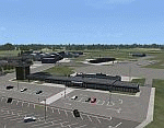
Odense Lufthavn (Odense Airport) is situated close the village of Beldringe, a few km north of Odense, the main city on the island of Funen, Denmark. Like several other Danish airports it was established as an airbase by the Germans during World War II. It was taken over by the Danish state after the war and owned by the state until 1998, at which time it was taken over by a consortium of local authorities, including the city of Odense.
Since the opening of the Great Belt Lin in 1997 there has been no regular passenger flights, apart from some charter traffic during the summer season. But there is a lot of traffic with one- and two-motor craft (including rotor craft) due to the many companies based in the airport.
The package is a complete scenery of the airport, including a few buildings around it. It includes approach lights, runway lights, taxiway lights and light on the apron, the car parking area and the surrounding roads. A traffic file with the (limited) charter traffic of the airport is also included.
| Filename: | Odense_Airport_EKOD_Funen_Denmark.zip |
| License: | Freeware, limited distribution |
| Added: | 31st October 2009, 10:29:34 |
| Downloads: | 3,728 |
| Author: | Peter H. Poulsen |
| Size: | 13.63 MB |
| Category: Flight Simulator 2004 - Scenery | |
| Alaska North Slope 5 - Nuiqsut PAQT |
|
Images related to this file:
File Description:
The town of Barrow is in the far north of Alaska, and these are coastal villages or radar installations to the west, south, and now east of Barrow. There will be further additions. Nuiqsut is a mainly Inuit community on the west side of the Colville River, around 20 miles south of the coast, and with a slowly declining population of around 420 or so. The airfield is just south of the town and has a gravel runway 5,000 feet long and aligned 04-22 in FS9. The airfield is the only year-round contact route to the rest of the world, though there are plans for a permanent road. The AI includes daily passenger flights early and late in the day, cargo deliveries, and some GA. It seems that the only photos I had of the airport were either of the old building or were not of Nuiqsut at all. The only pic I have seen (recently, which is why I now have doubts) of the new building is insufficient to model it, so I am sticking with the old or maybe incorrect version.
| Filename: | Alaska_North_Slope_5__Nuiqsut_PAQT.zip |
| License: | Freeware, limited distribution |
| Added: | 21st June 2016, 21:45:32 |
| Downloads: | 244 |
| Author: | Roger Wensley |
| Size: | 4.37 MB |
| Category: Flight Simulator 2004 - Original Aircraft | |
| Piaggio P-166BL-2 (Iraqi YI-AHZ) |
|
File Description:
Thanks to Andrew Spring of www.p166.com!!
The fourth of the coming P-166 aircraft series. I'm going to built the whole family of these graceful twins.
The Piaggio P-166A is a light small twin. An Exotic two-engined prop that sold all over the world including America, UK, and Australia. The BL2 version has some great improvements with respect to the older series: the new IGSO-540A1C engine pulls the aircraft at top speeds up to 180 Kts and performs great at high altitudes due to injected fuel. Comes with longer re-modelled nose for greater aerodynamics that lets install new advanced avionics. The larger tiptanks improve greatly the plane's range. The First BL2 is dated 1975. Its origin is traced Back to the Piaggio P-136, a light anphibian, wich the P-166 keeps the wings, the engines and the tailplanes. The first P-166A flew in November 1957. The aircraft is still in production in a slightly modified turboprop version, the P-166D-P1. This model is 788 Kbs with c.a. 23000 polygons in c.a.170 assemblies. Features Clickable Dynamic VC with non-planar throttle quadrant. Detailed internals. Fully compatible with FS 2002 (pro edition)
| Filename: | Piaggio_P166BL2_Iraqi_YIAHZ.zip |
| License: | Freeware |
| Added: | 25th January 2004, 20:12:45 |
| Downloads: | 3,423 |
| Author: | Mario Noriega |
| Size: | 5.8 MB |
| Category: Flight Simulator 2004 - Scenery | |
| CYEN Estevan Saskatchewan Municipal Airport |
|
Images related to this file:
File Description:

CYEN Estevan Municipal airport is situated approximately three miles (6 Km) north of the City of Estevan. CYEN Estevan Muni was constructed using GMAX and represents the airport as it was in the Summer of 2006. It includes all the buildings at the airport, runway signs, addition of some fencing, anda new rotating beacon that is closer to the actual device. CYEN also includes a landclass file to better represent the terrain around the airport, at least as far as the limits of the default landscape will allow.
The airport is home to Sunrise Aviation (which operates the field for the city) and some 26 light aircraft. CYEN handles a wide variety of Canadian and U.S. corporate and charter aircraft given the large oil and coal mining industry in the area. With the U.S. border so close by, CYEN is also the first stop for many U.S. registered aircraft that land to clear customs and refuel.
(This is a re-upload of the scenery to replace the original that was lost in the AVSIM hack. No changes have been made)
| Filename: | CYEN_Estevan_Saskatchewan_Municipal_Airport.zip |
| License: | Freeware |
| Added: | 7th May 2010, 12:47:13 |
| Downloads: | 1,702 |
| Author: | Gregory Putz |
| Size: | 1.67 MB |
| Category: Flight Simulator 2004 - Scenery | |
| Deline CYWJ - Northwest Territories, Canada |
|
Images related to this file:
File Description:
This is the third in a series of airfields that follow in a southward direction that early access route to the Canadian northern shore, the Mackenzie River. Deline is south of Tuktuk, Inuvik, Fort McPherson, and Fort Good Hope, all already posted. Deline is at 704 feet asl and around 50 miles east of the the Mackenzie, where the Great Bear River flows out of the western end of Great Bear Lake on its way to the Mackenzie. This lake is huge. The town of Deline has a population of around 500, and the first trading post (of the North West Company) was established there as early as 1799. The Hudson Bay Company opened an outpost in 1825 to support the Franklin Arctic Exploration expedition, and it was then called Fort Franklin. The name was changed to Deline in 1993. The airport is just over a mile north of the town, and has almost 4,000 feet of gravel runway. There is no fuel available. The original airfield is still visible just to the north of the town, from before it was rebuilt on higher ground (better drainage) and away from the houses. AI will follow with later posts.
| Filename: | Deline_CYWJ__Northwest_Territories_Canada.zip |
| License: | Freeware, limited distribution |
| Added: | 5th July 2014, 14:47:36 |
| Downloads: | 241 |
| Author: | Roger Wensley |
| Size: | 2.54 MB |


© 2001-2026 AVSIM Online
All Rights Reserved
Privacy Policy |