
Where Flight Simulation Enthusiasts Gather from Around the World!
AVSIM Library - Search Results

| Category: Flight Simulator 2004 - Aircraft Repaints, Textures and Modifications | |
| P-51D G-SIJJ "Jumpin'Jacques" |

|
File Description:
"Jumpin Jacques" is a P-51D-20-NA model, built at North American’s Inglewood facility in California. Accepted by the USAAF on December 21 1944 as 44-72035, she was assigned to the 332nd fighter group in the Mediterranean Theatre of operations. The 332nd became very famous as the first all Afro American manned Group known as "The Tuskegee Airmen" although references to them at the time refer to them as "The Red Tails". She entered combat with the 15th Air force around March 1945 serving out the last few months of the war on escort and ground attack sweeps over Germany, Austria and Czechoslovakia. She still carries the battle scars to this day, with bullet repairs in several places on the fuselage. After the war, she was repatriated to the US and served with several ANG units. She was released from active duty in 1953 and in 1956 sold to Whitman Enterprises, CA, who registered her as N5411V.
She remained in the Us until 1981, when she was sold to Colombia. In 1989, she was bought by Jacques Bourret of Aero Retro, based in St.Rambert, France, with the registration F-AZMU. When looking for a colour scheme for the P-5, Jacques came upon the photo of a Mustang named "Jumpin’ Jacques" and could not resist adopting this as the new scheme. The original "Jumpin’ Jacques" was flown by Lt Jacques E Young of the 3rd Fighter Squadron, 3rd Air Commando Group, a unit that operated out of the Philippines.
At present, she is with the Hangar11 group of North Weald, UK, flying with the registration G-SIJJ. She has been repainted completely in early 2007, and it is this paintscheme that is depicted with this repaint.
Repaint for the Shockwave WWII Fighters P-51D Mustang by Jan Kees Blom, based on the paintkit by John Terrell.
| Filename: | P51D_GSIJJ_JumpinJacques.zip |
| License: | Freeware |
| Added: | 28th January 2008, 22:19:02 |
| Downloads: | 357 |
| Author: | Jan Kees Blom |
| Size: | 8.41 MB |
| Category: Flight Simulator 2004 - Scenery | |
| Glacier Bay - Alaska/Canada, Version 2, Part 1 of 2 |
|
Images related to this file:
File Description:
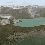
Glacier Bay v2 is a complete replacement of the default FS2004 landscape and scenery of more than 90,000 square kilometers (36,000 sq miles) of Southeast Alaska and adjacent areas of Yukon and British Columbia. File 1 of 2 (also requires glbayv2b.zip)
Landscape enhancements include high-resolution terrain mesh, detailed shorelines, rivers, lakes, and glaciers, and accurate land cover data with custom seasonal ground textures. Inland water bodies can be made to "freeze over" via an on/off switch. Other landmarks include the settlements of Juneau, Haines, Skagway, Yakutat, Atlin, and Carcross as well as road and railroad networks, cabins, lodges, and lighthouses. We modeled or enhanced 16 main airfields (plus one fictitious airstrip), 20 unlisted airstrips, 16 seaplane bases, and seven heliports. We've also included AI ship traffic in various locations as well as optional flightplans for GA and floatplane AI traffic.
Glacier Bay v2 is fully compatible with other third-party add-ons, including terrain mesh (FSGlobal, FS Genesis, etc.), ground textures (Ground Environment, BEV, FScene, etc.), and landscape enhancements (Ultimate Terrain Canada/Alaska, Misty Fjords, Tongass Fjords, Freight Dogs). A configurator panel (requires .Net Framework!) allows users to set compatibility options and to choose levels of scenery detail. We provide an autoinstaller and detailed documentation with a sectional map of the coverage area and a list of weblinks to real-world information.
For feedback and questions, please visit the Glacier Bay v2 support forum at http://forums.fsaddon.eu/viewforum.php?f=10. This project is a collaboration of nine FS developers from Germany, Austria, USA, and Canada, logging more than 1000 hours of work over the past 14 months. We acknowledge the kind support of FSAddon.com. However, this project is independent of any commercial company or product. Enjoy!
| Filename: | Glacier_Bay__AlaskaCanada_Version_2_Part_1_of_2.zip |
| License: | Freeware, limited distribution |
| Added: | 28th May 2010, 19:34:54 |
| Downloads: | 41,284 |
| Author: | Holger Sandmann, Rainer Duda, Michael Eder, Scot Fraser, Manfred Herz, Jay Langham, Jon Patch, Larry Silsbee, and Jim Vile |
| Size: | 56.46 MB |
| Category: Flight Simulator 2004 - Scenery | |
| Glacier Bay - Alaska/Canada, Version 2, Part 2 of 2 |
|
Images related to this file:
File Description:

Glacier Bay v2 is a complete replacement of the default FS2004 landscape and scenery of more than 90,000 square kilometers (36,000 sq miles) of Southeast Alaska and adjacent areas of Yukon and British Columbia. File 2 of 2 (also requires glbayv2a.zip)
Landscape enhancements include high-resolution terrain mesh, detailed shorelines, rivers, lakes, and glaciers, and accurate land cover data with custom seasonal ground textures. Inland water bodies can be made to "freeze over" via an on/off switch. Other landmarks include the settlements of Juneau, Haines, Skagway, Yakutat, Atlin, and Carcross as well as road and railroad networks, cabins, lodges, and lighthouses. We modeled or enhanced 16 main airfields (plus one fictitious airstrip), 20 unlisted airstrips, 16 seaplane bases, and seven heliports. We've also included AI ship traffic in various locations as well as optional flightplans for GA and floatplane AI traffic.
Glacier Bay v2 is fully compatible with other third-party add-ons, including terrain mesh (FSGlobal, FS Genesis, etc.), ground textures (Ground Environment, BEV, FScene, etc.), and landscape enhancements (Ultimate Terrain Canada/Alaska, Misty Fjords, Tongass Fjords, Freight Dogs). A configurator panel (requires .Net Framework!) allows users to set compatibility options and to choose levels of scenery detail. We provide an autoinstaller and detailed documentation with a sectional map of the coverage area and a list of weblinks to real-world information.
For feedback and questions, please visit the Glacier Bay v2 support forum at http://forums.fsaddon.eu/viewforum.php?f=10. This project is a collaboration of nine FS developers from Germany, Austria, USA, and Canada, logging more than 1000 hours of work over the past 14 months. We acknowledge the kind support of FSAddon.com. However, this project is independent of any commercial company or product. Enjoy!
| Filename: | Glacier_Bay__AlaskaCanada_Version_2_Part_2_of_2.zip |
| License: | Freeware, limited distribution |
| Added: | 28th May 2010, 19:36:31 |
| Downloads: | 40,558 |
| Author: | Holger Sandmann, Rainer Duda, Michael Eder, Scot Fraser, Manfred Herz, Jay Langham, Jon Patch, Larry Silsbee, and Jim Vile |
| Size: | 85.99 MB |
| Category: Flight Simulator X - Aircraft Repaints, Textures and Modifications | |
| FS2004/FSX/P3D Overseas National - ONA DC-6A 1959 |
|
Images related to this file:
File Description:
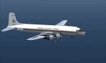
This is a repaint of the Douglas DC-6A (CB17 model) in Overseas National Airways - ONA 1959 colors. The freeware CalClassic DC-6A CB-17 model by Greg Pepper and Tom Gibson is needed for this repaint. ONA was originally formed in 1950 by George Tompkins to undertake overseas contracts on behalf of the USAF. Douglas DC-4s were initially used, with DC-6s joining them later. However, due to underbidding on contracts, ONA declared itself bankrupt on October 29 1963. After this, the airline was extensively re-organized and began operations once again in October 1965, with a fleet of 7 DC-7s. Soon after, in June and July 1966 the airline's first jetliners joined the fleet in the form of DC-8-50Fs. After a 1966 ruling by the CAB, ONA was granted permission to undertake inclusive tour charters, affinity group charters, and single entity charters to transatlantic and Caribbean markets. This was a godsend to the airline and it started to become quite profitable. Over the next decade, the fleet expanded to include: L-188s, DC-8-61/63CFs, DC-8-20/30s, DC-9-30s, and the granddaddy of them all; the DC-10-30CF. During the winter of 1975/76 tragedy struck. Two ONA DC-10s were lost in accidents in the space of two months (November 1975 & January 1976). This was a major blow to the airline and its image. This, coupled with financial difficulties, led the the filing of its second bankruptcy on September 7, 1978. That was the final nail in the coffin. This repaint is on DC-6A N660NA, which joined the airline in 1958, ans was sold to AAXICO in 1961. Textures are 32bit bmp. This repaint was tested on FSX-SE and should work on FSX, P3D v1-3, & FS2004.
| Filename: | FS2004FSXP3D_Overseas_National__ONA_DC6A_1959.zip |
| License: | Freeware |
| Added: | 19th June 2019, 15:55:19 |
| Downloads: | 74 |
| Author: | Ted Giana |
| Size: | 7.57 MB |
| Category: Flight Simulator X - Gauges | |
| TCAS and Traffic Display Gauge V2.0 |
|
Images related to this file:
File Description:
This TCAS and Traffic Display Gauge Version 2.0 includes significant improvements from V1.0. It has been developed for the FSX Flight Simulator SP1/2 also. It should also work with Acceleration.The functionality for the TCAS part is based on general specs for commercial aircrafts. It does not provide in detail the function for a specific aircraft model. It is a generic gauge, and can be simple added to any aircraft as a standalone popup window.
In addition the gauge provides a AI traffic display in the ranges of 10,20, and 40 miles.Within this display mode, no TCAS rules are valid, which means all AI aircraft are displayed independent of any altitude or distance.
Improvements in V2.0 are: 1: Full TCAS and traffic display capability is provided even though your aircraft is on the ground. Only the trigger of the alarm/warn sound and the blinking lamp display willbe blocked. 2: An AI HDG pointer will be displayed. It shows in which direction the AI is moving. 3: A bearing pointer has been introduced. It allows the pilot to point to a specific AI.4: The AI additional text info display follows the structure of an ATC text.5:The AI additional text can be selected individually per AI with a mouse click.
6: Each AI display contains a ID index number (0 � 20).7: The design of the TCAS and Traffic Display Box has been updated.8: Increased the number of AIs displayed on the screen in display mode.
For installation and functional description look at the doc inside the ZIp.
CREDIT goes to :
Stefan Schneider for his support on special XML issues and TCAS functionality.
Bob Familton for his review of the documentation and testing for SP1 FSX.
Doug Dawson for his dsd-XML-sound interface in order to generate the sounds.
| Filename: | TCAS_and_Traffic_Display_Gauge_V20.zip |
| License: | Freeware |
| Added: | 25th October 2010, 13:37:36 |
| Downloads: | 3,757 |
| Author: | Dietmar Loleit |
| Size: | 981.32 KB |
| Category: Flight Simulator 2004 - Scenery | |
| Twin Lakes Airstrips in British Columbia Canada |
|
Images related to this file:
File Description:
There are three grass airstrips within sight of each other from the air at Twin Lakes in BC, which is between the close junction of Elkin Lake and Vedan Lake. The two lakes are similarly shaped and sized and in the same narrow valley between high ground that runs north-south; hence the name. Elkin is to the north, and Vedan is to the south. Twin Lakes CAG4 is on the strip of land between the two lakes and it is unclear to me who it belongs to etc. It is not in the Nav Canada copy that I have with me which is from 2010, and the online version does not cover grass strips. It is probably owned by whoever lives in the house next to the red hangar. The runway is 3,600 feet of grass aligned 14-32 at 3,945 feet ASL. Chaunigan Lake Lodge CF83 is over to the northwest from Twin Lakes by around 2 miles or so and as the name suggests it services the Lodge of that name, which is on the northeast corner of Chaunigan Lake. The runway is 2,600 feet of grass aligned 02-20 at 4,900 feet ASL. You might want to read about altitude power reductions for the take off. Elkin Creek Guest Ranch CBL9 is at the southern end of Vedan Lake and serves the ranch. This appears to be another high-budget operation and the runway is 3,670 feet of grass aligned 36-18 at 3,999 feet ASL. I have posted this as three separate airstrips, but I suggest that you add these to your "BC airfields" folder as previously suggested. Up to you. If you find a defect, email me. Ignore the post of Chilanko Lodge posted today. I requested Avsim to delete it but it seems they didn't read the email. It was originally posted as a correction for the original post of the three posted here.
| Filename: | Twin_Lakes_Airstrips_in_British_Columbia_Canada.zip |
| License: | Freeware, limited distribution |
| Added: | 21st November 2020, 23:29:09 |
| Downloads: | 126 |
| Author: | Roger Wensley |
| Size: | 25.39 MB |
| Category: Prepar3D V1-4 - Aircraft Repaints, Textures and Modifications | |
| North American P-51D 3rd ACG (C) 'Bad Angel' |
|
Images related to this file:
File Description:
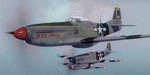
This folder contains a second repaint for the A2A WoP3 P-51D Mustang, in the colors of P-51D-20 44-63272 “Bad Angelâ€, flown by Lt. Louis Curdes of the 4th Fighter Squadron, 3rd Air Commando Group. He is one of a very few American pilots to have kills against each of the three major Axis powers, and I believe the only US pilot to display an American flag among his victory markings.
While serving in the MTO, Curdes downed several Fw-190’s, and one of the Macchi C.202’s he downed is now on display at the National Air & Space Museum in Washington DC. He was shot down over Italy and spent a short time as a POW before escaping. Because he was an escaped POW, he couldn’t fly again against the Germans for security reasons.
He was transferred to the PTO, and on February 10, 1945, during a sweep to Bataan Island, he saw a P-51 pilot parachute into the sea. Curdes circled around him to pinpoint his position to rescuers. While circling, he saw a USAAF C-47 that was preparing to land on the Japanese-held strip on Batan. The C-47 crew didn’t respond to repeated attempts at radio contact and, unable to shepherd the C-47 to safety, Curdes saw only two possibilities – first that it was a Japanese plane bearing false US markings (the DC-3 having been built under licence in Japan prior to the war), or it was a US plane whose crew was unaware the field had fallen to the Japanese. He therefore carefully shot out both engines, causing the plane to land in the sea. All 13 people on board the C-47 were rescued – and they were indeed Americans, including a nurse Curdes had previously dated. Repaint by Jan Kees Blom.
| Filename: | North_American_P51D_3rd_ACG_C_Bad_Angel.zip |
| License: | Freeware |
| Added: | 3rd November 2018, 23:18:24 |
| Downloads: | 49 |
| Author: | Jan Kees Blom |
| Size: | 6.11 MB |
| Category: Flight Simulator 2004 - Scenery | |
| Seward PAWD in Alaska V2 plus 6AK5 |
|
Images related to this file:
File Description:
This is V2, the combined original and also V1. If you have already installed V1 then you do not need this. The town of Seward (population around 2,700) is on the east coast of the Kenai Peninsula, 70 miles east of Kenai town and also 70 miles southeast of Anchorage, amid mountains and glaciers at the northern end of the 20 mile long and fjord-like Resurrection Bay. It is also at the southern end of both the Alaska Railway and the Seward Highway, and has a sheltered dock for freight and also for cruise liners. Passengers from the liners can enjoy local attractions (dog sledging on a glacier?) and also easily continue further north by bus or train to Anchorage or to other tourist attractions such as Denali. The airport is next to the port and the town, with two runways aligned (in FS9, not taking account of the recently wandering magnetic north) 15-33 and 12-30, both asphalt and 2,100 and 4,200 feet long respectively. Only 12-30 (and its taxiways) is lit, with VASI on 30. There are no regularly scheduled flights to Seward; with buses and trains running direct from Anchorage there is no money to be made. There are some charter flights coordinated with cruise liners, and some freight flights, the very occasional visit by the Coastguard, but most flights are GA, air taxi,or short scenery-viewing trips for summer tourists. In a mountainous area the only sure thing about the behaviour of AI aircraft is that it is unpredictable but often involves a mountain; nothing to be done about it. At Seward there is also marine AI from and to the port, in the shape of a cruise liner and an Alaskan ferry, but the latter only if you have Holger Sandmann's Alaska scenery installed. Also included with this is a correction for Fire Island 6AK5, near Anchorage, that takes the airfield out of the water; this is something I have meant to do for the last 5 years.
| Filename: | Seward_PAWD_in_Alaska_V2_plus_6AK5.zip |
| License: | Freeware, limited distribution |
| Added: | 19th January 2016, 18:27:26 |
| Downloads: | 591 |
| Author: | Roger Wensley |
| Size: | 12.47 MB |
| Category: Miscellaneous Files - Demos from Commercial Vendors | |
| Lufthansa Airbus A350 |
|
File Description:
The A350 XWB (Xtra Wide-Body) is Airbus’ response to market demand for a medium capacity long range wide-body family. Designed with airlines’ priorities in mind, the A350 XWB confronts the challenges of high fuel prices, rising passenger expectations and increasing environmental concerns.
Available from 2013, it has an entirely new, uncompromising, 21st Century design with a wider and taller fuselage for extra space and passenger comfort. A complete family of airliners sized to generate cost reductions and provide unprecedented operating flexibility for airlines; three basic passenger versions are being offered. With a range of up to 8,300nm/15,380km they include the A350-800 for 270 passengers in a spacious three-class configuration; the A350-900 for 314 passengers and the A350-1000 seating 350 passengers. An ultra long-range version, the A350–900R, will fly even further while a freighter version, the A350–900F, will complement the passenger models.
As befits the most advanced aircraft family in its segment, the A350 XWB is able to provide greater economy on long-range markets and is equally attractive as a route opener or as part of a multi-type Airbus fleet offering optimized network solutions. Thanks to the application of the latest innovations, the A350 XWB is able to offer 20 per cent lower cash operating costs per seat than competing aircraft in this size category and fuel efficiency improvements of up to 25 per cent per seat. The fly-by-wire A350 XWB Family is a significant addition to the Airbus product range. A member of the Airbus FBW Family of aircraft, it benefits from the same operational commonality as the other members of the Family. This handling and flight deck commonality allows airlines to benefit from the unique Airbus Family concept of cross crew qualification and mixed fleet flying, and will ensure smooth introduction into service. Panel, GAUGES, model, sound and textures by www.afs-design.de - Author: A.Meyer.
| Filename: | Lufthansa_Airbus_A350.zip |
| License: | Commercial demo |
| Added: | 23rd February 2008, 02:35:33 |
| Downloads: | 2,471 |
| Author: | Andreas Meyer |
| Size: | 3.14 MB |
| Category: Flight Simulator X - Scenery | |
| MYXY - Duncan Town, Ragged Island Chain, Bahamas - Version 2 |
|
File Description:
The Ragged Island Chain consists of a string of small islands in the Bahamas. Only one island, Ragged Island, has a settlement on it which is known as Duncan Town. This FSX scenery improves the airstrip at Duncan Town and creates a new private airstrip on Nurse Cay. The airstrip at MYXY (Duncan Town) has been lengthened by 500 feet and widened by 25 feet. Six parking ramps now exist as well as a fuel pump and helipad. Additional taxiways have been added and lights for the runway, taxiways and apron. A small building has been added to serve as a combined terminal, control tower, and customs office. There is also a hangar to protect your plane from tropical storms. These improvements were necessary to accomodate the increased air traffic due to the new high rise tropical hotel, the Ragged Island Resort. There is also a lighthouse on the island and a cruise ship with helipad just off to the east. A large private yacht just to the north also has a helipad. You can watch dolphins swim at both of those locations - the helipads make great viewing spots. About 20 miles north of Ragged Island is Nurse Cay (MYXN). This is where my private airstrip and villa are located. The airstrip has a 2500 ft concrete runway and a parallel taxiway as well as a helipad. The runway, taxiways, and apron are all lit for night operations. The airstrip was built right on a marsh so wandering off the runway or taxiways could result in getting wet. You will find a variety of birds flying around at various locations throughout this scenery. A flight plan is also included for a dusk flight from Ragged Island (MYXY) to Nurse Cay (MYXN). So come on out to Ragged Island, because it's better in the Bahamas! This is version 2 and supercedes my original file - this version corrects the runway numbers at MYXN.
| Filename: | MYXY__Duncan_Town_Ragged_Island_Chain_Bahamas__Ver.zip |
| License: | Freeware |
| Added: | 24th August 2007, 15:55:49 |
| Downloads: | 2,408 |
| Author: | Mike Lanza |
| Size: | 13.43 KB |


© 2001-2026 AVSIM Online
All Rights Reserved
Privacy Policy |