
Where Flight Simulation Enthusiasts Gather from Around the World!
AVSIM Library - Search Results

| Category: Flight Simulator 2004 - Scenery | |
| Cape Verde Islands Domestic Airports |

|
Images related to this file:
File Description:
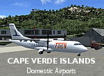
Googlyafcads and simple scenery for five airports in the Cape Verde Islands, all
of which are served by regular domestic flights of TACV - Transportes Aereos de
Cabo Verde. Each of these has been "overlooked" by Microsoft in Flight Simulator
2004 and are provided with nothing other than a runway. These scenery files add
aprons, taxiways, buildings and other airport features to Flight Simulator's bland
representation and allow you and "AI" traffic to land, taxi, park and take off
in a realistic manner.
The airports represented are: GVBA Rabil, GVMA Maio, GVSF Sao Filipe, GVSN Preguica and GVSV Sao Pedro.
The scenery does not purport to be ultra-accurate. Based on high-detail satellite
imagery from Google Earth (except Sao Filipe), the layout is proportianally correct
but the added airport features, such as buildings, are built from default Microsoft
objects and add-on libraries so will not look like the real thing. Sao Filipe is
largely imaginary owing to poor quality of the satellite image, but has been created
to be similar to other airports of like size.
You are not obliged to download and install any additional scenery libraries,
but to enjoy this scenery in its entirety, you may wish to. It will work fine,
with or without.
[File re-uploaded at request of AVSIM]
| Filename: | Cape_Verde_Islands_Domestic_Airports.zip |
| License: | Freeware |
| Added: | 15th June 2010, 01:00:46 |
| Downloads: | 6,997 |
| Author: | John Hinson |
| Size: | 84.1 KB |
| Category: Flight Simulator 2004 - Scenery | |
| OSM World: Western Europe |
|
Images related to this file:
File Description:
Read Installation instructions carefully, this is a complex scenery package!
This package includes a "Dev Kit" should you wish to expand it to other areas! Please contact me if you wish to do so! This is community effort! If we all contribute, we will hopefully have the entire world covered one day!
Welcome to OSM World: Western Europe! This is a vector data scenery package covering the western European area. Coastlines, Rivers, lakes, roads, railways, and power lines with detail never before seen! All in an autogen-compatible density! You can see roundabouts, train terminals, harbor areas in a resolution of a point every 10 meters. At this same resolution a vectorial city class places residential (in small and big building variations, depending on surface area) and industrial areas exactly where they are supposed to be. This gives the city areas a resolution far superior to the capacity of FS-2004 default landclass bitmaps, limited to approximately 1 Km x 1 Km squares. OSM World: Western Europe will even give you small roads leading to small towns (even a few houses across)! From big highway intersections, including ramps, to the tiniest rural pathways covering the entire western area! Wherever in Western Europe you fly, there is something to see!
| Filename: | OSM_World_Western_Europe.zip |
| License: | Freeware |
| Added: | 13th October 2014, 00:18:39 |
| Downloads: | 4,139 |
| Author: | Mario Noriega |
| Size: | 274.75 MB |
| Category: Flight Simulator X - Scenery | |
| Iguassu Falls - Save The Planet |
|
Images related to this file:
File Description:
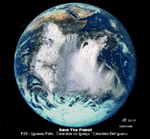
The Iguassu Falls, Itaipu Hydroelectric Power Plant, Foz do Iguassu City and Land Class Package for FSX
Save The Planet is my version of the Iguassu Falls, Itaipu Dam, bridges and landclass scenery for FSX.
Differently from my other version for MSFS 2004, I created a mesh of 5 meter resolution for Iguassu Falls area
to give me some idea how I could proceed. So, I decided to use on this addon
an image background avaliable at server (VirtualEarthSatellite). Thanks Microsoft.
Non-Airport Scenery - ICAO (SBFI). coming soon at www.Terra-Brasilis.org
Portuguese: Cataratas do Iguassu,
Spanish: Cataratas del Iguazu are waterfalls of the Iguassu River located on the border of the Brazilian state of Parana (in the Southern
Region) and the Argentinian Province of Misiones.
The Falls are shared between the Iguazu National Park (Argentina) and Iguacu
National Park (Brazil). The parks were designated UNESCO World Heritage Sites.
The Itaipu Hydroelectric Power Plant is located in the Parana River, in the stretch of the frontier between Brazil and Paraguay, 14 km north of the Friendship Bridge.
The area of the project extends from Foz do Iguassu, in Brazil, and Ciudad del Este, in Paraguay, in the south, up to Guaira (Brazil) and the Guaira Falls (Paraguay), in the north.
Enjoy FSX Iguassu Falls Scenery!
| Filename: | Iguassu_Falls__Save_The_Planet.zip |
| License: | Freeware |
| Added: | 9th December 2010, 01:57:00 |
| Downloads: | 2,847 |
| Author: | Cicero Costa |
| Size: | 31.71 MB |
| Category: Flight Simulator 2004 - Scenery | |
| Mary River CMR2 on Baffin Island in Nunavut Canada |
|
Images related to this file:
File Description:
This is a very early version of an airfield in Nunavut built to serve an iron ore mine some 100 miles south of Pond Inlet on Baffin Island. In 2004 the airstrip was just being built, with a very basic camp set up for the construction crew who then went on to develop the roads etc in the immediate area. The original plan was for an opencast mine, with ore being transported south on a new (and expensive) railroad link to a new port on the south shore of Baffin Island. This plan was later changed to a (much cheaper) road to Milne Inlet, north of Mary River. And there my story rests, as although production has now started I have no further information about the operating mine. Nolinor currently flies regular supply flights into the camp; the AI here is for the early days. The gravel runway is 4,800 feet long and 150 feet wide, aligned 124T-304T as all runway headings in the north are given as true rather than the unreliable magnetic, which would be 12-30. Runway lighting and PAPI was installed early on and is included here; signage is not and the apron is the early version.
| Filename: | Mary_River_CMR2_on_Baffin_Island_in_Nunavut_Canada.zip |
| License: | Freeware, limited distribution |
| Added: | 18th August 2018, 02:57:19 |
| Downloads: | 136 |
| Author: | Roger Wensley |
| Size: | 4.82 MB |
| Category: Flight Simulator 2004 - Aircraft Repaints, Textures and Modifications | |
| Italian Air Force, Lockeed F-104G "Starfighter" |
|
Images related to this file:
File Description:
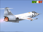
Lockheed's F-104 "Starfighter" was sleek, sexy, and difficult to fly. Essentially a J-79 turbojet with tiny wings and a place for the pilot to sit, it had a poor turning radius and very unpredictable behavior at high angles of attack along with very high takeoff and landing speeds. Its strength was never in its agility, but rather in its speed. The type was the only aircraft in existence at the time that could sustain speeds of over Mach 2.0, and it had a stellar rate of climb.
The "Starfighter" was an icon among jet interceptors throughout the 1970s. It was built also in Italy (G version), under licence. The first Italian F-104G flown during the end of 1962 and the last one (S version) was retired from active service in 2004 (42 Years !!!).
Textures only for two "Starfighters" of the 9 Gruppo of 4 Aerobrigata of the Aeronautica Militare Italiana (Italian Air Force), the first unit to receive the "Starfighter", based on Grosseto Airport, Italy, 1963/64. These textures require a legal copy of the payware Alphasim F-104G. The paints were done with the paintkit provided by Alphasim/Frank Safranek and the metal base textures provided by Henry William. Repaint by Manuele Villa.
| Filename: | Italian_Air_Force_Lockeed_F104G_Starfighter.zip |
| License: | Freeware |
| Added: | 4th June 2010, 11:28:46 |
| Downloads: | 599 |
| Author: | Manuele Villa |
| Size: | 6.05 MB |
| Category: Flight Simulator 2004 - Scenery | |
| WIKD/WIOD Tanjung Pandan/Buluh Tumbang/H.A.S. Hanandjoeddin, Indonesia |
|
File Description:
Googly scenery for WIKD/WIOD Tanjung Pandan/Buluh Tumbang/H.A.S. Hanandjoeddin,
Indonesia, based on Google Earth satellite data. It is a small domestic airport
serving the island of Belitung, located about 17 miles from the main town of the
island - Tandjungpandan. The island produces mainly tin and pepper but there are
some beaches that are generating tourist traffic too.
Flight Simulator 2004 has made no provision for any traffic at this airport and
this scenery seeks to redress the situation. The airport sees daily scheduled
traffic operated by Batavia Air and Sriwijaya Air.
The scenery does not purport to be ultra-accurate. Based on poor quality
satellite imagery from Google Earth, the layout is proportionally correct but the
added airport features, such as buildings, are built from default Microsoft objects
and add-on libraries so will not look exactly like the real thing.
You are not obliged to download and install any additional scenery libraries,
but to enjoy this scenery in its entirety, you may wish to. It will work fine,
with or without.
The ICAO code for this airport has recently changed from WIKD to WIOD. The included
files allow you to either retain the old code or optionally change the airport to
use the new one.
| Filename: | WIKDWIOD_Tanjung_PandanBuluh_TumbangHAS_Hanandjoed.zip |
| License: | Freeware |
| Added: | 22nd February 2008, 09:19:27 |
| Downloads: | 1,774 |
| Author: | John Hinson |
| Size: | 64.96 KB |
| Category: Combat Flight Simulator 1 and 2 - Aircraft | |
| MiG-15 KPAFAC(North Korea Air Force)No.823 for CFS2 |
|
File Description:
MiG-15 KPAFAC(North Korea Air Force)No.823 for CFS2
KPAFAC(North Korea Air Force)MiG-15 No.823 operated by the 176th GvIAP at Antung Air base,April 1951.
This aircraft was damaged in the mission of the 12-04-51.This day, 36 MiG-15 from the 196th IAP(Colonel Yevgeni Pepelyayev)and 176th GvIAP(Lt.Col Sergei Vishnyakov)intercepted a force of 48 B-29(19th,98th and 307th bombing wings) escorted by 36 F-84s
and 18 F-86s tasked to attack the Yalu bridges.
USAF claim for this mission four MiG shot down by the F-86 and six for the B-29.Actually ,only one MiG-15 was lost(176th GvIAP)shot down by James Jabara(334 FIS, 4 FIW)and the combat damage for the MiG-15 No.823.
Three B-29's were destroyed:69682(19th BW, 93rd BS),62252 (307th BW, 371st BS) damaged near Sinuiju railroad bridge, crashed near Suwon,65369 (19th BW, 93re BS) crashed and burned on landing at Kadena AB; five others B-29s of the 19th BW were write off and one of the 307th BW after landing.Victories go to :A. M. Kochegarov(B-29A BuNo 44-86370 19 BW),Boris A. Obratsov(B-29A BuNo 44-61835 19 BW),Serafim P. Subbotin(B-29A BuNo 44-62252 307 BW),Fiodor A. Shebanov(B-29A BuNo 44-62252 19 BW),Konstantin Sheberstov(B-29A damaged - written off 19 BW),Grigorii I. Ges(B-29A damaged - written off 19 BW)
Ivan V. Suchkov(B-29A damaged - written off 19 BW),Pavel S. Milaushkin(B-29A damaged - written off 19 BW),A. F. Plitkin(B-29A damaged - written off 19 BW),Nazarkin(B-29A damaged - written off 307 BW),Boris S. Abakumov(B-29A crew bailed out 307 BW).
| Filename: | MiG15_KPAFACNorth_Korea_Air_ForceNo823_for_CFS2.zip |
| License: | Freeware |
| Added: | 5th January 2004, 18:00:56 |
| Downloads: | 333 |
| Author: | Daniel Nole |
| Size: | 115.08 KB |
| Category: Flight Simulator 2004 - Scenery | |
| Iles de la Madeleine CYGR in Quebec Canada |
|
Images related to this file:
File Description:
The Iles de la Madeleine are a group of spit islands linked by bridges in the Gulf of St Lawrence. They are east of New Brunswick, north of Cape Breton Island, west of the Island of Newfoundland, and south of the mainland coast of Quebec. On a southwest to northeast axis they are 40 miles in length and the airport CYGR is pretty much at the midpoint of the southern line of islands. Take a look at the overhead from FS9 to see what I mean. CYGR has two runways, one is aligned 08-26 and is just under 4,400 feet long and 150 feet wide with lighting and PAPI at both ends. The second is aligned 16-34 and is 3,600 feet long and 150 feet wide, without lights or PAPI. Both are asphalt. The apron is not huge, and a newish (in 2010) hangar was built with separate access to the 16-34 runway. There are daily flights by Air Canada and Pascan Aviation included in the AI. The AI also includes some boats and a ferry, and I first used these with my Dutch Harbor scenery, so if you have that already.... This scenery also includes Cindy Hook, a small boat harbour just 2 miles southwest of the airport, and the larger harbour at Cap aux Meules a further 3 miles away that accommodates the daily ferry trips, along with fishing boats etc. Also included here is a further addition to the Homer PAHO scenery in the shape of a boat that is included in the Homer Spit harbour. Just add the contents of the scenery folder to the Homer scenery folder of your Homer installation, and the texture folder contents to the Homer texture folder. This is hopefully the last PAHO addition, and again apologies. If you find an error email me please, and note that my email address has been changed to rogwens at Gmail dot com.
| Filename: | Iles_de_la_Madeleine_CYGR_in_Quebec_Canada.zip |
| License: | Freeware, limited distribution |
| Added: | 28th July 2021, 17:02:18 |
| Downloads: | 188 |
| Author: | Roger Wensley |
| Size: | 26.7 MB |
| Category: Flight Simulator 2004 - Scenery | |
| Anticosti Island in Quebec Canada |
|
Images related to this file:
File Description:
Anticosti Island is in the Gulf of St Lawrence, around 25 miles off the Quebec mainland coast. It is some 40 miles wide and 130 miles long on an east west axis. There are few urban areas and only one that can be described as a small town, namely Port Menier at the western end of the southern coast, with a population of under 1,000. There is a ferry service to the harbour. The airport, Port Menier CYPN, is around 3 miles northeast of the town, with an asphalt runway aligned 11-28, 4,875 feet long and 150 feet wide with PAPI at each end. In 2010 (the approximate date of this scenery) a gravel runway was still visible at the eastern end of the field. This was no longer in use by 2010, except perhaps by small planes on skis in the winter. The island, with its small population, small urban area, and no industry other than logging, has as a result a mainly undisturbed wildlife population. This has made deer hunting and fishing the main tourist activities, with one company (called Safari) having an exclusive licence to exploit large areas of mountains and rivers. Planeloads of hunters and fishermen are flown in on chartered Nolinor Aviation planes from the south. There are a further two airfields in the eastern end of the island, and in 2010 Rivere-Aux-Saumons CTH7 had a 5,500 feet gravel runway, linked by road to a lodge area at the mouth of the river. This is the only lodge area that I have been able to locate, but there are others. To the south Riviere Bell CRB5 had at that time a gravel runway that was 3,000 feet long. This has been lengthened since then and both runways were recently (2021) asphalted. If you find an error email me please, and note that my email address has been changed to rogwens at Gmail dot com.
| Filename: | Anticosti_Island_in_Quebec_Canada.zip |
| License: | Freeware, limited distribution |
| Added: | 31st July 2021, 18:23:40 |
| Downloads: | 80 |
| Author: | Roger Wensley |
| Size: | 11.78 MB |
| Category: Flight Simulator 2004 - Scenery | |
| Bethel area airfields in southwest Alaska close to the Yukon River |
|
Images related to this file:
File Description:
This presumes you have already installed my post of Bethel PABE. In the Yukon River area of Alaska there are a lot of small villages close together, which is unusual for Alaska. Almost all of them are on the coast or a river bank, and the local economies depend on fishing. Some are larger than others and have a fish processing plant, such as in Emmonak. This is the largest such plant and it exports prepared fish by cargo planes which fly in on a daily basis, using an extended runway. This post includes airfields to the south and west of PABE, 17 of them; some of them already included and now modified. There will be more airfields to the north and northwest of Bethel in a future post. There are revisions to Bethel to include parking spaces for Yute Air (newly included here) and extra spaces for Ryan Air. Both of these flew Cessna 205 planes into the smaller village strips from Bethel (past tense as Yute Air recently went bankrupt). The northwest area is served both from Bethel and also from St Mary's PASM, which is in the northwest and at a more economical range to the local airfields (100 miles closer than Bethel). These smaller airfields have few airfield buildings or any other creature comforts; featuring heavily are a new standard blue garage building (sometimes not yet installed) and a small and old terminal shed (that has sometimes collapsed and been removed). Go to "http://vfrmap.com/" for free vfr maps of the area, There is a pic of the local chart area included here. The screenshots are a random sample. Kipnuk PAKI is the one that appears to have a second and long grass runway; what it actually has is the ground prepared for a new and long gravel runway but which hasn't been started yet as it has taken 10 years just to prepare the ground. I have no idea why.
| Filename: | Bethel_area_airfields_in_southwest_Alaska_close_to.zip |
| License: | Freeware, limited distribution |
| Added: | 16th April 2019, 22:47:47 |
| Downloads: | 155 |
| Author: | Roger Wensley |
| Size: | 5.93 MB |


© 2001-2026 AVSIM Online
All Rights Reserved
Privacy Policy |