
Where Flight Simulation Enthusiasts Gather from Around the World!
AVSIM Library - Search Results

| Category: Flight Simulator 2004 - Scenery | |
| SRTM Mesh for Madagascar Part 1 |

|
File Description:
this mesh cover the north of madagascar island, it based on africa srtm data. enjoy
| Filename: | SRTM_Mesh_for_Madagascar_Part_1.zip |
| License: | Freeware, limited distribution |
| Added: | 2nd April 2004, 15:37:19 |
| Downloads: | 11,567 |
| Author: | jean gabriel laurent |
| Size: | 35.59 MB |
| Category: Flight Simulator 2004 - Scenery | |
| SRTM Mesh for Madagascar Part 2 |
|
File Description:
this is the part 2 of madagascar mesh, it cover the south of island, enjoy
| Filename: | SRTM_Mesh_for_Madagascar_Part_2.zip |
| License: | Freeware, limited distribution |
| Added: | 2nd April 2004, 15:40:35 |
| Downloads: | 10,843 |
| Author: | jean gabriel laurent |
| Size: | 24.21 MB |
| Category: Flight Simulator 2004 - Scenery | |
| Guatemala & Honduras SRTM Mesh Part 1 |
|
File Description:
This terrain mesh scenery was made to fit Jozef Kusters' Nicaragua mesh on its south-eastern edges. It covers Guatemala, western & northern Honduras (including Isl de la Bahia - Roatan), Belize and Salvador. Based on SRTM Data (3 arc/sec), generated with Matthew Styles's program "SRTM To BGL v1.04", sampled to LOD9 resolution (76m) with 5 interpolation passes. While tested under Fs2004, this mesh should also run in FS2002.
This part contains Guatemala-S.BGL. See guatemala_honduras_mesh_pt1.jpg for .BGL files coverage.
| Filename: | Guatemala__Honduras_SRTM_Mesh_Part_1.zip |
| License: | Freeware |
| Added: | 30th September 2003, 15:19:59 |
| Downloads: | 6,991 |
| Author: | Yohann Baptiste |
| Size: | 16.92 MB |
| Category: Flight Simulator 2004 - Scenery | |
| Turkey Mesh SRTM V2, Part II |
|
Images related to this file:
File Description:
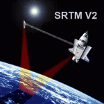
SRTM Version 2 is the result of a substantial editing effort by the National Geospatial Intelligence Agency and exhibits well-defined water bodies and coastlines and the absence of spikes and wells.
| Filename: | Turkey_Mesh_SRTM_V2_Part_II.zip |
| License: | Freeware |
| Added: | 25th January 2011, 14:32:45 |
| Downloads: | 2,882 |
| Author: | Tuncer Celik |
| Size: | 79.06 MB |
| Category: Flight Simulator 2004 - Scenery | |
| Turkey Mesh SRTM V2, Part I |
|
Images related to this file:
File Description:

SRTM Version 2 is the result of a substantial editing effort by the National Geospatial Intelligence Agency and exhibits well-defined water bodies and coastlines and the absence of spikes and wells.
| Filename: | Turkey_Mesh_SRTM_V2_Part_I.zip |
| License: | Freeware |
| Added: | 25th January 2011, 14:32:24 |
| Downloads: | 3,444 |
| Author: | Tuncer Celik |
| Size: | 88.4 MB |
| Category: Flight Simulator 2004 - Scenery | |
| Turkey Mesh, Part 1 of 5 |
|
File Description:
Created from 3 arc second data and re-sampled @LOD9 (best fit for this data). The created area extends from N35E025 (lower left corner) to N44E047 (upper right corner). You need all the five bgl-files plus the two correction files to cover the whole area. Otherwise you will have only a coverage of the corresponding file. Matthew Style's SRTM_3ARCSEC_TO_BGL program was used to interpolate the srtm data and automate the bgl file creation (Many Thanks to Matthew for his great utility).
| Filename: | Turkey_Mesh_Part_1_of_5.zip |
| License: | Freeware |
| Added: | 15th February 2010, 09:30:31 |
| Downloads: | 11,998 |
| Author: | Abdulkadir Ozturk |
| Size: | 31.29 MB |
| Category: Flight Simulator 2004 - Scenery | |
| Northern Venezuela SRTM Mesh part 2 |
|
File Description:
This terrain mesh scenery covers north of Venezuela (southern boundary is 8°48'N) and Dutch caribeans: Aruba, Curacao & Bonaire islands.
Based on SRTM Data (3 arcsec, 90m), generated with Matthew Styles's program "SRTM To BGL v1.04", sampled to LOD9 resolution (76m) with 5 interpolation passes.
This part contains Venezuela-NW.bgl. See venezuela_n_mesh_pt2-1.jpg for the .BGL files coverage.
| Filename: | Northern_Venezuela_SRTM_Mesh_part_2.zip |
| License: | Freeware |
| Added: | 7th October 2003, 18:19:24 |
| Downloads: | 8,628 |
| Author: | Yohann Baptiste |
| Size: | 14.31 MB |
| Category: Flight Simulator 2004 - AI Aircraft | |
| Boeing B-52 Stratofortress (Part 1) |
|
Images related to this file:
File Description:

Boeing B-52 Stratofortress (Part 1). The B-52 first flew in 1952, the last one was built in 1963, and there are still over 90 of the original 744 airframes either in service or in a ready-reserve status. With extensive avionics upgrades starting this year, the USAF plans on using the B-52s until 2045. The aircraft has an impressive resume, having served in five shooting wars and was the backbone of Strategic Air Command's nuclear deterrent air component during almost forty years of Cold War service.
Jake Burrus started this AI traffic model a couple of years ago, and I was honoured to pick up the project and get it across the finish line, with no small amount of help from Mike MacIntyre, as usual. This is a 7-LOD AI traffic model representing the Stratofortress in all of its operational service. This is part 1, covering all operational models which only did nuclear deterrence, not actual combat use. This file includes the B-52B, B-52C, B-52E, and RB-52B models, with a total of 68 repaints across all variants. Also included are optional models for VFR traffic use. Aircraft model by Jake Burrus and Mike Pearson, master textures and repaints by Mike Pearson, flight dynamics by Mike MacIntyre. Please read the extensive documentation contained in the file.
| Filename: | Boeing_B52_Stratofortress_Part_1.zip |
| License: | Freeware |
| Added: | 24th September 2013, 22:09:56 |
| Downloads: | 1,470 |
| Author: | Michael Pearson |
| Size: | 35.75 MB |
| Category: Flight Simulator 2004 - Scenery | |
| Australian Lighthouses - Part 5 - Western Australia |
|
File Description:
Around Australia's coastline there are over 350 lighthouses. I received a suggestion a month ago asking if I would do the locations of the lighthouses down the coast of New South Wales and when I did a bit of research I thought, why not do the whole 36,735 kilometres around Australia? Here is Part 6 - the lighthouses located on the coastline of Western Asutralia - the first landfall for the early European explorers and many decades before Captain James Cook encountered the Great South Land. Some installations no longer exist but I have included several (not all of them) for those of us who like historical and period flying. If it was there in 1935, it's there in this package! There is a Read Me included. No third-party content is required.
| Filename: | Australian_Lighthouses__Part_5__Western_Australia.zip |
| License: | Freeware |
| Added: | 11th February 2006, 00:54:54 |
| Downloads: | 2,268 |
| Author: | Bruce Kennewell |
| Size: | 137.27 KB |
| Category: Flight Simulator 2004 - Scenery | |
| Australian Lighthouses - Part 7 - Northern Territory |
|
File Description:
Around Australia's coastline there are over 350 lighthouses. I received a suggestion a month ago asking if I would do the locations of the lighthouses down the coast of New South Wales and when I did a bit of research I thought, why not do the whole 36,735 kilometres around Australia? Here is Part 7, the Northern Territory and the last in the sequence. There are only a handfull of lighthouses in the N.T. and most of those are more of the "beacon" style rather than the traditional design. Those installations which no longer exist have been excluded. A Read Me is included. No third-party content is required.
| Filename: | Australian_Lighthouses__Part_7__Northern_Territory.zip |
| License: | Freeware |
| Added: | 11th February 2006, 02:48:46 |
| Downloads: | 2,324 |
| Author: | Bruce Kennewell |
| Size: | 142.11 KB |
© 2001-2026 AVSIM Online
All Rights Reserved
Privacy Policy |