
Where Flight Simulation Enthusiasts Gather from Around the World!
AVSIM Library - Search Results

| Category: Flight Simulator 2002 - Scenery | |
| Nakhon Phanom Royal Thai Air Force Base (NKP) |

|
File Description:
A model of Nakhon Phanom Royal Thai Air Force Base (NKP). Situated in the far northeast corner of Thailand right across the Mekong River from Laos, NKP was the smallest, remotest, and most primitive of the Thai airbases utilized by the US Air Force. Many of the operations conducted at NKP were top-secret. NKP was the headquarters of "Task Force Alpha", the underground command center directing "Arc Light" bombing of the Ho Chi Minh trail. The 56th Air Commando Wing employed a variety of fixed wing aircraft and helicopters for interdiction, close air support, psychological warfare, search and rescue, forward air control, and clandestine insertion and extraction of special operations personnel in Laos and North Vietnam. One of the key covert missions conducted at NKP was "Operation Igloo White", which involved the planting and monitoring of electronic sensors along the Ho Chi Minh Trail. Air America used NKP as a base to supply the various hill tribes in Laos.
This is the fourth in a series of Vietnam War era Thai airbase models. (It was preceded by Ubon, Udorn, and Korat.)
Note: This scenery requires the trees_v3.zip object library by Gerrish Gray.
| Filename: | Nakhon_Phanom_Royal_Thai_Air_Force_Base_NKP.zip |
| License: | Freeware |
| Added: | 21st July 2003, 20:44:51 |
| Downloads: | 829 |
| Author: | George Knowles |
| Size: | 1.71 MB |
| Category: Flight Simulator X - Scenery | |
| HALA - Hawassa Intl. - Hawassa, Ethiopia |
|
Images related to this file:
File Description:
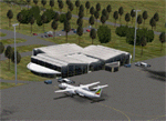
This project adds the booming city of Hawassa, Ethiopia, creates the new international airport (HALA), moves (and rebuilds) the downtown airport (recoded to HALX), and includes AI flight plans for the Ethiopian Airlines service that began April 2016. Tested in both the default FSX: Acceleration and with FTX Global/Vector, accurate coastlines, lakes, road data, and SRTMGL1 (30m) mesh, as well as corrected landclass are provided based on the latest available satellite imagery. The Hawassa International Airport was created using information from the current satellite footprint and the promotional video from Ethiopian Airports Enterprise (EAE). Although there is still very little published data on the airport, it is fully functional.
Updates were created or rebuilt in a manner which carefully aligns airport data with current satellite imagery. Scenery was created using Airport Design Editor X v1.70.6042, SBuilderX 3.13, and the FSX Object Placement Tool. Scenery objects were added and modified from stock FSX scenery to resemble as closely as possible the actual airports. The FSX apron lights included are from the set created by Jim Dhaenens. Thanks to Ron Blehm for bringing this part of the world to my attention.
| Filename: | HALA__Hawassa_Intl___Hawassa_Ethiopia.zip |
| License: | Freeware |
| Added: | 20th July 2016, 09:06:40 |
| Downloads: | 1,022 |
| Author: | Carlyle Sharpe |
| Size: | 10.41 MB |
| Category: Flight Simulator X - Scenery Design | |
| Airfield Lights Toolbox (AFLT) |
|
File Description:
Airfield Lights Toolbox (or AFLT for short) is a comprehensive utility for the creation of standard airfield lights and light arrays for Microsoft Flight Simulator and Prepare3D v1.4 (collectively referred to as "FlightSim") airports. AFLT includes 3D models for the usual airfield light fixtures (runway/taxiway edge and centerline lights, runway threshold/end split lights, obstruction lights and beacons, PAPI/VASIs, wigwags and various approach light configurations) from which you should be able to create just about any airfield light arrangement. AFLT generates complete approach and threshold light arrays (including strobes) based on simple text configuration files. As well, pilot-control of airfield lighting is fully implemented.
The light sources in AFLT's light models are BGL_LIGHTs. Unfortunately, P3D Version 2 does not (yet) support BGL_LIGHTs and does not provide any alternative. (We had hoped that v2.1 would have fixed this, but "no joy". Hopefully, Lockheed Martin will see fit to rectify this deficiency.) Consequently, AFLT is only "P3Dv2-ready".
ALFT is not a library of airfield lights; it is a utility for creating object libraries and light arrays. A general knowledge of FlightSim scenery file organization and airport design is necessary for its use.
| Filename: | Airfield_Lights_Toolbox_AFLT.zip |
| License: | Freeware, limited distribution |
| Added: | 23rd February 2014, 01:21:14 |
| Downloads: | 1,797 |
| Author: | Don Grovestine |
| Size: | 3.85 MB |
| Category: Flight Simulator X - Scenery | |
| Goma Intl (FZNA) DRC and Gisenyi (HRYG) Rwanda |
|
Images related to this file:
File Description:
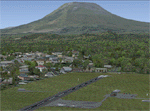
This project includes the neighboring Goma Intl (FZNA) and Gisenyi (HRYG) airports. After Goma's only runway was severely damaged by the eruption of Mount Nyiragongo in 2002, the runway, originally 3000m long, was reduced to 1800m of serviceable pavement after lava flowed onto the northern part runway and through the city center. In 2013, German NGO Welthungerhilfe ("World Hunger Aid") signed a contract to rehabilitate 500m of runway damaged by the lava flow. Goma resumed scheduled international flights in 2015, and this project reflects the airport as of March 2016, with runway 18/36 renumbered to 17/35. SRTMGL1 (30m) mesh brings the volcanoes in the area into much greater detail. This scenery is complimented by the Kigali Intl (HRYR) scenery (FSX_HRYR_Kigali_2016.zip).
Updates were created or rebuilt in a manner which carefully aligns airport data with current satellite imagery. Scenery was created using Airport Design Editor X v1.70.6042, SBuilderX 3.13, and the FSX Object Placement Tool. Scenery objects were added and modified from stock FSX scenery to resemble as closely as possible the actual airports. The FSX apron lights included are from the set created by Jim Dhaenens.
| Filename: | Goma_Intl_FZNA_DRC_and_Gisenyi_HRYG_Rwanda.zip |
| License: | Freeware |
| Added: | 4th August 2016, 21:11:20 |
| Downloads: | 2,283 |
| Author: | Carlyle Sharpe |
| Size: | 5.25 MB |
| Category: Flight Simulator X - Scenery | |
| 2016 Kigali Intl (HRYR) Rwanda |
|
Images related to this file:
File Description:
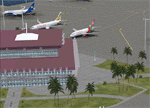
This sequel to the 2009 Kigali Intl (HRYR) Rwanda scenery (by Jacques Botha and Frits Beyer) brings it up to date with the current layout and enables full compliance with FTX Global/Vector and FSX. Buildings are added and adjusted to their real-world locations, and the new taxiway and south apron are added according to the May 2016 satellite imagery. In addition to real-world gate locations, custom apron markings are added along with apron lighting. The landclass around Kigali is also updated, and SRTMGL1 (30m) mesh is included. This scenery can be complemented by the Goma (FZNA) and Gisenyi (HRYG) scenery (FSX_FZNA-HRYG_CS.zip), and GA flightplans are included to supplement the commercial traffic at Kigali and provide more activity at FZNA and HRYG.
Updates were created or rebuilt in a manner which carefully aligns airport data with current satellite imagery. Scenery was created using Airport Design Editor X v1.70.6042, SBuilderX 3.13, and the FSX Object Placement Tool. Scenery objects were added and modified from stock FSX scenery to resemble as closely as possible the actual airports. The FSX apron lights included are from the set created by Jim Dhaenens.
| Filename: | 2016_Kigali_Intl_HRYR_Rwanda.zip |
| License: | Freeware |
| Added: | 4th August 2016, 21:10:09 |
| Downloads: | 3,389 |
| Author: | Carlyle Sharpe, Jacques Botha, and Frits Beyer |
| Size: | 17.12 MB |
| Category: Flight Simulator X - Scenery | |
| Bhutan Airports and Paro Valley |
|
Images related to this file:
File Description:
This project adds and updates all of the airports of Bhutan. Bathpalathang (VQBT) and Gelephu (VQGP) are added, Yongphulla (VQ10) is updated and recoded as VQTY, and Paro (VQPR) is fully updated to reflect current satellite imagery. These are all fully functioning AI airports as well. Special attention was given to the entire Paro Valley, and numerous road/river vectors were updated around Gelephu. Accurate coastlines, lakes, road and river data, as well as corrected landclass are provided based on the latest available satellite imagery. They are optimized to fit seamlessly with FTX Vector's roads/water, but they should be fully functional in all FSX configurations.
GA-encoded flight plans for the Buddha Air/Kathmandu charter are provided to enhance service to Paro. NASA SRTM Global 3 arc second terrain mesh is also included for all of Bhutan. Updates were created or rebuilt in a manner which carefully aligned airport data with current satellite imagery, when available. Scenery was created using Airport Design Editor X v1.61.5298, SBuilderX 3.13, and the FSX Object Placement Tool. Scenery objects were added and modified from stock FSX scenery to resemble as closely as possible the actual airports.
| Filename: | Bhutan_Airports_and_Paro_Valley.zip |
| License: | Freeware |
| Added: | 19th January 2015, 06:09:17 |
| Downloads: | 11,441 |
| Author: | Carlyle Sharpe |
| Size: | 21.4 MB |
| Category: Flight Simulator 2004 - AFCAD Files | |
| Presidente Nicolau Lobato International, Dili, East Timor (WPDL) v2 |
|
File Description:
"Euraka!" I cried in the middle of the night. My wife rolled over and mumbled "its not me, it must be the cat". But I was pleased with myself, for I had suddenly thought of a way to eliminate Microsoft's radiused corners where taxiway meets runway. They are a nifty arrangement, when you want them, but at this airport (clearly evidenced by Google Earth) they do not exist on the concrete connections. So here is a revised version of my Googlyafcad for WPDL Dili-Comoro-Komoro-Presidente Nicolau Lobato International or whatever it is called today. I considered calling this version 1.0062A so as to impress but I think you might prefer me to call it it version 2. Unfortunately, Microsoft's perception of this airport in Flight Simulator is a wee bit under scale and the ramp areas provided barely allow the parking of a flea, never mind the Boeing 737s that serve this airport. This A&F Data file allows you and "AI" traffic to land, park and take-off in the proper manner. But there is more . . . the Google Earth picture clearly shows three parked
helocopters, so to give the place a little atmosphere, I've provided an additional file which will place three static helicopters at the airport. They will only show if you have the Rwy12 libraries
installed, but the file won't bite if you don't. (replaces af2_wpdl.zip)
| Filename: | Presidente_Nicolau_Lobato_International_Dili_East_.zip |
| License: | Freeware |
| Added: | 12th February 2007, 13:07:25 |
| Downloads: | 753 |
| Author: | John Hinson |
| Size: | 44.33 KB |
| Category: Flight Simulator 2004 - Scenery | |
| Exploring Our World - Part 2 - Easter Island, Chile - SCIP - a complete makover. |
|
File Description:
Exploring Our World - Part 2 - Easter Island, Chile. In part two of this new series you will find a complete makeover of Easter Island which MS virtually ignored. Designed to compliment the fine Mataveri International Airport by Daniel Rojas (scip_o7.zip at Flightsim.com), this package includes Mesh and adjusted coastlines by John Young. John has also provided a new Afcad which removes unrealistic pushback starts. A new landclass file by John Burford adds the villages near the airport and more realistic ground treatments. You will also find numerous scenery enhancements using objects from the RWY12 and EZ Scenery libraries. Francisco Vargas has contributed a set of Thermals which soaring fans will enjoy. Of special interest is the use of AI Volkswagens, as taxi's driving around the airport and AI Helicopters that take visiting tourists on sightseeing tours. The AI Volkswagens have been provided by Ranier Girbig and are used with his permission. Easter Island, home of the mysterious head statues (Moai) has many new and exciting things just waiting for you to explore. Even the small adjacent Moto Nui Island, which MS forgot, has been added. This is the second of a series exploring lesser known parts of our FS world. Please unzip (using folders option) to a temporary folder and follow the documentation very carefully to assure a proper installation. ......
| Filename: | Exploring_Our_World__Part_2__Easter_Island_Chile__.zip |
| License: | Freeware |
| Added: | 13th July 2006, 03:22:45 |
| Downloads: | 6,695 |
| Author: | David "Opa" Marshall and friends |
| Size: | 6.7 MB |
| Category: Flight Simulator 2004 - Scenery | |
| Scenery Objects - Rwy 12 scenery Level 2 |
|
File Description:
[File re-uploaded at request of AVSIM] This pack contains the standard scenery objects for the Rwy12 scenery generation program by Israel Roth and Seev Kahn and is specifically issued for the benefit of the end users of my add-on scenery series, although there is no reason why it will not work equally well with any other sceneries designed using this software. Most other designers have stated that the end user MUST download the massive 45 MB full program but this is not only pointless and unnecessary, it is not in accordance with the recommendations of Israel and Seev. Furthermore, the obligatory automatic installation programme is flawed and only works correctly if you have Flight Simulator 2004 installed to the default directory.
This pack of scenery objects addresses all of these issues, and all of my scenery sets will work with or without it - with three possible levels of scenery detail:
Level 1 - the airport scenery will only use Microsoft's default scenery objects (no extras require to be installed).
Level 2 - the airport scenery will additionally display all standard Rwy 12 scenery objects (Fedex vehicles, static GA aircraft, people and trees.
Level 3 - the airport scenery will additionally display third-party Rwy 12 objects.
The latter will require separate download and installation will be detailed in my scenery sets.
| Filename: | Scenery_Objects__Rwy_12_scenery_Level_2.zip |
| License: | Freeware |
| Added: | 20th June 2010, 10:35:15 |
| Downloads: | 12,949 |
| Author: | Israel Roth, Seev Kahn; compiled by John Hinson |
| Size: | 2.83 MB |
| Category: Flight Simulator X - Scenery | |
| VNLK-LUKLA-FSX |
|
File Description:
well it starts as always, i can't find any usable freeware airport in this case for
the VNLK - Lukla Airport so I'll build it myself again...............
well what can i say here it is after a lot of work as real as possible with a lot of
details with the Default scenery built ..........
starts from Kathmandu as in the original with a propeller plane or a transport
heli and brings the climbers and adventurers to the Himalaya Mountains.........
Installation:
copy the folder VNLK-Lukla Scenery into the addon folder of the FSX, start the
FSX Settings, change scenery library , add area, press OK , after that you can
already start............
Extras:
to be able to see people I deliver the file 3DPeoble_Lib with you can
also put it in the Copy the addon folder and activate it in FSX as described
during installation and you'll see you people..............
the same applies to EZ-Scenery-Object files for extra buildings! ( Lukla building )
! Danger ! You don't need these files if you already have them. !
There is a video about my airport on Youtube https://youtu.be/uffenHkCKao
Support:
Questions and help on my Youtube channel
https://www.youtube.com/channel/UC7vHXQMa3hhU2iGtODXlkHw
or by email to [email protected]
And now have fun learning to land under difficult conditions.....
| Filename: | VNLKLUKLAFSX.zip |
| License: | Freeware |
| Added: | 8th April 2023, 01:34:00 |
| Downloads: | 466 |
| Author: | Wagner Ewald alias Jamaika |
| Size: | 76.72 MB |


© 2001-2026 AVSIM Online
All Rights Reserved
Privacy Policy |