
Where Flight Simulation Enthusiasts Gather from Around the World!
AVSIM Library - Search Results

| Category: Flight Simulator 2004 - Scenery | |
| KQA Akutan, Alaska |

|
Images related to this file:
File Description:
This is Akutan, which comprises the water airport, the town, and the Trident crab and fish processing plant just to the west of the town. Akutan is in the Aleutians in an inlet on the island of the same name, around 35 miles ENE of Dutch Harbor, and is served by a Grumman Goose amphibian that flies from Dutch Harbor. The population is just over a thousand, though this can increase as more seasonal workers are employed at the plant. The church is not as big as it looks; the long part is a gymnasium. The Ai includes the Akutan end of a Grumman Goose flight from Dutch Harbour (the AI files are part of the Dutch Harbor scenery) which will take off from the Dutch Harbor runway and land on water at Akutan. It will then park at the bottom of the ramp up onto the apron, which is actually usable if you want to taxi up it. In reality it is a PenAir flight, here it is Reeve Aleutian for technical reasons. The Sea AI includes fishing boats from the Trident dock and a Coast Guard cutter from the town dock; the latter as explained in the updated version of Dutch Harbor, which you should already have installed.
| Filename: | KQA_Akutan_Alaska.zip |
| License: | Freeware, limited distribution |
| Added: | 10th August 2012, 16:54:02 |
| Downloads: | 492 |
| Author: | Roger Wensley + Sidney Schwartz |
| Size: | 3.17 MB |
| Category: Flight Simulator X - Scenery | |
| KDEN - Denver, Colorado International Airport |
|
Images related to this file:
File Description:
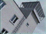
Denver Colorado International Airport For FSX. Several improvements have been made to the default airport, those being:
1. A United Airlines commuter terminal has been added to Concourse B along with custom made jetways complete with the United Airlines logo (these jetways are NOT animated).
2. All jetways and scenery objects will display as long as scenery complexity in FSX is set at normal or higher.
3. The vehicle paths have been redesigned so as not to allow airport vehicles to enter taxiways
4. Optionally, all runways may be opened for AI traffic.
5. The land class has been changed in places so as to prevent autogen objects from displaying on the airport grounds.
6. The tower view has been changed to display from the roof of the control tower.
7. Extra fuel trucks have been added throughout the airport.
8. All gates are accurately portrayed.
9. All taxiways are included and are accurately named, and taxiway signs are accurately placed.
Also, there is an option to place several static United Airlines and Southwest Airlines aircraft in designated spots.
This is an improved version of the airport which I first did in 2007.
Please refer to the README FIRST.txt file for important information
| Filename: | KDEN__Denver_Colorado_International_Airport.zip |
| License: | Freeware, limited distribution |
| Added: | 5th January 2014, 23:51:59 |
| Downloads: | 3,480 |
| Author: | Patrick Finch |
| Size: | 2.57 MB |
| Category: Flight Simulator 2004 - Scenery | |
| Portland KPDX 2010 scenery for FS9 |
|
Images related to this file:
File Description:
Portland KPDX 2010 is a highly detailed and accurate replacement for the default FS9 KPDX scenery. The airport has been completely rebuilt and includes:
* All new taxiways, aprons, roads, buildings and parking areas, covering the airport itself and extending east along Airport Way to the I205 bridge.
* Custom terminal with accurate placement of jetways, gate numbers, ramp lighting and other features, including the Horizon Air terminal extension.
* Custom versions of the old short-term and recently completed long-term parking structures.
* Custom version of the very cool Horizon Air engine runup structure.
* The I205 bridge has been moved to its correct location. If you are using Ultimate Terrain the bridge and roads will now line up.
* Photo textures used wherever feasible.
Peter Ham made the excruciatingly detailed AFCAD and placed the zillions of scenery objects. Sidney Schwartz made the stunningly attractive custom scenery objects. This project represents many hours of work on our part, and we hope you enjoy using it as much as we enjoyed making it. This scenery was designed to work in conjunction with Ultimate Terrain. If you do not have Ultimate Terrain, some of the roads will probably be misplaced, but everything else should work OK.
| Filename: | Portland_KPDX_2010_scenery_for_FS9.zip |
| License: | Freeware |
| Added: | 25th November 2010, 14:19:19 |
| Downloads: | 5,701 |
| Author: | Sidney Schwartz & Peter Ham |
| Size: | 4.33 MB |
| Category: Flight Simulator X - Aircraft Repaints, Textures and Modifications | |
| air algerie livery of wilco a340-300 |
|
File Description:
air algerie leased an a340-300 from hifly
The Airbus A340 is a long-range, wide-body passenger airliner that was developed and produced by Airbus. In the mid-1970s, Airbus conceived several derivatives of the A300, its first airliner, and developed the A340 quadjet in parallel with the A330 twinjet. In June 1987, Airbus launched both designs with their first orders and the A340-300 took its maiden flight on 25 October 1991. It was certified along with the A340-200 on 22 December 1992 and both versions entered service in March 1993 with launch customers Lufthansa and Air France. The larger A340-500/600 were launched on 8 December 1997; the A340-600 flew for the first time on 23 April 2001 and entered service on 1 August 2002.
Keeping the eight-abreast economy cross-section of the A300, the early A340-200/300 has a similar airframe to the A330. Differences include four 151 kN (34,000 lbf) CFM56s instead of two high-thrust turbofans to bypass ETOPS restrictions on trans-oceanic routes, and a three-leg main landing gear instead of two for a heavier 276 t (608,000 lb) MTOW. Both airliners have fly-by-wire controls, which was first introduced on the A320, as well as a similar glass cockpit. The later A340-500/600 have a larger wing and are powered by 275 kN (62,000 lbf) Rolls-Royce Trent 500 for a heavier 380 t (840,000 lb) MTOW.
The shortest A340-200 measured 59.4 m (195 ft), and could cover 12,400 km / 6,700 nmi with 210–250 seats in 3-class. The most common A340-300 reached 63.7 m (209 ft) to accommodate 250–290 passengers and had a 13,500 km / 7,300 nmi range. The A340-500 was 67.9 m (223 ft) long to seat 270–310 over 16,670 km / 9,000 nmi, the longest-range airliner at the time. The longest A340-600 was stretched to 75.4 m (247 ft), then the longest airliner, to accommodate 320–370 passengers over 14,450 km / 7,800 nmi.
As improving engine reliability allowed ETOPS operations for almost all routes, more economical twinjets have replaced quadjets on many routes. On 10 November 2011, Airbus announced that the production reached its end, after 380 orders had been placed and 377 delivered from Toulouse, France. By the end of 2021, the global A340 fleet had completed more than 2.5 million flights over 20 million block hours and carried over 600 million passengers with no fatalities. The A350 is its successor; the McDonnell Douglas MD-11 and the Boeing 777 were its main competitors. Lufthansa is the largest operator and the largest customer with 34 A340 aircraft in its fleet.
| Filename: | air_algerie_livery_of_wilco_a340300.zip |
| License: | Freeware |
| Added: | 29th May 2022, 17:02:17 |
| Downloads: | 165 |
| Author: | moussa cherif baya |
| Size: | 10.55 MB |
| Category: Flight Simulator X - Scenery | |
| GB-0112 - RAF Bassingbourn - Cambridgeshire, England |
|
File Description:
RAF Bassingbourn is a former Royal Air Force station located in Cambridgeshire approximately 3 mi (5 km) north of Royston, Hertfordshire and 11 mi (18 km) south west of Cambridge, Cambridgeshire, England.
RAF Bassingbourn was constructed by John Laing & Son between 1937 and 1939 in the parishes of Wendy and Bassingbourn immediately to the west of the A14 (now the A1198) road. The site selected was low ground between several tributaries of the River Cam. The area had been long cleared of forest and tended to be swampy and unstable, and because the boggy ground produced a persistent mist over the large meadow the site was considered ideal for airfield camouflage.
During the Second World War it served first as an RAF station and then as a bomber airfield of the Eighth Air Force, of the United States Army Air Forces (USAAF). It remains the home of the Tower Museum Bassingbourn. From 19 August 1942 to 25 June 1945, Bassingbourn served as headquarters for the 1st Combat Bombardment Wing of the 1st Bomb Division. It was assigned USAAF designation Station 121.
The RAF resumed occupation of Bassingbourn on 26 June 1945, the airfield was officially returned on 10 July 1945. The station became one of the main airfields for long-range transport aircraft. In 1948 and 1949 Avro York, Avro Lancaster and Douglas Dakota aircraft from the base took part in the Berlin Airlift, a massive operation transporting essential commodities to the beleaguered city.
In February 1952, RAF Bassingbourn received its first allocation of English Electric Canberra bombers and became the first jet bomber operational conversion unit (OCU) in the world. Canberras operated from Bassingbourn for 17 years and one of the aircraft is on static display in the Barracks. From 1963 to 1969 the Joint School of Photographic Interpretation was also located there.
On 29 August 1969, the last RAF Commanding Officer, Sqn Ldr A.M. McGregor MBE, turned over the station to the British Army as Bassingbourn Barracks.
The barracks were established, on the site of the former RAF Bassingbourn airfield, in January 1970, as the new Depot for the Queen's Division. The depot was responsible for training recruits undergoing their 19-week basic training before joining a regular battalion; in 1993 the Barracks were re-designated the home of the "Army Training Regiment, Bassingbourn" and remained as such for nearly 20 years. Bassingbourn Barracks closed as an army training location in August 2012.
The site was reopened for training Libyan soldiers in 2014 but closed down the same year.
Since approximately 1970 the site has retained its RAF links by being the home of 2484 (Bassingbourn) Squadron Air Training Corps.
| Filename: | GB0112__RAF_Bassingbourn__Cambridgeshire_England.zip |
| License: | Freeware |
| Added: | 30th May 2016, 11:01:25 |
| Downloads: | 321 |
| Author: | Terry Boissel |
| Size: | 1.58 MB |
| Category: Flight Simulator 2004 - Scenery | |
| Kaltag KAL in Alaska |
|
Images related to this file:
File Description:
Kaltag is a small village on the west bank of the Yukon River, around 65 miles east of the coast at Unalakleet and about 40 miles south of where the river turns from north-south to east-west, east being upstream towards the distant Fairbanks. The population is just under 200 and living from fishing and the land. The airfield is close by and has a gravel runway aligned 21-3 and just under 5,000 feet long. Apart from the airfield itself, and it's buildings, this scenery modifies the local land class, adds village buildings while reducing the village size to reality, and creates a new airfield background. Kaltag is located on the edge of three different airlines coverage areas, and is served by Bering Air from the northwest, ERA from the southwest, and also by Wright Air from Fairbanks in the east. These are included in the AI.
A note here about my scenery making. This is post number 507 and there will not be many more to follow this as I am almost at the end of the photos I either took or found for scenery purposes. There is a limit to what can be located online and I have already been making use of the little there is; eg Unalakleet. So, if you are near an airport (preferably Canadian or Alaskan) and have a camera..... Let me know.
| Filename: | Kaltag_KAL_in_Alaska.zip |
| License: | Freeware, limited distribution |
| Added: | 20th August 2019, 19:04:35 |
| Downloads: | 101 |
| Author: | Roger Wensley |
| Size: | 3.57 MB |
| Category: X-Plane - Scenery | |
| EPGO - Goraszka 2007 for X-Plane 8 |
|
Images related to this file:
File Description:
EPGO GORASZKA 2007 SCENERY FOR X-PLANE 8
----- ABOUT THE AIRPORT -----
EPGO Goraszka airport is located 12nm (20km) south-east of Warsaw downtown and Warsaw Frederic Chopin International Airport. It was built in 1994 and belongs to General Aviation company, which offers aero-taxi flights, air transport and special flights (air photo, patrol) and airport services. The airport has a 800m-long runway and a lightened helipad, which can be used by helicopters up to 5700kg weight. General Aviation's fleet includes Antonov AN-2, PZL-104 Wilga 80, Bell 407 and 427. Since 1996 the International Air Picnic Goraszka is organized every year by "Polish Eagles" Foundation created on initiative of Zbigniew Niemczycki.
----- SCENERY FEATURES -----
This airstrip has never been included in any of X-plane series default airports list and this is the first, detailed scenery of EPGO. Main features of the scenery are:
-Ground photo texture for the surrounding area - perfect for VFR approaches (four seasons + night textures)
-Airport ground high resolution textures - feel the grass when taxiing (four seasons + night textures)
-Highly detailed 3D objects, all photo textured - we made over 300 photos to have them all realistically textured
-Detailed autogen for the whole area - almost every building and every tree
-Tower view - feel like an air traffic controller
| Filename: | EPGO__Goraszka_2007_for_XPlane_8.zip |
| License: | Freeware, limited distribution |
| Added: | 27th October 2015, 15:16:51 |
| Downloads: | 25 |
| Author: | Drzewiecki Design |
| Size: | 50.53 MB |
| Category: X-Plane - Scenery | |
| EPGO - Goraszka 2007 for X-Plane 9 |
|
Images related to this file:
File Description:

EPGO GORASZKA 2007 SCENERY FOR X-PLANE 9
----- ABOUT THE AIRPORT -----
EPGO Goraszka airport is located 12nm (20km) south-east of Warsaw downtown and Warsaw Frederic Chopin International Airport. It was built in 1994 and belongs to General Aviation company, which offers aero-taxi flights, air transport and special flights (air photo, patrol) and airport services. The airport has a 800m-long runway and a lightened helipad, which can be used by helicopters up to 5700kg weight. General Aviation's fleet includes Antonov AN-2, PZL-104 Wilga 80, Bell 407 and 427. Since 1996 the International Air Picnic Goraszka is organized every year by "Polish Eagles" Foundation created on initiative of Zbigniew Niemczycki.
----- SCENERY FEATURES -----
This airstrip has never been included in any of X-plane series default airports list and this is the first, detailed scenery of EPGO. Main features of the scenery are:
- Ground photo texture for the surrounding area - perfect for VFR approaches (four seasons + night textures)
- Airport ground high resolution textures - feel the grass when taxiing (four seasons + night textures)
- Highly detailed 3D objects, all photo textured - we made over 300 photos to have them all realistically textured
- Detailed autogen for the whole area - almost every building and every tree
- Tower view - feel like an air traffic controller
| Filename: | EPGO__Goraszka_2007_for_XPlane_9.zip |
| License: | Freeware, limited distribution |
| Added: | 27th October 2015, 15:18:36 |
| Downloads: | 49 |
| Author: | Drzewiecki Design |
| Size: | 44.65 MB |
| Category: Flight Simulator 2004 - Scenery | |
| CYOC - Old Crow - Yukon Territory, Canada |
|
Images related to this file:
File Description:
Old Crow is in the far north of the Yukon Territory, Canada, 115 miles south of the nearest coastline and 30 miles east of the border with Alaska. The town has a population of less than 300 and the population are reliant on the caribou migration for an annual food supply replenishment. The fact that it is the only Yukon town that cannot be reached by car makes the airport important, and there are regular flights by Air North, the Yukon airline. They are included in the AI along with GA aircraft. I had several tries at matching up the Hawker Siddeley 748 with the right set of textures and I have included both here so that you do not have to go through the same torture. Thanks go to Hernan for sorting all that out, and for his textures. The airport is beside the town that is built along a bank of the Porcupine River. I have replicated the current shore line of the river that has cut a new channel at one end of the town, and I flattened the river as it was somewhat mountainous. The runway is gravel and just over 5,000 feet long, aligned 03-21. The terminal building is specific to Old Crow as I had photos, but the hangars are approximations and the village houses are only representational.
| Filename: | CYOC__Old_Crow__Yukon_Territory_Canada.zip |
| License: | Freeware, limited distribution |
| Added: | 5th December 2014, 13:31:46 |
| Downloads: | 370 |
| Author: | Roger Wensley |
| Size: | 7.58 MB |
| Category: Flight Simulator 2004 - Scenery | |
| CYPE - Peace River - Northwest Alberta, Canada |
|
Images related to this file:
File Description:
The Peace River flows east from the Rockies, joining up with the Slave River to empty into Great Slave Lake. The town is on both banks close to a bend, 245 miles northwest of Edmonton. The population is 7,000 and the surrounding area is either farmland or forest and used for winter sports; Peace River hosted the 2004 Alberta Winter Games. The airport is just over 3 miles west of the town. The runway is 5,000 feet of wide asphalt (150 feet) aligned 04/22, lit, and with PAPI. There is a second runway to the south of the main runway, 1,900 feet of grass and aligned 08/26. The apron is to the north of the runway at the eastern end and is large; there is a purpose-built terminal building, plus other hangar buildings along taxiway C that extends westward from the apron. The airport gives the impression that it is under-used; there are no long lines of parked planes waiting for the weekend and few scheduled flights. These are mainly (totally?) by Sunwest Home Aviation, but unfortunately nobody has made the textures for Sunwest and my talents do not run in that direction so I have made believable substitutions. There is also a small but obstinate AI difficulty, described in the notes.
| Filename: | CYPE__Peace_River__Northwest_Alberta_Canada.zip |
| License: | Freeware, limited distribution |
| Added: | 10th November 2013, 23:56:22 |
| Downloads: | 332 |
| Author: | Roger Wensley |
| Size: | 10.83 MB |
© 2001-2026 AVSIM Online
All Rights Reserved
Privacy Policy |