
Where Flight Simulation Enthusiasts Gather from Around the World!
AVSIM Library - Search Results

| Category: Flight Simulator X - Scenery | |
| Goma Intl (FZNA) DRC and Gisenyi (HRYG) Rwanda |

|
Images related to this file:
File Description:
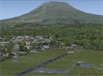
This project includes the neighboring Goma Intl (FZNA) and Gisenyi (HRYG) airports. After Goma's only runway was severely damaged by the eruption of Mount Nyiragongo in 2002, the runway, originally 3000m long, was reduced to 1800m of serviceable pavement after lava flowed onto the northern part runway and through the city center. In 2013, German NGO Welthungerhilfe ("World Hunger Aid") signed a contract to rehabilitate 500m of runway damaged by the lava flow. Goma resumed scheduled international flights in 2015, and this project reflects the airport as of March 2016, with runway 18/36 renumbered to 17/35. SRTMGL1 (30m) mesh brings the volcanoes in the area into much greater detail. This scenery is complimented by the Kigali Intl (HRYR) scenery (FSX_HRYR_Kigali_2016.zip).
Updates were created or rebuilt in a manner which carefully aligns airport data with current satellite imagery. Scenery was created using Airport Design Editor X v1.70.6042, SBuilderX 3.13, and the FSX Object Placement Tool. Scenery objects were added and modified from stock FSX scenery to resemble as closely as possible the actual airports. The FSX apron lights included are from the set created by Jim Dhaenens.
| Filename: | Goma_Intl_FZNA_DRC_and_Gisenyi_HRYG_Rwanda.zip |
| License: | Freeware |
| Added: | 4th August 2016, 21:11:20 |
| Downloads: | 2,276 |
| Author: | Carlyle Sharpe |
| Size: | 5.25 MB |
| Category: Flight Simulator 2004 - AI Flight Plans | |
| !UPDATED! Enerjet Summer 2010 |
|
Images related to this file:
File Description:

Project: UPDATED Enerjet Summer 2010 Flightplans (2 aircraft)
Date: 14 September 2010 (very late release)
Enerjet is a new charter airline based in Canada. It operates to popular destinations from Canada and their
base at Calgary International Airport, Vancouver - Vancouver International Airport and Toronto - Pearson International Airport.
Currently Enerjet operates two Boeing 737-700w aircraft for Suncor Energy on a long-term contract transporting their employees to the
Oil Sands projects. Also, Sunwing/Signature Vacations flights for summer from Calgary, Edmonton and Vancouver to Puerto Vallarta and
Cancun. To fill out the flight plans I have added some sun destinations which were previously served by now defunct carrier
Skyserice. Enerjet was one of the carriers which was selected to finish out their summer flights.
*** I highly recommend you download and install my "Suncor Energy CRJ 900 Flightplans and Oil Sands Airfields AFCAD2s" found on Avsim - suncorenergycrj900_winter_2008-2009.zip
The flightplans use my AFCAD2s for the following private airfields:
AF2_CFG6 - Fort McKay/Firebag Aerodrome, Firebag River, Alberta
Again a "big" thank you to Darren Belanger for providing the airport charts for these airfields and the repaints for Enerjet - enerjet_737w_dtb.zip
| Filename: | UPDATED_Enerjet_Summer_2010.zip |
| License: | Freeware |
| Added: | 14th October 2010, 03:49:05 |
| Downloads: | 1,116 |
| Author: | Jerel Gregory Hayes |
| Size: | 6.34 KB |
| Category: Flight Simulator 2004 - Miscellaneous Files | |
| Config File - Mega Pack |
|
File Description:
These is a summary of 37 config files for the Payware product "Aerosoft Aiport Enhancement Services". For more information about this wonderful add-on, please visit Aerosoft's website. I added all posted config files till yet from Michel Hunziker and Sander van Esch plus several created by my own. I made these files, so you don't need to search around a long time. Unfortunately not all possible files are included so everyone is free to complete this files. Included are these files: Michel Hunziker: aes_a310_hnac.zip, aes-a321.zip, aes-a319.zip, aes-a320.zip, aes-a332.zip, aes-rj85.zip, aes-rj1h.zip, aes-md81.zip, aes-md82.zip, aes-md83.zip, aes-md87.zip, aes-md88.zip,aes-md90.zip, aes-a343.zip, aes-b753.zip, aes-b772.zip, aes-b773.zip, aes-b733.zip, aes-b735.zip, aes-b752.zip Sander van Esch: aes_b733_50n.zip, aes_b734_50n.zip, aes_b735_50n.zip, aes_b738_posky.zip, aes_b73g_posky.zip, aes-b763.zip my own: aes-pssconcorde2004, aes-ewg-A319, aes-EWG-A322, aes-TUP-154B2, aes-FeelThere-B734, aes-PSS-B752FR,aes-CLS-A345, 2x aes-CLS-A346, aes-CSIM-B707, IFDG-MD11 PAX vers. ( incl. Model and new panel )
| Filename: | Config_File__Mega_Pack.zip |
| License: | Freeware |
| Added: | 4th February 2007, 05:17:09 |
| Downloads: | 2,273 |
| Author: | Maurizio Reith feat. Michel Hunziker & Sander van Esch |
| Size: | 14.15 MB |
| Category: Prepar3D V1-4 - Scenery | |
| GMTT - Tangier Ibn Battuta Airport |
|
File Description:
Tangier Ibn Battuta Airpor (French: Aéroport de Tanger-Ibn Battouta), IATA: TNG, ICAO: GMTT, is an international airport serving Tangier (Tanger in French), the capital city of the Tanger-Tetouan-Al Hoceima region in Morocco. A new airport terminal building was opened in 2008 to provide for many more flights and increased passenger capability, as Tangier has grown rapidly and modernised.
Aircraft parking space of 40,640 square metres (437,445 sq ft) supports up to four Boeing 737s and one Boeing 747.
For small craft two dedicated sections are assigned. The air terminal is 12,000 m2 (129,167 sq ft) and designed to handle 1,250,000 passengers per year. The cargo terminal is 529 m2 (5,694 sq ft) of covered space.
The 3500 meter long runway 10/28 is open and is capable of handling all sizes of aircraft up to the size of a Boeing 747 and Airbus A380-800.
The airport has an ILS status (Loc – Glide – DME) and offers the following radionavigational aids: VOR – DME – NDB. PAPI lighting available for runway 10/28 for approaches from either direction.
| Filename: | GMTT__Tangier_Ibn_Battuta_Airport.zip |
| License: | Freeware |
| Added: | 9th June 2021, 00:08:54 |
| Downloads: | 772 |
| Author: | Eduardo Puelker |
| Size: | 10.22 MB |
| Category: Flight Simulator 2004 - Scenery | |
| CYCS - Chesterfield Inlet - Nunavut, Canada Modified V1 |
|
Images related to this file:
File Description:
This version of Chesterfield Inlet corrects the VASI position on the runway, and also updates the taxiway edge lights to a newer and smaller version which is more realistically sized. This is a complete version and does not require you to have installed the old version. There is new AI, which is for Arviat, Whale Cove, and Chesterfield Inlet; this enlarges on and replaces the version posted with Whale Cove so use this one. The First Air and Calm Air flights also visit Rankin Inlet (made by Sid) and the GA flights originate in Rankin Inlet. There is a revised Rankin Inlet bgl so that the planes are allowed to use the gates. Chesterfield Inlet is a small village on the west coast of Hudson Bay, with a population of 340 or so. It is the oldest community in Nunavut and was established around a Hudson Bay Company post in 1911. It is 55 miles north of Rankin Inlet (Sid and Pete's post). The airfield is close to the village and has a gravel runway 3,600 feet long aligned 124T/304T (true, not magnetic).
| Filename: | CYCS__Chesterfield_Inlet__Nunavut_Canada_Modified_.zip |
| License: | Freeware, limited distribution |
| Added: | 23rd August 2014, 11:22:36 |
| Downloads: | 198 |
| Author: | Roger Wensley |
| Size: | 3.3 MB |
| Category: Flight Simulator 2004 - Scenery | |
| Alma CYTF in Quebec Canada |
|
Images related to this file:
File Description:
This is the second of five sceneries around Lac Saint-Jean in Quebec, Canada. Alma, the town, is 7 miles east of Lac Saint-Jean, on both the northern and southern banks of the Saguenay River. The airfield is at the southern edge of the town, with a single 13-31 runway 5,000 feet long and approach lighting at both ends. There is a visible ILS sytem but this was no longer in operation by 2010, the approximate date setting of this scenery. The largest operation on the field, by far, is Panorama Helicopters (actually Helicopteres Panorama) and this is reflected in the AI and a parked static helicopter. The ai includes helicopters that were originally posted as part of the payware Alaska Fjords series, with the permission of FSAddon. There are also other planes listed that will be required here or for the future posts in this series and are included here. The amphibious Beaver AI plane will only be available if you already have the payware Aerosoft Beaver installed, and I should have made it clear that the float Beaver included in the CTD3 AI was also an Aerosoft plane.
| Filename: | Alma_CYTF_in_Quebec_Canada.zip |
| License: | Freeware, limited distribution |
| Added: | 6th November 2017, 19:30:34 |
| Downloads: | 226 |
| Author: | Roger Wensley |
| Size: | 17.42 MB |
| Category: Flight Simulator 2004 - Scenery | |
| Kugluktuk CYCO in Nunavut, Canada |
|
Images related to this file:
File Description:
Kugluktuk is on the coast of northern mainland Canada on the mouth of the Coppermine River. It is around 250 miles west of Cambridge Bay and 200 miles south of Ulukhaktok. Tuktoyaktuk is 450 miles west. Kugluktuk used to be called Coppermine as copper was mined along the banks of the river and used for spear and arrow heads, and this attracted a semi-permanent population. The population now numbers around 1,450. The airfield is inland from the village and the 5,500 feet of 100 feet wide gravel runway is aligned 121T/3301T where T stands for "true" as opposed to magnetic in the Northern Domestic Airspace. Both JETA-1 and 100LL are available, dispensed by a truck as the storage tanks are just off the northern edge of the field. There are flights by First Air and Canadian North and the AI includes a daily flight of each, plus a cargo visit by Buffalo; the closest large city is Yellowknife, 375 miles south. I should have mentioned a long time ago that to see the apron lights working requires you to have the "lights_ss_v2" by Sidney Schwartz installed.
| Filename: | Kugluktuk_CYCO_in_Nunavut_Canada.zip |
| License: | Freeware |
| Added: | 10th November 2012, 04:03:35 |
| Downloads: | 428 |
| Author: | Roger Wensley |
| Size: | 3.04 MB |
| Category: Flight Simulator 2004 - Scenery | |
| Attawapiskat CYAT in northern Ontario, Canada |
|
Images related to this file:
File Description:
Attawapiskat is on the north bank of the river of the same name, around 7 miles upstream from where the river meets the west shore of James Bay at its mid point. The top end of the Bay is around 140 miles north, Moosonee is around the same to the south, and the east shore 140 miles to the east. The town has a population of around 1,600, although this varies with the seasons as hunting and the traditional way of life on the land is still important to the Cree-speaking inhabitants. The airport is just to the north of the town with a gravel runway almost 3,500 feet long, and I have included the recently installed PAPI. The Canada Flight Supplement does not say anything about fuel being available so I presume the tanks beside the apron are no longer in use. There is also no apron lighting, unless it has been installed recently. There are flights by Air Creebec and by several other smaller airlines and I have included both Air Creebec and Wasaya; their textures are available for download and the planes are as listed in the AI folder.
| Filename: | Attawapiskat_CYAT_in_northern_Ontario_Canada.zip |
| License: | Freeware, limited distribution |
| Added: | 3rd January 2013, 01:37:50 |
| Downloads: | 376 |
| Author: | Roger Wensley |
| Size: | 3.54 MB |
| Category: Flight Simulator 2004 - Scenery | |
| Kenmore Village Field CF08 near Ottawa in Ontario, Canada |
|
Images related to this file:
File Description:
Kenmore Village Field is in Ontario, at the northwest corner of the village of Kenmore. Kenmore is around 13 miles southeast of Ottawa airport and 3 miles east of Bank Farm Field. The village doesn't appear in FS as it is too small, but I have recreated it based on the roads that show in Ultimate Terrain. There is a grass runway 09/27 (actually 086/266) that is 3,100 feet long, and the grass is good, and with lights. The field is owned by a gentleman in his mid 70's who sold his plane five years ago and less than two years later discovered that he really didn't want to give up flying; he then went out and bought another slightly older and cheaper version of the one he sold. The house is in a direct line with the runway approach from the east; try to miss it. There is a large hangar and workshop behind the house and to the north of the runway center line, and a second older hangar on the same side a bit further along, both modeled specifically for this.
| Filename: | Kenmore_Village_Field_CF08_near_Ottawa_in_Ontario_.zip |
| License: | Freeware, limited distribution |
| Added: | 9th February 2010, 13:39:57 |
| Downloads: | 394 |
| Author: | Roger Wensley |
| Size: | 10.69 MB |
| Category: Flight Simulator 2004 - Gauges | |
| Reduced Braking Effectiveness in Rain and Snow |
|
File Description:
If you want more realism and are tired of having the same braking effectiveness in rain and snow as on a dry runway then this is for you.
There are two gauges, "BrakingAction" and "BrakingAction_AntiSkid".
Use the gauge "BrakingAction" for aircraft which do not have an AntiSkid system; do not use it on aircraft with antiskid (e.g. airliners) - for those use "BrakingAction_AntiSkid".
The gauges will reduce braking effectiveness during rain, snow, and freezing rain. In addition, the "BrakingAction" gauge simulates blocked wheels if you stay on the brake for too long; blocked wheels will further reduce the braking effectiveness; in addition, blocked wheels will put wear on the tires on dry and rainy runways; this may lead to a blown tire.
NOTE: The gauges are made for users who either use the keyboard or an assigned button (or two for differential brakes) on the joystick for braking. The gauges will most likely not work with devices that allow a progressive braking input, i.e. that allow you to apply brake pressure anywhere between 0 and 100% (I guess there are rudder pedals that allow you to do that).
| Filename: | Reduced_Braking_Effectiveness_in_Rain_and_Snow.zip |
| License: | Freeware |
| Added: | 27th February 2015, 18:09:43 |
| Downloads: | 306 |
| Author: | Detlev J. Rohmer |
| Size: | 132.84 KB |
© 2001-2026 AVSIM Online
All Rights Reserved
Privacy Policy |