
Where Flight Simulation Enthusiasts Gather from Around the World!
AVSIM Library - Search Results

| Category: Flight Simulator 2004 - Scenery | |
| Port Hardy CYZT in British Columbia, Canada |

|
Images related to this file:
File Description:
Port Hardy airport is on the coast of Vancouver Island in BC, at the far northern end and 5 miles east of the town. The town and the airport are both gateways to local touristic attractions such as Cape Scott Provincial Park, the North Coast and BC Marine Trails, and kayaking, caving, surfing, fishing, camping, and scuba diving (and I discovered just how big orca are). Fishing, logging, and mining have been important and to an extent still are for the town population of just over 4,000. The airport, along with the ferries, connects Port Hardy to the rest of the west coast with Pacific Coastal Saab 340 or Beechcraft 1900C flights to and from Vancouver at least twice a day. There are also Grumman Goose amphibious flights to local float bases such as Port McNeill, Alert Bay, Whaletown, Surge Narrows, Echo Bay, and Minstrel Island. These are all included in the AI and previously posted. There are three runways: 11-29 of 5,000 feet with ILS on 11 and righthand circuits on 29, 07-25 of 4,000 feet with righthand circuits on 25, and 16-34 with a much shortened 3,500 feet on 34 due to a displaced threshold. There is a control tower but it is not manned 24 hours a day; a "mandatory frequency" (MF for short and a Canadian invention) is used by the tower when it is manned, and when there is no tower response the aircraft continues to announce intentions and position. Something I have been meaning to explain to those who query it, is that in real life as well as in FS9 helicopters at a mixed use airport or airfield will act as if they are planes and join downwind, turn on base and then finals, "land" along the runway and then use the taxiway to the parking. This means all aircraft are doing the same thing and an orderly queue avoids collisions. This is one of a series connected in some way with Pacific Coastal airline destinations, the first being Bella Coola. There is AI available for Pacific Coastal online.
| Filename: | Port_Hardy_CYZT_in_British_Columbia_Canada.zip |
| License: | Freeware, limited distribution |
| Added: | 11th November 2018, 16:48:50 |
| Downloads: | 234 |
| Author: | Roger Wensley |
| Size: | 19.26 MB |
| Category: Flight Simulator X - Original Aircraft | |
| Boeing 787-8XLR Qantas |
|
Images related to this file:
File Description:
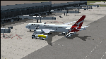
Qantas is requesting proposals (Dec 2018) for design of an aircraft model or variation that is capable of non-stop flights over 10,000 nm for YSSY to EGLL and/or YPPH to KDFW and return service routes. This model is the best choice for Boeing based on real world data. The Boeing 787-8XLR "Dreamcruiser" will have a maximum range of 13,600 nm at FL450E (Mach .83) which will give her more than the desired capabilities, and will be the very efficient. This model (B788XLR) is based on the current 787-8 using weight modifications to increase the range without adding additional fuel tanks, and designed for luxury/comfort with only 161 paid passengers on board. Everything in this model is realistic to the best of my abilities. If Boeing creates this model, it will likely be very similar to this. The name is my own invention, as are all of the weight characteristics. Based on all of my extensive testing, there is no other aircraft capable of these requirements, to date. The 787-800 is certainly the right choice for Qantas if Boeing decides they will modify the original model to fit these requirements. In reality, there is no such aircraft as a 787-8XLR Dreamcruiser. Not yet, anyway. My data shows the aircraft is capable of long-range non-stop flights over 13,000 nm east or west at Mach .82 and above FL435. However, this can only be done by lowering the empty weight and using the full fuel capabilities designed within the original model. This simple modification cuts the total souls on board down to 176, with 161 paid passengers, 11 flight attendants, and 4 pilots in two shifts. Full fuel can now be used in all long-range flights which is actually not common for most 787-800s in service today (Fuel Managed). Ramp and MTOW remain the same, but because she flies higher than normal, and has less weight, she can cruise much further than any other 787. In reality, this is what the 787 was originally designed to do.
| Filename: | Boeing_7878XLR_Qantas.zip |
| License: | Freeware |
| Added: | 12th January 2019, 20:18:29 |
| Downloads: | 481 |
| Author: | Douglas E Trapp |
| Size: | 35.3 MB |
| Category: Flight Simulator 2004 - Scenery | |
| Cordova Smith PACV & Municipal CKU in Alaska US |
|
Images related to this file:
File Description:
Cordova is on the south coast of Alaska, around 150 miles east of Anchorage and 45 miles south of Valdez. The town is mainly built on a small but relatively flat area between the east side of Prince William Sound and Eyak Lake, and has a population of around 2,350 in 2010, the approximate date of this scenery.
The Municipal Airfield CKU is on the north side of Eyak Lake to the east of Cordova, with the runway that is 1,800 feet of unlit gravel squeezed between the lake and the road that runs around the lake. The hangars and parking aprons are reached by taxiing across, and to some extent along, the road. Float planes are also taken from the lake to an apron to the west of the runway.
Cordova Airport PACV (named in the real world "Merle K. (Mudhole) Smith", and I will leave you to research this) is known as Cordova Smith in FS9 and is 10 miles to the east of the town on relatively flat ground between mountains to the north and the sea to the south. The runway is 8,080 feet of lit asphalt aligned 09-27 with ILS on runway 27 and VASI on both ends. The aprons are to the north side of the runway and are reached by back-taxiing; there are no taxiways parallel to the runway. The main apron serves Alaska Air via the western of two taxiways. The GA parking and hangars are mainly reached by using the eastern taxiway, though there is in fact a connecting taxiway between the two (for GA, but definitely not for airliner use). The taxiway further to the west serves the separated Alaska Coastguard apron and hangar, which is mainly for helicopter use. There is a nominally grass runway 1,900 feet long and aligned 16-34 to the south of the main runway; in fact it appears to be more gravel than grass. I have left this inactive as otherwise AI Alaska Air planes would be attempting to use this when the wind made it seem like a good idea.
The AI includes Alaska Air (twice a day) and also Coastguard helicopters, along with GA.
| Filename: | Cordova_Smith_PACV__Municipal_CKU_in_Alaska_US.zip |
| License: | Freeware, limited distribution |
| Added: | 22nd January 2022, 21:53:03 |
| Downloads: | 148 |
| Author: | Roger Wensley |
| Size: | 16.93 MB |
| Category: Flight Simulator X - Aircraft Repaints, Textures and Modifications | |
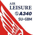
| FSX/P3D Thomas Ruth Air Leisure Egypt SU-GBM Airbus A340-212 |
|
Images related to this file:
File Description:
(TEXTURES ONLY)
(ONLY TESTED IN FSX: STEAM EDITION)
This was requested by Ahmed Fouad on the Facebook as well as in Flightsim. This has been requested by him for a while so I decided to do it.
Happy New Years guys! This is my first livery for the year. Sadly, as of writing this, Flightsim just went offline for renovation and may stay like that for who knows how long. Could be days, weeks, or even months.
I used the placards from Joey_C's Dragonair A330-300 Livery for the Bulk Cargo Doors as well as the Cargo Door Levers. He is the same user I asked permission from to use his decals and door placards for my Dragonair Cargo 747-300SF Livery, so thanks to him again for letting me borrow his textures with his permission! You should also check out his page if you like flying with X-Plane!
I spent a few hours on this livery just by doing the logo alone. Since I needed a high quality photo of the tail logo, I used OpenAI's ChatGPT to upscale the logo and it did, though the edges still look very pixelated. So I spent a few hours trying to re-draw every line so it could be the highest quality as possible.
I further spent the entire day trying to find photos of the cargo door placards, specifically the "CARGO DOOR OPERATIONS" Instructions text. In real life, it included both in English and Arabic. I tried looking for a photo of the instructions for hours until I found it on a YouTube Shorts video. Then I used that as a reference which also took me a few hours trying to make lines, outlines, and text for it. I didn't want to spend more time doing the same thing for the Arabic text, so I used ChatGPT to translate all of the text and I just remove the background using DXTBMP.
Instructions and more information are included in the readme file.
| Filename: | FSXP3D_Thomas_Ruth_Air_Leisure_Egypt_SUGBM_Airbus_.zip |
| License: | Freeware |
| Added: | 3rd January 2026, 14:44:37 |
| Downloads: | 37 |
| Author: | Ryubunao |
| Size: | 79.81 MB |
| Category: X-Plane - Scenery | |
| London 2004 |
|
File Description:
Continuing my new free releases for this year, here is my London 2004 scenery package that I designed for my personal
use but now I want to share it with the community. I have had numerous requests to do more cities and airports so this is my third scenery for 2004. Being the lazy
person I am, no research was done and no claim to real life cities and airports is intended or implied.
I have added many objects to the airports and cities including terminals, hangers, buildings, castles, city scapes and
other fun and interesting things. All of which were culled from all the wonderful designers in the X-Plane Community
such as B. Brooks & Christian Franz, Ted Davis, Tom Curtis, Ralph Glass, Tim Chandler, Didier Chauveau and all the
other hard working and exceptionally talented designers who have inspired me. Many thanks to each of you for your
contributions to the X-Plane community.
Like all my scenery packages, the additions to the citys and airports are purely fictional. The airports themselves are
unaltered. I have enhanced London Heathrow (EGLL), London Gatwick (EGKK), London City (EGLC) airports and of
course the city of London . A special thanks to Robert Bunce for his NYEXPRO packages and Ken Spiker for his
KWIKCITIES package. If I inadvertently left out other objects and scenery designers, it was purely unintentional and I
offer my apologies.
All airports and cities come with Night Textures. Flying at dusk and dawn will add additional enjoyment to your
experience. You may want to experiment with your Autogen settings for best results. I turn mine way down in the
rendering settings so that autogen buildings don't sit on top of custom objects and roads. It will improve framerates as
well.
Installation: Place the extracted "London 2004" folder into your "Custom Scenery" folder. I have included apt.dat files
for v6.70 and v7.30. Keep the apt.dat file for your particular XP version. Apt.dat files are different formats for v6 and v7.
Please send any comments or suggestions to [email protected]. If you choose to rate my Scenery Packs and
give less than a "9" rating, I would appreciate knowing what I can do to improve them. I can only do that with your
feedback.
My Other Free Scenery Packages are:
Charlotte-Rock Hill,
Houston-Galveston,
Iraq,
Nice, France,
San Diego 2004,
San Francisco 2004.
All are available at X-Plane.org and Avsim.com.
Have fun and FLY SAFE!.
| Filename: | London_2004.zip |
| License: | Freeware |
| Added: | 18th January 2004, 22:54:38 |
| Downloads: | 6,517 |
| Author: | Bill Moore |
| Size: | 9.28 MB |
| Category: Flight Simulator 2004 - Scenery | |
| PABR - Barrow - Alaska, USA |
|
Images related to this file:
File Description:
The town of Barrow is in the far north of Alaska, and is best known in flying circles as the place where Wiley Post crashed his floatplane on takeoff and killed himself and Will Rogers. The crash was some 15 miles south of Barrow and was "assisted" by the mismatched fuselage, wings, and floats that had been assembled to create the floatplane. The Barrow population is largely Inupiat and totals some 4,400. The downtown area of Barrow is immediately north of the airport. The second and largest part of Barrow is further north past a string of lagoons and is locally called Browerville. To the northeast along the coast is the smallest part around what used to be the Naval Arctic Research Lab, and is now a college. To the east of this are the DEW buildings, plus two large navy hangars and the gravel runway that was used to serve the DEW station. The PABR runway is aligned 06-24 in FS9 and is 7,100 feet long and 150 feet wide, built on top of a gravel base and surround that copes with the underlying permafrost. There is PAPI at both ends and an ILS and approach lights on 06; 06 circuits are to the right. The airport notes include a warning that the apron is not a standard width and that large planes that are enroute to the far end of the runway will not be able to taxi past a plane parked at the gate and should use the runway as a taxiway, then turn and takeoff. FS9 AI cannot cope with that, so the apron here is wider. There are, in real life and the AI, daily flights by Air Alaska (three at least) and Era (several, and which is now called Ravn, hence the new hangar door motif) and air cargo flights by Northern Air Cargo and Everts, plus GA. The buildings have been made with photographic textures or textures made from reference photos. I decided that while 500+ scenery objects was probably ok for most people the required 900+ to "make" the town of Barrow would likely not be. The auto-generated FS9 town objects could not be left as Barrow with trees would not look at all like reality; I have "faded" the density of the town buildings into the distance from the airport.
| Filename: | PABR__Barrow__Alaska_USA.zip |
| License: | Freeware, limited distribution |
| Added: | 17th May 2016, 09:32:36 |
| Downloads: | 972 |
| Author: | Roger Wensley |
| Size: | 15.12 MB |
| Category: Flight Simulator 2004 - Scenery | |
| VAGO Goa/Dabolim Navy, India |
|
File Description:
Googly scenery for Dabolim Navy Airport, Goa - a busy Indian military airport also used for
civilian flights which is poorly provided for in Flight Simulator 2004. These scenery
files add taxiways, aprons, buildings and other airport features, so that you and
your "AI" traffic can land, taxi, park and take off in a realistic manner.
Today Goa is a popular tourist destination, but it does not have its own civilian
airport. Instead the ever-increasing number of charter flights use the Indian
Navy's airport. But they may only land when the Navy's novice pilots are not
pretending the runway is a 11,000 foot aircraft carrier deck so civilian flights
have to be packed into short periods (before 9 am and 1 pm to 6 pm) and this leads
to the small terminal ramp being literally packed with aircraft at times. All kinds
of jets from around the world up to Boeing 747s call here, flown by European and
Asian operators like Air Deccan, Air India, Air Sahara, Arkefly, Condor Thomas Cook,
Go Air, Indian Airlines, Jet Airways, Kingfisher Airlines, Monarch Airlines,
Spicejet, SriLankan Airlines, Thomsonfly, Tiger Airways, Transaero and XL Airways
along with ATR turboprops on shorter flights with Air Deccan. The
Indian Coast Guard has a base here for its aircraft, and the Indian Air Force
carry out exercises from time to time with their fighter bombers. The Navy's
three-aircraft aerobatic team is also based here.
To cope with the increasing traffic, the airport is currently under development
and enlargement but details of this are not currently available so this scenery has
been created showing the existing arrangements. This, combined with the limitations
of Flight Simulator and its parking and taxying arrangements, means that it isn't
possible to realistically pack the aircraft all in at busy times. Any overflow of traffic will
find itself diverted to the Navy's parking area or even the aircraft museum.
However, my observations are that many of the schedules prepared for Flight
Simulator do not recognise the limited landing times and the traffic is spread
fairly evenly throughout the day, so such overflows should be infrequent.
The scenery does not purport to be ultra-accurate. Based on high-detail satellite
imagery from Google Earth, the layout is proportionally correct but the added
airport features, such as buildings, are built from default Microsoft objects
and add-on libraries so will not look like the real thing.
You are not obliged to download and install any additional scenery libraries,
but to enjoy this scenery in its entirety, you may wish to. It will work fine,
with or without.
| Filename: | VAGO_GoaDabolim_Navy_India.zip |
| License: | Freeware |
| Added: | 8th August 2007, 23:14:21 |
| Downloads: | 3,959 |
| Author: | John Hinson |
| Size: | 78.48 KB |
| Category: Flight Simulator X - AFCAD Files | |
| Robert J. Miller Air Park Airport (KMJX), NJ |
|
File Description:
Located 05 miles SW of Toms River, New Jersey on 232 acres of land, R.J. Miller Air Park is a public asphalt strip 5949' in length. The airport buildings and immediate surrounding area have been included, magnetic variation adjusted, PAPI properly placed, taxiway lines drawn accurately, beacon properly placed, lit winsock and wind tee (both functional). The parking available has been matched to the current configuration of the airport, which is still undergoing renovation. Not included is the under-construction building just to the south of the terminal and the additional large hangar just north of the already-existing one. Taxiway lighting could not be seen in aerial photos - complete liberty on behalf of the author was taken when placing taxiway lights. Helipad is lit at night although the real world pad is not. Tiedown parking is available on the main tarmac in three sections: Southwest, Northeast, and regular Parking which is in the middle. RAMP_GA_SMALL parking spots are for aircraft with wingspans no greater than 40 feet. RAMP_GA_MEDIUM parking spots are for aircraft with wingspans no greater than 60 feet. RAMP_GA parking spots are occupied/blocked by static objects and should not be chosen as a start location (although collision detection with all such objects has been disabled). There are 4 open hangars - three to the Southwest are for RAMP_GA_SMALL aircraft while the Northeast one is for RAMP_GA_MEDIUM aircraft or smaller. All hangar parking spots are labeled DOCK_GA. A hangar on the main tarmac and a hangar on the tarmac to the south and west removed from the airport have attendants that can be called on NAV2 - this appears to be FS9 only. Both hangars have undecorated interiors and no parking spots to start from. There is only one helipad to start on but helicopters can also start in any RAMP_GA_MEDIUM location with no problem. Fuel for aircraft/helicopters is available by stopping next to the fuel pumps (not the fuel tank) at the north end of the main tarmac. The helipad will supply fuel when landed on.
Scenery constructed with use of satellite images/streetview/aerial photos - the author has not been there in person.
This scenery is meant to be used in conjunction with MegaScenery Earth New Jersey/Delaware 002. It is not required, but apron use is minimized to allow satellite scenery to show through as much as possible, and objects are placed based on the MSE textures - lack of it may make scenery look out of place.
| Filename: | Robert_J_Miller_Air_Park_Airport_KMJX_NJ.zip |
| License: | Freeware |
| Added: | 4th August 2011, 21:45:08 |
| Downloads: | 372 |
| Author: | Drew Sikora |
| Size: | 2.22 MB |
| Category: Flight Simulator X - Original Aircraft | |
| JELAIR - Maersk Air, Boeing 737-2L9 (OY-MBZ) - version 3 |
|
Images related to this file:
File Description:

This aircraft (for FSX, with update-patch #2) is a simulated replica of Maersk Air's 'Pocket Rocket' OY-MBZ (a Boeing 737-2L9 a.k.a. 737-200/Advanced) anno 1989. It is designed for a screen-resolution of 1280x1024. Other resolutions have not been tested. It will NOT work correctly in FS2004 (FS9). It has been tested on Windows XP (32bit) and Windows 7 (64bit) only. It is designed to be as realistic as possible, and flight-experience from the real aircraft, as well as large amounts of documentation, have been used to get it as accurate as possible. It has a fairly advanced panel with many systems simulated, such as a passenger oxygen system, a cabin pressure system, anti-skid brakes, EPR control of each engine (with the possibility of asymmetric thrust), IVSI with TCAS, Sperry SP177 autopilot with working CWS and level-change button, active yaw-damper, Quality-of-flight index (so you can see how well you operate the aircraft), windshield wiper, custom flight-computer, automatic Vspeeds for takeoff and landing, takeoff trim calculator, master caution system, PAX simulator (if you make a mistake they may die), a JT8D-17 engine with slow spin-up time (do not idle it on approach). It features a relatively realistic random-failures/error simulation which will trigger, or de-trigger, any of a variety of possible failures/errors (from small gauge-errors to large engine-failures or cabin de-compression). The chance of a failure/error is very low (you may never even get one, but they can happen, so stay alert), maybe less than 1 percent chance per 24 hours of flight-time. It features engine-management simulation, so overheating an engine will cause it to fail (now you actually need to pay attention to the EGT during engine-startup, and have your finger ready at the fuel-cutoff switch just in case you need to save the engine from heat-damage). It features sounds recorded from the actual aircraft (OY-MBZ).
This is the third release of this JELAIR addon. A very big thank you to all the following very talented people that participated directly or in-directly in the production of this add-on: Original Model by Erick Cantu, Original Panel by Pablo Contouris, Original Panel BMP by Bob Scott, Original Panel Gauges by Ken Mitchell, Doug Dawson, Pierre Fasseaux, SPanel, www.FS2X.com, Original Sound by Christoffer Petersen, Original Textures by Henry William, FDE, various modifications and adjustments for aircraft type, as well as additional gauges and sounds by JELAIR
| Filename: | JELAIR__Maersk_Air_Boeing_7372L9_OYMBZ__version_3.zip |
| License: | Freeware |
| Added: | 16th April 2011, 13:52:24 |
| Downloads: | 7,035 |
| Author: | Erick Cantu, Pablo Contouris, Bob Scott, Ken Mitchell, Doug Dawson, Pierre Fasseaux, Christoffer Petersen, Henry William, Jacob Larsen |
| Size: | 80.51 MB |
| Category: Flight Simulator 2004 - Scenery | |
| Chicoutimi / St-Honore CYRC in Quebec Canada |
|
Images related to this file:
File Description:
This is the third of five sceneries around Lac Saint-Jean in Quebec, Canada. Saint-Honore is a village on a crossroads 32 miles east of the lake, and the airport, called Chicoutimi in the Nav Canada Flight Supplement, is a mile or so east of the village. It is of the familiar triangular military design with three runways 12-30, 06-24, and 18-36. Of these, the longest is 12-30 at over 6,000 feet and has approach lighting and glide slope indicators. Of the other two 06-24 is now closed, but this scenery is based on the 2010 situation with all three open. There are two apron areas, one just to the south of 12-30 and a second to the northwest of 06-24 and served by a separate taxiway. The largest operator is a training establishment based on the northern apron and with a sizeable fleet of Beechcraft trainers (Skipper) that does not exist as an FS9 plane, so these are represented by a similar stand-in substitute. There is also a helicopter emergency evacuation operation to the east of the large control tower, and other hangars. The south apron has two main companies, Max Aviation and Exact Air, both of which run local regular scheduled flights in the area (though both appear to have now subcontracted these out to other companies) and also engage in training and charter flights. There is also a parachute training company. The ai includes flights by the companies on the field and also GA. The list of AI planes is explained in the AI folder, with details of downloads etc. The fleet of training aircraft is one of the planes in the revised (by Nick Tselepides) Piper Aircraft, designed for AI Traffic by Andras Neumann with a Paintkit by Charles Dayhuff adapted by Graham Eccleston, and Paints by Graham Eccleston, Andras Neuman and Frank Cooper along with the trainer repaint by Nick Tselepides. The Max and Exact aircraft textures are approximations by me; apologies. The use of the runways also as taxiways complicates the AI on runway 12-30 as directed by ATC. The AI will always leave 12-30 by the earliest exit, which means that the fleet of trainers will exit to the southern apron but will then taxi back onto the runway to reach taxiway A or runway 36 (according to wind direction) to proceed to the northern apron. In real life they land long and then taxi straight to the end of the runway to reach taxiway A or runway 36 without using the south apron at all. There is no way to correct this so just be ready to go around.
| Filename: | Chicoutimi__StHonore_CYRC_in_Quebec_Canada.zip |
| License: | Freeware, limited distribution |
| Added: | 12th November 2017, 17:35:21 |
| Downloads: | 342 |
| Author: | Roger Wensley |
| Size: | 29.03 MB |


© 2001-2026 AVSIM Online
All Rights Reserved
Privacy Policy |