
Where Flight Simulation Enthusiasts Gather from Around the World!
AVSIM Library - Search Results

| Category: Orbiter - Spaceships | |
| Minuteman II Missile |

|
File Description:
The Minuteman was Americas Third Operational ICBM System. During the Cuban Missile Crisis it was America's "Ace In The Hole". It has been operational at U.S. bases since 1962 reaching a peak of 1,000 missiles.
The Minuteman II program was economically crucial to the development of integrated circuits. It was the first mass-produced system to use a computer constructed from integrated circuits, and used most of the production of such circuits from 1962 through 1967. The other major customer of these circuits was the Apollo Guidance Computer, which had similar weight and ruggedness constraints.
The Orbiter version keeps up with the historical aspect of this horrible weapon. This add-on is created for historical purposes only, and we do not condone using Orbiter to simulate nuclear war. No active Minuteman II missiles currently exist today. The only way to see one now is at a museum or on display at various Air Force bases world wide. This add-on simulates the flight plan and package delivery of a real Minuteman II missile.
The warhead included in this add-on is from the Trinity package created by Dave Rowbothham. The warhead activates at about 4 minutes to impact. It arms at 2000 feet and detonation occurs at 1800 feet.
| Filename: | Minuteman_II_Missile.zip |
| License: | Freeware |
| Added: | 27th September 2004, 16:24:26 |
| Downloads: | 1,380 |
| Author: | Jim Williams |
| Size: | 1.12 MB |
| Category: Flight Simulator X - Scenery | |
| Aeroworks Railroad Valley 2013 |
|
Images related to this file:
File Description:
Railroad Valley is our oldest scenery project and by far the largest. It was originally released for FS2000 and version 2 was used in the Battle of the Airlines 2003 online race. It is a follow on to our series of fictional airports and surrounding areas that we call Flight Centers, such as our popular Malibu Flight Center 2. Included in the package is our centerpiece - Flight Center 3 at Echo Canyon and Flight Center 4 at Lunar Lake. Flight center 3 is our prime military headquarters, and functions as an aircraft manufacturing and flight test center all in one. It's much like a combined version of Edwards AFB and Palmdale Air Force Plant 42 in real life. Flight Center 4 is loosely based off of the High-technology Aerospace Warfare Center (or HAWC) from the earliest Dale Brown novels. The bases lie roughly 50 miles north of Area 51, Groom Lake, Nevada, and are just outside of the Nevada Test Site and the Nellis Air Force Range. In addition there are many other airports and flying locales too numerous to mention here. Full documentation contained within. Uses over 100 custom scenery macros specifically created for this release. Scenery and macros by Jason L. Terry. Additional Macros by Joshua B Nyhus.
| Filename: | Aeroworks_Railroad_Valley_2013.zip |
| License: | Freeware |
| Added: | 27th September 2013, 20:40:07 |
| Downloads: | 436 |
| Author: | Jason L. Terry |
| Size: | 29.71 MB |
| Category: Flight Simulator X - Scenery | |
| Ireland VFR Small Airports Part 2 |
|
Images related to this file:
File Description:
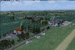
Ireland VFR Small Airports Part 2.
This scenery consists of EIME Casement Aerodrome, EIWT Weston Executive Airport and EIKH Kilrush Airfield. Casement and Weston are within 8nm of Dublin International whilst Kilrush lies approximately 30miles to the south west.
EIME's main runway 11/29 is 1,829m (6,001feet) in length and has handled the largest of heavies. Weston caters for small executive jets, GA and helicopters. Kilrush is a small private airstrip with grass and paved runways.
The scenery has been created almost entirely from real photographs and features many open hangers with internal textures. Each airport features a full panoramic view from inside the tower, sound, lighting, and smoke effects, together with animations, high definition people and military personnel. Full night lighting with wash lighting of the aprons is included. The scenery can be used as a standalone, however it also uses many objects from my Ireland VFR Small Airports Part 1. It has been tested with FSXA only and is designed to complement vfr photographic scenery. It will also work with the default terrain and I have included a set of photoreal textures with night masks. Full installation instructions are included in the Readme file. I hope you enjoy using the airports as much as I enjoyed making them.
| Filename: | Ireland_VFR_Small_Airports_Part_2.zip |
| License: | Freeware, limited distribution |
| Added: | 15th February 2012, 04:35:57 |
| Downloads: | 4,341 |
| Author: | George Keogh |
| Size: | 86.1 MB |
| Category: Flight Simulator 2004 - Scenery | |
| Port McNeill CAT5 in British Columbia, Canada |
|
Images related to this file:
File Description:
Port McNeill is at the northern end of Vancouver Island, on the coast and around 20 miles east of Port Hardy. The town population is just over 2,000 and the main industry is logging, followed by sand and gravel quarrying and exporting for the construction industry. Tourism rates third.
The airport, a mile or so east of the town, provides a swift connection for nearby islands and the surrounding area to the rest of the west coast, and serves as the HQ main base for West Coast Helicopters. Their newly built large hangar and office accommodation is next to their older hangar to one side of the central public parking area, opposite the club house cum terminal and hangars. There are two runways: 06-24 which is asphalt, 2,400 feet long, and lit; and 11-29 of gravel, 3,650 feet long and also lit. There is some taxiway lighting, but not, for instance, for the connection between runways, which is in real life a ramp up to the gravel runway which is 15 feet higher. There are no regularly scheduled flights and traffic consists mainly of the West Coast helicopters, plus GA and irregular charters, the latter being mostly from Port Hardy.
| Filename: | Port_McNeill_CAT5_in_British_Columbia_Canada.zip |
| License: | Freeware, limited distribution |
| Added: | 18th November 2018, 05:49:13 |
| Downloads: | 137 |
| Author: | Roger Wensley |
| Size: | 13.29 MB |
| Category: Flight Simulator X - Aircraft Repaints, Textures and Modifications | |
| Air Berlin Boeing 737 (Variety Package) |
|
Images related to this file:
File Description: The ZIP-file contains different
repaints of Air Berlin for the PMDG 737 NGX, including the Santa Claus Tour (Weihnachtsflieger)
and 35 years logojets. Installation instructions are included in the readme.
PMDG 737-800/900 Base Pack and 600/00 Expansion Pack are required. Accurate
airline options configuration and yoke checklist texture is included. UPDATE
INFO: aircraft configurations files have been updated to match its real world
counterparts. This file contains updated
a/c configs and replaces the following files: pmdg_737ngx_800wl_ber.zip
pmdg_737ngx_800wl_ber1.zip
pmdg_737ngx_800wl_ber2.zip
pmdg_737ngx_800wl_ber3.zip
pmdg_737ngx_800wl_ber4.zip
pmdg_737ngx_800wl_ber5.zip
pmdg_737ngx_800wl_ber6.zip

| Filename: | Air_Berlin_Boeing_737_Variety_Package.zip |
| License: | Freeware, limited distribution |
| Added: | 12th July 2014, 07:58:05 |
| Downloads: | 3,055 |
| Author: | Christian Mohr |
| Size: | 103.02 MB |
| Category: Flight Simulator 2004 - Scenery | |
| LFBT Tarbes/Lourdes-Pyrenees, France |
|
Images related to this file:
File Description:
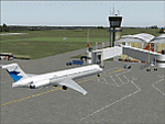
Googly scenery for LFBT Tarbes - a normally quiet airport that just sees a few
domestic flights a day but bursts into life for those of the the Catholic faith to
participate in the pilgrimage to Lourdes. At these times it is served by a
regular stream of charter flights and the airport can handle aircraft as large
as the Boeing 747. The only scheduled flights are between here and Paris, normally operated by Canadair CRJ700 craft worked by Brittany Air International on behalf of Air France, but a huge range of charter operators - mostly from Italy, Ireland, Belgium, the
United Kingdom and Germany - may be seen here at times and although seasonal this
traffic represents 80% of the airport's entire annual activity.
The scenery does not purport to be ultra-accurate. Based on less-than-perfect
satellite imagery from Google Earth, the layout is proportionally correct but the
added airport features, such as buildings, are built from default Microsoft objects
and add-on libraries so will not look exactly like the real thing. You are not obliged to download and install any additional scenery libraries, but to enjoy this scenery in its entirety, you may wish to. It will work fine, with or without.
[File re-uploaded at the request of AVSIM]
| Filename: | LFBT_TarbesLourdesPyrenees_France.zip |
| License: | Freeware |
| Added: | 4th May 2010, 15:02:30 |
| Downloads: | 7,811 |
| Author: | John Hinson |
| Size: | 73 KB |
| Category: Flight Simulator X - Scenery | |
| TLPC George F. L. Charles Airport Castries, Saint Lucia |
|
File Description:
George F. L. Charles Airport (TLPC) is a small airport in Saint Lucia, mostly serving the caribbean Islands. It is the airport that is situated in the north of the island in the capital city of Castries.
It serves quite a few regional airlines mainly operating turbo props like the dash8, ATR and smaller types, but has handled bigger types in the past such as MD82 (BWIA) and B722 (AMERIJET). Since stopped because of noise complaints. (SIGHS)
This is my first attempt at scenery design. I was motivated to build this scenery because I grew up near the airport and always enjoyed flying in there Whether in real or in the sim.
Since FSX, there`s been no scenery built for it and I could not stand the default scenery. So almost two years ago, not knowing a thing about scenery design and where to start, I embarked on this project. It is by no means perfect, but I think it is better than what is on offer. There are no custom ground textures cause I have not worked it out yet, maybe in a later update. The buildings where all made with Google Sketchup8 free version and converted with ModelConverterX and added to FSX with Instant Scenery 2. ENJOY.
| Filename: | TLPC_George_F_L_Charles_Airport_Castries_Saint_Lucia.zip |
| License: | Freeware |
| Added: | 14th April 2013, 13:01:54 |
| Downloads: | 1,696 |
| Author: | Finbar Lesmond |
| Size: | 13.12 MB |
| Category: Flight Simulator 2004 - Scenery | |
| Cape Verde Islands Domestic Airports |
|
Images related to this file:
File Description:
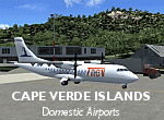
Googlyafcads and simple scenery for five airports in the Cape Verde Islands, all
of which are served by regular domestic flights of TACV - Transportes Aereos de
Cabo Verde. Each of these has been "overlooked" by Microsoft in Flight Simulator
2004 and are provided with nothing other than a runway. These scenery files add
aprons, taxiways, buildings and other airport features to Flight Simulator's bland
representation and allow you and "AI" traffic to land, taxi, park and take off
in a realistic manner.
The airports represented are: GVBA Rabil, GVMA Maio, GVSF Sao Filipe, GVSN Preguica and GVSV Sao Pedro.
The scenery does not purport to be ultra-accurate. Based on high-detail satellite
imagery from Google Earth (except Sao Filipe), the layout is proportianally correct
but the added airport features, such as buildings, are built from default Microsoft
objects and add-on libraries so will not look like the real thing. Sao Filipe is
largely imaginary owing to poor quality of the satellite image, but has been created
to be similar to other airports of like size.
You are not obliged to download and install any additional scenery libraries,
but to enjoy this scenery in its entirety, you may wish to. It will work fine,
with or without.
[File re-uploaded at request of AVSIM]
| Filename: | Cape_Verde_Islands_Domestic_Airports.zip |
| License: | Freeware |
| Added: | 15th June 2010, 01:00:46 |
| Downloads: | 6,997 |
| Author: | John Hinson |
| Size: | 84.1 KB |
| Category: Flight Simulator X - AFCAD Files | |
| CYWG - Winnipeg James Armstrong Richardson International Airport / Winnipeg, Manitoba, Canada |
|
Images related to this file:
File Description:
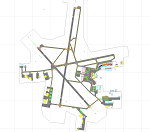
CYWG - Winnipeg James Armstrong Richardson International Airport / Winnipeg, Manitoba, Canada
This airport update was made with the latest version of ADE (Airport Design Editor) and made for FSX as a replacement for the stock (default) airport. I found that most stock airports in FSX lack a decent amount of character and realism and this area in particular was dreadful! The stock airport was rather inaccurate. I've made several additions to the airport which are listed below. All these enchancements are as close to the real airport as I can get with stock library objects. I've used satellite images, terminal photos and maps throughout the whole process so building locations are as accurate as possible. Happy landings in the beautiful Canada!
Features:
*Greatly expanded parking apron
*Brand new main terminal building with its 11 jetways and regional airline parking and parking garage
*Old terminal (soon to be demolished) with construction vehicles
*Hangar and other airport buildings added
*Cargo terminal with parking
*Military cargo area
*Airport vehicles and objects throughout the airport
*Main road in front of airport added with static vehicles
*Airport fire station with fire trucks
*Static de-icing area with vehicles
*Old runway 7/25 which was demolished in the 1990s and FSX inexplicably included has been removed
| Filename: | CYWG__Winnipeg_James_Armstrong_Richardson_Internat.zip |
| License: | Freeware |
| Added: | 24th July 2012, 08:12:46 |
| Downloads: | 2,960 |
| Author: | Jaison Diaz |
| Size: | 163.14 KB |
| Category: Flight Simulator 2004 - Scenery | |
| WIKD/WIOD Tanjung Pandan/Buluh Tumbang/H.A.S. Hanandjoeddin, Indonesia |
|
File Description:
Googly scenery for WIKD/WIOD Tanjung Pandan/Buluh Tumbang/H.A.S. Hanandjoeddin,
Indonesia, based on Google Earth satellite data. It is a small domestic airport
serving the island of Belitung, located about 17 miles from the main town of the
island - Tandjungpandan. The island produces mainly tin and pepper but there are
some beaches that are generating tourist traffic too.
Flight Simulator 2004 has made no provision for any traffic at this airport and
this scenery seeks to redress the situation. The airport sees daily scheduled
traffic operated by Batavia Air and Sriwijaya Air.
The scenery does not purport to be ultra-accurate. Based on poor quality
satellite imagery from Google Earth, the layout is proportionally correct but the
added airport features, such as buildings, are built from default Microsoft objects
and add-on libraries so will not look exactly like the real thing.
You are not obliged to download and install any additional scenery libraries,
but to enjoy this scenery in its entirety, you may wish to. It will work fine,
with or without.
The ICAO code for this airport has recently changed from WIKD to WIOD. The included
files allow you to either retain the old code or optionally change the airport to
use the new one.
| Filename: | WIKDWIOD_Tanjung_PandanBuluh_TumbangHAS_Hanandjoed.zip |
| License: | Freeware |
| Added: | 22nd February 2008, 09:19:27 |
| Downloads: | 1,774 |
| Author: | John Hinson |
| Size: | 64.96 KB |


© 2001-2026 AVSIM Online
All Rights Reserved
Privacy Policy |