
Where Flight Simulation Enthusiasts Gather from Around the World!
AVSIM Library - Search Results

| Category: Flight Simulator 2004 - Scenery | |
| Mountain View CPZ3 in Ontario, Canada |

|
Images related to this file:
File Description:
This is Mountain View, a small RCAF airfield at the eastern end of Lake Ontario on Prince Edward Island, some 40 miles west of Kingston. Mountain View is used for training during the summer months, and part of this training is for C-130 crews, who practice landing on rough or unprepared landing strips. The crews are based at Trenton, which is a large base 10 miles to the northwest on the mainland. There are (or were, I haven't seen it recently) numerous parked and ancient fighter planes such T-33's and Canadair Tutors; these could also have possibly been used for summer training or perhaps were just stored. Last summer there were only two hangars left standing; in 2002 there were five. In real life you would be on the lookout not only for C-130's but also (at certain times during the summer) for parachutists and also gliders. This airfield is one that you will fly over and not land on; I confess that I have cheated with the length of the 06L-24R gravel "practice" runway, so that it became possible for the FS version of a touch-n-go with a C-130 to be completed without using the grass. The aerial photograph shows the new "practice" gravel runway under construction.
| Filename: | Mountain_View_CPZ3_in_Ontario_Canada.zip |
| License: | Freeware, limited distribution |
| Added: | 9th March 2012, 15:05:57 |
| Downloads: | 350 |
| Author: | Roger Wensley |
| Size: | 7.26 MB |
| Category: Flight Simulator X - Aircraft Repaints, Textures and Modifications | |
| ALS-Sim SU-27SKM Flanker - (B_RNLAF) Package |
|
Images related to this file:
File Description:
This package contains a "just for the fun of it" fictional set of liveries for the Flanker B in RNLAF colors.
What if the Royal Netherlands Air Force could not temporarely afford a follow up for the aging F-16AM/BM due to the credit-crisis.
Countries with a debt to the Netherlands operating SU-27 Flankers offer the Netherlands some of their aircraft as a down-payment to this debt.
The Netherlands accept these aircraft as a temporary solution for replacement/addition to their aging F-16 fleet.
Some existing (311/323) and some former squadrons (re-established; 314/316/325) are equipped with the Flanker, all modified to SU-27SKM standard.
Some are painted in low visible ghost grey, some in the grey f-16 style colors and some in the standard Russian tropical style (as aggressor aircraft).
The pilot's and missile colors are also altered (life AA-11's now have IR seeker-heads). 2 aircraft also have NATO-style inert blue painting for the missiles, denoting they lack propulsion
but have real seeker-heads for training.
Flankers in NATO member Netherlands Air force colors; Now that's an odd but pretty sight :-)
You need the payware ALS-SIM SU-27 Flanker B for FSX in order to use this repaint and modification package.
| Filename: | ALSSim_SU27SKM_Flanker__B_RNLAF_Package.zip |
| License: | Freeware |
| Added: | 2nd April 2012, 22:12:52 |
| Downloads: | 162 |
| Author: | Rene Spaan |
| Size: | 26.19 MB |
| Category: Flight Simulator 2004 - Scenery | |
| PASN St Paul Island in Alaska |
|
Images related to this file:
File Description:
This is St Paul Island airport, plus the town and the harbour which has featured alongside Dutch Harbor in the tv series Deadliest Catch.
St Paul is in the Pribilof group of five islands around 250 miles north of Dutch Harbour. The town has a population of less than 600, so a lot smaller than Dutch Harbour and with only one processing plant, Trident.
The Ai includes a PenAir flight, a Coast Guard C-130, and Coast Guard helicopters; sea AI includes a fishing boat and a Coast Guard cutter. The Coast Guard C-130 and helicopter flights are to Dutch Harbor, so both sceneries are required to make it work as it should. The airport has 6,500 feet of 150 feet wide asphalt with 1,000 feet of over-run at each end, aligned 36/18, lit, and with two aprons at the southern end. There is no hangerage except for Coast Guard helicopters. Runway 36 has at its northern end a hill.
In real life the runway slopes up to the north by over 60 feet, but in FS9 it doesn't; hence the change in airport elevation to 80 feet ASL to get the northern end at least partly out of a box canyon. There is fuel available and it is dispensed from a truck, there are no pumps.
| Filename: | PASN_St_Paul_Island_in_Alaska.zip |
| License: | Freeware, limited distribution |
| Added: | 12th August 2012, 17:39:02 |
| Downloads: | 1,101 |
| Author: | Roger Wensley, Sidney Schwartz |
| Size: | 4.06 MB |
| Category: Flight Simulator X - Scenery | |
| NZGA- Galatea Aerodrome (VectorLandClass, New Zealand) |
|
Images related to this file:
File Description:
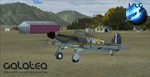
Welcome to Galatea (ICAO: NZGA), a gateway to exploring the Urewera ranges and the east coast of New Zealand. Galatea is a small and basic airstrip with only one old hanger, a public toilet and a small clubhouse on a wide plain surrounded by native bush and pine plantation near Murupara in the Bay of Plenty of New Zealand. It is a grass strip of 1025m length and 60m width and aligned 01/19 with a group rating of 8. No night lighting or fuel is available.
The FSX model includes custom textures and models placed on an aerial image. It makes extensive use of items from the free VLC object libraries which are required to be installed (download from www.vectorlandclass.co.nz downloads menu). This scenery and the VLC libraries have been funded
by sales of VectorLandClass and although you do not need VLC to use it, your purchase helps further development.
To the south west of Murupara township and sawmill is the LakeLand Helicopters base which just fits onto the photo-real coverage. Library objects have been placed here although they may not be accurate as the site was not visited when taking reference photos. This airfield makes a great stop over when flying between Rotorua, Mount Tarawera, Whakatane or Gisborne.
We hope you enjoy exploring the area!
| Filename: | NZGA_Galatea_Aerodrome_VectorLandClass_New_Zealand.zip |
| License: | Freeware, limited distribution |
| Added: | 15th November 2012, 23:35:42 |
| Downloads: | 1,127 |
| Author: | Tim Barnes / VectorLandClass |
| Size: | 45.7 MB |
| Category: Flight Simulator X - Scenery | |
| Pichlingersee - LOW1 |
|
Images related to this file:
File Description:
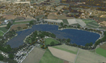
The Pichlingersee (LOW1) is a quarry pond near Linz (LOWL) in Austria (Upperaustria). The ILS approach to the runway 27 cross this lake. The helipad is in possession of Water Rescue Department and was not build on land. It was build "in water".
For the implementation of this area about 500 objects were set by hand from myself. Including not only trees and shrubs, but also signs, park benches, emergency call boxes (gernerated in gmax) etc at there right place. At night it was dark in real, so I does not create night texture. The scenery has 1.5 km ground imagery at 20cm per pixel and vary (hope) with the seasons.
Der Pichlingersee ist ein Baggersee in der Nhe von Linz (LOWL) in sterreich (Obersterreich). Der ILS Anflug auf die Landebahn 27 fhrt genau ber diesen See. Die Hubschrauberplattform gehrt der dortigen Wasserrettung und wurde nicht auf dem Land, sondern in den See hinein gebaut.
Fr die Umsetzung des Areals wurden von mir ber 500 Objekte von Hand gesetzt. Darunter nicht nur Bume und Strucher, sondern ebenso Schilder, Parkbnke, Notrufsulen (in gmax generiert) usw. an ihrem richtigen Platz. Da es dort in der Realitt nachts stockdunkel ist, habe ich auf Nachttexturen verzichtet. Die Szenerie hat eine 1.5 km Bodentextur mit 20cm/px und wechselt (hoffentlich) mit den Jahreszeiten.
| Filename: | Pichlingersee__LOW1.zip |
| License: | Freeware |
| Added: | 9th January 2013, 00:44:19 |
| Downloads: | 2,000 |
| Author: | Oliver Brandl |
| Size: | 54.71 MB |
| Category: Flight Simulator X - Scenery | |
| YEEB Eneabba, Western Australia strip and townsite |
|
File Description:
YEEB Eneabba strip and townsite
Sand mining town in heart of wildflower area Located 278 km north from Perth via the Brand Highway, Eneabba is basically a sand mining town surrounded by some of the most extensive and spectacular wild flower displays anywhere in Western Australia. The town itself is, to be fair, a real non-event with dreary modern housing (with more than a hint of construction town design), a small shopping centre and a service station all of which look as though they have sprung up in the last 20-30 years. The wealth of the area is based on the rutile sands which lie to the south of the town as well as farming, particularly cattle grazing. With an estimated 80 per cent of the world's known rutile supplies the town can boast that it has the biggest deposits of rutile in both Australia and the world. The major mining company in the area is Iluka Resources Ltd. Eneabba is basically a service town for the mines but some of the miners, realising that Eneabba is hardly a paradise, have opted for commuting and live on the coast at Leeman and drive to work preferring the beach to the dry inland.
REQUIRES blencowe_librarykit_309494.zip (Available HERE)
| Filename: | YEEB_Eneabba_Western_Australia_strip_and_townsite.zip |
| License: | Freeware |
| Added: | 25th February 2013, 23:48:24 |
| Downloads: | 255 |
| Author: | Alan Blencowe |
| Size: | 3.59 MB |
| Category: Flight Simulator X - Scenery | |
| LFLJ - Courchevel, France |
|
File Description:
This FSX scenery package contains the LFLJ Courchevel airport in the French Alps. The airport has a very short, upslope runway of only 525 m (1,722 ft). The airport is considered one of the seven most dangerous in the world. It has a difficult approach, a 300 foot upslope runway and is adjacent to the Courchevel ski runs. The Courchevel airport altitude is the highest in Europe, with a mean elevation of 6,520 feet. This airport is intended to be used with FSX and the free addon - TileProxy. TileProxy provides real-time photorealistic satellite imagery in place of the stock auto generated FSX scenery or any other scenery package. The Courchevel airport was originally released as part of an FSX airport scenery package containing 15 airports, located in the French Alps. The link to the original 15 French Alps Airport package is shown below. This file is not required, but allows you to download 15 related French Alps airports. The LFLJ, Courchevel airport in the original 15 airport package was missing a required scenery file which corrects the airport altitude (from 6420 ft. to 6520 ft.) due to the mis-location of the stock FSX airport. This download provides all three of the required .bgl scenery files.
related download:
http://library.avsim.net/search.php?SearchTerm=french+alps+airports&CatID=root&Go=Search
| Filename: | LFLJ__Courchevel_France.zip |
| License: | Freeware |
| Added: | 30th November 2013, 20:20:07 |
| Downloads: | 6,045 |
| Author: | John Greenwood |
| Size: | 655.63 KB |
| Category: Flight Simulator 2004 - Aircraft Repaints, Textures and Modifications | |
| KLM Aerocarto DH-89B Dominie (PH-OTA) |
|
Images related to this file:
File Description:
This file contains a repaint for the beautiful de Havilland DH-89A Dragon Rapide by Dave Garwood c.s. which is available at Classic British Flight Sim. It features the DH-89B Dominie PH-OTA of KLM's susidiary KLM Aerocarto which was used from 1952 till 1962 for air photography. The real aircraft still exists, in the camouflage livery it had during its days with the -then- Netherlands Air Force. It is part of the static collection of the Nationaal Militair Museum (National Military Museum) at Soesterberg, Netherlands which is to open its doors in the Autumn of 2014. The de Havilland DH-89 Dragon Rapide was designed as a short-haul airliner for 6-8 passengers, making its first flight from Hatfield on 17 April 1934. During WW2 many Dragon Rapides were impressed by the military forces for communications transport and served under the name de Havilland Dominie. Additionally over 500 Dominies were built, the majority as radio and navigation trainers but several also as communications and transport aircraft. Since de Havilland's priority was the mass production of the famous Mosquito, 335 of the Dominies (including PH-OTA)
were built by Brush Coachworks Ltd., Loughborough, UK. In all 731 DH-89's were built, several of which are still airworthy some 68 years after production came to an end. Repaint by Maarten Brouwer.
| Filename: | KLM_Aerocarto_DH89B_Dominie_PHOTA.zip |
| License: | Freeware, limited distribution |
| Added: | 28th January 2014, 11:03:21 |
| Downloads: | 184 |
| Author: | Maarten Brouwer |
| Size: | 1.29 MB |
| Category: Flight Simulator X - Aircraft Repaints, Textures and Modifications | |
| Jet Airways Boeing 737NGX (VT-JGX) |
|
Images related to this file:
File Description:

Jet Airways (9W) Boeing 737-75R/WL (VT-JGX) (current Livery) for PMDG 737-700 FSX only (repaint only) (Expansion needed to the original PMDG 737 package)(Payware).
Features:
1. Jet Airways Logo (New Livery with correct positions in referenced to the aircraft)
2. Accurate placement of the Indian Flag.
3. Tail textures were made many times before I was "satisfied". Correct gradient of the vector on the tail
4. Studied and averaged precise sky blue color for fuselage under the ribbons.
5. All colors of the ribbon were sampled by more than 3 pictures.
6. Clean White Engine colors.
7. Hand Drawn to match ribbons and their placement on the fuse. 100% Hand crafted.
8. Accurate winglets.
9. White winglets.
9. Boeing 737-700 decal behind and inline with last exit (in Boeing font and accurate dark blue color).
10.Registration under the dark blue ribbon in accurate position, spacing, font, and color
11.Jet Airways logo flipped correctly (right side).
12.Added dirt textures to wing and aft belly.
13.Registration in accurate place on wing (color and font also studied and accurate).
14.Registration included on bottom of the wing as well.
15.All accurate colors and relative positions to the plane in real life.
16.Lots of Love put in to the project as well
| Filename: | Jet_Airways_Boeing_737NGX_VTJGX.zip |
| License: | Freeware, limited distribution |
| Added: | 19th January 2015, 19:00:53 |
| Downloads: | 472 |
| Author: | Rohan Patel |
| Size: | 21.27 MB |
| Category: Flight Simulator 2004 - Scenery | |
| Ontario Small Fields in Canada: #05 Pelee Island (CYPT) |
|
Images related to this file:
File Description:
This is the fifth in a series of small airfields in southern Ontario Canada, Pelee Island CYPT, an airfield on the island in Lake Erie and the southernmost airfield in Canada. The airfield has an asphalt runway of 3,300 feet, aligned 09/27 in FS9 while today in real life it is 10/28 due to the wandering magnetic pole. There is also a second runway, 36/18 and around 1,500 feet of gravel. There is a small terminal building which now has blue cladding; here it is still in the dirty yellow of the original colour scheme.
This version is based upon what appears to be a "lost" 2005 scenery of Pelee Island. When I started to make Pelee Island I discovered that in fact I already had a version installed; my memory can be excused, as I installed it in 2005. I modified the scenery to include parking, taxiways that connected, revised runway markings, new windsocks, new signage, larger apron, parked cars and planes, revised landclass, AI, etc. My intention was to instruct you to download and install the original and then incorporate my changes. Problem: it does not appear to exist for download; perhaps it was washed away when the Avsim site crashed. I have included it in this post. If anyone knows who made it please let me know.
| Filename: | Ontario_Small_Fields_in_Canada_05_Pelee_Island_CYP.zip |
| License: | Freeware, limited distribution |
| Added: | 5th August 2015, 18:52:25 |
| Downloads: | 171 |
| Author: | Roger Wensley |
| Size: | 4.39 MB |


© 2001-2026 AVSIM Online
All Rights Reserved
Privacy Policy |