
Where Flight Simulation Enthusiasts Gather from Around the World!
AVSIM Library - Search Results

| Category: Flight Simulator 2004 - Scenery | |
| Devils Tower Terrain Mesh (ver 2) |

|
File Description:
This terrain mesh covers most of Crook County, Wyoming which contains Devils Tower National Monument. This terrain mesh was obtained from NED 1 arc second data and resampled to LOD10 resolution (38.2m). The area near the Devils Tower was obtained from NED 1/3 arc second data and resampled to LOD11 resolution (19.1m). The exact coverage is everything between W105* 7' 30" to W104* 0' 0" by N45* 0' 0" to N44* 15' 0". Devils Tower can be found by starting at Ipy Ranch (WY14) and traveling on a track of 194 degrees for 3 nautical miles. This version corrects a major positional error that was present in the first release and includes higher resolution data near the Devils Tower.
| Filename: | Devils_Tower_Terrain_Mesh_ver_2.zip |
| License: | Freeware |
| Added: | 26th November 2003, 00:25:13 |
| Downloads: | 3,558 |
| Author: | Joshua Robertson, 3D Softworks Design Studios |
| Size: | 4.54 MB |
| Category: Flight Simulator X - Aircraft Repaints, Textures and Modifications | |
| "Frenesi" P-51D Mustang (N357FG) V.2 |
|
Images related to this file:
File Description:
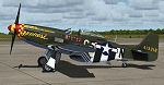
This is a repaint for the payware Warbirdsim P-51D "Mustang Tales" product. This is a new and vastly improved/updated version of my previous repaint, depicting the restored P-51D (F-6K) 44-12852, owned by Dan Friedkin/Comanche Fighters, based at Comanche Ranch, Eagle Pass, Texas. The aircraft is painted in the markings of General Tommy Hayes' P-51D-5-NA "Frenesi", of the 364th FS, 357th FG, 8th AF, which was named after the 1940 Artie Shaw tune. Starting in 2009, this aircraft was sent to Midwest Aero Restorations for restoration to complete WWII-stock condition/configuration, and first flew in January 2017. This repaint is stand-alone and does not require my previous version to be installed. New bump maps and modified cockpit textures included.
| Filename: | Frenesi_P51D_Mustang_N357FG_V2.zip |
| License: | Freeware |
| Added: | 7th July 2017, 17:11:01 |
| Downloads: | 159 |
| Author: | John Terrell |
| Size: | 32.63 MB |
| Category: Flight Simulator 2004 - Scenery | |
| Backcountry USFS fields for 19m terrain mesh in Idaho |
|
Images related to this file:
File Description:
These backcountry airfields are for use with the FSGenesis 19m mesh of Idaho; they almost certainly do not work without it. I also have Ultimate Terrain installed, with the settings as noted. The 15 airfields included here are almost all United States Forestry Service fields: 1U1 Moose Creek, 2ID7 Cayuse Creek, 2U5 Shearer, 3U1 Warren, 12ID Flying B Ranch, 24K Krassel, 75c Orogrande, I08 Cabin Creek, ID67 Lower Loon Creek, ID76 Wilson Bar, S81 Indian Creek, S92 Fish Lake, U54 Bernard, U79 Chamberlain, U81 Cold Meadows. There is also a 85U bgl included to remove the remnants of Soldier Bar which is impossible to make into a scenery with the terrain mesh, and spoiled the surroundings if left untouched and intact. The screenshots are typical examples giving a good impression of the terrain.
| Filename: | Backcountry_USFS_fields_for_19m_terrain_mesh_in_Id.zip |
| License: | Freeware, limited distribution |
| Added: | 22nd July 2019, 16:38:48 |
| Downloads: | 102 |
| Author: | Roger Wensley |
| Size: | 22.2 MB |
| Category: Flight Simulator 2004 - Miscellaneous Files | |
| Emma Field Sightseeing Tour Release III |
|
File Description:
Fly a VFR-tour in the area around Seattle, Washington. You will need some skills of bush-flying. Included in this package are a detailed tour-description, maps (one per stage), situation- and WX-files (also per stage). You will leave from Emma Field (KEWL) and visit the following airfields: Forks (S18), Sekiu (11S), Sequim Valley (W28), Orcas Island (KORS), Lynden (38W), Israels Farm (WA56), Stehekin State (6S9), Lake Wenatchee State (27W), Skykomish State (S88), Sky Harbor (S86), Bandera State (4W0), Easton State (KESW), Trout Lake (66WA), Mt.St.Helens Aero Ranch (WN10), Seaside Muni (56S), Westport (14S) and Cricket Field (4WA2), before you return to Emma Field.
This tour is based on the products Emma Field (Lago), GeoRender 5 (Lago), GeoRender 6 (Lago) and Orcas Island (FSAddon), but can also be flown without (one of) these. Enjoy.
| Filename: | Emma_Field_Sightseeing_Tour_Release_III.zip |
| License: | Freeware |
| Added: | 30th July 2004, 16:21:08 |
| Downloads: | 1,686 |
| Author: | Jaap van Hees |
| Size: | 5.84 MB |
| Category: Flight Simulator 2004 - Scenery | |
| Twin Lakes Airstrips in British Columbia Canada |
|
Images related to this file:
File Description:
There are three grass airstrips within sight of each other from the air at Twin Lakes in BC, which is between the close junction of Elkin Lake and Vedan Lake. The two lakes are similarly shaped and sized and in the same narrow valley between high ground that runs north-south; hence the name. Elkin is to the north, and Vedan is to the south. Twin Lakes CAG4 is on the strip of land between the two lakes and it is unclear to me who it belongs to etc. It is not in the Nav Canada copy that I have with me which is from 2010, and the online version does not cover grass strips. It is probably owned by whoever lives in the house next to the red hangar. The runway is 3,600 feet of grass aligned 14-32 at 3,945 feet ASL. Chaunigan Lake Lodge CF83 is over to the northwest from Twin Lakes by around 2 miles or so and as the name suggests it services the Lodge of that name, which is on the northeast corner of Chaunigan Lake. The runway is 2,600 feet of grass aligned 02-20 at 4,900 feet ASL. You might want to read about altitude power reductions for the take off. Elkin Creek Guest Ranch CBL9 is at the southern end of Vedan Lake and serves the ranch. This appears to be another high-budget operation and the runway is 3,670 feet of grass aligned 36-18 at 3,999 feet ASL. I have posted this as three separate airstrips, but I suggest that you add these to your "BC airfields" folder as previously suggested. Up to you. If you find a defect, email me. Ignore the post of Chilanko Lodge posted today. I requested Avsim to delete it but it seems they didn't read the email. It was originally posted as a correction for the original post of the three posted here.
| Filename: | Twin_Lakes_Airstrips_in_British_Columbia_Canada.zip |
| License: | Freeware, limited distribution |
| Added: | 21st November 2020, 23:29:09 |
| Downloads: | 126 |
| Author: | Roger Wensley |
| Size: | 25.39 MB |
| Category: Flight Simulator X - Flight Plans | |
| Rocky Mountain Airport Tour |
|
File Description:
Rocky Mountain Airport Tour:
A very hard flight plan in common GA Aircraft. I flew this with a Carenado B58. VFR Flight with wild swings in Altitudes. Maintain 16000 (One Six Thousand) feet for most of the flight to and from the airports. You will have to fly around mountains on approaches with steep short field finals. GPS flight plan is just a guide. You will have to follow the mountain passes from some airports in order to attain sufficient altitude (in some cases). Don't wimp out! Max load your plane.
Country: USA
State: Cololorado
Start: KDRO (Make sure you start from a parking spot)
End: KHDN
Most difficult: Taking off at Buckhorn Ranch (8000+ feet ALT, 4000 FT Runway)
Toughest area between airports:
KASE to KEGE
Time to compleat: about 3 hours
Good Luck.
Questions Contact me at AVSIM
Avsim ID: hawkDsl
To Install: Copy "Rocky Mountain Airport Tour.pln" and paste it into you FSX flight plan file
Win7 : userfiles/my document/Flight Simulator X Files
| Filename: | Rocky_Mountain_Airport_Tour.zip |
| License: | Freeware |
| Added: | 21st July 2012, 13:26:52 |
| Downloads: | 473 |
| Author: | Henry Oeser |
| Size: | 1.94 KB |
| Category: Prepar3D V5 - Aircraft Repaints, Textures and Modifications | |
| Hispano HA-1112 Buchon (G-AWHR) White 5 |
|
Images related to this file:
File Description:
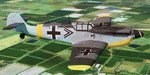
This folder contains a repaint for theHispano HA-1112 Buchon by Flight Replicas. It shows Hispano HA-1112-M1L Buchon C.4K-152 / 220 / ‘White 5’ (G-AWHR).This particular aircraft was built by Hispano Aviacion in Saville in 1959. This aircraft was one of 27 purchased at auction from the Spanish Air Force by Spitfire Productions for use in the making of the 1968 film ‘Battle of Britain’. After filming this aircraft was acquired by Wilson C Edwards and shipped to the U.S.A. Edwards acquired these aircraft as payment for his flying services filming ‘Battle of Britain’, and stored the majority disassembled in a hangar on his ranch in Big Spring, Texas, USA.
She was acquired by the Air Leasing Ltd and arrived back in the U.K in 1996.
This particular airframe is the last ‘Bf 109’ which Luftwaffe ace Adolf Galland flew, while he was serving as an adviser on the movie ‘Battle of Britain’.
G-AWHR ‘White 5’ made her first post-restoration flight from Sywell Aerodrome, Northampton on July 1st, 2019.
Repaint by Jan Kees Blom, based on the paintkit by Flight Replicas.
| Filename: | Hispano_HA1112_Buchon_GAWHR_White_5.zip |
| License: | Freeware |
| Added: | 20th September 2020, 19:36:11 |
| Downloads: | 42 |
| Author: | Jan Kees Blom |
| Size: | 22.27 MB |
| Category: Flight Simulator 2004 - Scenery | |
| Green Lake CBG2 in British Columbia Canada |
|
Images related to this file:
File Description:
Green Lake is on the eastern side of the Coast Mountains of British Columbia, around 40 miles north of Cache Creek and 15 miles south of 100 Miles House (a previous posting). The airfield is beside the lake shore and serves the Flying U holiday ranch with a grass runway 2,575 feet long and aligned 18-36. There is no lighting. There is also mooring on the lake for boats and float planes. I have posted it as Green Lake CBG2, but I suggest that you just add it to your previously created "BC airfields", if you followed my previous suggestion. You then avoid the inevitable doubling up of common textures etc. Plus that way you will have just one FS9 library post to do and new airfields will not need yet another posting. Up to you. It just occurred to me that probably only a few of you have a copy of the Nav Canada Airfields handbook, so won't know the airfield altitudes, which is useful to have amid mountains. So, Pemberton is 670 feet Above Sea Level, Cache Creek 2,034 feet ASL, and Green Lake 3,550 feet ASL. The others to follow as posted. If you find a defect, email me.
| Filename: | Green_Lake_CBG2_in_British_Columbia_Canada.zip |
| License: | Freeware, limited distribution |
| Added: | 18th November 2020, 19:44:00 |
| Downloads: | 89 |
| Author: | Roger Wensley |
| Size: | 10.05 MB |
| Category: X-Plane - Scenery | |
| BR AM SWMK - Maturaca Airfield v1.0.0 |
|
Images related to this file:
File Description:
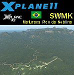
This is an X-Plane 11 and X-Plane 10 scenery package for Maturaca Airport (ICAO: SWMK, no IATA code) which is an airport serving Maturaca village, in São Gabriel da Cachoeira, Amazonas, Brazil, located in the vicinity of "Pico da Neblina" (Peak of the Haze, in English), the highest mountain in Brazil, 2,995.3 metres (9,827 ft) above sea level, in the Serra da Neblina, part of the Serra do Imeri, a section of the Guiana Highlands on the Brazil–Venezuela border, in the middle of the Amazon rainforest. It includes corrected aprons, ramps, gates, taxiways, lighting system, village buildings, ortho-photoscenery for the airfield area, and (XP11 only) airport ground services (like push back). This scenery was tested and is operational (as of April 14, 2017) in "X-Plane 11.00 RC #1 64 bit", Windows 10 Home. It was also tested and is also operational (as of April 14, 2017) in "X-Plane 10.51 64 bit", Windows 10 Home. Only the default X-Plane 11 libraries, by Laminar Research, are needed. No third party libraries are used.
A few extra objects are used and included in the package, thanks to artist Paulmort (Hangar 24, Hangar House, Ranch House, Deluxe Log Cabin, Hangar Barn) and to artist Capnsully (Grow Grass for Xplane). They are included in the package, no need to download them.
| Filename: | BR_AM_SWMK__Maturaca_Airfield_v100.zip |
| License: | Freeware |
| Added: | 15th April 2017, 06:23:29 |
| Downloads: | 132 |
| Author: | Rui Mesquita |
| Size: | 35.57 MB |
| Category: Flight Simulator 2004 - Scenery | |
| Backcountry airfields for 19m terrain mesh in Idaho USA |
|
Images related to this file:
File Description:
These four backcountry fields are for use with the FSGenesis 19m mesh of Idaho, and are Big Creek, Johnson Creek, Dixie, and Sulphur Creek Ranch. They have been revised to fit and almost certainly do not work without the 19m mesh; a quick comparison with Big Creek before and after demonstrates the difference. I also have Ultimate Terrain installed. The three ingredients of terrain mesh, UT main roads, and UT streams, along with their individual margins of error, very often create conficts of space that make a grass runway impossible to site with it's correct length. Given the choice of turning off roads or streams (the terrain mesh cannot be turned off, obviously) I chose streams; the roads are less obviously incorrect, plus it matters not if roads go uphill while a climbing stream is to be avoided. On that basis the original series is reissued here for use with the 19m terrain mesh, on the presumption that you have already downloaded the original series. There are no textures or AI included as they remain the same as the originals, and the new scenery bgl's replace the originals to get the runways and grass etc in the right positions. There will be follow-on fields that are new, and all of the new ones will be only for the 19m mesh.
| Filename: | Backcountry_airfields_for_19m_terrain_mesh_in_Idah.zip |
| License: | Freeware, limited distribution |
| Added: | 29th May 2017, 04:19:43 |
| Downloads: | 125 |
| Author: | Roger Wensley |
| Size: | 2.22 MB |


© 2001-2026 AVSIM Online
All Rights Reserved
Privacy Policy |