
Where Flight Simulation Enthusiasts Gather from Around the World!
AVSIM Library - Search Results

| Category: Flight Simulator X - Scenery | |
| Blue Canyon Wind Farm |

|
File Description:
Scenery adding the Blue Canyon Wind Farm (Phase 1) north of Lawton, Oklahoma with antimated windmills and upgrading the nearby Jennings Ranch and airfield (OL09). This scenery was created with Airport Design Editor, utilizes an antimated windmill model posted at the FS Developer Community by hcornea, and has been tested using Ultimate Terrain X.
| Filename: | Blue_Canyon_Wind_Farm.zip |
| License: | Freeware |
| Added: | 28th October 2008, 20:40:19 |
| Downloads: | 609 |
| Author: | Art Poole |
| Size: | 335.25 KB |
| Category: Flight Simulator 2004 - Scenery | |
| The Happy Bottom Riding Club |
|
File Description:
Pancho Barnes' ranch near Edwards Air Force Base was at the very centre of the flight research world. Her bar attained almost legendary status and was the favourite place for those with 'The Right Stuff' to hang out. The era best fits with Golden Wings but the scenery works equally well in default FS9. Includes an AI traffic file for Golden Wings aircraft.
| Filename: | The_Happy_Bottom_Riding_Club.zip |
| License: | Freeware |
| Added: | 21st March 2006, 22:03:11 |
| Downloads: | 950 |
| Author: | Nigel Mason |
| Size: | 866.91 KB |
| Category: Flight Simulator 2004 - Miscellaneous Files | |
| Emma Field Sightseeing Tour Release II |
|
File Description:
Fly a VFR-tour in the area east of Seattle, Washington. You will need some skills of
bush-flying. Included in this package are a detailed tour-description, maps (one per stage), situation- and WX-files (also per stage).
You will leave from Emma Field and visit the following airfields: Elma (4W8), Flying M Ranch (OR05), Mount St. Helens Aero Ranch (WN10), Sultan Field (39P), Packwood (55S), Ranger Creek (21W), Cashmere-Dryden (8S2), Chelan (6S9),Stehekin State (1S2), Twisp Muni (2S0), Darrington Muni (1S2), Sky Harbor (S86), Harvey Field (S43), Diamond Point(2WA1), Lost Valley (KLVY), Forks (S18) and Washabamaggie Lake, before you return to Emma Field.
This tour is based on the products Emma Field, GeoRender 1, GeoRender 3, GeoRender 4, GeoRender 5 and GeoRender 6 (all Lago) and freely downloadable scenery, but can also be flown without (one of) these.
Enjoy.
| Filename: | Emma_Field_Sightseeing_Tour_Release_II.zip |
| License: | Freeware |
| Added: | 18th December 2003, 23:37:29 |
| Downloads: | 2,238 |
| Author: | J. van Hees |
| Size: | 5.07 MB |
| Category: Flight Simulator 2004 - Scenery | |
| Landing Areas for Western Australia V1 |
|
File Description:
A collection of 35 dirt station strips (ranch strips)and country airstrips for Western Australia made from a blend of AFCAD, Airport, Runway 12, E.O.D. and Google Earth and using my country api's. Some textures are mine and the rest are an accumulation of 6 years FS. An addition to the many other fine contributions for WA. Simply unzip in addon scenery and register the folder in your FS.
| Filename: | Landing_Areas_for_Western_Australia_V1.zip |
| License: | Freeware |
| Added: | 13th August 2006, 20:39:56 |
| Downloads: | 1,163 |
| Author: | Alan Blencowe |
| Size: | 5.03 MB |
| Category: Flight Simulator 2004 - Scenery | |
| YAYE |
|
File Description:
YAYE is an exisiting airport(FS & real world) in Australia's northern territory. This is enhanced per request by a friend, Rico, in the Netherlands. YAYE now hasVOR, NDB, ILS, hotel with parking lot and cars, sattilite dish, radio antenna, hot air ballons, gas station, tour buses arriving,people here and there. It has 2 moving radar dishes, enhanced terminal with jetways at the gates,AI ready, sheep/duck ranch, 5 heliports. Abacus library, and abw files, ex-scenery, and ryw12 library files needed.
| Filename: | YAYE.zip |
| License: | Freeware |
| Added: | 5th June 2006, 04:49:45 |
| Downloads: | 607 |
| Author: | Robert Lacy |
| Size: | 27.59 KB |
| Category: Flight Simulator X - Scenery | |
| Death Valley National Park - California, USA |
|
Images related to this file:
File Description:
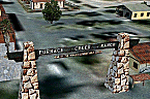
FSX Scenery--Death Valley. This scenery covers several areas of Death Valley National Park (CA). See the World's lowest golf coarse at Furnace Creek Ranch, the moving rocks at the RaceTrack, Scotty's Castle, Panamint Spring, and Stovepipe Wells. Custom designed buildings with photorealistic textures, night textures, and satellite image for the grounds. This scenery has been tested on FSX Gold Edition (FSX Deluxe and Acceleration Expansion Pack), FSGenesis 9.6 terrain mesh, and Win7 operating system. Requires RWEOBJv5.zip & RWEOBJc5.zip (or later) Object Libraries. By Ron Ezra.
| Filename: | Death_Valley_National_Park__California_USA.zip |
| License: | Freeware |
| Added: | 13th January 2016, 22:23:10 |
| Downloads: | 457 |
| Author: | Ron Ezra |
| Size: | 5.53 MB |
| Category: Flight Simulator 2004 - Scenery | |
| Tsuniah Lake Lodge CAF4 in British Columbia Canada |
|
Images related to this file:
File Description:
Tsuniah Lake Lodge is an airstrip that serves the Lodge of the same name at the western end of the lake. Tsuniah Lake is close to the eastern side of Chilko Lake, some 7 miles south of the northern end of Chilko Lake and the recent post of Tsylos Lodge. Tsuniah Lodge is at the eastern and lake end of the grass runway, which is 4,000 feet of grass aligned 04-22 and in good condition at 4,026 feet ASL. No lights. The lodge is extensive with numerous separate cabins and I would expect the prices to be up there with the cost of the chartered planes that delivered guests. There is a second airstrip included here, around 3 miles north of the northern end of Chilko Lake and which used to serve the Wilderness Ranch before it was closed. The runway closed I mean. It is still visible but now not used at all although the ranch still functions. I have posted this as Tsuniah Lake Lodge CAF4, but I suggest that you add this to your "BC airfields" folder as previously suggested. Up to you. If you find a defect, email me.
| Filename: | Tsuniah_Lake_Lodge_CAF4_in_British_Columbia_Canada.zip |
| License: | Freeware, limited distribution |
| Added: | 23rd November 2020, 20:03:34 |
| Downloads: | 89 |
| Author: | Roger Wensley |
| Size: | 10.29 MB |
| Category: Flight Simulator X - Scenery | |
| Hawaii - Niihau |
|
Images related to this file:
File Description:
Niihau, the westernmost of the inhabited Hawaiian Islands, is privately owned and used primarily to raise cattle. It's small population works the ranch. Because it is so isolated, it is the last of the Hawaiian Islands where Hawaiian is the primary language.
Niihau has no airport of its own. You get there by taking off from Kauai and flying west. I'd recommend using Port Allen (PAK). Unless visibility is limited, you can see Niihau across the water from the airport. Just take off and fly a heading of 270 degrees. However, a saved flight which places you just off Niihau's shore is included in the package should you need it.
| Filename: | Hawaii__Niihau.zip |
| License: | Freeware |
| Added: | 15th December 2009, 23:19:34 |
| Downloads: | 2,526 |
| Author: | Richard Sorochak |
| Size: | 36.49 MB |
| Category: Flight Simulator 2004 - Scenery | |
| Air Force Flight Test Center, Detachment 3 (A.K.A. "Groom Lake" or "Area 51") |
|
File Description:
This set of files is a scenery enhancement for the Air Force Flight Test Center, Detachment 3, or AFFTC Det. 3, for short (more commonly, but erringly, refered to as "Area 51"). This package includes a faithfully reproduced digital rendition of the original area based upon the true footprint of the real-world airstrip near Groom Dry Lake, Watertown, Nevada.
This scenery is fully set up for all of your AI traffic needs, and is, I believe, the most accurate representation of the Groom Lake Facility to date. Enjoy flying the restricted skies of Dreamland Ranch! This package was designed for use with Flight Simulator 2004 ONLY.
| Filename: | Air_Force_Flight_Test_Center_Detachment_3_AKA_Groo.zip |
| License: | Freeware |
| Added: | 5th August 2006, 16:05:43 |
| Downloads: | 4,678 |
| Author: | Patrick Brodeur |
| Size: | 1.94 MB |
| Category: Flight Simulator X - Scenery | |
| Land's End SeaPlanes; West Coast Travels |
|
File Description:
Part III in the four part scenery series of Land's End SeaPlanes. Part III, West Coast Travel covers the United States West Coast from Seattle Washington to San Diago, California. This scenery pack requaires Lands End SeaPlanes Part I and Part II. Part III includes, KAST - Astoria Regional Airport, KONP - Newport Municipal Airport, Newport, Oregon; KOTH - North Bend Airport, North Bend Oregon; KBOK - Brookings State Airport, Brookings Oregon; KACV - Arcata-Eureka Airport, Arcata, California; OQ5 - Shelter Cove Airport, Shelter Cove, Ca; CA51 - The Sea Ranch, Ca; KHAF - Half Moon Bay, Ca; O62 - Carmel Valley Vintage; L52 - Oceano County; and more. Package includes hundreds of custom models, effects, textures. Includes both day and night textures.
| Filename: | Lands_End_SeaPlanes_West_Coast_Travels.zip |
| License: | Freeware, limited distribution |
| Added: | 21st November 2008, 19:06:05 |
| Downloads: | 2,619 |
| Author: | Chris Carel |
| Size: | 42.47 MB |


© 2001-2026 AVSIM Online
All Rights Reserved
Privacy Policy |