
Where Flight Simulation Enthusiasts Gather from Around the World!
AVSIM Library - Search Results

| Category: Flight Simulator X - Scenery | |
| Burke Lakefront Airport (KBKL), Clevland, Ohio |

|
Images related to this file:
File Description:

File Description:
This airport was made using Google sketch up 8, Airport Facilitator X and Instant Scenery 2. Burke Lakefront Airport is a general aviation airport located next to Lake Erie in Cleveland, Ohio. I have made custom 3D buildings using Google sketchup for the airport. This update makes it so that all the buildings will show because some people were having problems with the buildings. All the buildings have photo textures to make it closer to real life. The update also makes it so that the airport ICAO is not included in the airport name and an installer program is included. I put static aircraft on the ramp, airport vehicles and more fuel trucks. I added more parking and fuel spots. I also made a parking lot full of cars. If you choose to start off at a DOCK gate, you will start off inside one of the custom hangars. Starting off or taxiing inside of a hangar will cause a crash (unless you have crashes turned off). I added a helipad located near the FBO. I have also included the aviation high school, that is located at the northeast, and boats that are right next to it in the water. There will be more objects at the airport if your scenery complexity is set to normal (such as vehicles, aircraft, and fuel trucks). Tower view is from the roof of the control tower. This was all made based on Google Earth satellite imagery and Bing Maps. There are no night textures for the custom buildings. These will be added in a future version. Please read the readme for instructions on how to install. You do not need the original file for this update to work. This is for flight simulator X only. By Tyler Lawrence.
| Filename: | Burke_Lakefront_Airport_KBKL_Clevland_Ohio.zip |
| License: | Freeware |
| Added: | 7th April 2012, 11:42:42 |
| Downloads: | 1,347 |
| Author: | Tyler Lawrence |
| Size: | 6.82 MB |
| Category: Flight Simulator X - Scenery | |
| Ireland VFR Small Airports Part 3 |
|
Images related to this file:
File Description:
Ireland VFR Small Airports Part 3. This scenery consists of 1. EIKY Kerry International Airport, 2. EIBN Bantry Airfield, 3. EIBR Birr Airfield, and 4. Clonbullogue Airfield.
Kerry is situated in the South West of Ireland and serves as a gateway to the world famous Lakes of Killarney, The Ring of Kerry and the Dingle Peninsula. Bantry is ideal for visiting the rugged beauty of West Cork. Clonbullogue is home to the Irish Parachute Club and is situated approximately 30 miles southwest of EIDW Dublin. Birr is almost in the centre of Ireland and is home to a very active group of GA aviators.
The scenery has been created almost entirely from real photographs and all objects have been placed accurately using ordinance survey data and satellite imagery. It also includes animated marshallers, aircrew and passengers together with animated animals and vehicles. Appropriate sound effects have been added to each file together with smoke and strobe lighting. Full night lighting is included, with flood and wash lighting of the aprons and carparks. Each airport has been sub-divided into seperate elements, which can be switched on or off according to the users preference and hardware setup. It caters for GA enthuasiasts and for those who prefer to fly the heavies.
This scenery has not been designed as a standalone, it calls on many objects from my Ireland VFR Small Airports parts 1 and 2. It has also been designed to complement photographic scenery but will also work with the default terrain and I have inlcuded a set of landclass and photoreal textures. It also includes an extended set of photoscenery treescapes. Full installation instructions, settings, credits and tips can be found in the README file.
Please enjoy and I hope you like my airports as much as I enjoyed making them.
| Filename: | Ireland_VFR_Small_Airports_Part_3.zip |
| License: | Freeware, limited distribution |
| Added: | 8th April 2012, 22:40:52 |
| Downloads: | 3,747 |
| Author: | George Keogh |
| Size: | 81.33 MB |
| Category: Flight Simulator X - AFCAD Files | |
| MHRO - Juan Manuel Galvez International Airport / Roatan, Honduras (version 1.1) |
|
Images related to this file:
File Description:

MHRO - Juan Manuel Galvez International Airport / Roatan, Honduras (version 1.1)
This airport update was made with the latest version of ADE (Airport Design Editor) and made for FSX as a replacement for the stock (default) airport. I found that most stock airports in FSX lack a decent amount of character and realism and this area in particular was dreadful! The stock airport file for Roatan was completely devoid of any life. There were absolutely no parking spots for commercial aircraft and no terminal buildings; the nearby areas of Colonia/Loma Linda were completely barren. I've done major reworking to this airport and added the small terminal building as well as renumbered the runway to the correct designation and length. The nearby town has been rendered complete with a variety of vessels small and large in the ocean. I hope you enjoy. Below is a list of changes/additions. All these enchancements are as close to the real airport as I can get with stock library objects. I've used satellite images, terminal photos and maps throughout the whole process so building locations are as accurate as possible. Happy landings in Honduras!
Features:
*Expanded parking apron
*Terminal building with parking for commercial traffic (Delta and United fly to Roatan from the US with regular service)
*Renumbered runways to correct designations and modified runway length and lighting accurately
*Nearby neighborhoods modeled complete with marinas and cruise ship port (cruise ship parked at the pier visible on approach)
*Diving, fishing, cargo and recreational vessels visible in the ocean surrounding the airport v1.1
*Several hotels dotting the area near the airport as well as West End/Gibson Bight
*Roads with static vehicles near the airport
*Corrected taxiway signs v1.1
| Filename: | MHRO__Juan_Manuel_Galvez_International_Airport__Ro.zip |
| License: | Freeware |
| Added: | 15th July 2012, 06:47:04 |
| Downloads: | 686 |
| Author: | Jaison Diaz |
| Size: | 6.85 KB |
| Category: Flight Simulator 2004 - Scenery | |
| Alaska North Slope 9; Point Hope PAPO |
|
Images related to this file:
File Description:
The town of Barrow is in the far north of Alaska, and these are coastal villages or radar installations to the west, south, and east of Barrow on the North Slope. There will be further additions. Point Hope is a village on a spit of land that is one of the oldest and continuously inhabited places in all of North America, not just the polar regions. The "Point" is what brought this about, migrating whales passing close to land as they rounded the point, and the traditional way of life continues to this day. The population is now around 670. The airport surpassed all my expectations of FS9. Go look at the area before you install this. The first thing you will notice is that FS9 does not list Point Hope PAPO. The town is there (way too big and in totally the wrong place) and the airport background is there (wrong place of course) but there is no airport! Some buildings, but no runway, no apron, nothing that can be used by a plane?!? In real life the town is 3 miles east of the point, the runway is situated between town and point and, unusually in the north, is asphalt. This is presumably possible because of the gravel make-up of the point itself, with very little vegetable content and the warming sea restricting permafrost movements. 4,000 feet of 75 feet wide asphalt, lit, PAPI at both ends, and aligned 01-19. The building that appears to be wrongly situated away from the apron is like that intentionally; it is a helicopter hangar (not used in winter?) and they presumably did not want the apron traffic to get in their way. The AI has daily flights by ERA, plus Northern Air Cargo, and some GA.
| Filename: | Alaska_North_Slope_9_Point_Hope_PAPO.zip |
| License: | Freeware, limited distribution |
| Added: | 25th July 2016, 20:20:35 |
| Downloads: | 254 |
| Author: | Roger Wensley |
| Size: | 3.02 MB |
| Category: Flight Simulator X - Aircraft Repaints, Textures and Modifications | |
| FSX/P3D Seaboard World 707-345C 1968 |
|
Images related to this file:
File Description:
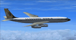
This is a repaint of the 707-345C in Seaboard World 1968 colors. The payware Captain Sim 707-300C is needed for this repaint. New York based, Seaboard & Western Airlines - an all cargo airline, was renamed Seaboard World Airlines on 26 April 1961. The "new" airline received the first of 6 CL-44 turboprops in August 1961. The CL-44 was the first modern airliner designed solely to carry freight. They were put into service after August 1961. By 1962, the Lockheed Constellations were all replaced, and Seaboard became an all-turbine-powered airline (with the exception of a solitary C-46 based in Europe). Two years later in 1964, Seaboard received their first pure jets in three DC-8-Fs. 1964 was the airline's best year ever, as profits jumped by 53%, and the future looked very bright. However, it was not to be. Seaboard was forced to compete over its routes with the freight capacity of the passenger airlines, which annually became more competent in the cargo field. Although they did have a bright spot in providing charters to the military, the air freight industry as a whole will eventually fail to achieve the traffic potential envisioned by "aviation experts". Nevertheless, Seaboard, with new jetliners at their disposal, went on and provided excellent service to its customers. They offered a wide range of cargo services to many points in Europe. Eventually, falling passenger charters and stiff competition took their toll. Seaboard was bought out in 1980 by the only real all-cargo success at the time - The Flying Tiger Line. Seaboard operated 2n 707-300Cs from 1968 to 1969. This aircraft, N7322S, was leased from VARIG in 1968. This repaint was tested on FSX-SE. It should work on FSX & P3D v1-3. Textures are DXT5 dds.
| Filename: | FSXP3D_Seaboard_World_707345C_1968.zip |
| License: | Freeware |
| Added: | 14th February 2019, 18:21:31 |
| Downloads: | 105 |
| Author: | Ted Giana |
| Size: | 3.97 MB |
| Category: Flight Simulator X - Original Aircraft | |
| "Janet Airways" Boeing 737-600 BBJ-ER |
|
Images related to this file:
File Description:
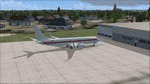
A highly classified small fleet of passenger aircraft known as "Janet" is operated for the United States Air Force to transport military and contractor employees. It mainly serves the Nevada National Security Site (most notably Area 51 (AR51) and Tonopah Test Range (TNX), from their terminal at Las Vegas' McCarran International Airport (KLAS). The planes are also used to fly to/from Air Force Plant 42 (KPMD), Naval Air Weapons Station China Lake (KNID), Hill Air Force Base (KHIF), and Edwards Air Force Base (KEDW). I encourage you to locate, download, and install the AFCAD files or scenery add-ons associated to these airports from any source you desire, but make sure they are designed for FSX. The fleet's "Janet" call sign, from which its de facto name comes, is said to stand for "Just Another Non-Existent Terminal", or more likely "Joint Air Network". Everything is realistic in this model, now, and most simmers know how inaccurate the original FSX 737-800 was. However, this aircraft simulates the accuracy of a 737-600 BBJ-ER, if there ever was one built. I modified everything to fit that aspect, except for the visual model. The engine characteristics are correct as well as all weight/balance and MOI. I even fixed the wheels to be accurate in base, track and pressure size. Everything I've done here is for educational purposes without any expectation of any monetary gain, and offered publicly for free. Read the Readme.txt file for installation and details. All persons involved with this and the original design are credited, unless they are unknown and have offered no credit details. Sounds by: Christoffer Petersen, Panel by: Pasquale Rinaldi, Redirected Texture by: Microsoft (Unknown Staff Member Names), Real World Engine/Aerodynamics by: Douglas E. Trapp, FS Flight Dynamics Engineer [email protected] July 2017
| Filename: | Janet_Airways_Boeing_737600_BBJER.zip |
| License: | Freeware |
| Added: | 8th July 2017, 20:04:30 |
| Downloads: | 1,920 |
| Author: | Douglas E. Trapp |
| Size: | 39.16 MB |
| Category: Flight Simulator 2004 - Scenery | |
| CPR5 - Woodstock - Ontario, Canada |
|
Images related to this file:
File Description:
This is the first of a south Ontario series. Woodstock is a town with a population of around 38,000, located 50 miles west of Lake Ontario. The airfield is 3 miles west of the town, with a single grass runway just over 3,000 feet long and 100 plus feet wide, aligned 05/23 in FS9 (in fact it is now 06/24 due to the magnetic north wandering off during the last 10 years). There have been at different times varying amounts of gravel mixed in with the grass on both runway and taxiway; the majority surface by far is grass and I have left it all as such, as there is no visually convincing way to mix the two without unreal sharp edges. The apron is on the northern side of the runway, and is now modified in shape to maximise the area available for crops. There are 10 "T" hangars and a small clubhouse in a single long building. There is no fuel, runway lighting, or taxiway or apron lights so usage is effectively restricted to daylight hours. To the east of CPR5 and on the edge of the town is a private airstrip with 2,800 feet of asphalt runway; I have added this as a visual reference, along with several large grain silos on the other side of the road. Hidden in plain sight amid the surrounding farmland, the first sighting of CPR5 is actually always of the adjacent and far more visible buildings just to the east of the apron, which are owned by a company that deals with everything to do with boats, up to and including fishing gear. These have been included. As ditches cannot be effectively duplicated in FS9 I have included some fences which do not exist in real life, to give some needed visual clues.
| Filename: | CPR5__Woodstock__Ontario_Canada.zip |
| License: | Freeware, limited distribution |
| Added: | 8th July 2015, 13:36:05 |
| Downloads: | 186 |
| Author: | Roger Wensley |
| Size: | 5.57 MB |
| Category: Flight Simulator 2004 - Scenery | |
| Silver City CFQ5 in Yukon Territory Canada |
|
Images related to this file:
File Description:
Silver City is a ghost town in the Yukon Territory, Canada, amid the Rocky Mountains and around 35 miles northwest of Haines Junction. It is on the southern end of Kluane Lake and in the Kluane National Park and this probably explains it's (minimal) survival after what appears to have been the shutdown of mining for silver. There is little information readily available. The date of this scenery is, as usual, around 2010. There was no recent regular service by Yukon Air North or any other airline, and the primary user of the airfield adjacent to the lake is a company called Icefield Discovery Tours. Their activity is probably very similar to the company at Haines Junction and involves trips to the National Park amid mountains and glaciers. There is also another organisation at the airfield, the Kluane Lake Research Station of the Arctic Institute. They have four buildings there but it is unclear how much aerial activity they generate, or if in fact they fly at all for their work. The runway is 3,000 feet of unlit gravel, aligned north-south. This post will be followed by Burwash, which is at the far northwestern end of the lake. There is no video of the Silver City airfield on Youtube, and it is not the most exciting airfield in the world, but the location is enough in real life for a visit to be made. On YouTube there is a series of posts by Angle of Attack showing the preparation and then the flight of an old Cessna 172 from Homer to Oshkosh for the installation of modern instruments. Interesting for me as they visit or fly over airfields I have made: Homer, Merrill, Tok Junction, Burwash, Silver City, Haines Junction, Watson Lake, Fort Nelson, and Grande Prairie. But they fly in the winter so it all looks very different.
| Filename: | Silver_City_CFQ5_in_Yukon_Territory_Canada.zip |
| License: | Freeware, limited distribution |
| Added: | 22nd January 2022, 21:57:41 |
| Downloads: | 97 |
| Author: | Roger Wensley |
| Size: | 9.86 MB |
| Category: Flight Simulator 2004 - Scenery | |
| Frozen Canadian & USA Rivers & Lakes Revision |
|
Images related to this file:
File Description:
This "freezes" all lakes and rivers for winter flying and means they can be landed on with skis or wheels; it is meant for low level flying rather than high level jet flights. This edition is complete in itself and now really covers all of Canada and parts of the USA along the border, including large parts of Michigan, Wisconsin, Minnesota, North Dakota, and Montana. It is reversible with an "untick" in the FS scenery library. The revision is the addition of frozen sea in the area of Baffin Island (where I and Sid & Pete have recently posted all of the Baffin Island airfields) as I missed this area last time. Sorry about that. I have spent some time making sure that the sea and the inlets along the coast in the south do not get frozen too, and also some of the lakes that are close to the coast and rarely get cold enough to freeze over. The Great Lakes do not usually totally freeze, but this is an either ON or OFF modification and partial freezing cannot be convincingly simulated, so I went for total ice. Along the north shore I went for the peak of the winter with sea ice all the way to the permanent polar cap; this is not totally realistic as there is usually a partially open lead along the coast, but as with the Great Lakes...... It will work without Ultimate Terrain, but as UT is what gets all the lakes and rivers there and in the right place (except in the far north) it is obviously much improved with UT. The pics show Rockcliffe in the winter with the frozen Ottawa River for real and in FS for comparison; without UT the river would not be in the right place.
| Filename: | Frozen_Canadian__USA_Rivers__Lakes_Revision.zip |
| License: | Freeware, limited distribution |
| Added: | 6th September 2011, 00:42:43 |
| Downloads: | 623 |
| Author: | Roger Wensley |
| Size: | 1.2 MB |
| Category: Flight Simulator X - Aircraft Repaints, Textures and Modifications | |
| Southwest Airlines Boeing 737-700 v2.2 Final Package |
|
File Description:
**** THIS FILE SUPERCEEDS MY ORIGINAL FILE b737_700_southwest_v21.zip **** v2.2 - REPORTED BUGS HAVE BEEN CORRECTED. The 737 was born out of Boeing's need to field a competitor in the short-range, small capacity jetliner market which had been opened up by the BAC 1-11 and the Douglas DC-9. Boeing was badly behind however when the 737 program was initiated in 1964, as both of these rivals were already into their flight certification programmes. The 737 was cheaper and quicker to design, featuring six-abreast seating compared to the 1-11 and DC-9's five-abreast layout.By the 1990s, the 737 had lost ground technologically to the newer Airbus A320. In 1993, Boeing initiated the 737-X or Next Generation (NG) program. The Next-Generation 737 encompasses the -600, -700, -800 and -900, and amounted to a complete redesign of the 30-year old airliner. The 737NG is an entirely new aircraft, sharing very little with previous 737s, other than fuselage frames. New wings, new avionics and revised engines were the biggest engineering changes. The 737 was given a glass cockpit with CRT screens (except the -900, which had newer and higher tech LCD screens) and digital systems inspired by the ones that were used on the 777. The parts count is down by about 33%, reducing weight and simplifying maintenance. Additional changes since its introduction include a new interior and performance enhancing winglets which reduce fuel consumption and improve take-off and climb performance. All textures have been modified in DXT-3 format for crisp visuals without comprimising frame rates. Includes the default FS-X Boeing 737 panel. Sounds have been defaulted to the FS-X 737-800, however I recommend the excellent 737 CFM56 "the real deal" version 2 soundpack (file name:737_cfm56__the_real_deal_version_2.zip located at AVSIM.com) for this aircraft series. Additionally, this aircraft series has no Virtual Cockpit (VC), therefore you must fly them using the 2-D default panel view only! This package includes Southwest Airlines liveries (Canyon Blue, Maryland One, Nevada One, Old Color & Shamu).
| Filename: | Southwest_Airlines_Boeing_737700__v22_Final_Packag.zip |
| License: | Freeware |
| Added: | 9th December 2006, 20:24:49 |
| Downloads: | 11,832 |
| Author: | Brian C. Selb |
| Size: | 13.59 MB |


© 2001-2026 AVSIM Online
All Rights Reserved
Privacy Policy |