
Where Flight Simulation Enthusiasts Gather from Around the World!
AVSIM Library - Search Results

| Category: Flight Simulator X - Aircraft Repaints, Textures and Modifications | |
| SpiceJet Airways Boeing 737-9GJER/WL (VT-SLC) |

|
Images related to this file:
File Description:
SpiceJet Airlines (SG) Boeing 737-9GJER/W (VT-SLC) (Dual Livery Options). PMDG 737-800/900 needed FSX/P3D. Leased aircraft often have many different liveries through the course of their history. VT-SLC is no exception to this.
Delivered in 2008, the aircraft was sold to BBAM which then leased the aircraft to SpiceJet as the reg (VT-SGB). In
2014, Spicejet's lease terminated and Anadolu Jet took the aircraft. In August 07, 2015, SpiceJet took N462DC (her orig.
registration) back, and re-registered her as VT-SLC. VT-SLC wears a hybrid livery to this day, but I opted to include
the regular SpiceJet livery AND the hybrid livery as two different repaint options! You may choose either or, for which
livery you wish to fly!
I did my best to include as many details as possible including: cockpit textures/decals, tail details, wing registration,
independent fuse panel wearing, and many more! Expect the high level of detail Flightsimfx is known for!
| Filename: | SpiceJet_Airways_Boeing_7379GJERWL_VTSLC.zip |
| License: | Freeware, limited distribution |
| Added: | 8th August 2016, 22:21:47 |
| Downloads: | 2,043 |
| Author: | Rohan Patel |
| Size: | 60.77 MB |
| Category: Flight Simulator X - Utilities | |
| SimLauncherX v5.9 |
|
Images related to this file:
File Description:
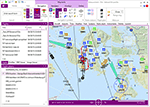
SimLauncherX (or SLX for short) can be used as a launcher application for both FSX:ME, FSX:SE and Prepar3D (v1, v2 and v3). Flights/scenarios can be loaded when launching the simulator or when the simulator is already running. New flights can be created by selecting one of the installed aircraft, selecting the start location (runway or parking position), selecting the type of weather and the time of day. You can also display and create flight plans and attach them to a flight as requested or active flight plan. Version 5.9 adds a flight computer, AI browser, interactive (spoken) checklists, PMDG 737/777 CDUs, approach charts, fleet management and many other improvements. SimLauncherX is a more modern version of my previous SimLauncher application with a lot of additional functionality:
- interactive map.
- display, create and modify flight plans.
- show .kml/.kmz files on the map.
- radio stack.
- instruments panel.
- scenery.cfg editor.
- dll/exe.xml editor.
- process monitor.
Works with FSX:ME, FSX:SE and P3D v1, v2 and v3.
| Filename: | SimLauncherX_v59.zip |
| License: | Freeware, limited distribution |
| Added: | 1st April 2017, 08:18:19 |
| Downloads: | 15,782 |
| Author: | Maarten Boelens |
| Size: | 52.64 MB |
| Category: Flight Simulator 2004 - Scenery | |
| Koyukuk KYU in Alaska |
|
Images related to this file:
File Description:
Koyukuk is a small village on the northern bank of the Yukon River, around 5 miles east of where the river turns from north-south to east-west, east being upstream towards the distant Fairbanks. The mouth of the Koyukuk River that joins the Yukon is just to the east of the village. The population is now under 100 and living from fishing and the land. During the late 1800's the local population lived off the land and also by the spin off from gold mining in the same way as the nearby Nulato, but when in the early 1900's gold mining activities moved to Nome and Fairbanks local prosperity plunged. In fact, the village only became a permanently inhabited establishment in 1939, when a school was built. The airfield is close by and has a gravel runway aligned 6-24 and 4,000 feet long with PAPI on the approach to 6. There is also a shorter and parallel grass runway that is only used in the winter snows by light planes that are on skis and without wheels. Apart from the airfield itself, and it's buildings, this scenery modifies the local land class, adds village buildings while reducing the village size to reality, and creates a new airfield background. Koyukuk is served by Wright Air from Fairbanks in the east and this is included in the AI provided with the post of Nulato. A note here about my scenery making. This is post number 509 and there will not be many more to follow this as I am almost at the end of the photos I either took or found for scenery purposes. There is a limit to what can be located online and I have already been making use of the little there is; eg Unalakleet. So, if you are near an airport (preferably Canadian or Alaskan) and have a camera..... Let me know.
| Filename: | Koyukuk_KYU_in_Alaska.zip |
| License: | Freeware, limited distribution |
| Added: | 30th August 2019, 18:23:12 |
| Downloads: | 125 |
| Author: | Roger Wensley |
| Size: | 3.26 MB |
| Category: Flight Simulator 2004 - Scenery | |
| St Michael Island in Alaska-St Michael 5S8 and Stebbins WBB |
|
Images related to this file:
File Description:
St Michael Island is 50 miles southwest of Unalakleet, an island that in fact appears to be a cape and a firmly attached piece of the mainland. On the island there are two villages, St Michael on the northeast corner and Stebbins on the northwest. St Michael has a new airfield that is west of the village by around a mile or so, with a gravel runway 4,000 feet long. The old and now closed airport was known as SMK, and is now readily identifiable by the new red-roofed school building that occupies the centre of the runway. The new airfield now has an icao code of PAMK, but FS9 does not readily accept icao code changes so we are stuck with the original code it was given, 5S8. The SMK icao of the old airport will still show on your gps as if I deleted it the runway would also have to be deleted, and a substitute and unsatisfactory gravel apron made to impersonate a runway. Stebbins is 5 miles west of St Michael and next to the shore, a smaller village than St Michael with around 250 inhabitants. The airfield is at the southern end of the village and has a gravel runway that is 3,000 feet long. The icao code is WBB. There is no AI included here as it was already included in the post of Shaktoolik. There is a correction here for Shaktoolik, which I now find should have had a blue garage, not a red one; I wrongly named a photo. A note here about my scenery making. This is post number 501 and there will not be many more to follow this as I am almost at the end of the photos I took or found for scenery purposes. There is a limit to what can be located online and I have already been making use of the little there is; eg Unalakleet. So, if you are near an airfield (preferably Canadian or Alaskan) and have a camera..... Let me know.
| Filename: | St_Michael_Island_in_AlaskaSt_Michael_5S8_and_Steb.zip |
| License: | Freeware, limited distribution |
| Added: | 1st August 2019, 16:45:58 |
| Downloads: | 95 |
| Author: | Roger Wensley |
| Size: | 3.88 MB |
| Category: Flight Simulator 2004 - Scenery | |
| Tok Junction 6K8 in Alaska, USA |
|
Images related to this file:
File Description:
Tok Junction is a village, or small town, on the Alaska Highway some 180 miles east of Fairbanks and 60 miles west of the Alaska-Canada border. The town is spread over a wide area on the flat terrain and barely registers among the trees, and as such is not shown in FS9 except as a grid of roads as there is no town terrain texture like it used in FS9. The airfield is at the eastern end of the town and adjacent to the Alaska Highway and I have included some surrounding houses, workshops, shops, lodges, etc. The single runway is 3,000 feet of 50 feet wide asphalt aligned 07-25 and lit. There is a small airline based on the airfield called 40-Mile Air. Their hangar is red and the name written large and 100LL fuel is available beside it at all times. Jet A-1 is available by a telephoned pre-arangement. They are, I believe, no longer flying scheduled flights but they do still function as an air taxi and they have a contract to deliver mail to surrounding villages that are not served by all-weather roads. The airfield now has a new icao "PFTO" but in FS9 it remains as the original FAA LID, 6K8. The FS9 roads are not accurately placed, and the grass airfield background is not really appropriate as the reality is more like gravel mixed with earth; it is however difficult to replicate this with the available textures and still prevent bushes or trees appearing. But, in the winter and with snow on the ground it looks as it should. A note here about my scenery making. There will not be many more to follow this as I am almost at the end of the photos I either took or found for scenery purposes, plus I expect to move on from FS9 at some point during next year.
| Filename: | Tok_Junction_6K8_in_Alaska_USA.zip |
| License: | Freeware, limited distribution |
| Added: | 14th January 2020, 17:49:21 |
| Downloads: | 176 |
| Author: | Roger Wensley |
| Size: | 25.47 MB |
| Category: Flight Simulator X - Scenery | |
| KLGB Long Beach Airport - Modernized terminal |
|
File Description:
The airport I chose is Long Beach Airport. This airport has been around for
many years and has had everything from the Air Force One to the 787 Dreamliner land here!
The airport is located between downtown Los Angeles and Orange County and offers a great
landing for tourists that do not want to land in the fifth busiest airport in the world,
Los Angeles International.

The reason why I decided to create this airport was because it is my home airport
and I am located only about five miles from it. Also, there is no good freeware FSX scenery for this airport.
Features included!:
- Modern Terminal with correct gate placements
- changed and edited roads and other buildings around airport
- added the jetBlue offices on the airport
- Cars added (all over the place!!!)
- trees added near drop off (California Palm trees)!
- baggage cars and other airport cars added.
- buses and car parking lots added
- "spring street" flight schools and private terminal added.
- Vehicles, AI aircraft, grave yard aircraft, and many other static joys throughout the airport!
- "Runup" aircraft near runway 34R.
- Boeing C-17 facility (no aircraft C17 there)
- updated taxi ways and heliports
- Airport Service vehicle roads updates and made with help from Google Earth.
- Accurate fence, jetblast fence, and boarders of airport.
- Cargo terminals added for ups and dhl
- Private (gulfstream and other private) jet spots added.
- Flight Schools such as Long Beach Flight Academy (one I go to!!!) accurately made.
- New taxi ways and terrain
- Aflite fuel truck spaces added
- Correct runway lengths of 25L
- More items you just need to see to believe!!!
Distribution limits (MUST CONTACT ME FOR REDISTRIBUTION).
| Filename: | KLGB_Long_Beach_Airport__Modernized_terminal.zip |
| License: | Freeware, limited distribution |
| Added: | 26th March 2012, 11:10:01 |
| Downloads: | 2,717 |
| Author: | Rohan Patel |
| Size: | 3.57 MB |
| Category: Flight Simulator 2004 - AI Aircraft | |
| Chance-Vought F-8 Crusader (Part 2) |
|
Images related to this file:
File Description:

Chance-Vought F-8 Crusader (Part 2). I present a comprehensive AI traffic model package for this classic aircraft of modern military history.
This is an original 8-LOD model, with many animations and features thanks to a growing confidence in XML-coding and making FSDS work for me instead of the other way around.
Nicknamed "The Last Gunfighter", this aircraft was the last production aircraft for the US Navy and Marine Corps which used guns as primary armament, and was in service at the twilight of this age, as well as the dawn of the missile age. Like all combat-experience aircraft, it had a relatively short life during its operational use (only about twenty years or so as a fighter), but was used a little longer as a recce aircraft; and beyond that in export service to France and the Philippines. The Crusader was used extensively in combat operations in Vietnam, played a crucial role in the Cuban Missile Crisis, and gave the newer F-4 Phantoms a fair run for their money in terms of air combat capability during this time. It is interesting to note that the 'elderly' F-8 Crusader had a better kill overall ratio in air combat in Vietnam than its F-4 successor.
This is part two of this model series, covering the F-8D, F-8E, and F-8H base models; with a total of 22 model options and 54 individual squadron paints. I am fairly confident that if any operational squadron of the USN and USMC used this aircraft from the late 50s to the late 60s, it is covered here at some time frame. Subsequent releases will include the later USN/USMC models, as well as the French and Philippine exports. Extensive credits and instructions are in the documentation. Base model and paint by Michael Pearson, flight dynamics by Michael McIntyre.
| Filename: | ChanceVought_F8_Crusader_Part_2.zip |
| License: | Freeware |
| Added: | 6th January 2013, 12:10:52 |
| Downloads: | 874 |
| Author: | Michael Pearson |
| Size: | 19.65 MB |
| Category: Flight Simulator 2004 - Scenery | |
| Coal Harbour CAQ3 float base in British Columbia, Canada |
|
Images related to this file:
File Description:
This is number eight in a series of new and renovated float bases in BC. Coal Harbour is in a sheltered cove off Holberg Inlet on the northwest coast of Vancouver Island, close to the village and 10 miles southwest of the Port Hardy float base. There is 100LL fuel and oil available. Due to the deep fjords that run into Vancouver Island from the west coast Coal Harbour is actually closer to the east coast than it is to the west coast. The tortuous route in through Quatsino Sound and Rupert Sound shelters the waters of Holberg Inlet from the stormy seas of the west coast, and fishing boats take advantage of this. The floatplane dock is to the south of the large (and old) hangar, adjacent to the southern end of the fixed dock where the ramp bridge descends to the floating docks. The video makes it clearer. The AI is a further adaptation of the CF36 AI and involves Beavers and Otters as listed in the AI folder. Due to the surrounding hills there may be some interference with AI aircraft, depending on the wind direction, though I have watched succesful Beaver and Otter landings. Amid the hills there is a very large hole in the ground to the east. The village name suggests it may have been for coal but though in fact there was a coal mine, that was a much smaller and unsuccesful venture; this particular scene of enthusiastic digging was for copper, until 1996. The main claim to fame of Coal Harbour was that it was the last whaling station in North America, using the buildings that were part of the RCAF float plane patrol base during WW2. One downloader reported a texture problem with Port McNeill, to which we found a solution. As he was the only person to email me I am going to presume that nobody else had the problem.
| Filename: | Coal_Harbour_CAQ3_float_base_in_British_Columbia_C.zip |
| License: | Freeware, limited distribution |
| Added: | 25th January 2017, 00:29:05 |
| Downloads: | 225 |
| Author: | Roger Wensley |
| Size: | 7.79 MB |
| Category: X-Plane - Scenery | |
| San Diego, Ca. 2004 - v6.70thru v7.30 |
|
File Description:
San Diego Scenery Package
for X-Plane v6.51+v7.XX
by Bill Moore
January 3, 2004
Here is a new San Diego scenery package that I designed for my personal use. I have had numerous requests to do more cities and airports so this is my first free scenery for 2004. Being the lazy person I am, no research was done and no claim to real life designs are implied.
I have added many objects to the airports and cities including terminals, hangers, buildings, stadiums, balloons, city scapes and other fun and interesting things. All of which were begged, borrowed or stolen from all the wonderful designers in the X-Plane Community such as Ken Spiker, Christian Franz, Ted Davis, Robert Bunce, Tom Curtis, B. Brooks and all the others who have inspired me. Many thanks to each of you for your contributions to the X-Plane community.
Like all my scenery packages, the additions to the citys and airports are purely fictional. The airports themselves are unaltered. I have enhanced "San Diego Intl.-Lindburg Fld. (KSAN), "North Island NAS. (KNZY), Miramar MCAS (KNKX), Imperial Beach NOLF (KNRS), General Abelardo L. Rodriquez Intl. (MMTJ) and a few other near by airports. A special thanks to Ted Davis for creating the orignal San Diego scenery that led me to adding to his great work. Also, Ken Spikers new KWIKCITYS package contributed to the completion of my version of San Diego and surrounding areas. His cities really added the crowning touch. Thanks Ken. If I inadvertently left out other object designers, it was purely unintentional and I offer my apologies.
Installation: Place the extracted "San Diego" folders in your "Custom Scenery" folder.
Please send any comments or suggestions to [email protected]. If you choose to rate my Scenery Packs and give less than a "9" rating, I would appreciate knowing what I can do to improve them. I can only do that with your feedback.
Have fun and FLY SAFE!
| Filename: | San_Diego_Ca_2004__v670thru_v730.zip |
| License: | Freeware |
| Added: | 4th January 2004, 05:18:56 |
| Downloads: | 814 |
| Author: | Bill Moore |
| Size: | 7.96 MB |
| Category: Flight Simulator 2004 - Miscellaneous Files | |
| Active Approach - PHNL (Honolulu Intl Honolulu, Hawaii) |
|
File Description:
As most know the Approach and Final (VMC) for AI Traffic in FS9 is a straight in type landing and does not always consider high terrain at airports. This is do to the way that the coding is written in FS9 and it puts limits on IFR arriving aircraft. If you open runways at certain airports the AI Traffic will fly directly through a mountain once it is established on Final for a runway. What you will see with my file is a different type approach used for the way I control AI Traffic in FS9. No longer do the AI Planes use a straight in approach when landing to the west at PHNL. My new AI Aircraft Approach coding for FS9 now uses a base leg approach so AI Traffic does not fly through the mountains. The Honolulu Control Tower will clear all AI Traffic (IFR FP) landing either on 26L and 26R as a straight in landing even though the offset to final is 30 degrees from the runway center line. The Control Tower will instruct the AI Planes landing on either 22L or 22R to fly a left base leg which is greater then a 45 degree offset and then the AI Planes will turn on a short 1.5 mile final. The left base approach to 22L and 22R runways is a 65 degree offset from the runway center line. My testing shows excellent behavior of the FS9 default models, PAI models and the Aardvark planes of all sizes to execute this new type of visual approach that I am now writting code for which supersedes the FS9 default straight in ATC hard code approach. Read the text file for all the default scenery enhancements (plus Jetways) added to PHNL along with a full understanding of how the new Approaches work *** 3rd Party Scenery Designers Special APProach bgl and a FS2004 Default Scenery AFCAD included ***
| Filename: | Active_Approach__PHNL_Honolulu_Intl__Honolulu_Hawa.zip |
| License: | Freeware, limited distribution |
| Added: | 16th March 2005, 04:10:43 |
| Downloads: | 5,604 |
| Author: | Jim Vile |
| Size: | 134.3 KB |


© 2001-2026 AVSIM Online
All Rights Reserved
Privacy Policy |