
Where Flight Simulation Enthusiasts Gather from Around the World!
AVSIM Library - Search Results

| Category: Fly! II - Scenery | |
| Gmunden Airfield V1 |

|
File Description:
Gmunden is a small airfield in the southwest of Linz. Only for use with my Austria west mesh scenery
| Filename: | Gmunden_Airfield_V1.zip |
| License: | Freeware |
| Added: | 4th January 2007, 20:19:48 |
| Downloads: | 114 |
| Author: | Harald Kraft |
| Size: | 266.31 KB |
| Category: Flight Simulator X - Scenery | |
| Quebec Mesh (Lod10), between N56°-N57° and W66°-W77°, Prov. of Quebec (Canada) |
|
File Description:
FSX 38m (Lod10) terrain mesh files of territory included between N56°-N57° and W66°-W77°, province of Quebec, Canada.
| Filename: | Quebec_Mesh_Lod10_between_N56N57_and_W66W77_Prov_o.zip |
| License: | Freeware, limited distribution |
| Added: | 1st March 2008, 14:37:15 |
| Downloads: | 3,041 |
| Author: | Gilles Gauthier |
| Size: | 21.6 MB |
| Category: Flight Simulator X - Scenery | |
| Nunavut Landscape - Canada |
|
File Description:
Elevation data (mesh-Lod10), land cover, water polygons, rivers, stream lines, lanes and shorelines around airports of Nunavut, Canada
| Filename: | Nunavut_Landscape__Canada.zip |
| License: | Freeware, limited distribution |
| Added: | 20th November 2010, 00:10:27 |
| Downloads: | 2,512 |
| Author: | Gilles Gauthier |
| Size: | 49.62 MB |
| Category: Flight Simulator X - AFCAD Files | |
| Ekdahl Airport (NJ59), NJ |
|
File Description:
Located 04 miles S of Freehold, New Jersey, Ekdahl Airport is a private turf strip 1300' in length bordered closely by trees. This makes for an interesting landing as the 90' width of the runway is all the room you have to play with. However because it can be difficult to gauge your distance to trees and also because even the slightest brush with a tree can cause a crash, all trees immediately adjacent to the runway have crash disabled - mainly so you can turn your plane around if you land on Runway 02. The hard surface runway was removed so make sure your terrain mesh complexity is set as high as possible to get that bumpy ground realism. A windsock is listed as being available on this field but I could not locate it in any imagery and so placed it by default near the hangar building. You can start on the runways or parked in front of the hangar. Make sure your plane is capable of these take off and landing distances! Tree height around the field was not listed so I again used my best judgement from studying aerial photos. There is no fuel or parking for transient aircraft available. The field is not lit - daytime VFR operations only are recommended.
Scenery constructed with use of satellite images/streetview/aerial photos - the author has not been there in person.
This scenery is meant to be used in conjunction with MegaScenery Earth New Jersey/Delaware 002. It is not required, but apron use is minimized to allow satellite scenery to show through as much as possible, and objects are placed based on the MSE textures - lack of it may make scenery look out of place.
| Filename: | Ekdahl_Airport_NJ59_NJ.zip |
| License: | Freeware |
| Added: | 13th August 2011, 16:53:55 |
| Downloads: | 172 |
| Author: | Drew Sikora |
| Size: | 550.03 KB |
| Category: Flight Simulator X - AFCAD Files | |
| Peters Airport (4NJ8), NJ v1.1 |
|
File Description:
Located 05 miles W of Somerville, New Jersey on 70 acres of land, Peters Airport is a private turf strip that will test your short field skills to the max. The published runway dimensions for this strip are 1700x200 feet, and for the most case this is fairly accurate - however at the ends of both runways you have tree obstacles to overcome so this can shorten the amount of usable runway significantly, although the tree obstacles are no higher than 12-14m. There is no hardened runway surface so you will be landing/taking off on terrain. Depending on how high your mesh resolution is, this can be a significant factor, as Runway 31 is mainly uphill enough that you will need to power up with parking brakes on if you want to make it in the air. Runway 13 is the best since you are going downhill and the trees at the end are fewer and smaller. Pay close attention to the pattern! Runway 13 is Left and Runway 31 is Right - this airport is within 2 miles of Solberg-Hunterdon (N51) and you don't want to get in the way of that field's traffic! The runway is not lit, so daytime VFR operations only. There are no services at this strip for transient aircraft.
Scenery constructed with use of satellite images/streetview/aerial photos - the author has not been there in person.
This scenery is meant to be used in conjunction with MegaScenery Earth New Jersey/Delaware 001. It is not required, but apron use is minimized to allow satellite scenery to show through as much as possible, and objects are placed based on the MSE textures - lack of it may make scenery look out of place.
| Filename: | Peters_Airport_4NJ8_NJ_v11.zip |
| License: | Freeware |
| Added: | 20th September 2011, 14:08:43 |
| Downloads: | 405 |
| Author: | Drew Sikora |
| Size: | 461.03 KB |
| Category: Flight Simulator 2004 - Scenery | |
| Scotts Bluff, Nebraska 19m Terrain Mesh |
|
File Description:
LOD 11 (19 m resolution) terrain mesh of Scotts Bluff National Monument in the panhandle of Nebraska and surrounding area. Compiled from NED 1/3" (10 m) elevation data. Proprietary software was used to smooth the terrain near KBFF and KIBM airports to eliminate the "runway plateau" side effects induced by high-resolution mesh.
| Filename: | Scotts_Bluff_Nebraska_19m_Terrain_Mesh.zip |
| License: | Freeware, limited distribution |
| Added: | 22nd April 2004, 18:16:00 |
| Downloads: | 1,332 |
| Author: | John K. Taylor |
| Size: | 6.69 MB |
| Category: Flight Simulator 2004 - Scenery | |
| EZ Scenery Grimes OK (1OK7) |
|
File Description:
FS2004 EZ Scenery Grimes OK (1OK7)
Area outside of airport's default flatten area require FS Global or Abasus extreme landscapes for mesh and the FREE library of EZ scenery objects available on FlightSim.com or AVSIM. I also use Ground Environment and Ultimate Terrain USA for landclass and mesh. FSX compatable.
Instructions inside.
jimmy R martin
| Filename: | EZ_Scenery_Grimes_OK_1OK7.zip |
| License: | Freeware |
| Added: | 3rd June 2006, 05:45:57 |
| Downloads: | 374 |
| Author: | jimmy R martin |
| Size: | 31.64 KB |
| Category: Flight Simulator X - Scenery | |
| ITATIBA P1 - Photo Realistic Scenery |
|
File Description:
ITATIBA P1 - 1/2
This is the complement of Campinas to cover ITATIBA region. This scenery is composed by five parts. Folow instructions on Readme.txt and have a nice visual flight.
Is a good idea install the FSX Mesh South America parts F7 and F8 cordinates in the map to have the essential mesh terrain.
| Filename: | ITATIBA_P1__Photo_Realistic_Scenery.zip |
| License: | Freeware |
| Added: | 11th August 2008, 08:27:11 |
| Downloads: | 1,356 |
| Author: | Gilson A. Rocchetti |
| Size: | 47.69 MB |
| Category: Flight Simulator 2004 - Scenery | |
| FS2004 EZ Scenery Elk City Mun OK (KELK) |
|
File Description:
FS2004 EZ Scenery Elk City Mun OK (KELK)
Area outside of airport's default flatten area require FS Global or Abasus extreme landscapes for mesh and the FREE library of RWY12 - EZ scenery objects available on FlightSim.com or AVSIM. I also use Ground Environment and Ultimate Terrain USA for landclass and mesh. FSX compatable.
Instructions inside.
| Filename: | FS2004_EZ_Scenery_Elk_City_Mun_OK_KELK.zip |
| License: | Freeware |
| Added: | 3rd June 2006, 21:38:22 |
| Downloads: | 447 |
| Author: | jimmy R martin |
| Size: | 139 KB |
| Category: Flight Simulator X - Scenery | |
| Mesh for Northern Africa, Base Grid 0603 - Part 1 |
|
Images related to this file:
File Description:
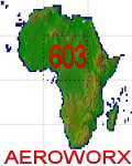
Highly detailed 76m SRTM mesh for Africa using the latest release of STRM Data V2.1. This file covers the Africa Area of base file 0603 (N01 and E00), North of the Equator. You need to download all two parts to restore the mesh bgl file. DO NOT DISABLE THE DEFAULT DEM 603 FILE.
| Filename: | Mesh_for_Northern_Africa_Base_Grid_0603__Part_1.zip |
| License: | Freeware |
| Added: | 8th February 2014, 22:03:34 |
| Downloads: | 2,536 |
| Author: | Martin du Preez, Hannes Steyn, Aeroworx |
| Size: | 307.22 MB |


© 2001-2026 AVSIM Online
All Rights Reserved
Privacy Policy |