
Where Flight Simulation Enthusiasts Gather from Around the World!
AVSIM Library - Search Results

| Category: Orbiter - Spaceships | |
| USS Enterprise NCC 1701-E |

|
File Description:
This addon is based on the mesh created by Ed Giddings (http://www.quantumss.freeserve.co.uk). Although it is my first addon for Orbiter, I think it's not too bad (especially for Trekkies;-). Contains a scenario with Enterprise in Mars-Orbit. It works fine with Orbiter version 031105.
Just unzip the archive into your Orbiter-folder and explore deep space...
| Filename: | USS_Enterprise_NCC_1701E.zip |
| License: | Freeware |
| Added: | 30th November 2003, 04:20:07 |
| Downloads: | 1,863 |
| Author: | Uli Klapp |
| Size: | 3.71 MB |
| Category: Flight Simulator 2004 - Gauges | |
| Apollo PVI (Pilot Vehicle Interface) /GPS |
|
File Description:
This gauge is modeled after the Apollo PVI for commercial jet aircraft. This gauge is written in XML and is designed to mesh with the default FS9GPS map input data. Compatible with FS2004 (FS9) ONLY! Size (pixel size) is the same as the FS9 default GPS so placement (or replacement) of the gauge is quick and easy.
| Filename: | Apollo_PVI_Pilot_Vehicle_Interface_GPS.zip |
| License: | Freeware |
| Added: | 24th December 2003, 05:34:07 |
| Downloads: | 5,094 |
| Author: | Keith Giveans |
| Size: | 97.88 KB |
| Category: Flight Simulator 2002 - Scenery | |
| Lake Elevation Corrections |
|
File Description:
The files in this package contain an update correcting some lake elevation for Quebec terrain mesh (FS2002) created from SRTM-3 : about 400 lakes in Manicouagan region, 21 in Gaspesia Peninsula and 20 on Anticosti Island. The coastline is corrected near by Magpie on Quebec North-Shore. Four river courses are corrected or created on Anticosti Island.
| Filename: | Lake_Elevation_Corrections.zip |
| License: | Freeware, limited distribution |
| Added: | 24th April 2003, 16:11:29 |
| Downloads: | 4,025 |
| Author: | Gilles Gauthier |
| Size: | 872.4 KB |
| Category: Flight Simulator 2002 - Scenery | |
| Parent Airfield, Québec Short Hops |
|
File Description:
Parent is situated in the Laurentian mountains north of Montreal. This is bush country and where I exhibit my bush plane macros soon to be published. Gilles Gauthier's mesh of Quebec Laurentians (freeware) and Lago's FSSE and FSSS are recommended but not obligatory. Quebec Short Hops 1 is needed. Details to obtain those in the download.
| Filename: | Parent__Airfield_Qubec_Short_Hops.zip |
| License: | Freeware |
| Added: | 13th June 2003, 15:41:34 |
| Downloads: | 858 |
| Author: | Léon Louis |
| Size: | 3.79 MB |
| Category: Flight Simulator X - Aircraft Repaints, Textures and Modifications | |
| ARX-5X Coyote - Expansion Pack |
|
Images related to this file:
File Description:
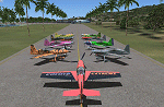
This is the expansion pack of 20 additional schemes for the Aeroworks Concept 5 and requires the original aircraft available here (ARX-5 Coyote v2.1 Package). The ARX-5X is a single-seat unlimited category aerobatic aircraft built around the 495c.i. 600hp Trace-Orenda OE600 V-8 aircraft engine and designed specifically for freestyle airshow type aerobatics. The expansion includes 12 domestic US schemes, and 8 international versions in the colors of England, Italy, Japan, Switzerland, Brazil, and Finland. By Jason L. Terry.
| Filename: | ARX5X_Coyote__Expansion_Pack.zip |
| License: | Freeware |
| Added: | 24th November 2012, 02:50:39 |
| Downloads: | 86 |
| Author: | Jason L. Terry |
| Size: | 8.32 MB |
| Category: Flight Simulator 2004 - Scenery | |
| Altitude adjustment for Dawson City CYDA |
|
Images related to this file:
File Description:
I discovered that the Northern Canada Terrain Mesh that I installed a while back was dumping part of my Dawson City Airport CYDA into a deep hole. I tried making a flatten to reduce the height of the terrain mesh land but that did not look at all realistic. So, the solution is to raise CYDA to 1,457 feet above sea level instead of the correct (correct according to the Nav Canada Supplement) level of 1,215 feet so that it melts into the surrounding terrain. There are still some rocky faces but at least they are not in the airfield. Do you need it? Not if your version looks ok. If it doesn't look ok then try this, but save your current version so you can go back to it if you need to.
| Filename: | Altitude_adjustment_for_Dawson_City_CYDA.zip |
| License: | Freeware, limited distribution |
| Added: | 23rd July 2019, 17:24:26 |
| Downloads: | 104 |
| Author: | Roger Wensley |
| Size: | 855.58 KB |
| Category: Flight Simulator 2004 - Scenery | |
| US North Cascades Mountains and Northwest Washington Coast |
|
File Description:
The files in this package completely replace the FS default landscape of the North Cascades Mountains and coastal areas of northwestern Washington State. Between Bellingham and Arlington (N-S), Orcas Island and Lake Chelan (W-E) you can now enjoy your VFR flights with accurate locations of coastlines, lakes, rivers, streams, roads, railroads, and power lines, as well as land use type (landclass) and terrain (add-on mesh). Also added are the larger glaciers of the majestic North Cascades volcanoes and peaks as well as several forestry roads and clearcuts outside the National Park and Wilderness areas. Made mostly with Christian Fumey's "Ground2K4" and Jim Keir's "Slartibartfast". Fully compatible with the recent freeware LOD10 add-on meshes of the western US. Mesh and landclass files will work in FS2002 but not the special scenery enhancements.
| Filename: | US_North_Cascades_Mountains_and_Northwest_Washingt.zip |
| License: | Freeware, limited distribution |
| Added: | 18th May 2004, 23:12:57 |
| Downloads: | 14,325 |
| Author: | Holger Sandmann |
| Size: | 12.72 MB |
| Category: Flight Simulator 2002 - Scenery | |
| Alaska Bush Scenery: Coghill Lake |
|
File Description:
Situated off College Fiord at the upper end of Prince William Sound, Coghill Lake is conveniently positioned for stopping off en-route between the Anchorage & Valdez areas. It's the actual location of a holiday cabin owned by the US Forest Service which can only be reached by floatplane, however I've added 2 airstrips to the area for extra interest. Coghill's main landing strip is sandy & partially overgrown, but has a good available length of 635m/2100' and some low-intensity edge lights. Ample parking for visitors is provided in a separate ramp area amongst the trees, reached via a basic but lit & signposted taxiway. Adjacent access by floatplane is possible using the small lagoon, as well as by College Fiord itself for larger loads. The other strip, a mile southwest across the river, only gets seasonal use by agricultural aircraft for spraying the local conifer plantations; its narrow gravel runway is slightly shorter at 588m/1930' & is a more challenging proposition with the surrounding trees and heavy brush all encroaching on the landing strip. Includes 2 versions: 1 for Eddie Denney's FS2002 mesh (recommended as this makes the airstrip profiles uneven), and another for both Eddie Denney's FS2000 mesh and the default mesh.
| Filename: | Alaska_Bush_Scenery_Coghill_Lake.zip |
| License: | Freeware, limited distribution |
| Added: | 28th May 2003, 19:07:22 |
| Downloads: | 1,933 |
| Author: | James Belk |
| Size: | 2.98 MB |
| Category: Flight Simulator X - Scenery | |
| EGLL - Heathrow Intl Airport - London, UK |
|
Images related to this file:
File Description:
This airport update is for EGLL and made only for FSX: The new Terminal 2A and 2B added, Terminal 3 pier six now has four gates added for the A380, Terminal 5 now has five gates added for the BA A380, taxiways, taxi signs and parking stands all updated to the latest charts, assigned parking as per their website this includes the airlines that will be moving to the new Terminal 2 later this year, extra parking also included, Cargo area rebuilt, extra fuel trucks, start location added to the lighted helipad, support vehicle roads rebuilt and many other scenery improvements, airport views are from inside the control tower (when in tower view) please view the readme before installation
| Filename: | EGLL__Heathrow_Intl_Airport__London_UK.zip |
| License: | Freeware, limited distribution |
| Added: | 18th April 2014, 07:10:43 |
| Downloads: | 50,663 |
| Author: | Ray Smith & Craig Scott |
| Size: | 1.67 MB |
| Category: Flight Simulator X - Scenery | |
| KHLX - Twin County Airport - Virginia, USA |
|
File Description:
Twin County Airport is located in the heart of the beautiful Blue Ridge mountains of southwest Virginia, adjacent to Interstate 77 near exit 19. We are 6 miles west of Hillsville and 11 miles northeast of Galax
This is a complete re-work of the airport based on Google Maps. Created with Airport Design Editor by ScruffyDuck Software using current FAA documentation and Google Earth measurements, this package offers a replacement for FSX's stock airport. All these enhancements are as close to the real airport as I can get with stock library objects and custom buildings.
| Filename: | KHLX__Twin_County_Airport__Virginia_USA.zip |
| License: | Freeware |
| Added: | 11th October 2014, 01:02:53 |
| Downloads: | 259 |
| Author: | Wayne Roberts |
| Size: | 196.49 KB |


© 2001-2026 AVSIM Online
All Rights Reserved
Privacy Policy |