
Where Flight Simulation Enthusiasts Gather from Around the World!
AVSIM Library - Search Results

| Category: Flight Simulator 2004 - Scenery | |
| CTH3 Canada, Quebec, Les Grandes-Bergeronnes |

|
Images related to this file:
File Description:
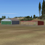
This is the scenery Les Grandes Bergeronnes (CTH3), which represents the reality. Les Grandes Bergeronnes is a small village located on Northern bank of the St-Laurent river of Quebec at Canada. This scenery is designed with FSDS and it accepts Mesh of Gilles Gauthier. This scenery functions for both FS-2004 and FS-X.
| Filename: | CTH3_Canada_Quebec_Les_GrandesBergeronnes.zip |
| License: | Freeware |
| Added: | 2nd January 2010, 19:29:43 |
| Downloads: | 379 |
| Author: | Regis Dassylva |
| Size: | 2.32 MB |
| Category: Flight Simulator 2004 - AFCAD Files | |
| Sucre SLSU Bolivia |
|
Images related to this file:
File Description:
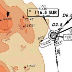
AFCAD file for FS2004 default scenery of Sucre SLSU Juanna A. De Padilla airport in Bolivia.
Brings runway to proper dimensions and adds approach (PAPI) lighting as in the real airport.
High elevation airport (9430 ft.) with surrounding terrain of the Bolivian Andes.
There is no night lighting at this airport. Approach charts included. Recommended mesh terrain: mesh_fermandois003_265585.zip
| Filename: | Sucre_SLSU_Bolivia.zip |
| License: | Freeware, limited distribution |
| Added: | 19th March 2010, 08:55:01 |
| Downloads: | 563 |
| Author: | Kyprianos Biris |
| Size: | 683.9 KB |
| Category: Flight Simulator X - Scenery | |
| CYBA Banff V1.1 |
|
File Description:
CYBA Banff Airport Relocated to correct position and made runway to slope with terrain. Used default object libraries and Canada19 terrain mesh but this will work without it. Version 1.1 adds Banff townsite, removes trees from ends of runways, and fixes missing section of trans-canada highway. Screen shots have been removed to reduce download size
| Filename: | CYBA_Banff_V11.zip |
| License: | Freeware |
| Added: | 21st June 2010, 10:56:52 |
| Downloads: | 1,487 |
| Author: | Rick Lackey |
| Size: | 3.83 KB |
| Category: Flight Simulator 2004 - Scenery | |
| Campbell River floats CAE3 UPDATE |
|
Images related to this file:
File Description:
This update deals with terrain variations that may be caused by an add-on mesh such as the Genesis one that I installed, and which I discovered made small hills that disrupted the fencing and car parks. This flatten will deal with this or a similar problem. If you aren't having a problem then you don't need this.
| Filename: | Campbell_River_floats_CAE3_UPDATE.zip |
| License: | Freeware, limited distribution |
| Added: | 15th July 2010, 01:58:09 |
| Downloads: | 414 |
| Author: | Roger Wensley |
| Size: | 572.44 KB |
| Category: Flight Simulator 2002 - Scenery | |
| Alava (Basque Country, Spain) - Photorealistic |
|
Images related to this file:
File Description:
Re-upload. This is the Photorealistic Scenery of the Province of Alava (Basque Country, Spain) for FS2002. Also valid for FS2004. It includes the mesh (LOD9) of the Basque Country and surroundings. To enjoy VFR flights take off from Foronda (LEVT), which is included in a beta version; discover all the marvelous landscapes of my province!!
| Filename: | Alava_Basque_Country_Spain__Photorealistic.zip |
| License: | Freeware |
| Added: | 21st July 2010, 00:33:14 |
| Downloads: | 2,264 |
| Author: | Carlos Martinez de Guerenu |
| Size: | 97.81 MB |
| Category: Prepar3D V1-4 - AFCAD Files | |
| FNDA Aeroporto of N'dalatando (Comandante Ngueto) - Angola |
|
Images related to this file:
File Description:
N'dalatando Airport (IATA: NDF) is an airport serving the city of N'dalatando, in Cuanza Norte Province, Angola. The runway is 6 kilometres (3.7 mi) east of the city.
The airport was capable of receiving medium-sized aircraft, such as Fokker 50s and Embraer 120s, 135s and 145s.
Optimized for ETM12m Africa - Enhanced Terrain Mesh 12m for ANGOLA vol.04.
| Filename: | FNDA_Aeroporto_of_Ndalatando_Comandante_Ngueto__An.zip |
| License: | Freeware |
| Added: | 18th September 2019, 02:31:55 |
| Downloads: | 254 |
| Author: | Giovanni Miduri |
| Size: | 4.15 MB |
| Category: Flight Simulator 2004 - Scenery | |
| Alaska Scenery Ellamar IZ9 and Tatitlek 7KA |
|
File Description:
2 small sceneries made using Lago's FS Enhancer 2004 (best if used with FSGenesis Alaska-Yukon mesh or some objects may be floating or sunk in terrain).
These are sceneries for two very close spots in Alaska ... They are Ellamar (IZ9), a floatplane dock and scattered houses and Tatitlek (7KA), a small gravel strip with more scattered houses.
| Filename: | Alaska_Scenery_Ellamar_IZ9_and_Tatitlek_7KA.zip |
| License: | Freeware |
| Added: | 6th July 2004, 22:46:45 |
| Downloads: | 1,742 |
| Author: | David King |
| Size: | 60.22 KB |
| Category: Flight Simulator 2004 - Scenery Design | |
| Alaskan Terrain Textures |
|
File Description:
ALASKAN TERRAIN TEXTURES.
Terrain textures for Alaska by Munch Brothers. These textures greatly enhance the color and look of the FS terrain. The textures can be used with or without default mesh. This package includes all seasonal variations. Future updates will include further improvments. Review the readme for installation. VERY IMPORTANT.
Enjoy, Don Elliott MUNCH BROS.
| Filename: | Alaskan_Terrain_Textures.zip |
| License: | Freeware, limited distribution |
| Added: | 24th April 2005, 15:16:42 |
| Downloads: | 1,875 |
| Author: | Don Elliott |
| Size: | 10.78 MB |
| Category: Flight Simulator 2004 - Scenery | |
| Anchorage to Valdez Trnn, Terrain |
|
File Description:
The files here display more scenery for default Fs2004 from Anchorage to Valdez. I wanted to make the flight from reading the report by Mac Af Uhr but wanted little better scenery. The terrain is Ocean and Inland waterbodies, Mesh, few flatten files. It might really be described “Freeware-quality” but I was trying to have it good…
| Filename: | Anchorage_to_Valdez_Trnn_Terrain.zip |
| License: | Freeware |
| Added: | 16th September 2005, 10:17:54 |
| Downloads: | 1,026 |
| Author: | Pierre G. Shlimon |
| Size: | 2.34 MB |
| Category: Flight Simulator 2002 - Scenery | |
| LightWeight Mesh Terrain for Europe and the Mediterranean (Part 3 of 4) |
|
File Description:
Framerate and download friendly mesh that covers all of the British Isles with the exception of the Shetlands, the northern tip of France, most of Belgium, all of the Netherlands, Denmark, Estonia, Latvia and Lithuania and parts of Norway, Sweden, Poland, the Czech Republic, Slovakia, Belarus and Russia (including Moscow). It is bounded by W20-E20-N60-N50.
| Filename: | LightWeight_Mesh_Terrain_for_Europe_and_the_Medite.zip |
| License: | Freeware |
| Added: | 25th July 2002, 16:25:27 |
| Downloads: | 10,633 |
| Author: | Svante Wendel |
| Size: | 13.17 MB |


© 2001-2026 AVSIM Online
All Rights Reserved
Privacy Policy |