
Where Flight Simulation Enthusiasts Gather from Around the World!
AVSIM Library - Search Results

| Category: Flight Simulator 2004 - Scenery | |
| Valdez Pioneer Field PAVD in Alaska |

|
Images related to this file:
File Description:
Pioneer Field is in Valdez Alaska, between the mountains to the north and the water of Valdez Arm to the south. It used to cater for a lot of the work for the Alaskan pipline and the nearby terminal and in the middle 1970's it was a very busy place. That is not the case now, and the tower is no longer manned though there is still an average of 35 flights a day and there are 30 planes (and helicopters) based at the field. There are three really odd hangars at the western end of the apron, with each of them having 6 "T" hangars which have been joined in a circle; this is the only place I have ever seen this. The recently resurfaced runway is 6,500 feet of 150 feet wide asphalt aligned 6/24 at 121 feet asl. There is also a wide and heavy duty asphalt and gravel surrounding runoff and base, probably because of drainage problems with water from the mountains. Fuel (both JetA and 100LL) is available from ERA Helicopters at the eastern end of the apron. All of the buildings on the field have been modelled specifically for this scenery, plus the nearby accomodation blocks. The AI flights are for the twice-daily ERA/Alaska Air flights using a Bombardier Dash 8-200.
| Filename: | Valdez_Pioneer_Field_PAVD_in_Alaska.zip |
| License: | Freeware, limited distribution |
| Added: | 21st January 2011, 03:29:51 |
| Downloads: | 1,199 |
| Author: | Roger Wensley |
| Size: | 3.97 MB |
| Category: Flight Simulator X - Scenery | |
| EDTQ Pattonville |
|
Images related to this file:
File Description:
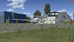
Airfield Pattonville (ICAO-Code: EDTQ)
See http://pattonville.pa.funpic.de/ for more information.
The Airfield Pattonville is a small airfield north of Stuttgart in southern germany. It is used by several aviator-clubs and hosts the base for a rescue helicopter. The runway suits for planes up till 3.5 tons.
This airfield was built bevor 2nd world war between Kornwestheim and Remseck-Aldingen. After WW2 it was used by the US-army and named "Ludwigsburg Army Airfield" and hosted missile-Launchpads during the Korea-war.
Since 16th of Juli 2003 The Airfield Pattonville is name as �������¢����������������Sonderlandeplatz Pattonville�������¢���������������� and has ICAO-Code EDTQ.
Due to the rising amount of airtraffic at Airport EDDS Stuttgart, the rescue-helicopter 'Christoph 51' moved to Pattonville at 1st of October 2009.
| Filename: | EDTQ_Pattonville.zip |
| License: | Freeware |
| Added: | 18th May 2012, 23:00:49 |
| Downloads: | 2,338 |
| Author: | Joe Herwig |
| Size: | 12.96 MB |
| Category: Flight Simulator 2004 - Scenery | |
| VFR of Lario, Area C2A - Como lake, Italy |
|
Images related to this file:
File Description:
*** REPLACEMENT OF PREVIOUS ISSUE, due to a bug of an High Winter texture ***
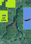
This is the fifth scenery of the "VFR of Lario" project, made with photorealistic terrain (multiseason & night) and with some 3D GMax realistic objects.
Information: Como's lake is in the north of Italy, closed to the Helvetic border; this scenery covers approximately an area of 7.5x6 kmt, from la "Zoca de l'Oli" and mountains over Ossuccio (NW) to Tremezzo (NE), and from Colonno (SW) to Magreglio (SE) and includes the NLC piers of Sala Comacina, Comacina island, Campo, Lenno, Tremezzo, Bellagio (2), S. Giovanni, Lezzeno; it includes several dedicated buildings as Taverna Bleu hotel (Sala Comacina), S. Maria e S.Giacomo churches and villa Balbiano (Ossuccio), church and pier of S. Michele (Colonno), villa del Balbianello (Lenno), hotel Villa Marie, S. Lorenzo Church, villa La Quiete, Grand Hotel, villa Carlotta, hotel La Darsena, Pub motor ship Bisbino (Tremezzo), villa Melzi, villa Giulia, buildings Carillon e lungolago Manzoni, hotels Excelsior, Du Lac, Metropole (Bellagio). Two NLC ferry (moted on the way Bellagio-Cadenabbia) are placed together with other minor boats and docks placed alongside the coast, including platforms for seaplanes arrival.
Contents: GMax objects as above and other buildings, minor piers and boats together with autogen buildings and trees are fully spreaded on the scenery.
| Filename: | VFR_of_Lario_Area_C2A__Como_lake_Italy.zip |
| License: | Freeware |
| Added: | 22nd May 2012, 18:12:41 |
| Downloads: | 1,671 |
| Author: | Aldo Della Vedova, Daniele Lanfranchi, Gian Mario Verga, Diego Caligiuri |
| Size: | 28.49 MB |
| Category: Flight Simulator 2004 - Scenery | |
| Nicholson Peninsula CWNP & Liverpool Bay CWLB DEW sites in Northwest Territories, Canada |
|
Images related to this file:
File Description:
These are DEW line sites in northern mainland Canada, to the east of Tuktoyaktuk.
Nicholson Peninsula is 100 miles east of Tuktoyaktuk and was not included in FS9. The peninsula is sometimes more like an island than a peninsula as it is barely connected to the mainland and at times is not connected at all (see the current Gogle Earth!). At the northern end there is another long and narrow gravel bar that is formed by the tide and currents and the gravel runway is on the top of this. It is now officially closed, but is still usable. The annual refuelling and maintenance to the NSW station up on the hills is carried out from a barge that lands tanker trucks onto the shore for the drive up the existing gravel roads that have been there since the early DEW station was established.
Liverpool Bay is 50 miles east of Tuktoyaktuk, up on higher land at around 300 feet ASL. The NWS (there was no previous DEW station at this site) is serviced by helicopter from Tuktoyaktuk or from a barge a mile away on the beach. There is a gravel landing pad on the north side of the station. To answer your question, the three little houses on stilts are actually fuel tanks for the generators, shaped to shed snow.
| Filename: | Nicholson_Peninsula_CWNP__Liverpool_Bay_CWLB_DEW_s.zip |
| License: | Freeware, limited distribution |
| Added: | 17th July 2012, 18:55:24 |
| Downloads: | 236 |
| Author: | Roger Wensley |
| Size: | 1.84 MB |
| Category: Flight Simulator X - Scenery | |
| YEEB Eneabba, Western Australia strip and townsite |
|
File Description:
YEEB Eneabba strip and townsite
Sand mining town in heart of wildflower area Located 278 km north from Perth via the Brand Highway, Eneabba is basically a sand mining town surrounded by some of the most extensive and spectacular wild flower displays anywhere in Western Australia. The town itself is, to be fair, a real non-event with dreary modern housing (with more than a hint of construction town design), a small shopping centre and a service station all of which look as though they have sprung up in the last 20-30 years. The wealth of the area is based on the rutile sands which lie to the south of the town as well as farming, particularly cattle grazing. With an estimated 80 per cent of the world's known rutile supplies the town can boast that it has the biggest deposits of rutile in both Australia and the world. The major mining company in the area is Iluka Resources Ltd. Eneabba is basically a service town for the mines but some of the miners, realising that Eneabba is hardly a paradise, have opted for commuting and live on the coast at Leeman and drive to work preferring the beach to the dry inland.
REQUIRES blencowe_librarykit_309494.zip (Available HERE)
| Filename: | YEEB_Eneabba_Western_Australia_strip_and_townsite.zip |
| License: | Freeware |
| Added: | 25th February 2013, 23:48:24 |
| Downloads: | 255 |
| Author: | Alan Blencowe |
| Size: | 3.59 MB |
| Category: Flight Simulator X - Aircraft Repaints, Textures and Modifications | |
| Asiana Airlines B777-200ER (PW) (HL7500) **UPDATE ** |
|
Images related to this file:
File Description:

REPAINT UPDATED FOR - new Captain Sim v1.0 folders, improved wear pattern on wings, correction to engine paint issues, converted to Pratt & Whitney engines.
This is a repaint of a Boeing 777-200ER, registration code HL7500, operated by Asiana Airlines, operated by Asiana Airlines, one of South Korea's two major airlines, along with Korean Air. Asiana has its headquarters in Asiana Town in Osoe-dong, Gangseo-gu, Seoul. The airline has its domestic hub at Gimpo International Airport and its international hub at Incheon International Airport. Asiana is a member of the Star Alliance and offers 516 daily departures throughout Asia, Europe, North America, and Oceania, operating 14 domestic and 85 international passenger routes and 20 cargo routes. Asiana currently operates eleven Boeing 777-200ER aircraft.
This repaint has plenty of clear markings so if you enjoy exterior detail, then you will love this repaint. You can see (and read): Door opening instructions; Static port directions; Air vent warnings; Engine hazard area; No Step warnings; RAT caution; APU intake warning; Stabilizer compartment access; Ground power supply; Forward and aft access door instructions; Pitot, ADA probe, Ice detector and TAT probe markings; Visible rivets; Enhanced window frames; Authentic Asiana logo; Bold, colorful Asiana livery and authentic flags; Lovely Asiana flight attendant; No frame rate hit.
To use this repaint, the Captain Sim B777-200 v1.0 is required. Repainted by Garrett Rowley, [email protected]
| Filename: | Asiana_Airlines_B777200ER_PW___HL7500__UPDATE_.zip |
| License: | Freeware |
| Added: | 27th February 2013, 14:36:54 |
| Downloads: | 4,172 |
| Author: | Garrett Rowley, Captain Sim |
| Size: | 30.12 MB |
| Category: Flight Simulator X - Scenery | |
| 63 AI Ships and AI Ship Traffic for South America and Europe V1 |
|
Images related to this file:
File Description:

Plenty of good designers have created beautiful navy ships and aircraft carriers for FSX, but only few have created container ships, tankers, off-shore supply ships, tugs, or bulk carriers and put them to sail around the globe in FSX. With this package I intend to fill a part of this gap and to bring more life to the mostly empty oceans in FSX by providing AI ships and AI traffic files with a fleet of modern merchant ships travelling through some of the most heavily trafficked sea routes in the world. The pack contains 63 AI ships based on more than 35 different GMAX models. Around one third are equipped with landable helicopter decks. Most ships have simple animations like rotating radars and most have custom light, smoke and wake effects. The pack also contains traffic files for the east coast of South America and the coasts of North West Europe: In South America ships visit Belem, Sao Louis, Natal, Recife, Salvador, Macae, Rio de Janeiro, Santos, Florianopolis, Pelotas, Porto Alegre, Montevideo, Buenos Aires and Puerto Madryn. In Europe ships visit Gibraltar, Algeciras, Lissabon, Bordeaux, La Rochelle, Saint Nazaire, Brest, Le Havre, Antwerp, Rotterdam, Amsterdam, Thamesport, Felixstowe, Bremerhaven, Hamburg, Esbjerg, Oslo, Aarhus, Copenhagen and St.Petersburg. For map of coverage, routes and ship details see the PDF manual.
| Filename: | 63_AI_Ships_and_AI_Ship_Traffic_for_South_America_.zip |
| License: | Freeware |
| Added: | 3rd March 2013, 16:37:41 |
| Downloads: | 23,947 |
| Author: | Henrik Nielsen |
| Size: | 17.24 MB |
| Category: Flight Simulator X - AFCAD Files | |
| KOPF - Opa Locka - Miami, Florida 2013 |
|
File Description:
Opa-locka Airport (IATA: OPF, ICAO: KOPF, FAA LID: OPF), also known as Opa-locka Executive Airport, is a general aviation airport and joint civil-military airfield 10 miles (16 km) north of Downtown Miami, primarily in metropolitan
Miami, Florida, United States, with a portion within the city proper of Opa-locka.
The airport's control tower is manned from 7:00 AM to 9:00 PM. The airport has four fixed base operators. It is owned by Miami-Dade County and operated by the Miami-Dade Aviation Department.
The tenant military activity is Coast Guard Air Station Miami, operating HU-25 Guardian jet aircraft, the HC-144 Ocean Sentry[4] turboprop aircraft and HH-65 Dolphin helicopters for coastal patrol and air-sea rescue operations.
Much of CGAS Miami's facilities were originally built during World War II as part of the former Naval Air Station Miami.
DayJet previously provided an on-demand jet air taxi service from this airport to 44 airports in 5 states. The company filed for Chapter 7 bankruptcy liquidation in 2008.
The airport is currently served by several cargo and charter airlines who use the U.S. customs facility. Maintenance and modification of airliners up to Boeing 747 size are carried out by several aviation firms
This file has the right coordenates, apron and characteristics of the airport, airport vehicles and buildings, Airport charts included.
| Filename: | KOPF__Opa_Locka__Miami_Florida_2013.zip |
| License: | Freeware |
| Added: | 6th January 2013, 11:39:28 |
| Downloads: | 770 |
| Author: | anwar gonzalez |
| Size: | 3.96 MB |
| Category: Flight Simulator 2004 - Scenery | |
| Union Island TVSU in the Grenadines, eastern Caribbean Version 1.1 |
|
Images related to this file:
File Description:
This is a self-contained version 1.1 that modifies the terrain flattens around the airport. I found that suddenly, and for no apparent reason, the Lesser Antilles mesh and my flattens were at war and creating hills within the airport boundary. If you are not having problems then you do not need this.
Union Island is in the southern tail of the chain of islands known as St Vincent and the Grenadines, between Canouan and Carriacou. Union is another small island, 3.5 miles long and at its widest 1.5 miles wide; the resident population is around 3,000, mostly in the two towns Clifton and Ashton. The airport is at the eastern end of the island, and has been extended into the sea on landfill. The runway is now around 2,480 feet long, aligned 08 (and with the southeast trade winds it is unlikely that you will find yourself using 26) and with a displaced threshold of 530 feet due to the hill to the west. The terminal is adjacent to a rather small apron; there is parking on the grass north of the taxiway. There are connecting flights by SVG to Barbados and the other islands and these are reflected in the AI. The airport has no lighting, and flights are obliged to land and depart in daylight hours only, outside of which the airport is closed.
| Filename: | Union_Island_TVSU_in_the_Grenadines_eastern_Caribb.zip |
| License: | Freeware, limited distribution |
| Added: | 16th June 2013, 18:46:33 |
| Downloads: | 526 |
| Author: | Roger Wensley |
| Size: | 2.02 MB |
| Category: Flight Simulator 2004 - Aircraft Repaints, Textures and Modifications | |
| US Airways Boeing 767-2B7ER (N256AY) |
|
Images related to this file:
File Description:

US Airways is a major U.S. airline owned by the US Airways Group, headquartered in Tempe, Arizona. It operates an extensive international and domestic network, with 198 destinations throughout North America, South America, Europe, and the Middle East. The airline is a member of the Star Alliance Network and utilizes a fleet of 346 mainline jet aircraft and 285 regional jet and turbo-prop aircraft. The carrier operates the US Airways Shuttle, a US Airways brand which provides hourly service between Boston, New York and Washington, D.C. Regional airline service is branded as US Airways Express, operated by contract and subsidiary airline companies. American Airlines and US Airways announced plans to merge, creating the largest airline in the world.
US Airways Boeing 767-2B7ER (N256AY). This livery painted on SkySpirit2010 BOEING 767-200 V5 aircraft. The textures are saved in 32bit format for quality graphics.
Its features are Opening doors & Cargo doors, detailed textures, accurate paint, dynamic shine & effects, dynamic flexing wings that respond to turbulence, fully independent
suspension, trim animation, gear steering, accurate flight dynamics, spoiler animation, crash effects, reflective cockpit windows, transparent navigation light lenses and many more.
Visit our Facebook page "Sky Level Textures" for news, updates and previews on my future repaint projects. Thanks for downloading & Happy flying.
| Filename: | US_Airways_Boeing_7672B7ER_N256AY.zip |
| License: | Freeware |
| Added: | 3rd December 2013, 14:59:25 |
| Downloads: | 1,281 |
| Author: | Giacomo Tomasini | Sky Level Textures |
| Size: | 30.95 MB |


© 2001-2026 AVSIM Online
All Rights Reserved
Privacy Policy |