
Where Flight Simulation Enthusiasts Gather from Around the World!
AVSIM Library - Search Results

| Category: Flight Simulator X - Scenery | |
| KBRT - RI Bong AFB |

|
Images related to this file:
File Description:
Richard I. Bong AFB, Brighton, Wis. Originally designed out in the 1950's as a NORAD Base with the 56th FIG assigned to cover the Milwaukee/Chicago region the Great Lakes. Later it was transferred to SAC as a B-47/KC-97 installations and the 4040th Air Base Squadron taking command of the base. Initial drainage and the runway were laid out and the runway was within 3 days of being poured when the project was cancelled and the base closed. The base later became the Richard Bong State Recreation Area west of Kenosha, Wis. on US-142. The layout of the runway can be seen by satellite. This is the first of two versions of this base, this has the B-47/KC-97 layout, the second (KBRT RI Bong-B-52) will be B-52/KC-135. Both are set-up for the NORAD unit (56th FIG) using F-101 Voodoo aircraft. Check readme for requirements.
| Filename: | KBRT__RI_Bong_AFB.zip |
| License: | Freeware |
| Added: | 24th October 2013, 20:06:04 |
| Downloads: | 625 |
| Author: | Larry Steinborn |
| Size: | 916.95 KB |
| Category: Flight Simulator 2004 - Scenery | |
| Cancun MMUN / CUN version 2.0 |
|
Images related to this file:
File Description:

This is an update to the default Cancun Int'l airport and Henry Carcamo's excellent freeware version of CUN, "cancun_2005.zip" available at AVsim.net. This download does not contain the entire airport. It only adds the brand new Terminal 3 and ramp area. Jetways and ramp vehicles are included, and it fits rith into the default or freeware version of the airport seamlessly. The AFCAD file included was built with AFX from a modified version of the AFCAD that came with Henry Carcamo's scenery, but it will work pretty well with the default version. I would like to give special thanks to Chris Donawho who requested this scenery and supplied me with the sat photos, T3 website, and even some Youtube.com videos which show the new terminal. This scenery will be updated once the new northern runway info is made public. All gate numbers are correct per actual airport diagrams. This scenery was built using FlightOne's Instant Scenery program.
| Filename: | Cancun_MMUN__CUN_version_20.zip |
| License: | Freeware |
| Added: | 15th December 2010, 02:46:06 |
| Downloads: | 5,280 |
| Author: | William Morgan /www.FRFStudio.net |
| Size: | 10.78 MB |
| Category: Flight Simulator X - Panels | |
| NEW Realistic HUD for the FSX F/A-18 Hornet |
|
Images related to this file:
File Description:

A realistic head-up display (HUD) for the FSX Acceleration F/A-18 Hornet. The HUD is an enhanced version of the original HUD for the F/A-18 by Scott Printz. The original functionality Scott built into it is preserved, and the following new features are added: 1) Precise ILS and TACAN navigation for aircraft carriers (including moving carriers) that allow carrier landings in low visibility and at night. 2) The HUD symbology is conformal to the outside world: The horizon bar stays on the horizon, velocity vector shows actual flight path as read against the outside world (if you keep your vector pointed at a certain spot on the runway, this is exactly where you will land). 3) Caged mode with ghost vector for use in heavy side wind conditions. 4) Elements repositioned to make the HUD look as close as possible to the real Hornet HUD. By Jivko Rusev.
| Filename: | NEW_Realistic_HUD_for_the_FSX_FA18_Hornet.zip |
| License: | Freeware, limited distribution |
| Added: | 29th November 2009, 22:08:20 |
| Downloads: | 1,675 |
| Author: | Jivko Rusev |
| Size: | 208.5 KB |
| Category: Flight Simulator X - Scenery | |
| Kloten/Zurich Airport - LSZH - Zurich,Switzerland |
|
Images related to this file:
File Description:
This is an accurate and up-to-date version of Zurich Airport with two optional files and made only for FSX, do not use in P3D: There is one version with the Crosswind runways activated and in full operation where all 3 runways will be used for takeoff/landing and one version as the default airport runway operation: A few changes have been made to improve the terminals appearance, assigned parking now updated as per their website including a gate (E67) and a parking spot at the maintenance apron for the A380, ILS added to runway 28 with all approaches and frequencies updated to the latest charts, new control tower, taxiways and taxi signs also updated to the latest charts, support vehicle roads rebuilt and many other scenery improvements and objects added, airport views are from the roof of the new control tower (when in tower view) please view the readme before installation.
| Filename: | KlotenZurich_Airport__LSZH__ZurichSwitzerland.zip |
| License: | Freeware, limited distribution |
| Added: | 15th May 2018, 15:53:03 |
| Downloads: | 44,602 |
| Author: | Ray Smith |
| Size: | 3.65 MB |
| Category: X-Plane - Scenery | |
| Susi Air Sceney Package Indonesia East Timor v1.0.0 |
|
Images related to this file:
File Description:

This is an X-Plane 11 scenery package in Indonesia and East Timor, 30 airfields in total, all of them are destinations for "PT ASI Pujiastuti Aviation", operating as Susi Air, an Indonesia airlines established in late 2004 by Mrs. Susi Pudjiastuti. Ideal for bush flight lovers, who like to have new challenges outside of the box. Susi Air is pictured in the 2014 TV mini-series "Worst Place to be a Pilot", that follows the highs and lows in the lives of the young British pilots who work for Susi Air, as they fly and land their planes in some of the most breath-taking, remote and dangerous locations on earth. For more info, search for "Worst Place to be a Pilot" in YouTube. This scenery package was tested and is operational (as of January 21, 2017) in "X-Plane 11 Public Beta #8 64 bit", Windows 10 Home. It is meant, primarilly, for XP11 use. However, it was also tested and is partially operational (as of January 21, 2017) in "X-Plane 10.51 64 bit", Windows 10 Home. Most of them will work 100% well in XP10, but a few of them will present mesh issues, once XP11 mesh is improved before the old XP10 mesh files.
List of airfields:
- WA0B Susi Air Idedua Airstrip
- WABI Susi Air Nabire
- WABP Susie Air Timika
- WABX Susi Air Bilai Airstrip
- WAJD Susi Air Wakde Airstrip
- WAJJ Susi Air Jayapura
- WAJW Susi Air Wamena Airport
- WICN Susi Air Headquarters
- WIHH Susi Air Jakarta
- WIPB Susi Int'l Pangandaran Beach Airstrip
- WPDL Dili International Airport
- WT17 Susi Air Siriwo Airstrip
- WT66 Susie Air Wewak Airstrip
- WT75 Susi Air Yogosem Airstrip
- WW01 Susi Air Makki Airstrip
- WW32 Susi Air Nevere
- WW56 Susi Air Pass Valley Airstrip
- WW68 Susi Air Pogapa Airstrip
- WX15 Susi Air Apowo Airstrip
- WX37 Susi Air Beoga Airstrip
- WXAR Susi Air Armopa Road Airstrip
- WXPJ Susi Air Puncak Jaya Mining Airstrip
- WXPN Susi Air Pulau Nurseen Airstrip
- WXRA Mount Rinjani Airstrip Lombok Island Indonesia
- WXTA Mount Tambora Airstrip Sumbawa Island
- WXTC Susi Air Teluk Cendrawasih Beach Airstrip
- WXZ5 Susi Air Kapeso Airstrip
- WXZ8 Susie Air Tsinga Mulu
- WZ31 Susi Air Kasonaweja Airstrip
- WZ38 Susi Air Kegata Airstrip
| Filename: | Susi_Air_Sceney_Package_Indonesia_East_Timor_v100.zip |
| License: | Freeware |
| Added: | 21st January 2017, 19:12:17 |
| Downloads: | 196 |
| Author: | Rui Mesquita |
| Size: | 6.98 MB |
| Category: Flight Simulator X - Scenery | |
| Carnes Farm |
|
Images related to this file:
File Description:
These are the files that I talked about in the Prepar3d forums. I created these objects for Fs9, then upgraded them to the scenery SDK for FSX. They were created 10 years ago in GMAX, and I have used them successfully ever since in Prepared 1.4 as well.
For some reason the individual farmhouse and other objects that I created are not showing up in Prepar3d version 2.0.
That's where you guys come in! These files are free to use in anyway you want as long as proper attribution is given, but, I would like you guys who have both Prepar3d 1.4 and 2.0 to try them out in both and report back to me as to whether you have the same problems that I do. That's your only fee. And I'd like you guys to give it a shot in both, or all four( I am not sure that they will work in FS9 anymore, but try it out. Unfortunately I can't recompile my FSX SDK Files back to FS9 if it doesn't work).
What's included:
1. Photo real scenery of Barbourville, 10 miles to the north west of stinking Creek where we live, and;
2. Photo real scenery of the farm area and stinking Creek, upon which I have placed my GMAX objects;
A. The farm house.Carnes Farm From the Bridge at 500 AGL.jpg
B. The barn, shed and the RV in back of the farmhouse.
C. A two-story long structure the top of which is an apartment but the bottom of which is a re-creation of Mama Carne's store, along with all the real wood floors shelves and original contents.. It is also o n Google earth in 3-D as it is here with further description .
... A little note on Gmax.. Mama Carne's store was one the first structures that I built in Gmax. It was just a box. Later, I added the true architectural features that you see including the steps and rails which took about as long to create as it would have to Saw and fit and hammer the real rails, risers and steps.
D. K-6, my little 2300 foot strip for runways 03 and 21. It has VOR - (117.55), ILS(110.1), and NDB(222).
E. Gerald Bingham's house, 1/4 mile up Warriors Path North from us.( mostly dirt road with gravel topping).
F. Dewitt Baptist Church.
Off property Knox county
G.Escoe's Store and Post Office complete with great prices for gas at the included pumps.
Escoes.jpg
H. Rex allen's killer corner...sheds and farm equipment on the sharpest bend on Stinking Creek...my son went off it with a flat tire, unscathed, but more than several have lost their lives on that curve... there may be several iterations of the sheds...just delete or rename the wrong ones...I was experimenting with ModelConverterX, Arno Gerretsen's wonderful model and object scenery tool.
I. sitting on top of the Barbourville Photo real scenery Barbourville PhotoReal over the shopping center.jpg is the Barbourville P3D Shopping Center2.jpg shopping center all the stores and all the storefronts ... it's on 25 E. as you head into Barbourville.
Recreated, is the entire shopping center with the now outmoded Wal-Mart sign. Probably my magnum opus.
note on the Gmax scenes.
All of the scenery was either directly measured and if not practical for a such a long measuring device, walked off, as in the Stinking Creek Bridge and shopping center. All of the objects were then photographed, in 360° where possible and saved as texture for inclusion in the Gmax model.
Enjoy!
...oh... how do you get there? Wellllll.... situate yourself at Middlesboro (1a6), and tune your Nav radio to K-69's VOR, 117.55, take off and climb to 3500 feet...grinnnnn
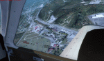
Welcome to Knox County Kentucky!
| Filename: | Carnes_Farm.zip |
| License: | Freeware |
| Added: | 2nd December 2013, 05:34:20 |
| Downloads: | 453 |
| Author: | Chas Honce |
| Size: | 91.13 MB |
| Category: Flight Simulator X - Scenery | |
| GB-0112 - RAF Bassingbourn - Cambridgeshire, England |
|
File Description:
RAF Bassingbourn is a former Royal Air Force station located in Cambridgeshire approximately 3 mi (5 km) north of Royston, Hertfordshire and 11 mi (18 km) south west of Cambridge, Cambridgeshire, England.
RAF Bassingbourn was constructed by John Laing & Son between 1937 and 1939 in the parishes of Wendy and Bassingbourn immediately to the west of the A14 (now the A1198) road. The site selected was low ground between several tributaries of the River Cam. The area had been long cleared of forest and tended to be swampy and unstable, and because the boggy ground produced a persistent mist over the large meadow the site was considered ideal for airfield camouflage.
During the Second World War it served first as an RAF station and then as a bomber airfield of the Eighth Air Force, of the United States Army Air Forces (USAAF). It remains the home of the Tower Museum Bassingbourn. From 19 August 1942 to 25 June 1945, Bassingbourn served as headquarters for the 1st Combat Bombardment Wing of the 1st Bomb Division. It was assigned USAAF designation Station 121.
The RAF resumed occupation of Bassingbourn on 26 June 1945, the airfield was officially returned on 10 July 1945. The station became one of the main airfields for long-range transport aircraft. In 1948 and 1949 Avro York, Avro Lancaster and Douglas Dakota aircraft from the base took part in the Berlin Airlift, a massive operation transporting essential commodities to the beleaguered city.
In February 1952, RAF Bassingbourn received its first allocation of English Electric Canberra bombers and became the first jet bomber operational conversion unit (OCU) in the world. Canberras operated from Bassingbourn for 17 years and one of the aircraft is on static display in the Barracks. From 1963 to 1969 the Joint School of Photographic Interpretation was also located there.
On 29 August 1969, the last RAF Commanding Officer, Sqn Ldr A.M. McGregor MBE, turned over the station to the British Army as Bassingbourn Barracks.
The barracks were established, on the site of the former RAF Bassingbourn airfield, in January 1970, as the new Depot for the Queen's Division. The depot was responsible for training recruits undergoing their 19-week basic training before joining a regular battalion; in 1993 the Barracks were re-designated the home of the "Army Training Regiment, Bassingbourn" and remained as such for nearly 20 years. Bassingbourn Barracks closed as an army training location in August 2012.
The site was reopened for training Libyan soldiers in 2014 but closed down the same year.
Since approximately 1970 the site has retained its RAF links by being the home of 2484 (Bassingbourn) Squadron Air Training Corps.
| Filename: | GB0112__RAF_Bassingbourn__Cambridgeshire_England.zip |
| License: | Freeware |
| Added: | 30th May 2016, 11:01:25 |
| Downloads: | 321 |
| Author: | Terry Boissel |
| Size: | 1.58 MB |
| Category: Flight Simulator 2004 - AFCAD Files | |
| Southwestern British Columbia Airport Corrections |
|
File Description:
As shorelines, water bodies, roads, railways and other features become more accurate in addon scenery, inaccuracies in airport placement become apparent. Although Microsoft did an excellent job of using published data to place airports, the published information is not always accurate. Some airports in the area of interest were misplaced by as much as 850m, thus conflicting with water and/or roadways. This release corrects Canadian airports in South-western British Columbia, in LOD5 cell 15x14 (915140). This area covers a portion of Vancouver Island from Duncan to Victoria, and the BC Mainland as far east as Douglas Lake and north of Pemberton. In this region CAK3, CAL3, CBT6, CYHE, CYLY, and CYPS are corrected, and Bruce Ellison has kindly modified his CAM3 for inclusion; see separate readme document for details. All these airports have been activated for AI use. A few buildings that may conflict from roads have been removed from CYNJ. The unrealistically large flatten and airport polygon at CYYJ is reduced in size. Airport features that end up in the water have been removed from CYVR and the overly large flatten there reduced. Some Rwy12 goodies have been tossed in as well, but if these are not important to the user, it is not necessary to have Rwy12 installed. Ultimate Terrain or similar accurate hydrology and roads recommended. FSGenesis 38m mesh or other high quality terrain mesh recommended.
| Filename: | Southwestern_British_Columbia_Airport_Corrections.zip |
| License: | Check within download |
| Added: | 30th May 2005, 07:31:45 |
| Downloads: | 3,002 |
| Author: | Jon Patch, Bruce Ellison |
| Size: | 1.53 MB |
| Category: Flight Simulator 2004 - Scenery | |
| Tongass Remote Airfield (RATR) - for "Tongass Fjords" (FS9) |
|
Images related to this file:
File Description:
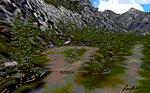
"Tongass Remote Airfield" (RATR) Alaskan scenery (Fictitious)
Tongass Remote Airfield is for Flight Simulator 2004 and for the "Tongass Fjords" (FS9) addon by Holger Sandmann & Bill Womack . You must have "Tongass Fjords" (FS9) for this to work.
Field history and description:
In the early days this area was well known to prospectors and hunters. A small mine was established and later abandoned. Around the late 40���¢��������s a crew was contracted to clear a small landing area to gain easier access for hunters and campers. Due to the extreme remoteness of this area that clearing took several years. The last phase was the approach, clearing by hand a descending glide slope through just the tops of the tall trees. There is now just enough room for a very experienced pilot to get in and out of this field. The airfield is 26 miles north of Petersburg Alaska (PAPG). This is a tricky narrow approach with a left hand dogleg and then an immediate right hand dogleg turn just before the final approach. Not much time to set up your approach, also, it's a very short runway. For experienced pilots only, and make sure that your life insurance is up to date. See enclosed Maps and info. Good luck.
| Filename: | Tongass_Remote_Airfield_RATR__for_Tongass_Fjords_F.zip |
| License: | Freeware, limited distribution |
| Added: | 11th February 2010, 00:49:22 |
| Downloads: | 623 |
| Author: | Jay Langham |
| Size: | 3.51 MB |
| Category: Flight Simulator 2004 - Scenery | |
| HLLQ El Beida/Labraq |
|
Images related to this file:
File Description:
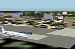
Googly scenery for HLLQ El Beida/Labraq - a joint civilian and military airport
near the north coast of Libya that is poorly provided for in Flight Simulator
2004. These scenery files add taxiways, aprons, buildings and other airport
features, so that you and your "AI" traffic can land, taxi, park and take off
in a realistic manner.
The city of Al Beida, or Al Bayda' or El Beda or Al Baidhah (depending on who
you are) has achieved its own airport status by using the end of a dead runway
at Labraq Air Base. In turn the airbase has contracted to use the opposite end
of the runway as its base of activity. The city is served by jets of Libyan
Airways and turboprop craft of Air One Nine and Ghadames Air Transport.
The scenery does not purport to be ultra-accurate. Based on high-detail satellite
imagery from Google Earth, the layout is proportionally correct but the added
airport features, such as buildings, are built from default Microsoft objects
and add-on libraries so will not look like the real thing.
You are not obliged to download and install any additional scenery libraries,
but to enjoy this scenery in its entirety, you may wish to. It will work fine,
with or without. [File re-uploaded at request of AVSIM]
| Filename: | HLLQ_El_BeidaLabraq.zip |
| License: | Freeware |
| Added: | 28th May 2010, 20:42:26 |
| Downloads: | 1,286 |
| Author: | John Hinson |
| Size: | 73.79 KB |


© 2001-2026 AVSIM Online
All Rights Reserved
Privacy Policy |