
Where Flight Simulation Enthusiasts Gather from Around the World!
AVSIM Library - Search Results

| Category: Flight Simulator 2004 - AI Aircraft | |
| Oberpfaffenhofen v2.2 - traffic package |

|
Images related to this file:
File Description:
This AI-Package has been prepared for the Oberpaffenhofen Airport (EDMO) located in
South-Germany 20 NM west of Munich and contains the following beautiful aircraft:
Dornier Do-27, Do-28, Do-228, Fairchild/Dornier, FD-328 Turboprop and Jet version,
FD-728 (did not go onto production line) and the amphibian Dornier Seastar,
Boeing-707 (AWACS/E3A), Breguet-Atlantic, Dassault/Dornier Alpha-Jet,
Lockheed-P3 Orion, British-Aerospace Canberra B.20, Hawker Sea-Fury, North-American
F-86A, and Bell UH-1D. The corresponding scenery "oberpfaffenhofen-v2.2_fs2004.zip"
is available here at the library.
Most of the planes perform testflights after a long term maintenance in the local
traffic pattern and some of the bigger ones leave IFR (in accordance with
"Instrument Flight Rules") to other airfields per attached flightplan. All the attached outstanding airplanes have been created by well known designers(see briefing). My part was just to put them together and to generate an almost reasonable AI-Flightplan. Gentlemen, let's take a rest, watching the airplanes and listening to ATC.
Re-upload.
| Filename: | Oberpfaffenhofen_v22__traffic_package.zip |
| License: | Freeware |
| Added: | 8th April 2011, 11:49:12 |
| Downloads: | 2,048 |
| Author: | Klaus Jone |
| Size: | 23.59 MB |
| Category: Flight Simulator X - Scenery | |
| LEMG-Xv4 |
|
Images related to this file:
File Description:
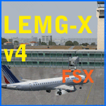
Shortly after the release of LEMG-Xv3 I've noticed it contained too many errors..A complete redo of the RWY 13+31 entrances. It's a little more complicated then FSX made it look like. Yet after finishing v4 I discovered a picture of the building of a second runway. I've tried to include this in my scenery. As in the pictures,it's under construction. This is the 2011situation. Includes D gates [T3 terminal] Jetways at the "D" gates now working. Removed buildings in the area, near the north side of the airport to make room for the new Runway. Adjusted Apron A1 for small aircraft. Added several parking spaces [A2 an A1 platform] Added some static planes on request. After some trial and error actions I was finally able to make some transitions plus missed approaches. You'll now have a proper RWY 13 - MAR transition [ILS13 in the GPS] A GDA Transition to [BLN2B / VIBAS1K] plus VJF1B STAR] Freeware scenery for FSX, just for fun.Made with ADE 1.47.07 Happy Landings!
| Filename: | LEMGXv4.zip |
| License: | Freeware, limited distribution |
| Added: | 30th April 2011, 00:16:20 |
| Downloads: | 2,325 |
| Author: | Joost Visser |
| Size: | 13.35 MB |
| Category: Flight Simulator 2004 - Aircraft Repaints, Textures and Modifications | |
| Luxair Boeing 737-700 |
|
Images related to this file:
File Description:

El Boeing 737-700 de Luxair (Luxair Societe Luxembourgeoise de Navigation Aerienne S.A.) (IATA: LG, OACI: LGL), es la aerolinea nacional de Luxemburgo. Es la sucesora de Luxembourg Airlines Company, el cual habia sido fundada en 1948, Luxair fue creada en 1961 para cumplir con los requerimientos de una creciente demanda para conexiones aereas entre Luxemburgo y otras capitales europeas. Su base de operaciones se encuentra en el Aeropuerto de Luxemburgo, El modelo fue hecho por el grupo Project Open Sky, incluye el modelo y las texturas, visiten mi blog en http://aerosimulaciones.blogspot.com/
The Luxair Boeing 737-700, Luxair S.A., Societe Luxembourgeoise de Navigation Aerienne, operating as Luxair, is the flag carrier airline of the Grand Duchy of Luxembourg. It operates scheduled services to 50 destinations in Europe, North Africa, the Mediterranean and Middle East, plus charter and seasonal summer services. Its head office is located on the grounds of Luxembourg - Findel Airport in Sandweiler. Its main base is Luxembourg - Findel Airport, The model was made by Project Open Sky, model and textures are included, visit my blog in http://aerosimulaciones.blogspot.com/
| Filename: | Luxair_Boeing_737700.zip |
| License: | Freeware |
| Added: | 14th September 2011, 00:47:58 |
| Downloads: | 525 |
| Author: | Juan Rodriguez / AeroSimulaciones |
| Size: | 7.25 MB |
| Category: Flight Simulator 2004 - Scenery | |
| 5B2 - Saratoga County Airport |
|
Images related to this file:
File Description:
5B2 - Saratoga County Airport v1.0

Located in the foothills of the Adirondack Mountains in upstate NY USA. This facility is owned by Saratoga County, formerly housed Rich Air and currently houses North American Aviation. 5B2 is a non-controlled airfield catering to small engine a/c up to a few private jet daily traffic serving 'The Northcountry' and Saratoga Springs, New York.
All Objects fully designed and completely redone in GMAX using high resolution 32bit photo-real textures. Optional DXT3 textures included. Also includes new AFCAD file, more accurate airport grounds perimeter, satellite photo-real grounds, custom taxiways, taxi-signs and taxi lights, area roads, animated hangar doors, and near area landclass. Some GA AI traffic tracks included with this release, afcad also designed to support general AI. Rwy12 objects (Lars Extra Object Library) required for a few static parking lot cars. All textures mipmapped for performance. By EdGeneer Cox.
| Filename: | 5B2__Saratoga_County_Airport.zip |
| License: | Freeware, limited distribution |
| Added: | 24th February 2012, 19:24:19 |
| Downloads: | 1,537 |
| Author: | EdGeneer Cox |
| Size: | 103.26 MB |
| Category: Flight Simulator 2004 - Aircraft Repaints, Textures and Modifications | |
| China Northern Airlines, Mcdonnell Douglas MD-82 |
|
Images related to this file:
File Description:
Maddog 2008 in China Northern Airlines B-2126 Repaint. You have to install payware LSH maddog 2008 first. The company was one of the six major airlines in mainland China which operated Airbus A300, MD-80/90 and Airbus A321, serving domestic routes as well as to Hong Kong, Japan, South Korea and North Korea. On May 7, 2002, exactly 10 years ago, China Northern Airlines Flight 6136(Reg.B-2138) was flying from Beijing to Dalian when the pilot reported fire on board. Downside residents thousands of people and a large Petroleum Refinery. The captain noticed the situation and minutes later the plane crashed into the bay, avoiding injuries on the ground. Later, they found a passenger purchased 7 air insurance policies of this flight and investigation on the wreckage showed a quantity of gasoline near his seat. The conclusion is a passenger committed suicide and delibrately set the plane on fire. After the crash, China Northern Airlines merged with China Southern Airlines and became one of the largest airlines serving mainland China.
| Filename: | China_Northern_Airlines_Mcdonnell_Douglas_MD82.zip |
| License: | Freeware, limited distribution |
| Added: | 8th May 2012, 15:35:59 |
| Downloads: | 353 |
| Author: | Alex Chao, LSH |
| Size: | 16.26 MB |
| Category: Flight Simulator 2004 - Scenery | |
| VFR of Lario, Area B1 - Como lake, Italy |
|
Images related to this file:
File Description:

This is the second scenery of the "VFR of Lario" project that follows the previous LagoComo_A1, made with photorealistic terrain (multiseason & night) and with some 3D GMax realistic objects. With this scenery there are also enclosed the great realistic meshes that cover all the Como lake area.
Information: Como's lake (called Lario), is placed in the north of Italy, closed to the Helvetic border. This second scenery covers approximately an area of 7.5x6 kmt, from Bosco di Falmoira/Rondago (NW) to Nesso (NE), and from Balerna/Chiasso (SW) to monte Bolletto (SE), and includes some details of the towns around the lake as Cernobbio (pier, Villa Erba and Convention Center, Villa d'Este, Akzo Nobel buildings), Moltrasio (pier), Carate Urio (pier), Laglio (villa Oleandra), Brienno (buildings and pier), Nesso (pier), Careno (pier), Faggeto Lario (pier), Torno (building and Pier), Blevio (pier).
Contents: several piers and small docks, motor ships and boats, an animated hydrofoil; some other buildings (GenericBuilding system) and trees widespread all over the scenery. Review of Brunate's funicolar and Castel Baradello, due to updated meshes.
| Filename: | VFR_of_Lario_Area_B1__Como_lake_Italy.zip |
| License: | Freeware |
| Added: | 26th January 2012, 15:23:57 |
| Downloads: | 1,948 |
| Author: | Della Vedova Aldo, Daniele Lanfranchi, Diego Caligiuri, Gian Mario Verga |
| Size: | 36.15 MB |
| Category: Flight Simulator X - AFCAD Files | |
| EIDW - Dublin Intl - Dublin, Ireland v1.1 |
|
Images related to this file:
File Description:
With enhanced jetway appearance depending on your scenery complexity settings!
EIDW - Dublin Intl - Dublin, Ireland Dublin Airport is the headquarters of Ireland's flag carrier (Aer Lingus), Europe's largest low-cost carrier (Ryanair) and Ireland's regional airline (Aer Arann). Ireland's fourth airline, CityJet, operates flights from the airport. The current Terminal 1 building originally opened in 1972, and was initially designed to handle five million passengers per year. In October 2007, a new pier was opened to the north of terminal 1. This pier caters for the majority of Ryanair flights. In 2009, a new extension featuring new food and retail outlets was added to the side of Terminal 1. Terminal 2 is a 75,000 m2 (810,000 sq ft) terminal and pier (pier E) which provides 19 air bridges for aircraft and is capable of handling 15 million passengers annually, thereby allowing the airport to handle 35 million passengers a year. Using ADEx 1.50, aeronautical maps and Google Earth (2009) all these changes have been built into the default FSX airport.
| Filename: | EIDW__Dublin_Intl__Dublin_Ireland_v11.zip |
| License: | Freeware |
| Added: | 18th October 2012, 15:17:06 |
| Downloads: | 3,267 |
| Author: | Menno C. Robert |
| Size: | 5 MB |
| Category: Flight Simulator 2004 - Scenery | |
| Clinton Point CWCP, Horton River CWHR & Keats Point CWKP; DEW sites in Northwest Territories, Canada |
|
Images related to this file:
File Description:
These are three DEW line sites in northern mainland Canada, to the east of Tuktoyaktuk.
Clinton Point is almost 300 miles east of Tuktoyaktuk and on the Northwest Territories and Nunavut border. It is the site of a closed DEW station (closed in 1993) and all the buildings have been removed, unlike many other sites where buildings are still almost complete. The roads and the gravel runway down by the beach are still there.
Horton River is 150 miles east of Tuktoyaktuk, up on higher land above the cliffs at around 500 feet ASL. The NWS (North Warning System) replaced the I site which was there previously and which ceased operations in 1963. The NWS is serviced by helicopter from a barge 400 yards away on the beach.
Keats Point is 270 miles east of Tuktoyaktuk, 7 miles from the coast but significantly close to a lake, which was probably used for float plane delivery in the summer (or ski plane delivery in the winter) of NWS station elements during construction.
| Filename: | Clinton_Point_CWCP_Horton_River_CWHR__Keats_Point_.zip |
| License: | Freeware, limited distribution |
| Added: | 17th July 2012, 18:57:08 |
| Downloads: | 282 |
| Author: | Roger Wensley |
| Size: | 2.07 MB |
| Category: Flight Simulator X - Scenery | |
| YBIU Ballidu, Western Australia |
|
File Description:
YBIU Ballidu is a town located in the Wheatbelt region of Western Australia, about 217 kilometres (135 mi) north of Perth. The townsite was gazetted in 1914, with street names of the original settlers. A primary school opened in the town on 4 September 1922, moving into permanent premises in 1924. Ballidu has a population of less than 100 people and consists of Ballidu Primary School, the local Art Gallery, a hall, a few shops for groceries and essentials and several farming supply stores. As Ballidu is a farming region, over the years (as the size of the surrounding farms has increased), the town has become smaller and smaller.
This airfield is run by Dunn Aviation and mainly home for their Air Tractor and Dromadaire fleet. (I have created a low poly version beacuse its my first aircraft model). It has a windsock and hangar but little else.
REQUIRES blencowe_librarykit_309494.zip (Available HERE)
| Filename: | YBIU_Ballidu_Western_Australia.zip |
| License: | Freeware |
| Added: | 25th February 2013, 08:24:07 |
| Downloads: | 468 |
| Author: | Alan Blencowe |
| Size: | 2.76 MB |
| Category: Flight Simulator X - Scenery | |
| YGNW Gnowangerup Shire airstrip and town, Western Australia |
|
File Description:
YGNW Gnowangerup Shire Airstrip. The Shire of Gnowangerup is a Local Government Area in the Great Southern region of Western Australia, about 120 kilometres north of Albany and about 370 kilometres southeast of the capital, Perth. The Shire covers an area of 4,268 square kilometres, and its seat of government is the town of Gnowangerup. Gnowangerup was initially gazetted as a Road Board in 1912, taking in eastern sections of Broomehill and Tambellup. On 1 July 1961, it became a Shire Council following changes to the Local Government Act. The area of gnowangerup is mainly wheat sheep on sandplain country. In the 1960's it was reported to have good rainfall but when the clearing started, the rainfall changed. Farmers who managed large properties were able to survive because of the economies of scale. At regular intervals, farmers in this area now have to cart water for their stock. REQUIRES Blencowe_LibraryKit.zip
REQUIRES blencowe_librarykit_309494.zip (Available HERE)
| Filename: | YGNW_Gnowangerup_Shire_airstrip_and_town_Western_A.zip |
| License: | Freeware |
| Added: | 28th February 2013, 02:44:27 |
| Downloads: | 261 |
| Author: | Alan Blencowe |
| Size: | 5.39 MB |


© 2001-2026 AVSIM Online
All Rights Reserved
Privacy Policy |