
Where Flight Simulation Enthusiasts Gather from Around the World!
AVSIM Library - Search Results

| Category: Flight Simulator 2004 - Scenery | |
| HSSS Khartoum, Sudan |

|
File Description:
Googly scenery for HSSS Khartoum, Sudan. For Sudan's main international airport,
the Flight Simulator depiction is somewhat simplified, depicting just a few
buildings which are badly located. These scenery files attempt to reproduce
the real atmosphere of the airport - from the huge clutter of small hangars
and workshops and large quantities of inactive planes through to the aircraft
dump at the north end of the airport.
The scenery does not purport to be ultra-accurate. Based on high-detail satellite
imagery from Google Earth, the layout is proportionally correct but the added
airport features, such as buildings, are built from default Microsoft objects
and third-party object libraries so will not look like the real thing.
You are not obliged to download and install any additional scenery libraries,
but to enjoy this scenery in its entirety, you may wish to. It will work fine,
with or without. These files complement the Sudan Airways AI Fleet Pack by Billy Rutherford &
John Hinson, updating the scenery files contained therein, but the two are not
inter-dependent.
| Filename: | HSSS_Khartoum_Sudan.zip |
| License: | Freeware |
| Added: | 9th March 2007, 17:29:13 |
| Downloads: | 4,417 |
| Author: | John Hinson |
| Size: | 38.74 KB |
| Category: Flight Simulator X - Scenery | |
| Gold Coast Airport (YBCG) |
|
File Description:
The Gold Coast Airport (formerly known as Coolangatta) is a busy international airport located some 100 ks south of Brisbane and 850 ks north of Sydney. This scenery contains and accurate depiction of the terminal, control tower, hangers and the very distinctive lighthouse at Coolangatta (with beacon) plus night lighting of the apron. In addition many buildings have been added to Coolangatta and Surfers some of which are original but many are stock buildings. The scenery has been reduced in complexity to attempt to be reasonably frame rate friendly. All models are GMAX or FSDS3.0. Extensive coastline changes has added beaches as far south as Byron Bay and the canal network behind Surfers Paradise, Bond Uni, Currumbin and Coolangatta. Recent upgrades of the airport to a 2500 metre runway have been reflected as well as a widened apron. Therefore it may look a little different from the current Google Earth image but it is accurate. The airport will now handle direct flights from Asia and typical planes landing might include Airbus 343 or similar wide bodied aircraft.
| Filename: | Gold_Coast_Airport_YBCG.zip |
| License: | Freeware |
| Added: | 12th July 2007, 15:08:44 |
| Downloads: | 6,176 |
| Author: | John Ross |
| Size: | 12.16 MB |
| Category: Flight Simulator 2004 - AI Aircraft | |
| Tupolev Tu-22 Belaja (NATO-code 'Blinder') |
|
File Description:
Tupolev Tu-22 Belaja (NATO-code 'Blinder') for AI Traffic. This is an excellent addition to your retro military AI world, a classic Cold War medium bomber. A very mean, sleek design, but not always kind to its crews, with over 70 of roughly 350 production aircraft lost in accidents. This aircraft saw extensive combat in the 70s and 80s, in North Africa, the Middle East, and Southwest Asia. The Blinder also found work as a high-speed recce and electronic warfare platform. This is a complete aircraft package, with with two LOD6 model options and four serials (two -PD and two -RD) from the 341st TbAP (Heavy Bomber Regiment), home-based at Machluschi AB, Minsk; the regiment saw combat service in Afghanistan in the 1980s. This initial release only uses the RD model, but subsequent repaints will use both -R and -RD models. A multi-layer PSP paint kit is also included. Aircraft model by Sergey Bunevich, flight dynamics by Sergey Ivanov, Anglo-Russian diplomacy and Cyrillic spelling lessons by Rysiek Winauer, master textures, repaints, and paint kit by Michael Pearson.
| Filename: | Tupolev_Tu22_Belaja_NATOcode_Blinder.zip |
| License: | Freeware |
| Added: | 4th November 2008, 04:36:24 |
| Downloads: | 1,096 |
| Author: | Sergey Bunevich, Michael Pearson |
| Size: | 6.23 MB |
| Category: Flight Simulator X - Scenery | |
| FSX: Enhanced Major Metro Autogen (requires FSX Enhanced Autogen World ) |
|
File Description:
This is the second and final part of our enhanced autogen release. This package repairs and upgrades 48 major city autogen building textures world-wide and RESTORES the light maps Aces missed in which large numbers of buildings (Paris, Berlin, London, etc) have been dark since the release of FSX. It includes North America, South America, Asia, Eurasia, Middle East, Europe, Africa and Australia. You MUST install PART ONE (fsx_enhanced_autogen.zip) before using this package. There are links included with the instructiions of this package to PART 1 should you need them along with instructions for FTX users. The included textures will add all the default missing light maps, blend perfectly with GEX Enhanced USA/Canada and are a great match for our upcoming GEX Europe release. Please note these are only textures for major metro auto-generated buildings and are not the city skyscrapers and landmarks. There is absolutely no performance loss -or- performance gain when using these textures which are ONLY for FSX and can not be used in FS9. Happy Holidays from Team GEX to the entire sim community!
| Filename: | FSX_Enhanced_Major_Metro_Autogen_requires_FSX_Enha.zip |
| License: | Freeware, limited distribution |
| Added: | 27th December 2008, 02:28:47 |
| Downloads: | 14,648 |
| Author: | Nick Needham and Anthony Vos of Ground Environment X |
| Size: | 14.21 MB |
| Category: Flight Simulator 2004 - Scenery | |
| Terrace CYXT in British Columbia, Canada - REVISED |
|
Images related to this file:
File Description:
This version includes the correct Piper Cub texture, unreported by all but one downloader (why?).
Terrace is fifteen miles east and inland from Prince Rupert, which is 500 miles north of Vancouver up the BC coast. It is at the point in the mountains where two fjords meet, one coming from Prince Rupert and the other from Kitimat. The airport is a couple of miles south of the town and on the south side of the Skeene River. There are two runways, and the main one is a recently-extended 7,500 feet long and lighted 33/15. The second is 5,373 feet of unlit 03/21. The apron has been enlarged to be able to accommodate a Boeing 737 so I have parked an Air Canada jet there, but the pics show the planes that do fly to Terrace, and these are Air Canada and Hawk Air Dash 8-300's. The original aircraft and the textures are down-loadable and and can be used for AI.
| Filename: | Terrace_CYXT_in_British_Columbia_Canada__REVISED.zip |
| License: | Freeware, limited distribution |
| Added: | 21st February 2010, 16:25:38 |
| Downloads: | 1,112 |
| Author: | Roger Wensley |
| Size: | 3.39 MB |
| Category: Flight Simulator 2004 - AFCAD Files | |
| Newark Liberty Int'l Airport (KEWR) with active Crosswind Runway |
|
Images related to this file:
File Description:
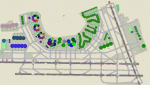
A high spec AFCAD2 for the FS2004 Newark Liberty Int'l Airport (KEWR) scenery by Steve Whalin. This afcad has been built using FAA Charts and information from the Airport Website. All taxiways are named and all aprons are reworked to be as real as possible according to photos. All gates are named as per real life and have airlines assigned to them. The Fedex and UPS aprons are represented and can accomodate many cargo aircraft. The final addition is random GA parking and the CO maintenance area to the north of the airport. Overflow parking is also available for rush hour periods (Ball Park). This airport features a tower view and also night and approach lighting. Finally, by using the crosswind runway technique, runways 04L/22R, 04R/22L and 11/29 can all be used simultaniously for take-off and landing. Runway 11/29 will be mainly used by CO Express flights. Enjoy!!
This afcad works with the Steve Whalin scenery only (Requires: kewr.zip).
| Filename: | Newark_Liberty_Intl_Airport_KEWR_with_active_Cross.zip |
| License: | Freeware |
| Added: | 2nd March 2010, 19:26:13 |
| Downloads: | 1,355 |
| Author: | Lee Brompton |
| Size: | 259.8 KB |
| Category: Flight Simulator 2004 - Scenery | |
| Herb's Field C417 near Ottawa in Ontario, Canada |
|
Images related to this file:
File Description:
Herb's is on the 417 between Ottawa and Montreal at the junction with highway 34, which is south of Hawkesbury. Herb's is a truckstop and a repair garage and a restaurant and a gas station, and is still (but only just!) an airfield. Which is to say there is still a runway, some 1,200 feet long and 30 feet wide. Do not go in your Cessna 172 as only the northern half is usable, and that after inspection from the air for any obstacles, parked cars, dogs, and similar obstacles. The southern half is the way in for trucks and cars, so make sure you can stop well before the ex-hangar which is now for truck repairs only. The planes all belonged to Herb's father, and even a casual inspection will reveal that they haven't moved for some time. If there is anything using the service road immediately to the north of the runway go around again, you won't be able to clear a vehicle and then land on the threshold.
| Filename: | Herbs_Field_C417_near_Ottawa_in_Ontario_Canada.zip |
| License: | Freeware, limited distribution |
| Added: | 14th February 2010, 14:39:56 |
| Downloads: | 386 |
| Author: | Roger Wensley |
| Size: | 2.02 MB |
| Category: Flight Simulator 2004 - Scenery | |
| Terrace CYXT in BC Canada Updated |
|
Images related to this file:
File Description:
This version of Terrace has night textures that work, good news for the 319 downloaders who did not tell the author that the ones already posted did not work. Why? Terrace is fifteen miles east and inland from Prince Rupert, which is 500 miles north of Vancouver up the BC coast. It is at the point in the mountains where two fjords meet, one coming from Prince Rupert and the other from Kitimat. There are two runways, the main one is a recently-extended 7,500 feet long and lighted 33/15 and the second is 5,373 feet of unlit 03/21. The apron has been enlarged to be able to accomodate a Boeing 737; though I don't think there is an airline using a 737 for flights to Terrace I have parked an Air Canada jet and the pics show the planes that do fly to Terrace, Air Canada and Hawk Air Dash 8-300's. The aircraft and the textures are down-loadable and and can be used for AI.
| Filename: | Terrace_CYXT_in_BC_Canada_Updated.zip |
| License: | Freeware, limited distribution |
| Added: | 3rd July 2010, 03:28:31 |
| Downloads: | 1,066 |
| Author: | Roger Wensley |
| Size: | 3.72 MB |
| Category: Flight Simulator 2004 - Scenery | |
| Sanikiluaq CYSK in Hudson Bay, Nunavut, Canada |
|
Images related to this file:
File Description:
Sanikiluaq is a village 740 or so inhabitants at N56 30, W79, which means in the southern part of Hudson Bay, close to James Bay. The village is at the north end of Flaherty Island, which is the largest of the Belcher Islands. You might fly there from La Grande Riviere in Quebec (200 miles SSE) or maybe from Moosonee in Ontario at the bottom of James Bay (350 miles SSW). Sanikiluaq village does not feature in FS9, so the first thing to do was to add it; it is the right shape and with around the right number of houses on the right streets but as I wasn't going to model 100+ individual houses just think of it as a hand-made auto-generated village. I also had to move the airfield over beside the river, so there is a DELETE file and a GRASS file and a ROADS file, as well as an AFCAD for AI and a scenery file. And AI for a visiting Air Inuit plane.
| Filename: | Sanikiluaq_CYSK_in_Hudson_Bay_Nunavut_Canada.zip |
| License: | Freeware, limited distribution |
| Added: | 11th October 2010, 23:15:41 |
| Downloads: | 516 |
| Author: | Roger Wensley |
| Size: | 2.21 MB |
| Category: Flight Simulator 2004 - Scenery | |
| Chiang Mai Photo scenery (Chiangmai city) |
|
Images related to this file:
File Description:
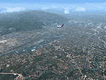
Chiang Mai was founded in the late 13th century. It was once the capital of Lanna, an independent Thai Kingdom and has preserved its unique cultural heritage to a marked degree. It is located 700 km (435 mi) north of Bangkok, among the highest mountains in the country. The city is on the Ping river, a major tributary of the Chao Phraya river. Culture of Chiang Mai is architecture reflects Lanna Thai,Burmese,Sri Lankan and Mon influences.There are some 300 temples in the city and on its outskirts. The Golden Age of Lanna-Chiang Mai lies some 500 years back in the time of king Tilokarat,but the city has recently been undergoing a process of regeneration,and while full of the bustle of modern life,it hasn't lost touch with its glorious past.
This scenery just only preview the real thing. If you visit Thailand, this city is the "must" see in your trip. The best time to go to Chiangmai is winter time since the weather is cool and bright sunny.
| Filename: | Chiang_Mai_Photo_scenery_Chiangmai_city.zip |
| License: | Freeware |
| Added: | 30th August 2010, 13:13:46 |
| Downloads: | 2,569 |
| Author: | PARIWAT LORDNGERN / Thaiflight Simulator |
| Size: | 26.31 MB |


© 2001-2026 AVSIM Online
All Rights Reserved
Privacy Policy |