
Where Flight Simulation Enthusiasts Gather from Around the World!
AVSIM Library - Search Results

| Category: Flight Simulator X - Scenery | |
| RAF Ludford Magna |

|
File Description:
RAF Ludford Magna was a Royal Air Force airfield operated by Bomber Command during the Second World War and the Cold War. The station lay on agricultural farmland immediately south of the village of Ludford, Lincolnshire and was sited 21.4miles (34.4 km) north east of the county town of Lincoln, Lincolnshire, England. The remains of the station can be seen from the B1225 Caistor High Street, and the long distance footpath the Viking Way passes right next to the eastern perimeter track.
It was the highest bomber airfield in England at 428 feet (130 m) above sea level, and cost £803,000 to build.
All credit must go to the following authors without whose work I could not have made this scenery; all credit for the models contained in it is theirs I merely placed it. If you don't have any of the third party addons you will only see the runway and peri track: Ted Andrews - Ian Pearson - Mike Hudson
| Filename: | RAF_Ludford_Magna.zip |
| License: | Freeware |
| Added: | 5th October 2015, 20:07:32 |
| Downloads: | 339 |
| Author: | Terry Boissel |
| Size: | 20.9 KB |
| Category: Flight Simulator X - Scenery | |
| RNAS Inskip |
|
File Description:
RNAS Inskip is located a few miles north of a place called Kirkham near Blackpool which is in the county of Lancashire (U.K.). During WWII the Lancashire plain was used extensively for airfields. Most famously, USAAF's BAD2, which General Doolittle labelled
'the world's greatest air depot' was located at Warton, only a few miles south of Inskip. What with RNAS Burscough and RAF Woodvale close by the other side of the river, the skies above the Ribble must have been a dense mass of most of the u.k./u.s.a. aircraft types ever flown during WW2.
Otherwise known as HMS Nightjar (X4IP), it was only open as an active airfield for a few years 1943 - 1946. It was used by the Fleet Air Arm
mainly for Radar Training and bombing practice, but many operational units would disembark from their carriers for upgrades or maintenance during carrier refits. Flying out of Inskip were many FAA types - Fireflies, Swordfish, Ansons, Barracudas, Fulmars, Tarpons (Avengers)
and Martlets (Wildcats).
| Filename: | RNAS_Inskip.zip |
| License: | Freeware |
| Added: | 18th September 2015, 06:01:18 |
| Downloads: | 383 |
| Author: | Ian Robinson |
| Size: | 27.89 MB |
| Category: Flight Simulator X - Scenery | |
| X2MB - RAF Membury - Berkshire, England |
|
File Description:
RAF Membury (ICAO X2MB) is a former Royal Air Force station built in the civil parish of Lambourn in Berkshire, England. The airfield is located approximately 4.6 miles (7.4 km) mi north-northwest of Hungerford, at the Membury services stop of the M4 motorway; about 60 miles (97 km) miles west-southwest of London. The airfield also lies immediately next to the Iron Age hill fort of Membury Camp.
Opened in 1942, it was used by both the Royal Air Force (RAF) and United States Army Air Forces (USAAF). During the war it was used by several combat units with varying missions. It was also a major supply and maintenance depot. After the war, it was a private airport until the construction of the M4 motorway in the 1960s when it was closed.
Today the remains of the airfield are located on private property with the former technical site now being an industrial estate (Membury Business Park).
Source: Wikipedia
| Filename: | X2MB__RAF_Membury__Berkshire_England.zip |
| License: | Freeware |
| Added: | 7th April 2016, 17:26:37 |
| Downloads: | 126 |
| Author: | Terry Boissel |
| Size: | 1.63 MB |
| Category: Flight Simulator X - Scenery | |
| RAF Manston 1944 |
|
File Description:
RAF Manston (ICAO EGMH)was an RAF station in the north-east of Kent, on the Isle of Thanet from 1916 until 1996. The site is now split between a commercial airport Kent International Airport (KIA) and a continuing military use by the Defence Fire Training and Development Centre (DFTDC), following on from a long-standing training facility for RAF firefighters at the Manston base.
Source: Wikipedia
I have represented it here in 1944 leading up to its part in Operation Market garden and D Day. It was one of the few airfields installed with the Fog Investigation Dispersal Organisation (FIDO) system designed to remove fog from airfields by burning it off with petrol and I have represented this with the 8 fuel tanks at the 29 end of the mail runway. I have laid the station out roughly according to an old map made in the mid 40s but I make no claims to the accuracy of building I have used.
| Filename: | RAF_Manston_1944.zip |
| License: | Freeware |
| Added: | 26th April 2016, 00:15:35 |
| Downloads: | 160 |
| Author: | Terry Boissel |
| Size: | 1.71 MB |
| Category: Prepar3D V1-4 - Scenery | |
| Johnston Atoll N16.43.46 W169.32.01, Pacific Islands United States of America |
|
File Description:
Johnston Atoll N16.43.46 W169.32.01, Pacific Islands United States of America. It is administered directly by the government through a dedicated body that provides for its protection. The atoll was inhabited until 2003. In late 2003, the US government transferred the Atoll jurisdiction to the United States Fisheries and Wildlife Service. Most materials and structures (including those used for chemical weapons storage) have been removed and the runway has been clearly marked as closed this is a old Naval Military base. The atoll is strategically located in the north Pacific Ocean about a third of the distance between Hawaii and the Marshall Islands.Access to the islands is closed to the public due to pollution from nuclear tests conducted in the past by the United States, and due to the presence in the past of a chemical weapons depot.
Important VFR point in the Pacific Ocean.
Within the downloaded package you will find readme files for scenery installation. Good fly VFR. Pasquale Marrulli.
| Filename: | Johnston_Atoll_N164346_W1693201_Pacific_Islands_Un.zip |
| License: | Freeware |
| Added: | 4th February 2018, 22:02:41 |
| Downloads: | 221 |
| Author: | Pasquale Marrulli |
| Size: | 3.09 KB |
| Category: Prepar3D V1-4 - Aircraft Repaints, Textures and Modifications | |
| Air Austral 1998 AI Package |
|
File Description:
Air Austral had yet to venture into longhaul flying in 1998, with 2 737-300s and a 737-500 flying to neighboring islands and venturing a bit into Western and Southern Africa. As the Comoros and Mayotte didn't have flag carriers, Air Austral and Air Madagascar connected destinations to these islands beyond RUN. Note that the YVA airport has since closed and the HAH airport further north is used now. These plans use the old airport and a scenery will eventually be created. Today, the airline has grown many times it's size in 1998 and now flies 777-300ERs and 787s across the globe.
Repaints for the FAIB 737-300 and 737-500 by APG and Alex\Funk included. Flightplans by Chasen Richardson. Part of the 1998 Flight Simulator Project. Follow us on Facebook at facebook.com/flightsim98 and on instagram as @bayviationsim. For more Retro AI, check out the forums at: http://retroai.proboards.com/
| Filename: | Air_Austral_1998_AI_Package.zip |
| License: | Freeware, limited distribution |
| Added: | 28th December 2019, 19:53:40 |
| Downloads: | 158 |
| Author: | Antoine Calleja, Alex\Funk,Chasen Richardson\Bayviation |
| Size: | 1.16 MB |
| Category: Flight Simulator 2004 - Scenery | |
| Bumba Airport (FZFU/BMB) |
|
File Description:
Scenery for Bumba airport (FZFU/BMB), namely a small airport located in the North part of the Democratic Republic of Congo (DRC), Mondala Province, serving the small town of Bumba located near the Congo river. Bumba is an ideal reference point for VFR flights along the Congo river in that region, as well as around that part of the DRC forest. The scenery contains two parts: the landclass, that defines the terrain at and around the airport, and the airport scenery, which contains the runway, the aprons, and the 3D objects. In comparison with the default FS2004 scenery, this contains brand new runway and aprons, drawn using custom textures that should give a more realistic feeling of the airstrip, and the landclass has been modified in order to represent faithfully the real landscape around the airport. The Static Object Library of RWY12 is necessary in order to properly display the 3D objects: it can be found easily in the AVSIM library.
| Filename: | Bumba_Airport_FZFUBMB.zip |
| License: | Freeware |
| Added: | 30th April 2020, 18:31:15 |
| Downloads: | 160 |
| Author: | Marco Ruggieri |
| Size: | 7.52 MB |
| Category: Prepar3D V1-4 - Scenery | |
| Morning Star Airport – Cape Town, South Africa |
|
Images related to this file:
File Description:
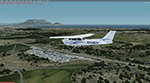
Morning Star airport is situated just north of Cape Town, Next to the N7. A small GA airport with a nice view of Cape Town and Table Mountain and right under the runway 19 approach to FACT. I could not find any official code for the airport, so I called it FAMR. Though I could learn some new skills under the current lockdown, so this is my first attempt at combining most techniques for building an airport, including some hangers and the club house for images I found on the internet. Developed using the P3D V4.5 SDK and tested in P3D V5. Developed to be used with the ORBX OpenLC Africa LC product and I uesd some ORBX library objects.
I included a small update to Robben Island to level the area where the prison is (not sure where it comes from but it is not located in the correct place) and to show the reamains of the old runways on the island.
| Filename: | Morning_Star_Airport__Cape_Town_South_Africa.zip |
| License: | Freeware, limited distribution |
| Added: | 17th May 2020, 17:23:59 |
| Downloads: | 391 |
| Author: | Johan Pienaar |
| Size: | 4.27 MB |
| Category: Flight Simulator 2004 - Scenery | |
| Wabush CYWK in Labrador Newfoundland Canada |
|
Images related to this file:
File Description:
Wabush is a small town close to Labrador City, 200 miles north of the Gulf of St Lawrence coast and close to the border with Quebec. The area is known for it's iron mining activity which started in the 1960's. The airport that serves the area is located close to Wabush and there is also a float base on the lake that abutts Labrador. This version is from around 2014. The single runway is aligned 01-19 and is 6,000 feet long, with PAPI on 19 and ILS on 01. Flights by Pascan Aviation, Air Inuit, and Provincial Airlines are included in the AI provided, along with GA flights. I also have WOA ai that provides Air Canada Jazz flights (not included here but worth downloading for Canada). There is also AI for the float base on the lake, which connects to River Deep Lodge for trout fishing on Atikonak Lake around 100 miles to the east and also included here.
| Filename: | Wabush_CYWK_in_Labrador_Newfoundland_Canada.zip |
| License: | Freeware, limited distribution |
| Added: | 24th August 2020, 23:15:16 |
| Downloads: | 216 |
| Author: | Roger Wensley |
| Size: | 16.1 MB |
| Category: Flight Simulator 2004 - Scenery | |
| Kangirsuk CYAS in Quebec Canada |
|
Images related to this file:
File Description:
Kangirsuk is an Inuit village in northern Quebec, on the coast of Ungava Bay. The airport is the only means of access on this coast for the population of around 550, apart from a period in late summer. It is between Quaqtaq and Aupaluk, and around 140 miles north of Kuujjuaq, a major centre in this area for supplies, medical care, education, and anything to do with local government. This version of the airport and village is from around 2010, with the original terminal building that has now been replaced. The runway is just under 3,500 feet of lit gravel aligned 04-22 and the AI includes the daily Air Inuit flight that connects Kangirsuk with Kuujjuaq and other local airfields en route. This is almost certainly the last of the northern Quebec coastal airfields that I will be able to model with the correct buildings; only two missing so not too bad.
| Filename: | Kangirsuk_CYAS_in_Quebec_Canada.zip |
| License: | Freeware, limited distribution |
| Added: | 27th August 2020, 17:41:07 |
| Downloads: | 84 |
| Author: | Roger Wensley |
| Size: | 5.67 MB |


© 2001-2026 AVSIM Online
All Rights Reserved
Privacy Policy |