
Where Flight Simulation Enthusiasts Gather from Around the World!
AVSIM Library - Search Results

| Category: Flight Simulator 2004 - Scenery | |
| Quaqtaq CYHA in Hudson Strait, Quebec, Canada |

|
Images related to this file:
File Description:
Quaqtaq is a small village of 310 or so inhabitants at N 61 W 69 37 on the Hudson Strait at the northwest corner of Ungava Bay. It's name has some connection with "tapeworm" in Inuit; there is a story but I won't recount it here. The village does not feature in FS9 but is included in this scenery with approximately the right shape. No village buildings were specifically modeled; they are hand-made non-specific village houses typical of the north. The airfield runway is 3,520 feet of gravel 100 feet wide and is at 103 feet above the shoreline. I added the roads, a new airfield background, plus of course there is the scenery file and the AFCAD and AI, which is an Air Inuit Dash 8-300. This is the last of a series in northern Quebec that all have similar terminal buildings; I know of others which have the same type of building but I have no photos to discover the differences.
| Filename: | Quaqtaq_CYHA_in_Hudson_Strait_Quebec_Canada.zip |
| License: | Freeware, limited distribution |
| Added: | 8th November 2010, 04:29:39 |
| Downloads: | 414 |
| Author: | Roger Wensley |
| Size: | 2 MB |
| Category: Flight Simulator X - AFCAD Files | |
| Old Bridge Airport (3N6), NJ |
|
File Description:
Located 05 miles S of Old Bridge, New Jersey on 120 acres of land, Old Bridge Airport is a public airstrip. Fuel is available by stopping next to the tank north of the parking area. This airport has hangars for transient aircraft - two hangars next to the parking area are open for parking. You can also start in them by selecting one of the DOCK parking options. Immediately adjacent to the airport is Raceway Park, which features a drag strip, road course, dirt bike course, and karting/motoX areas. Trees are summertime ONLY.
Scenery constructed with use of satellite images/streetview, the author has not been there in person.
This scenery is meant to be used in conjunction with MegaScenery Earth New Jersey/Delaware 001. It is not required, but apron use is minimized to allow satellite scenery to show through as much as possible, and objects are placed based on the MSE textures - lack of it may make scenery look out of place.
| Filename: | Old_Bridge_Airport_3N6_NJ.zip |
| License: | Freeware |
| Added: | 22nd November 2010, 18:40:52 |
| Downloads: | 211 |
| Author: | Drew Sikora |
| Size: | 1.61 MB |
| Category: Flight Simulator X - Scenery | |
| Benina International Airport HLLB 2010 V.1 FS2004/FSX-sp2 |
|
File Description:
Benina International Scenery. located in the town of Benina, 19 km east of Benghazi, from which it takes its name. The airport is operated by the Civil Aviation and Meteorology Bureau of Libya and is the second largest in the country after Tripoli International Airport. Benina International is also the secondary hub of both Buraq Air and flag carrier, Libyan Airlines. During World War II, the airport was used by the United States Army Air Force Ninth Air Force during the Eastern Desert Campaign. Known as Soluch Airfield, it was used by the 376th Bombardment Group, which flew B-24 Liberator heavy bombers from the airfield between 22 February & 6 April 1943. Once the combat units moved west, it was used as a logistics hub by Air Transport Command. It functioned as a stopover en-route to Payne Field near Cairo or to Mellaha Field near Tripoli on the North African Cairo-Dakar transport route for cargo, transiting aircraft and personnel.
| Filename: | Benina_International_Airport_HLLB_2010_V1_FS2004FS.zip |
| License: | Freeware |
| Added: | 28th November 2010, 19:49:42 |
| Downloads: | 4,295 |
| Author: | Emad Qtiefan |
| Size: | 10.79 MB |
| Category: Flight Simulator 2004 - Scenery | |
| Vadodara International Airport (VABO) |
|
Images related to this file:
File Description:
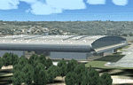
Vadodara International Airport (VABO) for FSX and FS2004.
Virtual aviation community stands basically on the grounds of what happens in the real world aviation and simulates the real thing, virtually. So that means they always have to be a step ahead and we follow. But my friend, we have a chance to make them follow us. Thats right! The proposed (final) integrated terminal at Vadodara shall have its construction commenced in mid of 2013 (the time can be altered, as real dudes define the situation). The design is finalized and here it is ..... the airport is basically " A basin kind".
Vadodara Airport or Civil Airport Harni (IATA: BDQ, ICAO: VABO) is a civilian airport located in the north-east of Vadodara, Gujarat, India in the suburb of Harni. A domestic airport until now, Vadodara Airport will become an international airport once the proposed new terminal is operational.
| Filename: | Vadodara_International_Airport_VABO.zip |
| License: | Freeware, limited distribution |
| Added: | 7th September 2010, 11:32:31 |
| Downloads: | 1,879 |
| Author: | Ashish Singh |
| Size: | 25.19 MB |
| Category: Flight Simulator 2004 - Scenery | |
| Como Idroscalo - Italy |
|
Images related to this file:
File Description:
Italian scenery with water runway and some existing objects and other buildings sintax generated; Information: Como is a beautiful town on the Como lake, north Italy, closed to the Swiss border. In the hills outside the town you can find Baradello old fortification (S) and Brunate small village (E). The lake, also called Lario, has a wonderful landscapes, reachable with battles of Navigazione Lago di Como. Description and content: Water runway placed approx on the real coordinates. Scenery includes: water runway with ILS; the Aero Club Como hangar, lighted with static float aircraft inside; some docks and a water NDB; two helicopter floating bases with an Huges 500D and dinghy; several sailboats and speedboats; football stadium, fantasy obelisco and statue; one Navigazione Lago di Como wharf and ticket office; buildings, hotels, hospital, cathedral, kiosk, restaurant etc.; Baradello old fortification and tower with Como flag; Brunate small village, with church and houses; several trees around the scenery and lights on lakefront and pier, on roads, hospital and jetty
| Filename: | Como_Idroscalo__Italy.zip |
| License: | Freeware |
| Added: | 9th February 2011, 20:43:31 |
| Downloads: | 1,423 |
| Author: | Aldo Della Vedova |
| Size: | 11.17 MB |
| Category: Flight Simulator X - Flight Plans | |
| OB-53 Minneapolis Minnesota |
|
Images related to this file:
File Description:
FSX Flight Plan for OB-53 Minneapolis Minnesota IFR high speed low altitude military training route. This is the eleventh in a series of flight plans I have uploaded. This route goes through mostly flat and rolling terrain in Minnesota, North Dakota and South Dakota. This route has three different sets of targets. These are great routes for B-52, F-111, B-1B, B-2 A6, A4, Vulcan and any fighter or bomber enthusiasts. Of course you can fly the route with any aircraft of your choice. Included in this package are two spectacular gauges by Karol Chlebowski for TFR flying and Pave Tack which includes many advanced features for bombing, navigation and reconnaissance. These two gauges will greatly enhance your ability to fly these challenging routes and are a great companion of the flight plans. Another option to download Version 2.1 of my mini panel which has all this functionality and more.
| Filename: | OB53_Minneapolis_Minnesota.zip |
| License: | Freeware |
| Added: | 11th July 2011, 00:27:26 |
| Downloads: | 173 |
| Author: | Bill McClellan |
| Size: | 1.13 MB |
| Category: Flight Simulator X - Scenery | |
| LFAW - Villerupt-Errouville |
|
Images related to this file:
File Description:
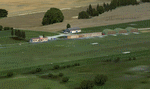
This scenery represents the field of Villerupt-Errouville LFAW where the flying club is based "Nord Lorraine" located in the north of the department 54 a few kilometers from Belgium and Luxembourg borders and the model aircraft club. The buildings have been modeled in GMAX, static devices are also present. Finally the autogen was placed on the same perimeter as the slab photo realistic.
********************************
Cette scene represente le terrain de Villerupt-Errouville LFAW qui est base l'aeroclub Nord Lorraine situe dans le nord du departement 54 a quelques kilometres de la Belgique et du Luxembourg ainsi qu'un club d'aeromodelisme et parachutisme.
L'ensemble des batiments ont ete modelises sous GMAX, des appareils statiques sont egalement presents.
Une dalle photo realiste a ete inseree mais je vous conseille de continuer le sol photo avec des logiciels comme fsEarthTile.
Enfin de l'autogen a ete place sur le meme perimetre que la dalle photo realiste.
| Filename: | LFAW__VilleruptErrouville.zip |
| License: | Freeware, limited distribution |
| Added: | 3rd January 2012, 11:24:06 |
| Downloads: | 1,862 |
| Author: | Alexandre Remy FAF010 |
| Size: | 17.72 MB |
| Category: Flight Simulator 2004 - Aircraft Repaints, Textures and Modifications | |
| Air Berlin Boeing 737-800 |
|
Images related to this file:
File Description:
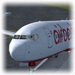
Empezamos septiembre e hice un nuevo repaint, esta vez del Boeing 737-800 de Air Berlin, esta es la segunda mayor linea aerea de Alemania, despues de Lufthansa, y la sexta mayor europea, Tiene su sede en la ciudad de Berlin, y opera vuelos cuasi-bajo costo entre 23 ciudades alemanas y ciudades europeas, destinos turisticos del Mediterraneo, las islas Canarias, Baleares y vuelos de largo recorrido a Las Americas, Asia y Africa. Modelo hecho por Project Open Sky, visiten mi blog en http://aerosimulaciones.blogspot.com/
Starting september and made a new repaint, the Air Berlin Boeing 737-800, Air Berlin is Germany's second largest airline, after Lufthansa, and Europe's sixth largest airline in terms of passengers. The airline operates an extensive network including holiday destinations in the Mediterranean region, the Canary Islands and North Africa and intercontinental destinations in Southeast Asia, the Caribbean and the Americas. Model by Project Open Sky, visit my blog in http://aerosimulaciones.blogspot.com/
| Filename: | Air_Berlin_Boeing_737800.zip |
| License: | Freeware |
| Added: | 7th September 2011, 22:15:10 |
| Downloads: | 862 |
| Author: | Juan Rodriguez / AeroSimulaciones |
| Size: | 7.87 MB |
| Category: Flight Simulator 2004 - Scenery | |
| World Trade Center Twin Towers (Textures Only) |
|
Images related to this file:
File Description:
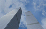
World Trade Center Twin Towers Textures - Only for Use With Tatu Kantomaa's New York City Objects.
These are Textures Only!
You must either have Tatu Kantomaa's New York City Objects scenery installed or you must download and install His scenery to use my textures (full details on file location in readme).
This is my way of rebuilding the Twin Towers and now they can Live again within the World of Flight Simulation.
Special Thanks To Tatu Kantomaa for granting me permission to upload these WTC texture modifications for use with His Great scenery "New York City Objects". His excellent scenery really improves NYC in FS9 with many other buildings created at a very high level of quality. Both North and South Tower Helipads are landable. You will find the Towers Glow with the color of the sunset so Dusk flights are very special when combined with My custom WTC night lighting. Please see Read Me file for more important information.
| Filename: | World_Trade_Center_Twin_Towers_Textures_Only.zip |
| License: | Freeware |
| Added: | 10th September 2011, 18:19:53 |
| Downloads: | 2,272 |
| Author: | Todd Manbeck,Tatu Kantomaa |
| Size: | 7.86 MB |
| Category: Flight Simulator 2004 - Scenery | |
| Gananoque CNN8 in Ontario, Canada |
|
Images related to this file:
File Description:
Gananoque is an ex-RCAF airfield 20 miles east of Kingston and Lake Ontario and 5 miles north of the Thousand Islands area of the St. Lawrence River and the US border. The airfield was a relief landing field for Kingston during WW2 and opened in 1940 with the classic triangle of runways. It closed in 1945 and is now a sky diving centre, still with the original single hangar and control tower. Fuel is no longer sold there so the only reason to pass by is as part of a visit to the Thousand Islands area, or perhaps look at the Canso (Canadian name for the PBY Catalina) which I understand is in the hangar. Unfortunately, when I turned up there was nobody there. The runways and the taxiways and the apron are all still usable but in what can only be called a state of random disrepair. Centre lines and signage are luxuries. I have included a photo with runway headings indicated.
| Filename: | Gananoque_CNN8_in_Ontario_Canada.zip |
| License: | Freeware, limited distribution |
| Added: | 22nd March 2012, 17:27:11 |
| Downloads: | 286 |
| Author: | Roger Wensley |
| Size: | 3.2 MB |


© 2001-2026 AVSIM Online
All Rights Reserved
Privacy Policy |