
Where Flight Simulation Enthusiasts Gather from Around the World!
AVSIM Library - Search Results

| Category: Navigation and ATC - Navigation | |
| McGrath Sectional Chart Chunks Optimized For Moving Map Application |

|
File Description:
Sectional chart chunks made from the August 2009 Sectional charts at the original scale, formatted in the WGS84 lat/lon geographic coordinate system for GPS, moving map application for flight simulation use.
These chart chunks were converted to the JPEG format for compatibility and size. Coverage is the full Sectional area North and South divided into JPEG tiles. They are about 3k x 3k pixels at 2.5mb with coverage of 90nm x 130nm per tile. Included is also the projection files and world files.
Note: This type of map is a equal grid and no further calibration is needed, only the two points referenced in the world file. Example: for users of FSM Moving Map, just mass import, done.
| Filename: | McGrath_Sectional_Chart_Chunks_Optimized_For_Movin.zip |
| License: | Freeware |
| Added: | 28th February 2010, 14:08:28 |
| Downloads: | 148 |
| Author: | David Myers |
| Size: | 15.39 MB |
| Category: Navigation and ATC - Navigation | |
| Kodiak Sectional Chart Chunks Optimized For Moving Map Application |
|
File Description:
Sectional chart chunks made from the August 2009 Sectional charts at the original scale, formatted in the WGS84 lat/lon geographic coordinate system for GPS, moving map application for flight simulation use.
These chart chunks were converted to the JPEG format for compatibility and size. Coverage is the full Sectional area North and South divided into JPEG tiles. They are about 3k x 3k pixels at 2.5mb with coverage of 90nm x 130nm per tile. Included is also the projection files and world files.
Note: This type of map is a equal grid and no further calibration is needed, only the two points referenced in the world file. Example: for users of FSM Moving Map, just mass import, done.
| Filename: | Kodiak_Sectional_Chart_Chunks_Optimized_For_Moving.zip |
| License: | Freeware |
| Added: | 1st March 2010, 22:12:20 |
| Downloads: | 149 |
| Author: | David Myers |
| Size: | 11.37 MB |
| Category: Navigation and ATC - Navigation | |
| Ketchikan Sectional Chart Chunks Optimized For Moving Map Application |
|
File Description:
Sectional chart chunks made from the August 2009 Sectional charts at the original scale, formatted in the WGS84 lat/lon geographic coordinate system for GPS, moving map application for flight simulation use.
These chart chunks were converted to the JPEG format for compatibility and size. Coverage is the full Sectional area North and South divided into JPEG tiles. They are about 3k x 3k pixels at 2.5mb with coverage of 90nm x 130nm per tile. Included is also the projection files and world files.
Note: This type of map is a equal grid and no further calibration is needed, only the two points referenced in the world file. Example: for users of FSM Moving Map, just mass import, done.
| Filename: | Ketchikan_Sectional_Chart_Chunks_Optimized_For_Mov.zip |
| License: | Freeware |
| Added: | 2nd March 2010, 00:30:36 |
| Downloads: | 193 |
| Author: | David Myers |
| Size: | 7.32 MB |
| Category: Navigation and ATC - Navigation | |
| Juneau Sectional Chart Chunks Optimized For Moving Map Application |
|
File Description:
Sectional chart chunks made from the August 2009 Sectional charts at the original scale, formatted in the WGS84 lat/lon geographic coordinate system for GPS, moving map application for flight simulation use.
These chart chunks were converted to the JPEG format for compatibility and size. Coverage is the full Sectional area North and South divided into JPEG tiles. They are about 3k x 3k pixels at 2.5mb with coverage of 90nm x 130nm per tile. Included is also the projection files and world files.
Note: This type of map is a equal grid and no further calibration is needed, only the two points referenced in the world file. Example: for users of FSM Moving Map, just mass import, done.
| Filename: | Juneau_Sectional_Chart_Chunks_Optimized_For_Moving.zip |
| License: | Freeware |
| Added: | 2nd March 2010, 00:33:13 |
| Downloads: | 218 |
| Author: | David Myers |
| Size: | 12.81 MB |
| Category: Navigation and ATC - Navigation | |
| Fairbanks Sectional Chart Chunks Optimized For Moving Map Application |
|
File Description:
Sectional chart chunks made from the August 2009 Sectional charts at the original scale, formatted in the WGS84 lat/lon geographic coordinate system for GPS, moving map application for flight simulation use.
These chart chunks were converted to the JPEG format for compatibility and size. Coverage is the full Sectional area North and South divided into JPEG tiles. They are about 3k x 3k pixels at 2.5mb with coverage of 90nm x 130nm per tile. Included is also the projection files and world files.
Note: This type of map is a equal grid and no further calibration is needed, only the two points referenced in the world file. Example: for users of FSM Moving Map, just mass import, done.
| Filename: | Fairbanks_Sectional_Chart_Chunks_Optimized_For_Mov.zip |
| License: | Freeware |
| Added: | 3rd March 2010, 05:55:56 |
| Downloads: | 182 |
| Author: | David Myers |
| Size: | 18.33 MB |
| Category: Navigation and ATC - Navigation | |
| Dawson Sectional Chart Chunks Optimized For Moving Map Application |
|
File Description:
Sectional chart chunks made from the August 2009 Sectional charts at the original scale, formatted in the WGS84 lat/lon geographic coordinate system for GPS, moving map application for flight simulation use.
These chart chunks were converted to the JPEG format for compatibility and size. Coverage is the full Sectional area North and South divided into JPEG tiles. They are about 3k x 3k pixels at 2.5mb with coverage of 90nm x 130nm per tile. Included is also the projection files and world files.
Note: This type of map is a equal grid and no further calibration is needed, only the two points referenced in the world file. Example: for users of FSM Moving Map, just mass import, done.
| Filename: | Dawson_Sectional_Chart_Chunks_Optimized_For_Moving.zip |
| License: | Freeware |
| Added: | 6th March 2010, 00:24:10 |
| Downloads: | 142 |
| Author: | David Myers |
| Size: | 17.46 MB |
| Category: Navigation and ATC - Navigation | |
| Cold Bay Sectional Chart Chunks Optimized For Moving Map Application |
|
File Description:
Sectional chart chunks made from the August 2009 Sectional charts at the original scale, formatted in the WGS84 lat/lon geographic coordinate system for GPS, moving map application for flight simulation use.
These chart chunks were converted to the JPEG format for compatibility and size. Coverage is the full Sectional area North and South divided into JPEG tiles. They are about 3k x 3k pixels at 2.5mb with coverage of 90nm x 130nm per tile. Included is also the projection files and world files.
Note: This type of map is a equal grid and no further calibration is needed, only the two points referenced in the world file. Example: for users of FSM Moving Map, just mass import, done.
| Filename: | Cold_Bay_Sectional_Chart_Chunks_Optimized_For_Movi.zip |
| License: | Freeware |
| Added: | 6th March 2010, 00:24:29 |
| Downloads: | 137 |
| Author: | David Myers |
| Size: | 4.41 MB |
| Category: Navigation and ATC - Navigation | |
| Cape Lisburne Sectional Chart Chunks Optimized For Moving Map Application |
|
File Description:
Sectional chart chunks made from the August 2009 Sectional charts at the original scale, formatted in the WGS84 lat/lon geographic coordinate system for GPS, moving map application for flight simulation use.
These chart chunks were converted to the JPEG format for compatibility and size. Coverage is the full Sectional area North and South divided into JPEG tiles. They are about 3k x 3k pixels at 2.5mb with coverage of 90nm x 130nm per tile. Included is also the projection files and world files.
Note: This type of map is a equal grid and no further calibration is needed, only the two points referenced in the world file. Example: for users of FSM Moving Map, just mass import, done.
| Filename: | Cape_Lisburne_Sectional_Chart_Chunks_Optimized_For.zip |
| License: | Freeware |
| Added: | 6th March 2010, 00:24:51 |
| Downloads: | 195 |
| Author: | David Myers |
| Size: | 16.96 MB |
| Category: Flight Simulator 2004 - Scenery | |
| Newport, Oregon - KONP. A conservative enhancement of the Newport, Oregon airport. |
|
Images related to this file:
File Description:
Newport, Oregon - KONP. A conservative enhancement of the Newport, Oregon airport which lies some 130 miles Southwest of Portland, Oregon. Featured is an AI U.S. Coast Guard Helicopter (included in the package) making training and reconnaissance flights over and around the area. Also included is a new bridge allowing the fishing fleet access to and from the bay. Tillamook, which is just North of Newport, is famous for it's cheese but you will find much more to enjoy on this portion of the Oregon coastline. Default, RWY12 and EZ scenery objects were used in this project. Please unzip to a temporary folder and follow the easy installation instructions. Compiled for your flying enjoyment by David "Opa" Marshall.
| Filename: | Newport_Oregon__KONP__A_conservative_enhancement_o.zip |
| License: | Freeware |
| Added: | 31st January 2010, 21:22:48 |
| Downloads: | 4,052 |
| Author: | David "Opa" Marshall |
| Size: | 2.52 MB |
| Category: Flight Simulator 2004 - Scenery | |
| Monument Valley, Kayenta (0V7), Utah/Arizona, Photo-Scenery |
|
Images related to this file:
File Description:
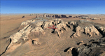
Monument Valley, Kayenta (0V7), Utah/Arizona, Photo-Scenery (FS9 & FSX)
This scenery covers the area from south of the San Juan River down to wonderful Monument Valley and Kayenta, AZ.
It extends my Lake Powell sceneries to the south and brings you another
3.500 sq km in 4.7m/pix quality. To explore the scenery depart from Kayenta (0V7) and head north.
High resolution versions of this scenery for FS9 and FSX (much sharper, but larger and multiple downloads) are available at www.blueskyscenery.com/CNY_South3West.html . The screenies are taken from the high-res versions, so expect this version to be slightly more blurry. YourDonation@Work: Dedicated to Thomas, Don and Eric.
| Filename: | Monument_Valley_Kayenta_0V7_UtahArizona_PhotoScene.zip |
| License: | Freeware, limited distribution |
| Added: | 23rd January 2010, 10:45:32 |
| Downloads: | 2,282 |
| Author: | Gottfried Razek - blueskyscenery.com |
| Size: | 93.49 MB |


© 2001-2026 AVSIM Online
All Rights Reserved
Privacy Policy |