
Where Flight Simulation Enthusiasts Gather from Around the World!
AVSIM Library - Search Results

| Category: Flight Simulator 2004 - Scenery | |
| Wanganui Airport, New Zealand. NZWU. Version-2 |

|
File Description:
Welcome to Wanganui, a small domestic airport on the lower west coast of the North Island of New Zealand.
It is located 2 nautical miles south-south-west of the City of Wanganui,serving the city and surrounding districts.
Wanganui Airport is also home to one of New Zealand's largest and most well known aerial agricultural contractors, Wanganui Aero Work.
This scenery is designed specifically for use with the GNZLAP Special AI Release "A Flock of Fletchers",by Charl Du Toit.
This AI package is freely available here on avsim, filename....... GNZLAPA1.zip .
This scenery is REQUIRED for the AI package to work properly. Scenery requires some EZ Scnerery Object sets (see INSTALL instructions for details).
| Filename: | Wanganui_Airport_New_Zealand_NZWU__Version2.zip |
| License: | Freeware, limited distribution |
| Added: | 7th September 2008, 13:30:03 |
| Downloads: | 981 |
| Author: | Lawrie Roache |
| Size: | 1.63 MB |
| Category: Flight Simulator X - AFCAD Files | |
| RCTP Taoyuan International Airport Taiwan |
|
File Description:
Updated version of the airport layout file (AFCAD) for the default RCTP Taoyuan International Airport in Taipei, Taiwan. The RCTP airport scenery in FSX is quite elaborate, but unfortunately has too many and wrongly numbered gates. This file removes the extra gates, assigns correct gates and terminals to all the major airlines, and adds realistic cargo parking spaces in the north apron. General parking on the EVA apron has been replaced by EVA and EVA Cargo spaces. The airport has been renamed as it has in real life, to "Taoyuan International". Tested with World of AI only. Parking for Taiwan-China direct flights at Terminal 2 for Chinese carriers provided. Tested with World of AI only.
| Filename: | RCTP_Taoyuan_International_Airport_Taiwan.zip |
| License: | Freeware, limited distribution |
| Added: | 28th March 2009, 15:16:34 |
| Downloads: | 2,064 |
| Author: | Marten Weber |
| Size: | 34.54 KB |
| Category: Flight Simulator 2004 - Scenery | |
| Canyonlands National Park, The Maze-South, Utah, Photo-Scenery (FSX too) |
|
Images related to this file:
File Description:
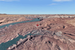
This is a re-upload of a package that was corrupted during the crash of the AVSIM library. This is the fourth package of the Arches/Canyonlands area. It covers the area southwest and including the confluence of the Colorado and Green Rivers. From there you can fly down Cataract Canyon which is famed for its premium whitewater rafting oportunities. Or explore the Maze (the area west of the Green and north of the Colorado River) with it's labyrinth of canyons and colorful sandstone formations. The scenery extends west to Hite (UT03) on Lake Powell. Brings the total Southern Utah coverage to 14.000 sq km in 4.7m/pix quality. YourDonation@Work: Dedicated to Patrick, Hideyuki and Art. Thanks!
| Filename: | Canyonlands_National_Park_The_MazeSouth_Utah_Photo.zip |
| License: | Freeware, limited distribution |
| Added: | 31st December 2009, 22:33:46 |
| Downloads: | 2,084 |
| Author: | Gottfried Razek - blueskyscenery.com |
| Size: | 95.67 MB |
| Category: Navigation and ATC - Navigation | |
| Bethel Sectional Chart Chunks |
|
File Description:
Sectional chart chunks made from the August 2009 Sectional charts at the original scale, formatted in the WGS84 lat/lon geographic coordinate system for GPS, moving map application for flight simulation use.
These chart chunks were converted to the JPEG format for compatibility and size. Coverage is the full Sectional area North and South divided into JPEG tiles. They are about 3k x 3k pixels at 2.5mb with coverage of 90nm x 130nm per tile. Included is also the projection files and world files.
Note: This type of map is a equal grid and no further calibration is needed, only the two points referenced in the world file. Example: for users of FSM Moving Map, just mass import, done.
| Filename: | Bethel_Sectional_Chart_Chunks.zip |
| License: | Freeware |
| Added: | 7th March 2010, 20:50:48 |
| Downloads: | 177 |
| Author: | David Myers |
| Size: | 14.67 MB |
| Category: Flight Simulator 2004 - Scenery | |
| Hay River CYHY, 2010 |
|
Images related to this file:
File Description:
First established as a permanent settlement in 1892, Hay River is located on the south shore of Great Slave Lake in the Canadian Northwest Territories. Like the territorial capital city of Yellowknife 115 miles to the north on the opposite shore of the lake, Hay River experiences brutal weather conditions, with an average mid winter temperature of minus 27C (minus 18F).
* Aprons and taxiways completely redone to be more accurate.
* Missing ground and water features added, land class adjusted.
* All default buildings replaced. Custom terminal building and other custom objects.
* Roads and railroads in vicinity of airport redone.
* Buffalo Airways AI traffic and static water bomber aircraft.
| Filename: | Hay_River_CYHY_2010.zip |
| License: | Freeware |
| Added: | 12th March 2010, 10:14:00 |
| Downloads: | 1,947 |
| Author: | Sidney Schwartz & Peter Ham |
| Size: | 13.2 MB |
| Category: Flight Simulator 2004 - Scenery | |
| Catalonia version II |
|
Images related to this file:
File Description:
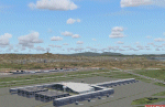
Catalonia is my small country located among Spain northeast and France southeast. Its surface it is 32000 km2 in its south area and of about 2000 kn2
In its area north. Your coastal fringe in the Mediterranean is about 630 kms. This is the whole Catalonia.
Their capital is Barcelona where the olympic games was played in recent years.
It is headquarters of the cathedral of Gaudi.It contains 7 big airports 7 airclubs and two seaports. The port of Barcelona is the first tourist port of the mediterranean of the they leave the big tourist cruises.
Airport LEBL is reconstructed with new great terminal
This scenery contents the new airport LEDA in Lleida city
| Filename: | Catalonia_version_II.zip |
| License: | Freeware |
| Added: | 17th March 2010, 23:29:15 |
| Downloads: | 7,102 |
| Author: | Toni Agramont |
| Size: | 74.05 MB |
| Category: Navigation and ATC - Navigation | |
| Whitehorse Sectional Chart Chunks Optimized For Moving Map Application |
|
File Description:
Sectional chart chunks made from the August 2009 Sectional charts at the original scale, formatted in the WGS84 lat/lon geographic coordinate system for GPS, moving map application for flight simulation use.
These chart chunks were converted to the JPEG format for compatibility and size. Coverage is the full Sectional area North and South divided into JPEG tiles. They are about 3k x 3k pixels at 2.5mb with coverage of 90nm x 130nm per tile. Included is also the projection files and world files.
Note: This type of map is a equal grid and no further calibration is needed, only the two points referenced in the world file. Example: for users of FSM Moving Map, just mass import, done.
| Filename: | Whitehorse_Sectional_Chart_Chunks_Optimized_For_Mo.zip |
| License: | Freeware |
| Added: | 28th February 2010, 06:29:44 |
| Downloads: | 145 |
| Author: | David Myers |
| Size: | 16.1 MB |
| Category: Navigation and ATC - Navigation | |
| Western Aleutian Islands Sectional Chart Chunks Optimized For Moving Map Application |
|
File Description:
Sectional chart chunks made from the August 2009 Sectional charts at the original scale, formatted in the WGS84 lat/lon geographic coordinate system for GPS, moving map application for flight simulation use.
These chart chunks were converted to the JPEG format for compatibility and size. Coverage is the full Sectional area North and South divided into JPEG tiles. They are about 3k x 3k pixels at 2.5mb with coverage of 90nm x 130nm per tile. Included is also the projection files and world files.
Note: This type of map is a equal grid and no further calibration is needed, only the two points referenced in the world file. Example: for users of FSM Moving Map, just mass import, done.
| Filename: | Western_Aleutian_Islands_Sectional_Chart_Chunks_Op.zip |
| License: | Freeware |
| Added: | 28th February 2010, 06:32:04 |
| Downloads: | 166 |
| Author: | David Myers |
| Size: | 7.82 MB |
| Category: Navigation and ATC - Navigation | |
| Point Barrow Sectional Chart Chunks Optimized For Moving Map Application |
|
File Description:
Sectional chart chunks made from the August 2009 Sectional charts at the original scale, formatted in the WGS84 lat/lon geographic coordinate system for GPS, moving map application for flight simulation use.
These chart chunks were converted to the JPEG format for compatibility and size. Coverage is the full Sectional area North and South divided into JPEG tiles. They are about 3k x 3k pixels at 2.5mb with coverage of 90nm x 130nm per tile. Included is also the projection files and world files.
Note: This type of map is a equal grid and no further calibration is needed, only the two points referenced in the world file. Example: for users of FSM Moving Map, just mass import, done.
| Filename: | Point_Barrow_Sectional_Chart_Chunks_Optimized_For_.zip |
| License: | Freeware |
| Added: | 28th February 2010, 06:32:41 |
| Downloads: | 158 |
| Author: | David Myers |
| Size: | 18.64 MB |
| Category: Navigation and ATC - Navigation | |
| Nome Sectional Chart Chunks Optimized For Moving Map Application |
|
File Description:
Sectional chart chunks made from the August 2009 Sectional charts at the original scale, formatted in the WGS84 lat/lon geographic coordinate system for GPS, moving map application for flight simulation use.
These chart chunks were converted to the JPEG format for compatibility and size. Coverage is the full Sectional area North and South divided into JPEG tiles. They are about 3k x 3k pixels at 2.5mb with coverage of 90nm x 130nm per tile. Included is also the projection files and world files.
Note: This type of map is a equal grid and no further calibration is needed, only the two points referenced in the world file. Example: for users of FSM Moving Map, just mass import, done.
| Filename: | Nome_Sectional_Chart_Chunks_Optimized_For_Moving_M.zip |
| License: | Freeware |
| Added: | 28th February 2010, 06:39:38 |
| Downloads: | 184 |
| Author: | David Myers |
| Size: | 16.46 MB |


© 2001-2026 AVSIM Online
All Rights Reserved
Privacy Policy |