
Where Flight Simulation Enthusiasts Gather from Around the World!
AVSIM Library - Search Results

| Category: Flight Simulator 2004 - AI Aircraft | |
| All Nippon Airways (1970-1990 project) Boeing 727-200 |

|
Images related to this file:
File Description:

All Nippon Airways (1970-1990 project) Boeing 727-200 for retro AI traffic; with 3 variations utilizing the AI Aardvark model set. Repaints by Michael Pearson.
| Filename: | All_Nippon_Airways_19701990_project_Boeing_727200.zip |
| License: | Freeware |
| Added: | 19th July 2010, 01:42:28 |
| Downloads: | 574 |
| Author: | Michael Pearson |
| Size: | 589.98 KB |
| Category: Flight Simulator 2004 - Aircraft Repaints, Textures and Modifications | |
| Private Douglas C-47 Skytrain (N5853J) |
|
Images related to this file:
File Description:
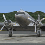
Douglas C-47 Skytrain, registration N5853J, full bare metal aircraft. Textures only for the Manfred Jahn Douglas DC-3/C-47 Skytrain.
By Juan Ernesto Oropeza.
| Filename: | Private_Douglas_C47_Skytrain_N5853J.zip |
| License: | Freeware |
| Added: | 10th January 2012, 16:41:05 |
| Downloads: | 639 |
| Author: | Juan Ernesto Oropeza |
| Size: | 4.1 MB |
| Category: Flight Simulator X - Gauges | |
| FIP - 5 Gauge Display - 2 Engine |
|
Images related to this file:
File Description:

This set of gauges is for use in the Saitek FIP and has been developed specifically for the Baron 58 and variants but should work with other twin prop aircraft. There are 3 options-
option 1. a pair of gauges for displaying on 2 FIPs (layout is similar to the fsx BB58 layout)
option 2. One gauge for displaying only on 1 FIP (left and right eng needle on each of the 5 main instruments )
option 3. a pair of gauges for displaying on 2 FIPs with larger diameter gauges and more user interaction than in 1. above.
1,2, & 3 all have the 5 main engine instrumentation ( RPM, Manifild Pressure, Fuel Flow rate, Oil Temp and Pressure, CHT/EGT Temp.) Additional features are added .e.g Marker Beacon indicators plus indicator of left / right fuel tank selected for each engine, NAV 1 & NAV 2 with DME data.
Option 1 & 3 also has fuel pump switches, alternator switches, starter buttons, cowl flaps and Amps (total load) gauge, and Battery volts gauge.
Option 3 also has additional avionics data and avionics and battery switch buttons. All this enables the aircraft to be started from cold and shut down to cold. The avionics data is useful if you only have one Saitek radio panel. i.e. dont have to keep clicking / rotating switches all the time. This option also gives user ability to alter NAV 1 standby frequency and swap to active.
With the 2 gauges in option 3 above plus my earlier FIP gauge containing a working Auto pilot and fuel levels / flaps and landing gear indicators (refer "FIP-AP Multi Fuel Gauges") there is everything required (not the primary flight display instruments) for flying a single or twin prop aircraft displayed across either 2 or 3 FIPs.
| Filename: | FIP__5_Gauge_Display__2_Engine.zip |
| License: | Freeware |
| Added: | 30th October 2014, 06:24:58 |
| Downloads: | 250 |
| Author: | Robert Budd |
| Size: | 2.4 MB |
| Category: Flight Simulator X - Scenery | |
| RAF Langham - Norwich, Norfolk, England |
|
File Description:
RAF Langham is a former Royal Air Force station, located 15 miles (24 km) North-West of Norwich, Norfolk, England, from 1940 to 1961. The airfield was the most northerly of the Norfolk wartime RAF airfields and was situated 3.3 miles (5.3 km) from the North sea at Blakeney. This made it a desirable location to be used by Coastal Command which had come into prominence since the outbreak of the Second World War. Originally the base was built as a dispersal and satellite station to RAF Bircham Newton during the first few months of the war and it became operational in the summer of 1940. Third party add-on will be needed - see the included read-me.
| Filename: | RAF_Langham__Norwich_Norfolk_England.zip |
| License: | Freeware |
| Added: | 4th January 2016, 16:20:02 |
| Downloads: | 211 |
| Author: | Terry Boissel |
| Size: | 1.41 MB |
| Category: Flight Simulator X - Scenery | |
| YBJW Banjawarn Station, Western Australia |
|
File Description:
YBJW Banjawarn Station is a remote sheep station in Western Australia. It is situated 220 miles (350 km) north of Kalgoorlie and 500 miles (800 km) north east of Perth, on the edge of the Great Victoria Desert. It covers an area of 500,000 acres (780 square miles), about the size of West Yorkshire and a little smaller than the Australian Capital Territory. In the 1990's Banjawarn was owned by the Aum Shinrikyo and following the Tokyo subway attack was the subject of an Australian Federal Police investigation. (Wikipedia) REQUIRES Blencowe_LibraryKit.zip
REQUIRES blencowe_librarykit_309494.zip (Available HERE)
| Filename: | YBJW_Banjawarn_Station_Western_Australia.zip |
| License: | Freeware |
| Added: | 25th February 2013, 08:45:56 |
| Downloads: | 442 |
| Author: | Alan Blencowe |
| Size: | 3.54 MB |
| Category: X-Plane - Scenery | |
| Costabrava |
|
File Description:
CostaBrava is a photorealistic scenery between the Medes Islands and Palamos. If you have installed the Ampuriabrava scenery you will see the continuation of the scenery going south of the Medes Islands.
Both sceneries (north east of Spain) cover the geographical area below:
Costa Brava / Ampuriabrava : lat 41.50N long 3.5E to lat42.20N long3.15E. It
covers an area of about 75 km longitudinal from north to south (from Portbou to Palamós), and about 20-25km wide from west to east. Two airports are located at Ampuriabrava and Girona/Costabrava.
You can install both sceneries or each one separately.
This scenery has been tested in version 7.xx and 8.00 for mac or pc.
Created by Juan Luis Quintana
| Filename: | Costabrava.zip |
| License: | Freeware |
| Added: | 10th February 2005, 04:12:19 |
| Downloads: | 752 |
| Author: | Juan Luis Quintana |
| Size: | 30.91 MB |
| Category: Flight Simulator X - Scenery | |
| Land's End SeaPlanes; West Coast Travels |
|
File Description:
Part III in the four part scenery series of Land's End SeaPlanes. Part III, West Coast Travel covers the United States West Coast from Seattle Washington to San Diago, California. This scenery pack requaires Lands End SeaPlanes Part I and Part II. Part III includes, KAST - Astoria Regional Airport, KONP - Newport Municipal Airport, Newport, Oregon; KOTH - North Bend Airport, North Bend Oregon; KBOK - Brookings State Airport, Brookings Oregon; KACV - Arcata-Eureka Airport, Arcata, California; OQ5 - Shelter Cove Airport, Shelter Cove, Ca; CA51 - The Sea Ranch, Ca; KHAF - Half Moon Bay, Ca; O62 - Carmel Valley Vintage; L52 - Oceano County; and more. Package includes hundreds of custom models, effects, textures. Includes both day and night textures.
| Filename: | Lands_End_SeaPlanes_West_Coast_Travels.zip |
| License: | Freeware, limited distribution |
| Added: | 21st November 2008, 19:06:05 |
| Downloads: | 2,617 |
| Author: | Chris Carel |
| Size: | 42.47 MB |
| Category: Flight Simulator 2004 - Scenery | |
| Lucky Lake CKQ5 in Saskatchewan, Canada |
|
Images related to this file:
File Description:
The village of Lucky Lake is 80 miles south of Saskatoon, with a small population of less than 300, most of whom are dependant on agriculture for income, either directly or indirectly. Marijuana is a recently introduced crop after the failure of a government-financed potato growing operation called SPUDCO. The village was previously known as Devil's Lake (don't ask me, I don't know). The airfield is half a mile north of the village, with an asphalt runway just over 3,000 feet long, lit, and aligned 07-25 in FS9; this has now changed to 08-26 with the wandering magnetic north. Circuits on 25 are right handed to avoid over-flying the village. 100LL fuel is available.
| Filename: | Lucky_Lake_CKQ5_in_Saskatchewan_Canada.zip |
| License: | Freeware, limited distribution |
| Added: | 25th May 2017, 17:53:36 |
| Downloads: | 138 |
| Author: | Roger Wensley |
| Size: | 5.36 MB |
| Category: Flight Simulator 2004 - Scenery | |
| Southern Ontario Canada LOD 9 Mesh |
|
File Description:
Please note that I forgot to cut the one side of the screenshots so the right side of the image is what was present on my second monitor which in the first two pictures was my background.
The default mesh for Southern Ontario Canada was pretty flat and did not show the small rolling hills that are present throughout the province. This is LOD9 (90 meter) mesh that covers ALL of Southern Ontario from Elliot Lake, Sudbury and North Bay in the North, to near Montreal in the east, to Windsor in the southwest and all points in between. This mesh covers the entire area of Ontario shown in the Toronto VNC.
| Filename: | Southern_Ontario_Canada_LOD_9_Mesh.zip |
| License: | Freeware, limited distribution |
| Added: | 16th January 2004, 02:01:29 |
| Downloads: | 6,542 |
| Author: | David Voogd |
| Size: | 41.32 MB |
| Category: Flight Simulator 2004 - Scenery | |
| Lauriston TGPZ on Carriacou Island in the Caribbean |
|
Images related to this file:
File Description:
Canrriacou Island, though part of the Grenadines geographically, is south of the island chain known politically as St Vincent and the Grenadines, and with Petite Martinique is a dependency of Grenada. Carriacou is around 7 miles long and 2 miles wide, with a resident population of perhaps 5,000. Lauriston airport is at the southwest end of the island, on the north coast, and the runway is around 2,600 feet and aligned 09/27. There are connecting flights both north and south to the other islands by SVG and LIAT. The terminal is stucco and pastel colours and not exactly new. The airport apron is tight. This is the last of my Caribbean series made for default FS9.
| Filename: | Lauriston_TGPZ_on_Carriacou_Island_in_the_Caribbea.zip |
| License: | Freeware, limited distribution |
| Added: | 6th July 2013, 22:23:03 |
| Downloads: | 643 |
| Author: | Roger Wensley |
| Size: | 2.47 MB |


© 2001-2026 AVSIM Online
All Rights Reserved
Privacy Policy |