
Where Flight Simulation Enthusiasts Gather from Around the World!
AVSIM Library - Search Results

| Category: Flight Simulator 2004 - Scenery | |
| Hadera 'Orot-Rabin' Power-Plant V2 |

|
File Description:
FS2004 Scenery - Orot-Rabin power plant near Hadera,
Israel (named after the late Israeli prime minister) is located
on the Mediterranean coast between Tel-Aviv and Haifa and
therefore is a well known landmark for VFR pilots. The
power plant is operated with coal and has an output of two
700mw + one 1,400mw turbines. A total of 2,800mw and
a 1,800 meter long unloading pier for coal ships. Made in
gmx. Enhanched with smoke effects and night lighting
for navigation.
| Filename: | Hadera_OrotRabin_PowerPlant_V2.zip |
| License: | Freeware |
| Added: | 18th November 2003, 16:55:19 |
| Downloads: | 6,786 |
| Author: | Seev Kahn |
| Size: | 687.86 KB |
| Category: Flight Simulator 2004 - Panels | |
| AIRBUS Twin Engine |
|
File Description:
Here is a new AIRBUS, TWIN panel for you AIRBUS enthusiasts. It is built solely on authentic photos and bitmaps to create a realistic flight environment. Many thanks go out to Ken Mitchell for his permission to use his fantastic gauges - which represent a good portion of the instrumentation. This is a highly detailed and realistic panel which really requires you to open and study the README file. I hope you enjoy it and look forward to your feedback, questions and suggestions.
| Filename: | AIRBUS_Twin_Engine.zip |
| License: | Freeware |
| Added: | 30th July 2005, 06:16:00 |
| Downloads: | 6,588 |
| Author: | Rad James Yarjan |
| Size: | 15.29 MB |
| Category: Flight Simulator X - Scenery | |
| Detailed Terrain Features for Southern Africa, Update 7 |
|
Images related to this file:
File Description:
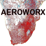
Scenery consist of Updated Terrain Vector data concerning Coastlines, rivers, dams, streams, roads, traffic, railroads, power lines and extrusion bridges for Southern Africa countries South of the Equator. A few minor changes was done to the vector data around Moogkgophong and Inhambane were updated by utilizing Satellite image backgrounds. This scenery is important and will be needed with release of Inhambane Airport and Flamingo Bay Resort by Aeroworx. Important to install the previous release fsxWorx01 and updates 1 to 6 before this file.
| Filename: | Detailed_Terrain_Features_for_Southern_Africa_Upda.zip |
| License: | Freeware |
| Added: | 19th September 2013, 21:31:13 |
| Downloads: | 2,813 |
| Author: | Hannes Steyn / Aeroworx |
| Size: | 4.51 MB |
| Category: Flight Simulator 2004 - Scenery | |
| KORD - O'Hare Intl Airport Chicago |
|
Images related to this file:
File Description:
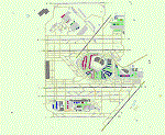
A total rebuild of the Chicago O'Hare airport. Repositioned the runways and taxiways to align with current Google Maps. Also, the Domestic and Intl terminals have been rebuilt and correctly positioned. New Jetways, Elevated roadways near the terminal, Added the new 9C/27C Runway with approaches and Navaids. And also extended the 9R/27L Runway to it's projected new length. Several taxiways have been added, deleted or moved as shown on the latest Airport Diagram chart. Made only for FS2004.
| Filename: | KORD__OHare_Intl_Airport_Chicago.zip |
| License: | Freeware |
| Added: | 30th March 2021, 16:48:51 |
| Downloads: | 1,309 |
| Author: | Johnny Alford |
| Size: | 39.93 MB |
| Category: Flight Simulator 2004 - Scenery | |
| Proyecto Mexico Real LOD8 (MESH) |
|
Images related to this file:
File Description:
Terrain Mesh that covers the entirety of Mexican Territory and related bordering U.S., Guatemala and Belize areas, part of the "Proyecto Mexico Real" project, compiled at LOD8 (4.96 arcseconds in latitude and 6.6 arcseconds in longitude) resolution from INEGI data. Intended to enhance the virtual flying experience with the more detailed LOD9 and LOD10 versions compiled from the same data. Compatible backwards with Flight Simulator 2000, Flight Simulator 2002 and Combat Flight Simulator 2. (Re-upload due to AVSIM hack)
| Filename: | Proyecto_Mexico_Real_LOD8_MESH.zip |
| License: | Check within download |
| Added: | 23rd January 2010, 11:37:33 |
| Downloads: | 3,623 |
| Author: | Juan Jose Galvan Bautista |
| Size: | 56.76 MB |
| Category: Flight Simulator X - Scenery | |
| SeaTac Area Airports |
|
Images related to this file:
File Description:
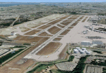
This scenery is a revision of the default Seattle-Tacoma (SeaTac), Boeing Field, Renton and Paine Field airports to work with MegaScenery Earth. The artificial plateau that Seatac is built on has been expanded and the new 3rd runway added. Runways, taxiways and various structures have been revised and/or relocated to match MegaScenery Earth ground textures. Default objects have been used in many cases to minimize FPS impact. MegaScenery Earth Washington-001 (KSEA, KBFI, KRNT) and -002 (KPAE) are required.
| Filename: | SeaTac_Area_Airports.zip |
| License: | Freeware |
| Added: | 11th December 2009, 09:51:46 |
| Downloads: | 5,567 |
| Author: | Al Wheeler |
| Size: | 2.48 MB |
| Category: Flight Simulator 2004 - Scenery | |
| Airports Northern Coast Alaska (PALU, PPIZ, PAWI, AK03) |
|
Images related to this file:
File Description:
The town of Barrow is in the far north of Alaska, and these are coastal villages or radar installations to the west of Barrow, and there will be additions. Cape Lisburne is a gravel runway right next to the coast with radar gear and accomodation buildings close by, and what was called "Top Camp" at the end of a long and steep road to the top of a nearby hill, or mountain. The runway is lit, as are most of them in this area of long dark winter nights. Barrow is 270 miles to the northeast. Point Lay PPIZ used to have a radar installation as well as a village, but the old buildings have now been removed and the gravel runway 05-23 has been lengthened to 5,000 feet to serve the village throughout the year. The population is around 270, living mostly traditionally and with an annual beluga whale hunt. Barrow is 180 miles to the northeast.
Wainwright PAWI, some 80 miles southwest of Barrow and on the coast, has a population of around 570. The PAWI runway is just under 5,000 feet long and like PPIZ is aligned 05-23, lit, and with PAPI on each end. The original runway of some 2,000 feet is still visible next to the apron. Three miles to the southeast there is a third runway, at AK03, serving the Wainwright DEW station. It was decided in 2007 to close the station and to remove the buildings both there and at Point Lay because of subsidence, but everything at Wainwright was still in place in 2009 and beyond. The villages have been "sketched" as opposed to replicated exactly. The texture folder includes the missing car textures for Barrow PABR, and the AI is modified PABR to include passenger flights by Ravn and cargo flights by Northern Air Cargo, plus limited GA. There are no flattened grassed areas at these airfields; they are runways and taxiways and aprons on a bed of gravel on permafrost.
| Filename: | Airports_Northern_Coast_Alaska_PALU_PPIZ_PAWI_AK03.zip |
| License: | Freeware, limited distribution |
| Added: | 16th June 2016, 15:59:24 |
| Downloads: | 364 |
| Author: | Roger Wensley |
| Size: | 10.84 MB |
| Category: Flight Simulator 2004 - Scenery | |
| Seward PAWD in Alaska V2 plus 6AK5 |
|
Images related to this file:
File Description:
This is V2, the combined original and also V1. If you have already installed V1 then you do not need this. The town of Seward (population around 2,700) is on the east coast of the Kenai Peninsula, 70 miles east of Kenai town and also 70 miles southeast of Anchorage, amid mountains and glaciers at the northern end of the 20 mile long and fjord-like Resurrection Bay. It is also at the southern end of both the Alaska Railway and the Seward Highway, and has a sheltered dock for freight and also for cruise liners. Passengers from the liners can enjoy local attractions (dog sledging on a glacier?) and also easily continue further north by bus or train to Anchorage or to other tourist attractions such as Denali. The airport is next to the port and the town, with two runways aligned (in FS9, not taking account of the recently wandering magnetic north) 15-33 and 12-30, both asphalt and 2,100 and 4,200 feet long respectively. Only 12-30 (and its taxiways) is lit, with VASI on 30. There are no regularly scheduled flights to Seward; with buses and trains running direct from Anchorage there is no money to be made. There are some charter flights coordinated with cruise liners, and some freight flights, the very occasional visit by the Coastguard, but most flights are GA, air taxi,or short scenery-viewing trips for summer tourists. In a mountainous area the only sure thing about the behaviour of AI aircraft is that it is unpredictable but often involves a mountain; nothing to be done about it. At Seward there is also marine AI from and to the port, in the shape of a cruise liner and an Alaskan ferry, but the latter only if you have Holger Sandmann's Alaska scenery installed. Also included with this is a correction for Fire Island 6AK5, near Anchorage, that takes the airfield out of the water; this is something I have meant to do for the last 5 years.
| Filename: | Seward_PAWD_in_Alaska_V2_plus_6AK5.zip |
| License: | Freeware, limited distribution |
| Added: | 19th January 2016, 18:27:26 |
| Downloads: | 593 |
| Author: | Roger Wensley |
| Size: | 12.47 MB |
| Category: Flight Simulator 2004 - Scenery | |
| CYSM - Fort Smith, Northwest Territories, Canada |
|
Images related to this file:
File Description:
Fort Smith is just north of the border between Alberta and Northwestern Territories, midway between Lake Athabasca to the southeast in (mostly) Saskatchewan (80 miles) and Great Slave Lake to the north west (90 miles). The runways all used to be larger, and while I don't know the history it looks as if it is ex-military and these are the remains of what were once 10,000 feet of asphalt. The main runway is now 11/29 and 6,000 feet long, and the secondary one is 1,800 feet of mostly gravel. There is an airline based at the field, Northwestern Air, and fuel (both 100LL and JA-1) is available at a self service point so long as you give it a credit card to read while you fill. The town of Fort Smith is two miles east of the airfield, on the bank of the Slave River and where there are some rapids that require a portage to get around them. Before aviation came along the river was a major route to the north and all those furry animals, which was why the Hudson's Bay Company established an outpost there in 1872. Today it has a population of 2,400 and the main activities are government administration of much of the Northwest Territories, education, and tourism.
| Filename: | CYSM__Fort_Smith_Northwest_Territories_Canada.zip |
| License: | Freeware, limited distribution |
| Added: | 28th January 2012, 17:11:47 |
| Downloads: | 592 |
| Author: | Roger Wensley |
| Size: | 4.29 MB |
| Category: Flight Simulator 2004 - Aircraft Repaints, Textures and Modifications | |
| Aerial Transit DC-6A / C-118A |
|
Images related to this file:
File Description:
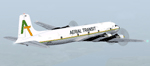
Textures for Tom Gibson's Douglas DC-6A - repainted by Manfred Meyer.
You need to download and install the latest Douglas DC-6A CB-16 base pack with model(use the model with Propspinners), sound and panel from the website calclassic.com.
These textures depict N96BL (c/n 43574) of Aerial Transit. Harold Bellomy and Charles Lawson founded 1963 the Bellomy & Lawson Company in Miami FL, buying DC-6 aircrafts an convert them to pure freighters. They run Challenge Air Transport and sold this airline 1982. Then they started 1983 a part 121 operation under the trading name "Aerial Transit" and ceased operations in 1991. The DC-6 aircrafts of aerial Transit, flying throughout the Caribbean and Central America and were often leased out to other operators of the region. N96BL was built 1952 as C-118A and delivered to the USAF as 51-3827. In 1976 bought by Bellomy & Lawson and registered as N3492F the aircraft served with Challenge AT and re-registered as N96BL from october 1983 until 1991 with Aerial Transit. Aerial Transits DC-6 always looking a little bit shabby and when flying this aircraft, keep in mind it has no pressurisation and no superchargers. So if you are forced to go above 10 000 ft take some oxygen bottles with you!
| Filename: | Aerial_Transit_DC6A__C118A.zip |
| License: | Freeware |
| Added: | 11th October 2014, 20:28:43 |
| Downloads: | 267 |
| Author: | Manfred Meyer |
| Size: | 4.23 MB |


© 2001-2026 AVSIM Online
All Rights Reserved
Privacy Policy |