
Where Flight Simulation Enthusiasts Gather from Around the World!
AVSIM Library - Search Results

| Category: Flight Simulator 2004 - AI Aircraft | |
| The 2006 Maine Military AI Aircraft and Airbases |

|
File Description:
The NorthEastern USA Military AI Aircraft and Airbase Collection Part 1: 2006 Maine Military AI Aircraft and Airbases package is the first in a series of complete Military AI packages that will cover all the currently active military aviation units in the New England states of Maine, New Hampshire, Vermont, Massachusetts, Connecticut and Rhode Island along with New York, New Jersey and Pennsylvania. This first package includes represenative AI fixed and rotary wing aircraft for all the military aviation units currently operating in the state of Maine, AFCADs for Bangor International Airport (KBGR) and Naval Air Station Brunswick (KNHZ) and novel and unique demonstration flightplans utilizing all of the above. Complete AI versions or conversions of such aircraft as the USN P-3C, USNR C-130T, USN SH-60B, USN HH-1N, ME ANG KC-135E, ME ARNG UH-60A, ME ARNG/CD RAID OH-58R, OSACOM C-12D and VT ANG F-16C (refueling flight conversion) are included. My thanks to John Young for the use of a modification of his excellent KBGR scenery version 3 and to Henry Tomkiewicz, Mike Stone, Jordan Moore, Owen Hewitt and Rok Dolonec for the use of their excellent aircraft models. This Military AI package created by Mike MacIntyre.
| Filename: | The_2006_Maine_Military_AI_Aircraft_and_Airbases.zip |
| License: | Freeware, limited distribution |
| Added: | 26th June 2006, 19:19:13 |
| Downloads: | 4,865 |
| Author: | Mike MacIntyre |
| Size: | 17.56 MB |
| Category: Flight Simulator 2004 - Scenery | |
| Georgetown Q61 California Scenery |
|
File Description:
This is a scenery upgrade for Georgetown Airport, California (Q61). This is part Six of a series of small airstrip and minor airfield scenery enhancements which are based on real world data from Google Earth.
Changes to the default include surrounding landclass changed to mixed forest to match better the realworld, new airfield polygon to match shape and earth colours. The hangers I added had a mix of open door and closed door models, but for some odd reason they are all showing as closed, maybe it's just my system or some glitch, let me know if you get open doors!
I also added the usual extras which are of course artistic license!
Note that there are two exclude files, that is because I forgot to save data with one and new excludes needed another file making, sorry for the clutter!
| Filename: | Georgetown_Q61_California_Scenery.zip |
| License: | Freeware |
| Added: | 26th March 2006, 17:40:05 |
| Downloads: | 576 |
| Author: | Kim Gowney |
| Size: | 349.98 KB |
| Category: Flight Simulator X - Scenery | |
| KDAY - Dayton International Airport - Vandalia, Ohio |
|
Images related to this file:
File Description:
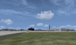
The Dayton International Airport, located 11 miles north of Dayton in Vandalia, Ohio, is a medium sized commercial airport serving nearly three million passengers annually with daily nonstop service to about twenty destinations.
This scenery includes a custom terminal building, moving jetways, and an AFX file with accurate parking assignments. Also modeled is the new air traffic control tower, terminal parking garage, the Fed Ex building, the PSA Airlines headquarters and maintenance hanger, the former Emery Worldwide cargo sort facility, the airport hotel, and hangers for fixed base operators Stevens Aviation and Wright Brothers Aero.
More than a thousand objects have been added to enhance detail around the airport using Flight 1's excellent instant scenery program. AI Traffic has been tested to ensure efficient flow. The landclass file has also been adjusted to better reflect the real airport.
| Filename: | KDAY__Dayton_International_Airport__Vandalia_Ohio.zip |
| License: | Freeware |
| Added: | 2nd December 2012, 22:32:37 |
| Downloads: | 1,571 |
| Author: | Matt Parr |
| Size: | 5.78 MB |
| Category: Flight Simulator 2004 - Scenery | |
| Himalayan Peaks Volume 2 - Mt. Everest photoreal textures |
|
File Description:
The photoreal textures in this package cover an area of about 100km (E/W) by 60km (N/S) featuring Mt. Everest and several neighboring peaks and are based on a Landsat 7 ETM 15-m multispectral image taken in October 2000. The relatively low resolution of the image makes for pretty grainy textures up close and I did not add any autogen, seasonal textures, or flattened water bodies. Nevertheless, I do believe the photoreal textures do a much better job at showing the grandiose alpine features of this area - rock faces, snow fields, glaciers, and bare ground - than generic landclass textures possibly can. The textures are placed for a best fit with our Mt. Everest area LOD10 terrain mesh, fs_him_01.zip, but probably work OK with the default LOD8 mesh of this area or third-party terrain mesh files.
| Filename: | Himalayan_Peaks_Volume_2__Mt_Everest_photoreal_tex.zip |
| License: | Freeware |
| Added: | 10th March 2010, 22:27:43 |
| Downloads: | 25,497 |
| Author: | Holger Sandmann |
| Size: | 75.71 MB |
| Category: Flight Simulator 2004 - Scenery | |
| Colorado Lakes Project III |
|
File Description:
This project features the lakes of Southwest Colorado, replaces the default Navajo Lake on the Colorado-New Mexico border, and adds over 300 highly detailed lakes to Colorado. They fit seamlessly with my "Colorado Lakes Project II" (colorado_lakes_project_2.zip) and "Colorado Lakes Project I" (colorado_lakes_project_1.zip) lakes. The original "Colorado Lakes Project I" is recommended to complete this package, as it contains McPhee, Lemon, and Vallecito Reservoirs.
These lakes are specifically designed to show off their photo realistic detail when used in combination with "FSGenesis-The Rockies 38.2m Terrain Mesh-Colorado" available as "fsg_dem38m_usrk_co.zip" at avsim.com, or comparable mesh. The free FSGenesis US National Landclass Project Beta 6 also adds beautifully to the landscape. These lakes work equally as well with the default mesh.
All lake information was projected from satellite imagery and compiled with a beta version of Jim Keir's "Slartibartfast" utility.
| Filename: | Colorado_Lakes_Project_III.zip |
| License: | Freeware |
| Added: | 3rd June 2004, 21:54:46 |
| Downloads: | 5,017 |
| Author: | Carlyle Sharpe |
| Size: | 444 KB |
| Category: Flight Simulator 2004 - Scenery | |
| The Victoria Falls of the Zambezi River, Zambia/Zimbabwe |
|
File Description:
One of the main landmarks of Africa, the spectacular Victoria Falls of the Zambezi River are missing in out-of-the-box FS. With a local SRTM LOD9 mesh as a base (included) and the help of satellite imagery, maps, Ground2K4, and GMax, we did our best to model a realistic representation of the falls, the river, and the gorge, complete with custom waterfall and spray effects. The portion of the Zambezi covered in this project extends from E25 to E26.5 (more than 100km), with the falls at its center. Also included is a replacement landclass file for an area of about 20km on either side of the Zambezi River and an optional AI boat (by Lynn and Bill Lyons) cruising on the Zambezi above the falls. Tested with FS2004 only but most scenery enhancements (not the AI boat) should work just as well in FS2002.
| Filename: | The_Victoria_Falls_of_the_Zambezi_River_ZambiaZimb.zip |
| License: | Freeware, limited distribution |
| Added: | 8th May 2004, 02:45:30 |
| Downloads: | 19,150 |
| Author: | Holger Sandmann and Johan van Wyk, Aeroworx |
| Size: | 3.5 MB |
| Category: Flight Simulator X - Scenery | |
| Corpus Christi Intl Aiport, TX (KCRP) |
|
Images related to this file:
File Description:
Corpus Christi, Texas, located on the Gulf of Mexico is a major aviation center with Naval Aviation headquartered here and home to an Army major depot that supports all tri-service rotor wing aircraft. While these activities are based in and around the town there is significant transient military traffic at KCRP along side commercial carrier service by AAL, SWA and UAL to KDFW, KHOU and KIAH. The airport has just completed a major upgrade to both runways (renumbered from default FSX/P3D scenery) and all taxi surfaces. This scenery was constructed with ADEv1.70 targeted for P3D; however, it works as well in FSX. All runway and ILS data has been 'as-built' in accordance with FAA NASD data with extensive use of hand-placed ground polys for taxi markings. I have omitted surrounding landclass modifications for a best fit with Orbx FTX Global OpenLC North America product.
| Filename: | Corpus_Christi_Intl_Aiport_TX_KCRP.zip |
| License: | Freeware |
| Added: | 31st October 2016, 00:39:10 |
| Downloads: | 1,525 |
| Author: | Dan Downs |
| Size: | 674.06 KB |
| Category: Flight Simulator X - Scenery | |
| Punta Gorda, FL- Charlotte County Airport (KPGD) |
|
Images related to this file:
File Description:
What appears to be a nearly "dead" airport in FSX is brought to life with scenery objects and air traffic. Generic floating buildings have been replaced with custom and library objects. Landclass changes, roads, rework of runways, taxiways and aprons, placement of library objects and a library of new airport buildings are included. Scenery in this package is based on Virtual Earth (Bing) and Google Earth imagery.
Even though the airport doesn't have a control tower and no gate parking is included in FSX, it does have a terminal and airline traffic in real life. Also, no GA traffic has been observed in FSX other than an occasional aircraft doing a couple of touch-and-gos and moving on. The World of AI traffic file for Allegiant Airlines does not include flights to this airport, so a traffic file is included adding the Allegiant flights as well as some GA flights. The World of AI package is required for the airline flights to display.
| Filename: | Punta_Gorda_FL_Charlotte_County_Airport_KPGD.zip |
| License: | Freeware |
| Added: | 3rd January 2011, 03:06:31 |
| Downloads: | 1,718 |
| Author: | Art Poole |
| Size: | 1.47 MB |
| Category: Flight Simulator X - Scenery | |
| SCIP - Isla de Pascua & Mataveri Intl - Easter Island |
|
Images related to this file:
File Description:
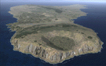
This project rebuilds Easter Island / Isla de Pascua. Mataveri Intl (SCIP) is completely overhauled, and all airport objects are aligned from satellite imagery. Landclass polygons and coastlines were meticulously hand-drawn directly from satellite imagery to provide the most detailed and accurate scenery available for this region. AI road and boat traffic is activated for the region. Accurate coastlines and road data, as well as corrected land and waterclass are provided based on the latest available satellite imagery. GA flights use default aircraft and include an option to add Chilean Air Force planes around the island. Numerous Moai (Easter Island heads) have been placed around the island according to satellite imagery. Scenery was created using Airport Design Editor X v1.61.5298, SBuilderX 3.13, and the FSX Object Placement Tool. Scenery objects were added and modified from stock FSX scenery to resemble as closely as possible the actual airports. The FSX apron lights included are from the terrific set created by Jim Dhaenens.
| Filename: | SCIP__Isla_de_Pascua__Mataveri_Intl___Easter_Islan.zip |
| License: | Freeware |
| Added: | 12th July 2014, 08:17:55 |
| Downloads: | 5,734 |
| Author: | Carlyle Sharpe |
| Size: | 5.33 MB |
| Category: Combat Flight Simulator 1 and 2 - Aircraft | |
| F4U-1D (2) VMF-351 #FF59 and VF-84 #184 Texture and Damage Files (Update) |
|
File Description:
F4U-1D (2) VMF-351 #FF59 and VF-84 #184 Texture and Damage files for upper side of starboard wing. The squadron markings were omitted. These updates are for revev's repaints for DBolt's model. Sorry for the inconvenience. Enjoy!
| Filename: | F4U1D_2_VMF351_FF59_and_VF84_184_Texture_and_Damag.zip |
| License: | Freeware |
| Added: | 3rd June 2006, 05:41:46 |
| Downloads: | 43 |
| Author: | Evan G. Butterbrodt |
| Size: | 1011.56 KB |


© 2001-2026 AVSIM Online
All Rights Reserved
Privacy Policy |