
Where Flight Simulation Enthusiasts Gather from Around the World!
AVSIM Library - Search Results

| Category: Flight Simulator 2004 - Scenery | |
| New York City Default Bridges and Objects v2.0 |

|
File Description:
I originally planned on "fixing" the George Washington Bridge, which was inadvertantly "sunk" by FSG's 38m mesh, and ended up repositioning and scaling a whole bunch of other default bridges and objects within about 50 miles of NYC. This addon was designed and tested for use with FS 9.1, FSG 38m mesh (available here at AVSIM), and Freeflow NE, UT/USA and USA Roads. It should also work with other road and water packages. I did not create any new scenery, I only repositioned default objects to their correct locations.
This should be the final version for a while. This version was tested with and adds compatibility for Megascenery NY and Aerosoft's Manhattan scenery. I also removed a few more objects that were placed in the water, and moved back to land a bunch of cranes around KEWR that were in the water.
Fixed stuff: All inappropriately placed NYC and Newark bridges (major, not autogen) up to Bear Mountain in the north and south to about the Verrazanno; Belmont Racing track; Shea Stadium; Meadowlands Stadium; World's Fair Tower; US Open Stadium. Added Meadowlands Race track and a few bridges around Newark, moved cranes around KEWR back to land, removed several objects in the water.
| Filename: | New_York_City_Default_Bridges_and_Objects_v20.zip |
| License: | Freeware |
| Added: | 10th November 2005, 16:48:46 |
| Downloads: | 6,556 |
| Author: | Thomas Perry |
| Size: | 558.69 KB |
| Category: X-Plane - Scenery | |
| BR AM SWMK - Maturaca Airfield v1.0.0 |
|
Images related to this file:
File Description:
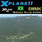
This is an X-Plane 11 and X-Plane 10 scenery package for Maturaca Airport (ICAO: SWMK, no IATA code) which is an airport serving Maturaca village, in São Gabriel da Cachoeira, Amazonas, Brazil, located in the vicinity of "Pico da Neblina" (Peak of the Haze, in English), the highest mountain in Brazil, 2,995.3 metres (9,827 ft) above sea level, in the Serra da Neblina, part of the Serra do Imeri, a section of the Guiana Highlands on the Brazil–Venezuela border, in the middle of the Amazon rainforest. It includes corrected aprons, ramps, gates, taxiways, lighting system, village buildings, ortho-photoscenery for the airfield area, and (XP11 only) airport ground services (like push back). This scenery was tested and is operational (as of April 14, 2017) in "X-Plane 11.00 RC #1 64 bit", Windows 10 Home. It was also tested and is also operational (as of April 14, 2017) in "X-Plane 10.51 64 bit", Windows 10 Home. Only the default X-Plane 11 libraries, by Laminar Research, are needed. No third party libraries are used.
A few extra objects are used and included in the package, thanks to artist Paulmort (Hangar 24, Hangar House, Ranch House, Deluxe Log Cabin, Hangar Barn) and to artist Capnsully (Grow Grass for Xplane). They are included in the package, no need to download them.
| Filename: | BR_AM_SWMK__Maturaca_Airfield_v100.zip |
| License: | Freeware |
| Added: | 15th April 2017, 06:23:29 |
| Downloads: | 132 |
| Author: | Rui Mesquita |
| Size: | 35.57 MB |
| Category: Flight Simulator 2004 - Scenery | |
| Mackenzie CYZY in British Columbia, Canada |
|
Images related to this file:
File Description:
Mackenzie is around 120 miles west of Peace River and the BC/Alberta border, at the southern end of Williston Lake. The lake is 135 miles long and the population of the town is about 3,500; those figures illustrate typical Canada, a huge area enjoyed by the few. The main occupations relate to timber and mining in some form, plus tourism (in particular winter sports tourism). The airport is 2 miles southwest of the town, with no regular scheduled flights but it is not unusual to find Central Mountain Air there delivering either charter passengers or freight. The single runway is aligned 16-34 and 100 feet wide lit asphalt that is just over 5,000 feet long, with (in 2010 or so) an additional 1,500 feet of gravel. There is PAPI at both ends of the asphalt. The largest operation based at the airfield is a helicopter company, at the northern end of the apron. There is a "mandatory frequency" of 123.5 which is a Canadian invention; you MUST have a radio. There is no control tower at the actual airfield, and if or when there is no response from further afield then you announce your intentions etc. In FS9 there is no way to "switch off or on" the monitoring of a MF radio frequency so you will find that this one is always silent.
| Filename: | Mackenzie_CYZY_in_British_Columbia_Canada.zip |
| License: | Freeware, limited distribution |
| Added: | 27th December 2018, 20:19:05 |
| Downloads: | 131 |
| Author: | Roger Wensley |
| Size: | 19.81 MB |
| Category: Flight Simulator 2004 - Flight Plans | |
| Crossing North America Flight Adventures-Package 3 |
|
File Description:
Inspired by Michael Doherty (Difficult & Dangerous Approaches) and David Dossiere (Hopping Round the World) and their flight adventures, I have put together a series of flight plan-adventures where the aircraft used are all available as freeware. A file locator is included with each package so that you can easily find and download the aircraft used. These packages each contain 10 flight adventures and each package begins at the location the previous package ended. All flightplans are VFR only and are designed so that you can enjoy the outstanding scenery of Alaska, Western Canada, Western and Mountain States of the lower 48, and Mexico.
The adventure, Crossing North America, begins at Pt Hope, Alaska and will conclude in the following months at Cancun, Mexico. The aircraft used are: General Aviation, Vintage, Warbirds, Bush Aircraft, and Propliners. No IFR flightplans or jets!
The flightplans are NOT designed to get you from Alaska to Mexico by the shortest route possible, but are in the spirit of David Dossiere's "Hopping Round the World" adventure flights, in that they take you into as many areas or airports as possible. Looking for some fun, flying low, and enjoying the scenery, then these flight adventures are for you.
Todate: 3,769 miles covered, using 26 different aircraft in the first 3 flight packs!
| Filename: | Crossing_North_America_Flight_AdventuresPackage_3.zip |
| License: | Freeware |
| Added: | 6th July 2004, 14:46:46 |
| Downloads: | 4,072 |
| Author: | Steve (Bear) Cartwright |
| Size: | 1.37 MB |
| Category: Flight Simulator X - Missions | |
| SAR...Bimbo, Zula, Dobo |
|
File Description:
Russian Circus " Flying Sagitarius" (ïîëåò Sagitarious ) is visiting
Georgia and its mountain communities. Due to the cold weather, not expected by Yokoliv Burulov,
owner and trapeze swinger of the circus, three of his "stars" had to be taken by truck to a hospital since
their bowels have suffered " Dirruscus-Megra" a common cold water desease in the mountains. The three
ill "stars" are the Elephant "Bimbo"--"Zula" the laughfing Zebra and "Dobo" the great Dansing Russian Brown Bear...
Together these animals are worth around 75,000 Rubles in the Circus Markets.----Now Yokoliv has received
a call that the truck had an accident on the road and the three characters have run into the mountains. Not
wasting time he has asked the nearby Air Force Base for help. General Gustrgy Bonklovsky commander of the base and circus lover, has agreed to provide him with a SAR helicopter that will search the area and find at all cost the Animals....You are called to be the pilot for the mission at hand. Its cold, muggy and for the last three days fog has been lingering all over the mountains.---"this is the life pilot" says General Bonklovsky , as he hands you the search area map with a sardonic smile. You smell the presence of resently drunk Vodka and leave the hut toward the spinning Chopper.---Download MI-8 Helicopter for Mission
| Filename: | SARBimbo_Zula_Dobo.zip |
| License: | Freeware, limited distribution |
| Added: | 28th April 2008, 04:29:52 |
| Downloads: | 1,166 |
| Author: | Gera Godoy Canova |
| Size: | 5.96 MB |
| Category: Flight Simulator 2004 - Scenery | |
| Denver (KDEN), Colorado, Photo-Scenery |
|
Images related to this file:
File Description:

Denver (KDEN), Colorado, Photo-Scenery for FS9 & FSX.
This package covers Denver, the capital of Colorado which is also nicknamed Mile-High City because its elevation is one mile (5.280 ft). The sixth RW (16R/34L) of Denver Int'l. Airport (KDEN) is the longest commercial RW in the US with a length of 16.000ft. This allows fully loaded B747's to take off in Denvers mile-high altitude during hot summer days, when density altitudes can approach 9.000(!) ft.
KDEN is a major hub for United Airlines and the headquarters for Frontier Airlines. The airports distinctive white tent-like fabric roof is designed to be reminiscent of the snow-covered peaks of the Rocky Mountains which you can see on approach or departure.
Other important airports covered by this region are Centennial Airport (KAPA), Buckley AFB (KBKF) and Rocky Mountain Metropolitan Airport (KBJC). Extends my Mt.Evans/Georgetown package to the east and provides another 3.500 sq km in 4.7m/pix quality.
High resolution versions for FS9 and FSX (much sharper, but larger and multiple downloads) are available at www.blueskyscenery.com/GNB_SouthEast.html
. The screenies are taken from the high-res versions, so expect this version to be slightly more blurry. YourDonation@Work: Dedicated to Mark and Charles. Thanks!
| Filename: | Denver_KDEN_Colorado_PhotoScenery.zip |
| License: | Freeware, limited distribution |
| Added: | 31st October 2009, 11:24:39 |
| Downloads: | 7,274 |
| Author: | Gottfried Razek, blueskyscenery.com |
| Size: | 95.21 MB |
| Category: Flight Simulator 2004 - Scenery | |
| Sulphur Creek Ranch ID74 private airfield in Idaho USA |
|
Images related to this file:
File Description:
This airfield is in the mountains of Idaho, around 30 miles south of Johnson Creek 3U2 which was the third in the series to be posted. Sulphur Creek Ranch is a privately owned airfield, serving the "Ranch", which translates into "restaurant-bar-lodge-and-holiday-cabins". The field is at 5,744 feet ASL, and the runway is 2,920 feet long and aligned 10-28. It is a single-ended runway, with 28 used for landing and 10 for take offs; this is down to a large chunk of mountain occupying the sky at the western end of the runway. The AI planes comply with this single runway concept and the only snag is that you cannot announce a landing as there is no runway offered for you to select for landing in the AI procedure. When taking off runway 10 is offered and you can announce take off. The land used by the ranch is mostly flat, and with a slant approach on finals and a late turn it is fairly straightforward. The largest landark is the man-made lake. Morgan Ranch 02ID is nearby and the grass area has been modified down in size as per reality. The buildings have been omitted as they are not adjacent to the runway and not visible, and I have no information on them.
| Filename: | Sulphur_Creek_Ranch_ID74_private_airfield_in_Idaho.zip |
| License: | Freeware, limited distribution |
| Added: | 25th May 2017, 17:54:33 |
| Downloads: | 164 |
| Author: | Roger Wensley |
| Size: | 6.21 MB |
| Category: Flight Simulator 2004 - Scenery | |
| Jerusalem |
|
File Description:
FS2004 Scenery - Jerusalem. The third part of Israel
scenery covering the mountain range of Samaria, Judea
and the cities of Jerusalem and Bethlehem. The scenery
is made in the highest detail with new terrain textures
and it shows all main roads, secondary roads, junctions,
rail roads, vegetation and residential areas with a
population of 1,000 and above. The scenery is enhanced
with over 300 structures and buildings made in Gmax.
Among them the Old City of Jerusalem with its walls and
gates, Mount Temple, the Wailling Wall, the city Citadel,
the Holy Sepulchre and all other major churches and
monasteries of Jerusalem, including the Church of
Nativity in Bethlehem and the churches on Mount Olive
and Mount Zion. The scenery also covers in high detail
the New City of Jerusalem, with all landmark structures
and buildings such as the Knesset (Israel's parliament),
museums, the Supreme Court, Yad-Vashem (the holocaust
memorial), Hadasa hospital, Teddi soccer stadium, all
hotels and highrise buildings and much more. There are
also landmarks outside Jerusalem such as the Latrun
Trappist monastery and the nearby Armor Corps Memorial.
All major structures are based on real measurements and
photos taken from the ground. The textures are all
specially made for this scenery. The scenery is enhanced
with night lighting to enable easy VFR navigation by
night.
| Filename: | Jerusalem.zip |
| License: | Freeware |
| Added: | 15th April 2004, 15:39:12 |
| Downloads: | 20,043 |
| Author: | Seev Kahn |
| Size: | 4.49 MB |
| Category: Flight Simulator X - Scenery | |
| YMDN Merredin, Western Australia, Town and Airfield |
|
File Description:
YMDN Merredin Town and Airfield - includes townsite landclass. Merredin, a town better known for its wheat and sheep exports. But for almost a decade, it's where one of Asia's busiest carriers, China Southern Airlines, has been sending its trainee pilots to learn how to fly. "They come from a country with a population of more than a billion people. Right now they live in Merredin - population, depending on who's visiting, around 2,000. For nine years now, they and hundreds like them have travelled to WA's empty, sprawling Wheatbelt to learn how to fly. The middle of the Wheatbelt is not the first place you'd look for the future of Chinese commercial aviation. But before these fledgling flyers can spread their wings with China's largest airline, they must pass six months of boot camp in Merredin. Most of them are from China's southern provinces. Their backgrounds are varied. For many of them, it's the first time that they've operated some form of machinery, which includes those students that haven't even had an exposure to driving a motor car. It's early days in their careers. The students are putting in the groundwork. First, mastering the art of piloting single-engine two-seater planes. It's all preparation for the Boeings and airbuses they'll eventually be flying on major international routes. The pressure is intense. Every aspect of the student's progress is measured. Failure can have serious implications for their hopes of becoming commercial pilots. It's part theory and part practical. But flying isn't the only thing that these young men have to get used to in Merredin. For one, there's the incredibly slow pace of country life. Merredin Shire sold the defunct airport for $1 - that's cheaper than a bag of lollies. The locals say the monetary sweetener has paid off." (From ABC transcript) REQUIRES Blencowe_LibraryKit.zip
REQUIRES blencowe_librarykit_309494.zip (Available HERE)
| Filename: | YMDN_Merredin_Western_Australia_Town_and_Airfield.zip |
| License: | Freeware |
| Added: | 28th February 2013, 13:56:12 |
| Downloads: | 281 |
| Author: | Alan Blencowe |
| Size: | 4.56 MB |
| Category: Flight Simulator 2004 - Miscellaneous Files | |
| Active Approach - LOWI (Innsbruck, Austria) |
|
File Description:
As most know the Approach and Final (VMC) for AI Traffic in FS9 is a straight in type landing and does not always consider high terrain at airports. This is do to the way that the coding is written in FS9 and it puts limits on IFR arriving aircraft. If you open runways at certain airports the AI Traffic will fly directly through a mountain once it is established on Final for a runway. What you will see with my file is a different type approach used for the way I control AI Traffic in FS9. No longer do the AI Planes use a straight in approach when landing at LOWI. My new AI Aircraft Approach coding for FS9 now uses a base leg approach so AI Traffic does not fly through the mountains. The Innsbruck Control Tower will clear all AI Traffic (IFR FP) landing either on 08 and 26 as a straight in landing even though the offset to final is 30 degrees from the runway center line. My testing shows excellent behavior of the FS9 default models, PAI models and the Aardvark planes of all sizes to execute this new type of visual approach. Read the text file for all the default enhancements added to LOWI along with a full understanding of how the new Approaches work *** Full set of Approach Charts included plus a FS2004 Default Scenery AFCAD ***
| Filename: | Active_Approach__LOWI_Innsbruck_Austria.zip |
| License: | Freeware, limited distribution |
| Added: | 10th April 2005, 05:16:39 |
| Downloads: | 9,146 |
| Author: | Jim Vile |
| Size: | 800.49 KB |
© 2001-2026 AVSIM Online
All Rights Reserved
Privacy Policy |