
Where Flight Simulation Enthusiasts Gather from Around the World!
AVSIM Library - Search Results

| Category: Flight Simulator X - Aircraft Repaints, Textures and Modifications | |
| Aerosoft F-16 Performance & Handling Upgrade - VIPER 2.0 Package |

|
Images related to this file:
File Description:
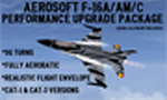
This is a performance upgrade package for the payware Aerosoft F-16 (NOT the version available through Steam!). Aerosoft made an awesome-looking airplane with realistic cockpit details, cool g-vapor effects, but the way it flew was...well, not so great...until NOW. With this "VIPER 2.0" upgrade, your Aerosoft F-16 will fly like the REAL THING! 9g turns, 8-Point Rolls, Double Immelmans, Cuban-8's, etc, etc, etc. Cue up your favorite F-16 demo on YouTube and follow along! Or, head out to your favorite mountain region and enjoy zooming through the canyons at 500 feet and 500kts! (the Alps north of Aviano AB are awesome fun!). After this upgrade your Aerosoft F-16 will be one fun-to-fly flight sim jet!
**For those of you who downloaded and installed my first "VIPER Upgrade" about two years ago, the improvements in this version are...
Adjusted Rudder/Nose Wheel steering sensitivity for a softer, more realistic "feel" while taxiing & flying.
Ailerons have a "smoother/softer touch" for those tiny adjustments made on final approach
Adjusted drag factors on spoilers, flaps and gear to get optimal final approach AOA, airspeed and better "throttle authority".
| Filename: | Aerosoft_F16_Performance__Handling_Upgrade__VIPER_.zip |
| License: | Freeware |
| Added: | 22nd November 2023, 16:10:26 |
| Downloads: | 107 |
| Author: | Daniel Gregory |
| Size: | 1.03 MB |
| Category: Flight Simulator X - Scenery | |
| Active ILS, VHHX (Hong Kong Kai Tak Airport) |
|
File Description:
This FSX Airport is more then just an enhanced style Airport. As most know the Approach and Final (VMC) for AI Traffic in FSX is a straight in type landing and does not always consider real world approaches. This is due to the way that the coding is written in FSX and it puts limits on IFR arriving aircraft. At certain airports the AI Traffic will fly directly through a mountain once it is established on Final for a runway. What you will see with my files is a different type approach used for both the way I control AI and User Airplane Traffic in FSX. My AI Aircraft Approach coding system for FSX uses a visual offset approach so AI Traffic does not fly through the mountains but flys the IGS/LDA 13 approach to the Checkerboard. Try your skill flying a Large Heavy Airplane vectored by ATC onto the approach course of the IGS/LDA 13 approach to Kai Tak. Read the text file for all the enhancements added to the FSX VHHX Airport along with a full understanding of how the new Approaches work *** Full set of Freeware Approach Charts included ***
| Filename: | Active_ILS_VHHX_Hong_Kong_Kai_Tak_Airport.zip |
| License: | Freeware, limited distribution |
| Added: | 19th September 2007, 11:57:46 |
| Downloads: | 27,444 |
| Author: | Jim Vile |
| Size: | 3.61 MB |
| Category: Flight Simulator X - Scenery | |
| EDCB - Ballenstedt Airport - Sachsen-Anhalt, Germany *Version 1* |
|
Images related to this file:
File Description:
The airfield Ballenstedt is located in the eastern foothills of the €œHarz (North German low mountain range) and with twenty thousand aircraft movements per year a relatively highly frequented airport.
The scenery is designed very much in detail. All important objects have been created by me using photos of the original field. Also some clearly visible landmarks are integrated like the large photovoltaic arrangement north of the asphalt runway and the quite large pig farm “Asmusstedt†situated east of the field. An additional important point of reference for glider pilots is the so-called "Gegenstein", a narrow rock on top of the small hill south of the Gliderfield. A retouched photo background, covering all four seasons, completes the scenery.
However, many smaller Objects, like people, cars or static airplanes in this scenery were
taken from three popular freeware libraries for whose use I got the friendly permission of the
authors. If these libraries are not installed , many objects are not visible!
The following libraries are used:
--------------------------------
1. FS-Piloten_Objektlibrary: http://www.fs-piloten.de/thread.php?threadid=1063
2. FSX_FlightPortLib: http://www.flightport.de/libraries/flightport-library/
3. 3d People Library: http://library.avsim.net/download.php?DLID=192454
| Filename: | EDCB__Ballenstedt_Airport__SachsenAnhalt_Germany_V.zip |
| License: | Freeware |
| Added: | 1st May 2016, 21:00:27 |
| Downloads: | 1,366 |
| Author: | Wolfgang Allers |
| Size: | 272.19 MB |
| Category: Flight Simulator 2004 - Flight Plans | |
| Crossing North America Flight Adventures-Package 1 |
|
File Description:
Inspired by Michael Doherty (Difficult & Dangerous Approaches) and David Dossiere (Hopping Round the World) and their flight adventures, I have put together a series of flight plan-adventures where the aircraft used are all available as freeware. A file locator is included with each package so that you can easily find and download the aircraft used. These packages each contain 10 flight adventures and each package begins at the location the previous package ended.
All flightplans are VFR only and are designed so that you can enjoy the outstanding scenery of Alaska, Western Canada, Western and Mountain States of the lower 48, and Mexico.
The adventure, Crossing North America, begins at Pt Hope, Alaska and will conclude in the following months at Cancun, Mexico. The aircraft used are: General Aviation, Vintage, Warbirds, Bush Aircraft, and Propliners. No IFR flightplans or jets!
The flightplans are NOT designed to get you from Alaska to Mexico by the shortest route possible, but are in the spirit of David Dossiere's "Hopping Round the World" adventure flights, in that they take you into as many areas or airports as possible. Looking for some fun, flying low, and enjoying the scenery, then these flight adventures are for you.
| Filename: | Crossing_North_America_Flight_AdventuresPackage_1.zip |
| License: | Freeware |
| Added: | 4th July 2004, 23:01:02 |
| Downloads: | 7,150 |
| Author: | Steve (Bear) Cartwright |
| Size: | 1.03 MB |
| Category: Flight Simulator 2004 - Flight Plans | |
| Crossing North America Flight Adventures-Package 2 |
|
File Description:
Inspired by Michael Doherty (Difficult & Dangerous Approaches) and David Dossiere (Hopping Round the World) and their flight adventures, I have put together a series of flight plan-adventures where the aircraft used are all available as freeware. A file locator is included with each package so that you can easily find and download the aircraft used. These packages each contain 10 flight adventures and each package begins at the location the previous package ended. All flightplans are VFR only and are designed so that you can enjoy the outstanding scenery of Alaska, Western Canada, Western and Mountain States of the lower 48, and Mexico.
The adventure, Crossing North America, begins at Pt Hope, Alaska and will conclude in the following months at Cancun, Mexico. The aircraft used are: General Aviation, Vintage, Warbirds, Bush Aircraft, and Propliners. No IFR flightplans or jets!
The flightplans are NOT designed to get you from Alaska to Mexico by the shortest route possible, but are in the spirit of David Dossiere's "Hopping Round the World" adventure flights, in that they take you into as many areas or airports as possible. Looking for some fun, flying low, and enjoying the scenery, then these flight adventures are for you.
| Filename: | Crossing_North_America_Flight_AdventuresPackage_2.zip |
| License: | Freeware |
| Added: | 4th July 2004, 23:01:15 |
| Downloads: | 5,324 |
| Author: | Steve (Bear) Cartwright |
| Size: | 1.2 MB |
| Category: X-Plane - Original Aircraft | |
| GlassWing: the Visible Biplane (Xp v7.62) |
|
File Description:
Welcome to GlassWing, the most detailed aircraft yet made for X-Plane. It represents a new generation of Xp planes: aircraft modeled mostly outside of PlaneMaker.
GlassWing is a four place, all metal sport biplane made for mountain flying. It offers superb climb rates, very short field capabilities and a high service ceiling. With its transparent skin, every major aircraft component is visible: spars, ribs, hinges and more. Right down to the spark plugs. It is a good visual tool for any flight school. It also shows the relationship between power and trim.
GlassWing can haul almost 700 pounds into remote regions, for scenic and challenging flights. With its 300 horsepower V8 engine, it climbs like a homesick angel and can turn on a dime. Comes with Greg Hofer's Garmin AVD 55 GPS plug in (PC only) for easy navigation. GlassWing is an excellent barnstormer, ribbon cutter, hangar and Tower buzzer.
Join Doug and Allison with their husky dog Sitka, on a weekend camping flight into the hills. Try some real flying: in the mountains, not over them. Land where no one has landed before. A good system with 128 VRAM is recommended for smooth flights. Fly the GlassWing today ! VISIT THE SCREENSHOT GALLERY AT: http://www.x-plane.org/home/xplanechris/GlassWing/Gallery/GlassWingGallery.html
| Filename: | GlassWing_the_Visible_Biplane_Xp_v762.zip |
| License: | Freeware |
| Added: | 8th January 2005, 05:45:33 |
| Downloads: | 387 |
| Author: | Christopher Coggon |
| Size: | 2.63 MB |
| Category: Flight Simulator 2004 - Scenery | |
| Farallon Island Chain, Version 4 |
|
File Description:
Beta version 4: Combines North, Middle, and Southeast Farallon Islands into one download. Lighthouse added to Southeast Farallon Island along with the water catchment pad (also serves as helipad). These islands were mysteriously absent from the FS2004 default scenery, probably owing to their small size. When I went to look for them I found a small mountain of water instead of the islands. Most people don't seem to be aware of the Farallon Islands. Located off the coast of California, near San Francisco, they are home to thousands of birds, seals, and some of the largest Great White sharks known to man. All of this is within a very short distance of the city. Today, it is a wildlife refuge and is off limits to visitation by the general public. Those of you interested in more info might check out "The Devil's Teeth" by Susan Casey. These islands were created as scenery objects instead of traditional terrain in order to preserve detail. The terrace on the Southeast Farallon Island is landable now but the terrain is pretty rough. If you're in Timberwolf Aviation and you're doing the multiplayer session on 03/26/2006, this is the version you should get.
| Filename: | Farallon_Island_Chain_Version_4.zip |
| License: | Freeware, limited distribution |
| Added: | 26th March 2006, 21:32:24 |
| Downloads: | 1,834 |
| Author: | Glen Gordon (Prof K.) |
| Size: | 1.51 MB |
| Category: Flight Simulator X - Flight Plans | |
| Wrong Way Charlie |
|
File Description:
Charlie Hungsfinger Took off from KaraKose in Eastern Turkey in his
Yellow Piper Cub happy to fly his 87 take off in his Eastern Europe
VFR tour.After a great 400 ft high, mountain hopping flight he desided to land in
a little town he saw at his 3 O´clock to get some water something to eat and
directions for he knew he was lost. He called the tower at Karakose and told them of his intentions.
Two hours later Charlie was behind bars in an Iranian Army base....With a possible
International Incident about to happen!!!!!!
-----
A special Forces Team based in the Turkish Air Force Base of Van has been ordered
to get Charlie out of his prison as soon as possible...No
need for an Internatinal Incident due to Charlie´s "wrong way tour"!!!...
The Mission calls for an air drop near the army base, there will be 6 Special forces
dudes and their STALWART!!..Charlie, if gotten out will be driven back to the
border since it is to dangerous to land a plane at the Iranian Base!!! or near it.. No Way!!!
A very dangerous mission indeed!...on Four engines, a Stealth Fighter, 8 Wheels and tough boots!!!
| Filename: | Wrong_Way_Charlie.zip |
| License: | Freeware, limited distribution |
| Added: | 29th August 2007, 03:27:22 |
| Downloads: | 700 |
| Author: | Gera Godoy C |
| Size: | 298.66 KB |
| Category: Flight Simulator X - AFCAD Files | |
| Active ILS Innsbruck, Austria (LOWI) |
|
File Description:
This FSX Airport is more then just a AFX style Airport. As most know the Approach and Final (VMC) for AI Traffic in FSX is a straight in type landing and does not always consider high terrain at airports. This is due to the way that the coding is written in FSX and it puts limits on IFR arriving aircraft. At certain airports the AI Traffic will fly directly through a mountain once it is established on Final for a runway. What you will see with my files is a different type approach used for both the way I control AI and User Airplane Traffic in FSX. No longer do the AI Planes use a straight in approach when landing at LOWI. My AI Aircraft Approach coding for FSX uses a visual offset approach so AI Traffic does not fly through the mountains. The Innsbruck Control Tower will clear all AI Traffic (IFR FP) landing either on RWY 08 or 26 as a straight in landing even though the offset to final is 30 degrees from the runway center line. Read the text file for all the enhancements added to the FSX LOWI Airport along with a full understanding of how the new Approaches work *** Full set of Freeware Approach Charts included ***
| Filename: | Active_ILS_Innsbruck_Austria_LOWI.zip |
| License: | Freeware, limited distribution |
| Added: | 21st July 2007, 13:04:43 |
| Downloads: | 6,072 |
| Author: | Jim Vile |
| Size: | 799.84 KB |
| Category: Flight Simulator 2004 - Scenery | |
| Watson Lake CYQH and CEJ9 in the Yukon Territories, Canada |
|
Images related to this file:
File Description:
Watson Lake is at 2,200 feet asl on the east side of the Rockies, in the Yukon Territories. The town is less than five miles north of the border with BC and is built around Wye Lake, just a few miles southeast of the much larger Watson Lake. Whitehorse is some 200 miles to the west, and Fort Nelson 220 miles to the east. The airport was built during WW2 and there remains one surviving original hangar, along with later additions. Unusually, the town of Watson Lake came into being because of the airport's existence, though with the closure of one mine that the airport used to serve and the serial closure of another (closed four times?) both the airport and the town (population 500) are in a downward spiral. The airport is 5 miles to the west of the town. There were two runways, but one is now closed and the remaining one is 08-26, 5,500 feet and 150 feet wide. There are two aprons, the northern one being half-used by CL 415 fire-fighting planes (included in the AI, along with Central Mountain Air). All the buildings for CYQH are modeled specifically, but the CJE9 shed is a guess.
| Filename: | Watson_Lake_CYQH_and_CEJ9_in_the_Yukon_Territories.zip |
| License: | Freeware, limited distribution |
| Added: | 14th July 2014, 21:38:57 |
| Downloads: | 443 |
| Author: | Roger Wensley |
| Size: | 17.6 MB |
© 2001-2026 AVSIM Online
All Rights Reserved
Privacy Policy |