
Where Flight Simulation Enthusiasts Gather from Around the World!
AVSIM Library - Search Results

| Category: Flight Simulator 2004 - Scenery | |
| Brevoort CWOB and BAF-3 radar plus Cartwright LAB-6 radar Canada |

|
Images related to this file:
File Description:
Brevoort airstrip and the BAF-3 radar it serves is on Brevoort Island, off one of the southeastern tips of Baffin Island and 140 miles east of Iqaluit. This scenery includes the BAF-3 buildings on the hilltop and those on the airstrip below, plus the roads connecting them and down to the beach landing area on the rocky coast. This scenery is made for the FSGenesis 76m terrain mesh for northern Canada, and there will be a repost of all my northern Canada airfields to suit this; I cannot think now why I never installed this mesh before. The AI reflects the use of civil airlines for resupply and transportation of personnel. Given the terrain the wind should be from the north so that ai lands using the 02 runway. Landing from the north will involve a terrain clash while take off towards the north will not as the climb out clears the hilltop. The video shows the 600 foot cliff at the runway threshold and an Air Tindi plane on the apron. Cartwright CYCA is on the Labrador coast and has been posted by Flight Ontario as part of their Goose Bay and Labrador Regional Airports sceneries. The nearby LAB-6 radar site is included here, connected to CYCA by an extended road. The site uses the same buildings as Brevoort and Saglek (posted recently) and although I have included them here as separate sceneries the contents can be placed in the same folders as Saglek with a saving in duplicated textures. The textures here are more accurate than Saglek so say yes to over-write; a downloader with personal experience of Brevoort noted that in reality they are lighter.
| Filename: | Brevoort_CWOB_and_BAF3_radar_plus_Cartwright_LAB6_.zip |
| License: | Freeware, limited distribution |
| Added: | 20th August 2017, 15:46:36 |
| Downloads: | 175 |
| Author: | Roger Wensley |
| Size: | 4.37 MB |
| Category: Flight Simulator X - Scenery | |
| Tonopah - KTPH |
|
File Description:
This file contains several BGL's which enhance the default FSX Tonopah, Nevada airport (KTPH).
Additional parking, scenery objects, and roads are added to the bland stock airport.
The "mesa" created by the stock airport backgound flatten is blended into the
surrounding terrain using "sloped flattens".
This scenery is not intended to re-create a perfect match to the real world but
to enhance the visual experience of flying into and out of the airport.
The files were tested with FSX-Acceleration\SP2 on WinXP Pro, DX9.
I used 10M mesh from the "FSX Usa 10 M terrains Project" when blending
the altitude data but the files should provide good results with the default FSX terrain.
| Filename: | Tonopah__KTPH.zip |
| License: | Freeware |
| Added: | 21st December 2007, 04:29:50 |
| Downloads: | 1,171 |
| Author: | Paul Strogen |
| Size: | 812.46 KB |
| Category: Flight Simulator X - Aircraft Repaints, Textures and Modifications | |
| Middle East Airlines "Sharklets" Airbus A320-232 (T7-MRF) |
|
Images related to this file:
File Description:

This is an Airbus A320 Iae of Middle East Airlines with sharklets. Registration: T7-MRF, Repaint by: Torsten Märtke, for Project Airbus A320-214, textures only! Repaint in 32bit. Works with FSX and FS9 --- enjoy :-)
| Filename: | Middle_East_Airlines_Sharklets_Airbus_A320232_T7MR.zip |
| License: | Freeware |
| Added: | 18th February 2017, 19:12:16 |
| Downloads: | 703 |
| Author: | Torsten Märtke |
| Size: | 8.18 MB |
| Category: Flight Simulator 2004 - Scenery | |
| Bahrain 2004 |
|
File Description:
Knowing nobody had come up with a Bahrain scenery, which is one of the most important scenery in the middle east. i decided to make one myself using Rafeal's Novasim.
| Filename: | Bahrain_2004.zip |
| License: | Freeware |
| Added: | 4th October 2003, 20:51:21 |
| Downloads: | 11,576 |
| Author: | Mohammad Al-bassam |
| Size: | 1.33 MB |
| Category: Flight Simulator X - Scenery | |
| Lebanon TerrainX V1.0 |
|
Images related to this file:
File Description:
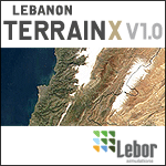
Lebanon TerrainX V1.0 by Lebor Simulations brings the landscape of Lebanon in FSX to life. The package improves the elevation, the coastline, the waterclass, the region aspect of the country as well as the landclass and it features most of Lebanon roads with moving traffic. This scenery package along with its future updates, will be a must have before installing any of our future IFR or VFR sceneries.
| Filename: | Lebanon_TerrainX_V10.zip |
| License: | Freeware |
| Added: | 12th April 2010, 22:20:58 |
| Downloads: | 1,863 |
| Author: | Lebor Simulations |
| Size: | 25.78 MB |
| Category: Flight Simulator 2004 - Scenery | |
| JRM Bahamas EZ Scenery Part #3 |
|
File Description:
FS2004 JRM Bahamas EZ Scenery Part #3
FS9+ EZ scenery Eleutheria Island JRM_Bhm3.zip (see JRM_bhm1.zip & JRM_bhm2.zip) This scenery utilizes FS Global Terrain Mesh and GroundEnv-1. All objects are available by download linked inside. Requires LAGO registered with updates. Completes Eleutheria & Cat Islands.Payware expected detail in which you can even motorcar on sightseeing trips stopping and watching all the eye candy. This scenery completes Eleutheria & Cat Island Bahamas FS9 & FSX only. My best yet and more to come! jimmy R martin [email protected] John 3:16
| Filename: | JRM_Bahamas_EZ_Scenery_Part_3.zip |
| License: | Freeware |
| Added: | 25th March 2006, 03:42:23 |
| Downloads: | 943 |
| Author: | jimmy R martin |
| Size: | 468.29 KB |
| Category: Flight Simulator X - Scenery | |
| KPTK, Oakland County International Airport, Michigan |
|
Images related to this file:
File Description:
New setup with photoreal background of this county-owned public-use airport. The airport holds an open house every year, showing aircraft based at KPTK, military aircraft and vintage aircraft. I used FreeMeshX as mesh.
| Filename: | KPTK_Oakland_County_International_Airport_Michigan.zip |
| License: | Freeware |
| Added: | 30th November 2018, 19:16:34 |
| Downloads: | 508 |
| Author: | Tim van Ringen |
| Size: | 19.96 MB |
| Category: Fly! II - Scenery | |
| Lebanon-Warren County Airport |
|
File Description:
Airport scenery/taxiways and surrounding area for Lebanon-Warren County Airport NE of Cincinnati, Ohio.
| Filename: | LebanonWarren_County_Airport.zip |
| License: | Freeware |
| Added: | 28th April 2003, 01:17:46 |
| Downloads: | 128 |
| Author: | Paul Simpson |
| Size: | 473.25 KB |
| Category: Flight Simulator 2004 - Scenery | |
| Kivitoo, Paulatuk, Qikiqtarjuak, Rowley Island, & West Baffin, adapted for FSGenesis 76m North Canada Terrain Mesh |
|
Images related to this file:
File Description:
These are replacement bgl's to convert five northern Canada fields for use with the FSGenesis 76m terrain mesh for northern Canada. The five are Kivitoo CWFK, Paulatuk CYPC, Qikiqtarjuak CYVM, Rowley Island CWFR, and West Baffin CWFW. These are not stand-alone, and the presumption is that you have already downloaded and installed the previously posted sceneries. This installation consists solely of replacing the existing scenery bgl's with the new. This is the last post of adapted northern airfields (unless more are discovered needing revision) and observations regarding and any further corrections that are required would be welcomed.
| Filename: | Kivitoo_Paulatuk_Qikiqtarjuak_Rowley_Island__West_.zip |
| License: | Freeware, limited distribution |
| Added: | 18th September 2017, 22:28:33 |
| Downloads: | 87 |
| Author: | Roger Wensley |
| Size: | 3.02 MB |
| Category: Flight Simulator 2004 - Scenery | |
| Byron Bay, Cape Dyer, Cape Hooper, Dewar Lakes, and Durban Island adapted for the FSGenesis 76m North Canada Terrain Mesh |
|
Images related to this file:
File Description:
These are replacement bgl's to convert five northern Canada fields for use with the FSGenesis 76m terrain mesh for northern Canada. The five are Byron Bay CWBB, Cape Dyer CWFD, Cape Hooper CWFH, Dewar Lakes CWFL, and Durban Island CWFB. These are not stand-alone, and the presumption is that you have already downloaded and installed the previously posted sceneries. The installation consists solely of replacing the existing scenery bgl's with the new. There will be further posts of northern airfields in groups of five, alphabetically, and observations regarding the amendments and any further corrections that are required would be welcomed.
| Filename: | Byron_Bay_Cape_Dyer_Cape_Hooper_Dewar_Lakes_and_Du.zip |
| License: | Freeware, limited distribution |
| Added: | 3rd September 2017, 20:01:55 |
| Downloads: | 73 |
| Author: | Roger Wensley |
| Size: | 3.49 MB |
© 2001-2026 AVSIM Online
All Rights Reserved
Privacy Policy |