
Where Flight Simulation Enthusiasts Gather from Around the World!
AVSIM Library - Search Results

| Category: Flight Simulator X - Scenery | |
| Ireland VFR Small Airports Part 3 |

|
Images related to this file:
File Description:
Ireland VFR Small Airports Part 3. This scenery consists of 1. EIKY Kerry International Airport, 2. EIBN Bantry Airfield, 3. EIBR Birr Airfield, and 4. Clonbullogue Airfield.
Kerry is situated in the South West of Ireland and serves as a gateway to the world famous Lakes of Killarney, The Ring of Kerry and the Dingle Peninsula. Bantry is ideal for visiting the rugged beauty of West Cork. Clonbullogue is home to the Irish Parachute Club and is situated approximately 30 miles southwest of EIDW Dublin. Birr is almost in the centre of Ireland and is home to a very active group of GA aviators.
The scenery has been created almost entirely from real photographs and all objects have been placed accurately using ordinance survey data and satellite imagery. It also includes animated marshallers, aircrew and passengers together with animated animals and vehicles. Appropriate sound effects have been added to each file together with smoke and strobe lighting. Full night lighting is included, with flood and wash lighting of the aprons and carparks. Each airport has been sub-divided into seperate elements, which can be switched on or off according to the users preference and hardware setup. It caters for GA enthuasiasts and for those who prefer to fly the heavies.
This scenery has not been designed as a standalone, it calls on many objects from my Ireland VFR Small Airports parts 1 and 2. It has also been designed to complement photographic scenery but will also work with the default terrain and I have inlcuded a set of landclass and photoreal textures. It also includes an extended set of photoscenery treescapes. Full installation instructions, settings, credits and tips can be found in the README file.
Please enjoy and I hope you like my airports as much as I enjoyed making them.
| Filename: | Ireland_VFR_Small_Airports_Part_3.zip |
| License: | Freeware, limited distribution |
| Added: | 8th April 2012, 22:40:52 |
| Downloads: | 3,747 |
| Author: | George Keogh |
| Size: | 81.33 MB |
| Category: Flight Simulator 2004 - Original Aircraft | |
| Convair CV-240 VBF CA-18 |
|
Images related to this file:
File Description:

Base pack for the "Convair CV-240 VBF reloaded" in CA-18 version, the famous American short haul
airliner from the fifties. This is a reloaded Gmax rendition based on the Calclassic Convair (by Greg Pepper and Tom Gibson), but it is no longer compatible with that model. Base for further CA-18 add-ons prepared by VBF. Includes visual model and textures for the first CV-240 ever built in 1947 (Reg.-ID NX90846) and painted in the house colors of Consolidated Aircraft. Panel and sound must be installed separately (see User Manual). Flight dynamics by FSAviator. By Virtual Birds Factory (Hans Hermann and Georg Hauzenberger)
| Filename: | Convair_CV240_VBF_CA18.zip |
| License: | Freeware, limited distribution |
| Added: | 7th September 2010, 21:14:28 |
| Downloads: | 5,359 |
| Author: | Hans Hermann and Georg Hauzenberger (based on the Calclassic Convair by Greg Pepper and Tom Gibson) |
| Size: | 4.33 MB |
| Category: Flight Simulator 2004 - Original Aircraft | |
| Convair CV-240 VBF CB-16 |
|
Images related to this file:
File Description:
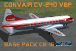
Base pack for the "Convair CV-240 VBF reloaded" in CB-16 version, the famous American short haul
airliner from the fifties. This is a reloaded Gmax rendition based on the Calclassic Convair (by Greg Pepper and Tom Gibson), but it is no longer compatible with that model. Base for further CB-16 add-ons prepared by VBF. Includes visual model and textures for a Convair CV-240-1 of Western Airlines, registration N8404H, with ventral staircase. Panel and sound must be installed separately (see User Manual). Flight dynamics by FSAviator. By Virtual Birds Factory (Hans Hermann and Georg Hauzenberger)
| Filename: | Convair_CV240_VBF_CB16.zip |
| License: | Freeware |
| Added: | 7th September 2010, 21:14:41 |
| Downloads: | 3,231 |
| Author: | Hans Hermann and Georg Hauzenberger (based on the Calclassic Convair by Greg Pepper and Tom Gibson) |
| Size: | 4.12 MB |
| Category: Flight Simulator 2004 - Original Aircraft | |
| Convair CV-240 VBF Military |
|
Images related to this file:
File Description:
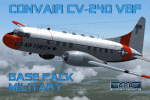
Base pack for the "Convair CV-240 VBF reloaded" in military versions, e.g. the famous USAF T-29
"Flying Classroom" from the fifties. This is a reloaded Gmax rendition based on the Calclassic
Convair (by Greg Pepper and Tom Gibson), but it is no longer compatible with that model. Base for further military add-ons prepared by VBF. Includes visual model and textures for a Convair CT-29A of USAF 7405th Support Sqdn in colors of 1965, t/n 0-91917. Panel and sound must be installed separately (see User Manual). Flight dynamics by FSAviator. By Virtual Birds Factory (Hans Hermann and Georg Hauzenberger)
| Filename: | Convair_CV240_VBF_Military.zip |
| License: | Freeware |
| Added: | 7th September 2010, 21:14:49 |
| Downloads: | 1,916 |
| Author: | Hans Hermann and Georg Hauzenberger (based on the Calclassic Convair by Greg Pepper and Tom Gibson) |
| Size: | 3.91 MB |
| Category: Flight Simulator 2004 - Aircraft Repaints, Textures and Modifications | |
| Breitling Super Constellation |
|
Images related to this file:
File Description:
FS2004/Fs2002 Breitling Super Constellation full package. Updated, photoreal, hand painted and weathered textures. Complete aircraft with accurate latest air file featuring reworked panel with reworked gauges, night lighting and cockpit views. Best viewed in high resolutions: 1024X768 or higher. Aircraft from Mike Stone, panel from Hansjoerg Naegele, Jan Visser, Wolfram Beckert and Howard Sodja, sound by Hansjoerg Naegele. Gauges from a lot of brilliant and helpful designers. Textures by LuÃ�ÂÂs da Costa Pereira and texture developments and upgrades by Shadmith Manzo.(REUPLOAD)
| Filename: | Breitling_Super_Constellation.zip |
| License: | Freeware |
| Added: | 19th June 2010, 03:37:31 |
| Downloads: | 747 |
| Author: | Textures by LuÃ�ÂÂs da Costa Pereira and texture developments and upgrades by Shadmith Manzo. |
| Size: | 22.29 MB |
| Category: Flight Simulator 2004 - Scenery | |
| CYVQ - Norman Wells - Northwest Territories, Canada |
|
Images related to this file:
File Description:
Norman Wells is the last of a series of airfields that are along (or close to) the Mackenzie River and in the Northwest Territories. It is 290 miles southeast of Inuvik and just 40 miles northwest of Tulita. The town growth was accelerated by the discovery of oil in the 1930's and the building of a small refinery in 1937, which is included here; there are now around 840 folks living in the town. The airport is adjacent to the town and has just under 6,000 feet of asphalt runway. North Wright Airways is headquartered there and this is reflected in the AI, which is for all of the newly-posted Mackenzie River postings. There is also helicopter AI, Canadian North, First Air, and there are GA flights. There is a mandatory frequency and the Norman Wells tower is manned 24 hours a day so you will follow atc instructions. In real life the terminal is on two levels; this steep change in terrain level is not possible to achieve in FS9 so although I made it as a two level terminal (ready for the FSX version?) it is here modified into a single level building. There are several "taxiways" which lead to the runway but are without hold short markings. These have been shown but are not included as AI routes. The helicopters presumably hover-taxi to the runway across grass (and snow) in real life; the AI helicopter will taxi on wheels. Note that at mixed-use airports planes and helicopters all follow the same rules of procedure.
| Filename: | CYVQ__Norman_Wells__Northwest_Territories_Canada.zip |
| License: | Freeware, limited distribution |
| Added: | 12th July 2014, 11:22:10 |
| Downloads: | 472 |
| Author: | Roger Wensley |
| Size: | 14.57 MB |
| Category: Flight Simulator 2004 - Scenery | |
| Dixie A05 Forest Service airfield in Idaho USA |
|
Images related to this file:
File Description:
This airfield is in the mountains of Idaho, the first in a series. There are not many mountain airfields that can be succesfully modelled in FS9 because the FS9 terrain does not always match reality; no creek for instance, or the valley too small. There are others where the grass strip is all there is, so there is nothing to model apart from resizing the cleared area. Some are well known, well maintained, have clean shower facilities, and are well used for a weekend by small planes with two people and a tent on board, for instance Johnson Creek. Others are less well known but still in good condition, such as Dixie or Big Creek. And there are also some with cabin rental facilities, such as Sulphur Creek Ranch. Other names come to mind, such as Flying B and Pistol Creek, but unfortunately for one reason or another these could not be made. The other difficulty involving hills is succesful AI landings and take offs. At Johnson Creek, for instance, the wind should be from the south to make AI landings more likely to succeed. Dixie is south of the village of the same name, and not to be confused with the dirt strip that is just beside the village. The runway is at 5,148 feet ASL, just over 4,000 feet long and aligned 18-36, and the parking area is at the northern end, opposite the Forest Service buildings. There is a chart of the area included, and to the south of Dixie is the next in the series, Big Creek U60.
| Filename: | Dixie_A05_Forest_Service_airfield_in_Idaho_USA.zip |
| License: | Freeware, limited distribution |
| Added: | 25th May 2017, 17:53:48 |
| Downloads: | 153 |
| Author: | Roger Wensley |
| Size: | 8.69 MB |
| Category: Flight Simulator X - Scenery | |
| KLGB Long Beach Modernized Terminal |
|
File Description:
DOWNLOAD THIS VERSION AND NOT ANY OTHER ONES BY ROHAN PATEL
THIS IS THE AIRPORT AFTER ALL MODERNIZATION PROJECTS HAVE BEEN COMPLETED
DOWNLOAD THIS VERSION AND NOT ANY OTHER ONES BY ROHAN PATEL
The airport I chose is Long Beach Airport. This airport has been around for many years and has had everything from the Air Force One to the 787 Dreamliner land here! The airport is located between downtown Los Angeles and Orange County and offers a great landing for tourists that do not want to land in the fifth busiest airport in the world, Los Angeles International.
The reason why I decided to create this airport was because it is my home airport and I am located only about five miles from it. Also, there is no good freeware FSX scenery for this airport.
Features included!:
- Modern Terminal with correct gate placements
- changed and edited roads and other buildings around airport
- added the jetBlue offices on the airport
- Cars added (all over the place!!!)
- trees added near drop off (California Palm trees)!
- baggage cars and other airport cars added.
- buses and car parking lots added
- "spring street" flight schools and private terminal added.
- Vehicles, AI aircraft, grave yard aircraft, and many other static joys throughout the airport!
- "Runup" aircraft near runway 34R.
- Boeing C-17 facility (no aircraft C17 there)
- updated taxi ways and heliports
- Airport Service vehicle roads updates and made with help from Google Earth.
- Accurate fence, jetblast fence, and boarders of airport.
- Cargo terminals added for ups and dhl
- Private (gulfstream and other private) jet spots added.
- Flight Schools such as Long Beach Flight Academy (one I go to!!!) accurately made.
- New taxi ways and terrain
- Aflite fuel truck spaces added
- Correct runway lengths of 25L
- More items you just need to see to believe!!!
Distribution limits (MUST CONTACT ME FOR REDISTRIBUTION).
| Filename: | KLGB_Long_Beach_Modernized_Terminal.zip |
| License: | Freeware, limited distribution |
| Added: | 14th December 2012, 01:37:48 |
| Downloads: | 2,589 |
| Author: | Rohan Patel |
| Size: | 3.98 MB |
| Category: Flight Simulator 2004 - Scenery | |
| Aasiaat BGAA on the west coast of Greenland |
|
Images related to this file:
File Description:
I wrote that Qikiqtarjuaq, on the east coast of Baffin Island, was the jumping off airfield for ferry flights for small planes from Canada to Europe via Greenland. Aasiaat is the airfield in Greenland that they jump to, 300 miles across the Davis Strait. The airfield is on the northern coast of Aasiaat Island, and the town of the same name is just two miles to the west. The runway is 2,600 feet of asphalt almost 100 feet wide and lit, at 74 feet ASL, aligned 12/30, with the apron and terminal building at the western end. Air Greenland run regular flights with a Dash-7 or 8, & Twin Otters, and the markings for the taxiway and parking spot in front of the terminal are exactly as they were six years ago. I have seen video since then that has further taxiway and parking spot markings added in, but I like the simplicity of the original. Unfortunately, given the limitations of FS and the single runway and simple taxiway routing there was no way to replicate both the parking facing away from the terminal AND the "through" taxiing to complete the circle back to the runway; after parking correctly the AI Air Greenland Dash-8 will reverse before heading out to take off. There is both JetA and 100LL fuel available. The surrounding area is rocky, and there is no grass around the runway; the airfield has compacted gravel instead.
| Filename: | Aasiaat_BGAA_on_the_west_coast_of_Greenland.zip |
| License: | Freeware, limited distribution |
| Added: | 26th March 2012, 11:01:16 |
| Downloads: | 691 |
| Author: | Roger Wensley |
| Size: | 2.73 MB |
| Category: Flight Simulator 2004 - Scenery | |
| Sioux Lookout CYXL in northern Ontario, Canada, updated |
|
Images related to this file:
File Description:
This greatly modifies my previous post of Sioux Lookout; it is stand-alone and does not require you to have the 2009 version. The AI provided with the post complements what was included with Dryden (March 2013). Sioux Lookout is in northern Ontario, 40 miles east of Dryden, and 145 miles northwest of Thunder Bay. The town is on the northeastern shore of a lake that I don't know the name of (I've been there, but has anyone COUNTED how many lakes Canada has?). It has a population of around 5,000. The main businesses are lumber, tourism, and health care. The airport is immediately adjacent to the northeastern corner of the town, and has 5,300' of asphalt which is aligned 16-34. There are two taxiways which curve and climb up to the apron which is 20 or 30 feet higher. When you taxi on them the knowledge that in reality you would be climbing makes sense of the curved routing. The apron is large and a mixture of asphalt and gravel. I did not make the terminal building and I have no photo or even a recollection of what it looks like, so you should first install Northwest Ontario Airports by Eric O'Link as he has a terminal building for CYXL that might be how it looks; some of his airfields collide with other and newer versions and I have kept only his CYXL and CYPL bgl's.
| Filename: | Sioux_Lookout_CYXL_in_northern_Ontario_Canada_upda.zip |
| License: | Freeware, limited distribution |
| Added: | 19th March 2013, 19:23:24 |
| Downloads: | 405 |
| Author: | Roger Wensley |
| Size: | 5.08 MB |


© 2001-2026 AVSIM Online
All Rights Reserved
Privacy Policy |