
Where Flight Simulation Enthusiasts Gather from Around the World!
AVSIM Library - Search Results

| Category: Prepar3D V1-4 - Aircraft Repaints, Textures and Modifications | |
| Continental Micronesia 1998 AI Package |

|
File Description:
Continental Mircronesia was Continental's Guam-based Pacific operation. In 1998, CMI had 3 747-200s and 16 727s (10 pax+ 6 flying DHL cargo), and was also using 4 Continental 757s to cover routes from GUM. The 747s mostly fly between NRT/GUM/HNL and spend their down time at the HNL maintenance base, but they also flew charters to OKJ and SDJ which are represented in these plans. The 727s fly all over the Pacific, serving most every large city in Japan as well as TPE, CNS, and the 7-stop GUM-HNL "milk run", flown twice weekly. The cargo plans for the 727s are representitive and also serve much the the Pacific reaching as far as Australia. I created arrival and departure banks most days so the planes often arrive back to GUM in the middle of the night around the same time. The "Micronesia" titles were removed from the last DC-10-30 in March 1998, after which time all DC-10s wore the standard Continental livery as did the 757-200s while using the CMI codes and callsigns. Currently, there is no Continental Micronesia DC-10 AI paint, but links to all relevant paints are included as well as Ranmori Scythe's FAIB 747-200 PW texture. Flightplans by Chasen Richardson. Part of the 1998 Flight Simulator Project. Follow us on Facebook at facebook.com/flightsim98 and on instagram as @bayviationsim. For more Retro AI, check out the forums at: http://retroai.proboards.com/
| Filename: | Continental_Micronesia_1998_AI_Package.zip |
| License: | Freeware, limited distribution |
| Added: | 1st December 2019, 20:55:52 |
| Downloads: | 167 |
| Author: | Ranmori Scythe, Chasen Richardson/Bayviation |
| Size: | 1.51 MB |
| Category: Flight Simulator 2002 - Scenery | |
| Grafton District Airport - NSW Australia |
|
File Description:
Grafton District Airport (YGFN) - (For 2002 only)
*******************************
A delighful small airport approximately 80 nautical miles from Coffs Harbour and a slightly shorter distance to Ballina and Lismore. This makes a good stopover for hopping down the east coast of Australia.
Originally released for FS2004 (and is better in 2004) but adds realism to FS2002 default airport.
The size of the airport has allowed me to put in that extra detail which makes to terminal and surrounds very much "as in real life". Photographic textures are used throughout for the buildings and even the trees are hand made macros from photographs at the airport.
AFCAD file is included to add AI traffic. For that reason and because of limited apron space no static planes have been used. You should obtain Traffic Tools to add more AI traffic to give the airport a little more life.
The scenery concentrates on adding a realistic terminal to the airport whilst leaving much of the default runway detail unchanged.
| Filename: | Grafton_District_Airport__NSW_Australia.zip |
| License: | Freeware, limited distribution |
| Added: | 7th December 2003, 03:15:56 |
| Downloads: | 480 |
| Author: | John Ross |
| Size: | 2.02 MB |
| Category: Flight Simulator 2004 - Scenery | |
| ETUO - RAF Gutersloh AB |
|
Images related to this file:
File Description:
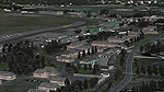
FS 2004 scenery - RAF Gutersloh AB (ICAO: ETUO)
The scenery represents the former airbase of RAF Gutersloh, one of the most populated military bases in West Germany during the Cold War, due to its location near the former East/West border. This scenery reflects the era at the end of the 1980s/beginning of the 90s, when the Harrier GR3 was in operation there, along with Chinook helicopters.
The airfield was built in 1935 and was used by the German Air Force during WW2, flying the Junkers JU-86 and Heinkel H-111. The first British squadrons were stationed there from 1947, with Mosquitos, Vampires and then Canberras.
The first Harrier arrived at Gutersloh in January 1977 and 3 and 4 Squadrons became resident until their farewell in 1993, after the cold war had ended. The airfield is currently used by the British army, but they will leave in 2014 to relinquish the area to the Government of Gutersloh for civil usage.
High detailed scenery by Manfred Schyma and Pete Beeby, supported by the Airfield Construction Group.
| Filename: | ETUO__RAF_Gutersloh_AB.zip |
| License: | Freeware |
| Added: | 10th October 2013, 20:30:01 |
| Downloads: | 1,925 |
| Author: | Manfred Schyma / Pete Beeby |
| Size: | 173.25 MB |
| Category: Flight Simulator 2004 - Scenery | |
| CZFM - Fort McPherson - Northwest Territories, Canada |
|
Images related to this file:
File Description:
This is the first of a series of airfields that follow (approximately) that early access route to the Canadian northern shore, the Mackenzie River. At the far northern end of the river and on the eastern side of the delta there is Tuktoyaktuk, then 80 miles south is Inuvik (both already posted). 70 miles south of Inuvik is Fort McPherson, on the east bank of the Peel River, 20 miles west of the junction with the Mackenzie and on the Dempster Highway. The town has a population of around 830, and (as usual in the north!) was the site of a Hudson Bay trading post, the main post for the Mackenzie delta area for over 50 years. The airport is less than 2 miles to the south of the town, and has 3,500 feet of gravel runway. AI is two ga flights and a Buffalo Airways delivery trip that hops north and south from field to field; this will change with further posts. There is no fuel available.
| Filename: | CZFM__Fort_McPherson__Northwest_Territories_Canada.zip |
| License: | Freeware, limited distribution |
| Added: | 4th July 2014, 05:33:03 |
| Downloads: | 289 |
| Author: | Roger Wensley |
| Size: | 2.3 MB |
| Category: Microsoft Flight Simulator (2020) - Aircraft Repaints, Textures and Modifications | |
| Ryan ST-A VH-AWG |
|
Images related to this file:
File Description:
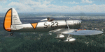
This folder contains a repaint for the Ryan ST-A by A1R Design Bureau. It shows Ryan ST-M VH-AWG. This aircraft was built in San Diego with c/n 459 in 1940, and shipped to the Netherlands East Indies, arriving there in January 1941. There it joined the Royal Netherlands Naval Aviation Service as S-23. In February 1942, together with the other Dutch Ryans, it was shipped to Ausralia, where it joined the RAAF as A50-11. It served with different RAAF training units until 1945, when it demobbed and sold, becoming VH-AGD. In 1948 it went to the Newcastle Aero Club in NSW. In 1956 it was sold to an owner in Victoria. In 1967 it bwas damged in an emergency landing near Mildura and tyhe wreackage was stored. In 1995, it was purchased as a restauration project by Graham Hosking and in 2000 it made its first post restoration flight, now registered VH-AWG, and painted in the original Dutch scheme as S-23. It is still airworthy and based in Victoria. Repaint by Jan Kees Blom.
| Filename: | Ryan_STA_VHAWG.zip |
| License: | Freeware |
| Added: | 12th June 2021, 23:17:02 |
| Downloads: | 15 |
| Author: | Jan Kees Blom |
| Size: | 78.86 MB |
| Category: Flight Simulator X - Scenery | |
| LOWL Linz Airport (also known as Blue Danube Airport), Austria |
|
Images related to this file:
File Description:
The airport Linz-Hoersching (blue danube airport linz) is located 10 km outside the city centre Linz direction south west direct from the town Hoersching. Therefore the epithet Hoersching.
This airport is in possession of the Austrian Army, but there is a civil right of use. The aerodrome Vogler is place south, the civil part is locate in north direction of the runway.
--------------------
Der Flugplatz Linz-Hoersching (blue danube airport linz) befindet sich 10 km ausserhalb des Stadtzentrums Linz in suedwestlicher Richtung direkt bei Hoersching. Darum auch der Beiname Hoersching. Der Flughafen gehoert dem oesterreichischen Bundesheer, es gibt aber ein ziviles Nutzungsrecht. Der Fliegerhorst Vogler ist suedlich, der zivile Teil noerdlich der Landebahn angesiedelt.
--------------------
Features: ground texture with 25cm / px., autogen, hand placed objects, correct road marking, correct taxiway signs, new middle lights, automatic switching of the seasons, night illumination.
| Filename: | LOWL_Linz_Airport_also_known_as_Blue_Danube_Airpor.zip |
| License: | Freeware |
| Added: | 21st July 2013, 13:47:13 |
| Downloads: | 11,006 |
| Author: | Oliver Brandl |
| Size: | 222.14 MB |
| Category: Flight Simulator 2004 - Miscellaneous Files | |
| Nick's Prop Dust with Control Gauges |
|
File Description:
Prop aircraft users are in for a real treat. This gauge/effects package automatically senses the terrain the aircraft is in contact with or flying over and changes the dust and water effects for the aircrafts prop/rotor wash based on dirt, dry mud or clay, snow, rain, water, ice, sand, gravel and short grass. In addition the real time surface conditions are also sensed. In example, a dry asphalt or concrete runway will produce no dust, however, the same runway with snow conditions present will automatically produce a throttle controlled snow blowing effect. The 25 included effects files and 5 gauges have been tuned to reflect a realistic representation of the dust/mist produced by different types of aircraft taking off or touching down on different terrains and surface conditions. The effects are properly influenced by cross wind conditions and reverse pitch is also supported. Effects files and gauges are included for large and small, single engine, multi-engine, amphibians, helicopters and massive scale military and commercial transports. It requires editing/adding lines in the aircraft.cfg and panel.cfg files. The README files include very complete and comprehensive instructions including a quick and easy copy/paste file for all the Microsoft prop aircraft and tutorial on making custom gauges from the ones provided.
By Nick Needham
| Filename: | Nicks_Prop_Dust_with_Control_Gauges.zip |
| License: | Freeware |
| Added: | 8th December 2003, 17:07:07 |
| Downloads: | 7,298 |
| Author: | Nick Needham |
| Size: | 1.22 MB |
| Category: Flight Simulator 2004 - Scenery | |
| Buckland PABL in Alaska |
|
Images related to this file:
File Description:
Buckland is a village on a small river, around 45 miles east of Deering and 15 miles inland from the river mouth. Like Deering, the population of 420 live from fishing and the land. The airfield is close by and has a gravel runway aligned 10-24 and 3,300 feet long with VASI at both ends. Apart from the airfield itself, and it's buildings, this scenery modifies the local (mostly treeless) land class, adds village buildings while reducing the village size to reality, and creates a new airfield background. Bering Air flies into Buckland from Kotzebue and is included in the AI. A note here about my scenery making. This is post number 505 and there will not be many more to follow this as I am almost at the end of the photos I either took or found for scenery purposes. There is a limit to what can be located online and I have already been making use of the little there is; eg Unalakleet. So, if you are near an airport (preferably Canadian or Alaskan) and have a camera..... Let me know.
| Filename: | Buckland_PABL_in_Alaska.zip |
| License: | Freeware, limited distribution |
| Added: | 10th August 2019, 18:51:45 |
| Downloads: | 145 |
| Author: | Roger Wensley |
| Size: | 4.11 MB |
| Category: Flight Simulator 2004 - Scenery | |
| Alaska North Slope 10; Kivalina KVL in Alaska |
|
Images related to this file:
File Description:
The town of Barrow is in the far north of Alaska, and these are coastal villages or radar installations to the west, south, and east of Barrow on the North Slope. There will be further additions. Kivalina is a small village (population around 350) midway in the 150 mile gap between Point Hope to the north and Kotzebue to the south. The village is on a spit of land that is growing smaller and smaller with every year of erosion and the rise of sea level. The runway is 3,500 feet of gravel aligned 12-30 to the north of the village on the same spit. It was expected that 2025 would see the end of both village and runway, and possibly also the natural harbour that is the reason for the village's location. The modified width of the spit shown here is halved from the original FS9, and erosion has continued, enough that a sea defence wall has now been built. The AI has a daily flight by an ERA Alaska Cessna 208B, and some GA; read the note about the 208 to be downloaded and/or properly installed.
| Filename: | Alaska_North_Slope_10_Kivalina_KVL_in_Alaska.zip |
| License: | Freeware, limited distribution |
| Added: | 27th July 2016, 21:12:15 |
| Downloads: | 243 |
| Author: | Roger Wensley |
| Size: | 2.87 MB |
| Category: Flight Simulator 2004 - Scenery | |
| Hicks Farm Field CF12 near Ottawa in Ontario, Canada |
|
Images related to this file:
File Description:
Hicks Farm is in Ontario and around 8 miles west of Rideau Valley Airpark CPL3 (which did not appear in FS9, probably because it was then mainly used by gliders, but is a post of mine). CPL3 is 15 miles south of Ottawa Airport, tucked into a right angle bend of the Rideau River. Ultimate Terrain puts the river into place, and I am not sure of how or if either CPL3 or CF12 work without UT, maybe somebody can let me know. Fly west from CPL3 along the river and Hicks Farm will be on the south side. It has a (mainly) grass runway 34/16 with a section of asphalt and totals some 5,500 feet overall. Alan, the owner of Hicks Farm, is in his mid 80's and was told last year that his insurance company no longer felt comfortable with him flying his Lear off a farm strip. The result of his enforced retirement from flying his Lear is that the grass has been allowed to take over somewhat, though there is still sufficient space to land most single engine light aircraft.
| Filename: | Hicks_Farm_Field_CF12_near_Ottawa_in_Ontario_Canad.zip |
| License: | Freeware, limited distribution |
| Added: | 11th February 2010, 00:50:23 |
| Downloads: | 271 |
| Author: | Roger Wensley |
| Size: | 1.43 MB |


© 2001-2026 AVSIM Online
All Rights Reserved
Privacy Policy |