
Where Flight Simulation Enthusiasts Gather from Around the World!
AVSIM Library - Search Results

| Category: Flight Simulator X - Scenery | |
| RAF Metheringham - Lincoln, Lincolnshire, England **FIX** |

|
File Description:
This is a fix which will sort out the scenery configuration error which prevented the scenery from showing.
Metheringham airfield is located two miles to the east of Metheringham village on the B1189. The airfield opened in October 1943 as a Class 'A' bomber airfield within 5 Group. The standard three intersecting concrete runways were provided as were two T2 hangars and a B1. One of the T2s was on the technical site to the south-west, which straddled the B1189 and the other was located off the eastern perimeter track. The bomb stores were to the north and between these and the north-west runway head stood the B1 hangar. The communal and accommodation sites were located in fields to the south and west. Metheringham was also equipped with FIDO fog dispersal equipment. The station closed in 1951 and very little remains of the station now although a small visitors centre with a little museum on site.
You will require third party add-ons - details in the included Read-me.txt file.
| Filename: | RAF_Metheringham__Lincoln_Lincolnshire_England__FI.zip |
| License: | Freeware |
| Added: | 15th November 2015, 14:25:30 |
| Downloads: | 206 |
| Author: | Terry Boissel |
| Size: | 95.84 KB |
| Category: Flight Simulator 2004 - Scenery | |
| Grafton District Airport - NSW Australia |
|
File Description:
A delighful small airport approximately 80 nautical miles from Coffs Harbour and a slightly shorter distance to Ballina and Lismore. This makes a good stopover for hopping down the east coast of Australia.
The size of the airport has allowed me to put in that extra detail which makes to terminal and surrounds very much "as in real life". Photographic textures are used throughout for the buildings and even the trees are hand made macros from photographs at the airport.
AFCAD and Traffic Tools files are included to add extra AI traffic. For that reason and because of limited apron space no static planes have been used.
The scenery concentrates on adding a realistic terminal to the airport whilst leaving much of the default runway detail unchanged. Changes which have been made to the runway include tidying up the taxi way fillets so the markings do not appear to be on the grass and the windsocks have been replaced with macros designed to resemble the Grafton windsocks. Other than that the airport merges into the default scenery without the usual "green oasis" effect.
| Filename: | Grafton_District_Airport__NSW_Australia.zip |
| License: | Freeware, limited distribution |
| Added: | 5th December 2003, 04:29:01 |
| Downloads: | 2,547 |
| Author: | John Ross |
| Size: | 2.1 MB |
| Category: Flight Simulator X - Scenery | |
| LOWL Linz Airport (also known as Blue Danube Airport), Austria |
|
Images related to this file:
File Description:
The airport Linz-Hoersching (blue danube airport linz) is located 10 km outside the city centre Linz direction south west direct from the town Hoersching. Therefore the epithet Hoersching.
This airport is in possession of the Austrian Army, but there is a civil right of use. The aerodrome Vogler is place south, the civil part is locate in north direction of the runway.
--------------------
Der Flugplatz Linz-Hoersching (blue danube airport linz) befindet sich 10 km ausserhalb des Stadtzentrums Linz in suedwestlicher Richtung direkt bei Hoersching. Darum auch der Beiname Hoersching. Der Flughafen gehoert dem oesterreichischen Bundesheer, es gibt aber ein ziviles Nutzungsrecht. Der Fliegerhorst Vogler ist suedlich, der zivile Teil noerdlich der Landebahn angesiedelt.
--------------------
Features: ground texture with 25cm / px., autogen, hand placed objects, correct road marking, correct taxiway signs, new middle lights, automatic switching of the seasons, night illumination.
| Filename: | LOWL_Linz_Airport_also_known_as_Blue_Danube_Airpor.zip |
| License: | Freeware |
| Added: | 21st July 2013, 13:47:13 |
| Downloads: | 11,018 |
| Author: | Oliver Brandl |
| Size: | 222.14 MB |
| Category: X-Plane - Scenery | |
| BR AM SWMK - Maturaca Airfield v1.0.0 |
|
Images related to this file:
File Description:
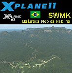
This is an X-Plane 11 and X-Plane 10 scenery package for Maturaca Airport (ICAO: SWMK, no IATA code) which is an airport serving Maturaca village, in São Gabriel da Cachoeira, Amazonas, Brazil, located in the vicinity of "Pico da Neblina" (Peak of the Haze, in English), the highest mountain in Brazil, 2,995.3 metres (9,827 ft) above sea level, in the Serra da Neblina, part of the Serra do Imeri, a section of the Guiana Highlands on the Brazil–Venezuela border, in the middle of the Amazon rainforest. It includes corrected aprons, ramps, gates, taxiways, lighting system, village buildings, ortho-photoscenery for the airfield area, and (XP11 only) airport ground services (like push back). This scenery was tested and is operational (as of April 14, 2017) in "X-Plane 11.00 RC #1 64 bit", Windows 10 Home. It was also tested and is also operational (as of April 14, 2017) in "X-Plane 10.51 64 bit", Windows 10 Home. Only the default X-Plane 11 libraries, by Laminar Research, are needed. No third party libraries are used.
A few extra objects are used and included in the package, thanks to artist Paulmort (Hangar 24, Hangar House, Ranch House, Deluxe Log Cabin, Hangar Barn) and to artist Capnsully (Grow Grass for Xplane). They are included in the package, no need to download them.
| Filename: | BR_AM_SWMK__Maturaca_Airfield_v100.zip |
| License: | Freeware |
| Added: | 15th April 2017, 06:23:29 |
| Downloads: | 132 |
| Author: | Rui Mesquita |
| Size: | 35.57 MB |
| Category: Flight Simulator X - Scenery | |
| LFAW - Villerupt-Errouville |
|
Images related to this file:
File Description:
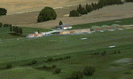
This scenery represents the field of Villerupt-Errouville LFAW where the flying club is based "Nord Lorraine" located in the north of the department 54 a few kilometers from Belgium and Luxembourg borders and the model aircraft club. The buildings have been modeled in GMAX, static devices are also present. Finally the autogen was placed on the same perimeter as the slab photo realistic.
********************************
Cette scene represente le terrain de Villerupt-Errouville LFAW qui est base l'aeroclub Nord Lorraine situe dans le nord du departement 54 a quelques kilometres de la Belgique et du Luxembourg ainsi qu'un club d'aeromodelisme et parachutisme.
L'ensemble des batiments ont ete modelises sous GMAX, des appareils statiques sont egalement presents.
Une dalle photo realiste a ete inseree mais je vous conseille de continuer le sol photo avec des logiciels comme fsEarthTile.
Enfin de l'autogen a ete place sur le meme perimetre que la dalle photo realiste.
| Filename: | LFAW__VilleruptErrouville.zip |
| License: | Freeware, limited distribution |
| Added: | 3rd January 2012, 11:24:06 |
| Downloads: | 1,864 |
| Author: | Alexandre Remy FAF010 |
| Size: | 17.72 MB |
| Category: Prepar3D V1-4 - Aircraft Repaints, Textures and Modifications | |
| Continental Micronesia 1998 AI Package |
|
File Description:
Continental Mircronesia was Continental's Guam-based Pacific operation. In 1998, CMI had 3 747-200s and 16 727s (10 pax+ 6 flying DHL cargo), and was also using 4 Continental 757s to cover routes from GUM. The 747s mostly fly between NRT/GUM/HNL and spend their down time at the HNL maintenance base, but they also flew charters to OKJ and SDJ which are represented in these plans. The 727s fly all over the Pacific, serving most every large city in Japan as well as TPE, CNS, and the 7-stop GUM-HNL "milk run", flown twice weekly. The cargo plans for the 727s are representitive and also serve much the the Pacific reaching as far as Australia. I created arrival and departure banks most days so the planes often arrive back to GUM in the middle of the night around the same time. The "Micronesia" titles were removed from the last DC-10-30 in March 1998, after which time all DC-10s wore the standard Continental livery as did the 757-200s while using the CMI codes and callsigns. Currently, there is no Continental Micronesia DC-10 AI paint, but links to all relevant paints are included as well as Ranmori Scythe's FAIB 747-200 PW texture. Flightplans by Chasen Richardson. Part of the 1998 Flight Simulator Project. Follow us on Facebook at facebook.com/flightsim98 and on instagram as @bayviationsim. For more Retro AI, check out the forums at: http://retroai.proboards.com/
| Filename: | Continental_Micronesia_1998_AI_Package.zip |
| License: | Freeware, limited distribution |
| Added: | 1st December 2019, 20:55:52 |
| Downloads: | 169 |
| Author: | Ranmori Scythe, Chasen Richardson/Bayviation |
| Size: | 1.51 MB |
| Category: Flight Simulator 2004 - Scenery | |
| CYRL & CKS4 - Red Lake & Fishing Lodge Outposts - Ontario, Canada |
|
Images related to this file:
File Description:
Red Lake is in Ontario, 90 miles east of the Manitoba border & 120 miles north of the US border. The town is at what was the northern end of "the road" for many years, & this has led to it becoming a centre for floatplane flights north to fishing lodges etc. It has also become THE centre of Noorduyn Norseman floatplanes in Canada & there is a Norseman on display & an annual Norseman festival. Red Lake CYRL airport is 3 miles north of the town with 5,000 feet of asphalt runway aligned 08-26 with PAPI at both ends. The apron is in two parts; the western for the fire fighting planes & the eastern for the new terminal & the hangars for North Star, Superior, and Wasaya. There is also a scruffy hangar that is used for storage & to the south of the east apron some private hangars. The town & the float base (CKS4) are at the southern end of Howey Bay. Planes taxi north before going to full power for take off, & there are two main companies based at CKS4, Chimo & Green's, both of them using Norsemans (or Norsemen?) among other planes. Chimo service their fishing lodge & outposts in the Roderick Lake area, & Green's (who have a base on the west side of Howey Bay) service their own outposts on Trout Lake & Nungesser Lake in the AI. There are other Red Lake float operations using Norsemans from further north on the lake & they service fishing lodges in the AI on Peisk Lake and Uchi Lake. The AI also includes some GA float planes, & there are numerous GA & scheduled flights into CYRL.
| Filename: | CYRL__CKS4__Red_Lake__Fishing_Lodge_Outposts__Onta.zip |
| License: | Freeware, limited distribution |
| Added: | 15th November 2015, 14:29:42 |
| Downloads: | 504 |
| Author: | Roger Wensley |
| Size: | 32.92 MB |
| Category: Microsoft Flight Simulator (2020) - Utilities | |
| WorkingTitleCJ4_LINDA_Module_ByJujunet_v0.2 |
|
File Description:
This module allows to use hidden controls of the default MSFS CJ4, using FSUIPC and LINDA software. Require : FSUIPC ver 7 full licence, Microsoft Flight Simulator and LINDA software. Installation : Uncompress archive in any place. Move CJ4.hvar on \Community\fsuipc-lvar-module\modules On LINDA software : Click on "Maintenance", on top, select "--aircrafts--". Click on "Select Source Folder", below "Import Aircraft Module", browse to the folder CJ4, click on "Import", or "Overwrite" if updating. This module for Linda freeware allows to bind : - Menu choice, menu inc/dec and puch : bind a key to browse to all screen menus, and scroll with an encoder to move up and down inside the menus. Push a key to validate. - Map zoom in/out - Terrain/WX - PFD functions (FRMT/TFC/NAV) - Seatbelt light - Safety light - Baro inc/dec - Baro std - AP modes : FLC, HDG, ALT, VS, APPR and Toga button. To create your own module, or customize this one, go to my Youtube Tutorial : My channel : https://www.youtube.com/channel/UCVgdlnaAk2Q4EOSCICW_0iA Changelog : Version 0.2 : Correction to working with the default CJ4 since AAU1 update, the Working title mod no longer exist.
| Filename: | WorkingTitleCJ4_LINDA_Module_ByJujunet_v02.zip |
| License: | Freeware |
| Added: | 16th January 2024, 14:29:33 |
| Downloads: | 37 |
| Author: | Julien GICQUIAUD |
| Size: | 6.35 KB |
| Category: Flight Simulator 2004 - Panels | |
| F16 |
|
File Description:
FS2004 Panel, F16 Air Show Tour. The panel of this jet fighter has been designed for cross country flying to events worldwide. The 2D cockpit is packed with new gauges that complement this high performance, yet docile aircraft. All gauges, lights, etc. are functional, easy to read, and are panel installed except GPS 500. For long distance flights, the panel contains on-demand refueling capabilities for both ground and air operations. A few of the new gauges are; 180-degree scan navigational radar, triple mode interceptor-refueling-terrain radar, refueling gauge with command screen, fuel center with time/distance remaining computer, new Descentometer for Mach-plus aircraft, analog engine gauges including thrust and fuel efficiency, plus a hangar full of warning and indicator lights. The intercept mode of the ai-radar feeds info to the autopilot to assist in the rendezvous with tanker to allow all-weather, day or night air refueling. Digital data for AP, radio, altimeter, timer, and Descentometer is input via a central keypad. Acknowledge ATC instructions using joystick. Designed for use with Kirk Olsson's F16 Viper. Includes 15 page illustrated instructions plus Intercept and Refueling tutorial. By Glenn Copeland
| Filename: | F16.zip |
| License: | Freeware |
| Added: | 12th January 2007, 03:00:43 |
| Downloads: | 5,782 |
| Author: | Glenn Copeland |
| Size: | 1.83 MB |
| Category: Flight Simulator 2004 - Scenery | |
| CYEN Estevan Saskatchewan Municipal Airport |
|
Images related to this file:
File Description:

CYEN Estevan Municipal airport is situated approximately three miles (6 Km) north of the City of Estevan. CYEN Estevan Muni was constructed using GMAX and represents the airport as it was in the Summer of 2006. It includes all the buildings at the airport, runway signs, addition of some fencing, anda new rotating beacon that is closer to the actual device. CYEN also includes a landclass file to better represent the terrain around the airport, at least as far as the limits of the default landscape will allow.
The airport is home to Sunrise Aviation (which operates the field for the city) and some 26 light aircraft. CYEN handles a wide variety of Canadian and U.S. corporate and charter aircraft given the large oil and coal mining industry in the area. With the U.S. border so close by, CYEN is also the first stop for many U.S. registered aircraft that land to clear customs and refuel.
(This is a re-upload of the scenery to replace the original that was lost in the AVSIM hack. No changes have been made)
| Filename: | CYEN_Estevan_Saskatchewan_Municipal_Airport.zip |
| License: | Freeware |
| Added: | 7th May 2010, 12:47:13 |
| Downloads: | 1,705 |
| Author: | Gregory Putz |
| Size: | 1.67 MB |


© 2001-2026 AVSIM Online
All Rights Reserved
Privacy Policy |