
Where Flight Simulation Enthusiasts Gather from Around the World!
AVSIM Library - Search Results

| Category: Flight Simulator X - Scenery | |
| RAF Fiskerton |

|
File Description:
RAF Fiskerton was a Royal Air Force station located north of the Lincolnshire village of Fiskerton, 5.0 miles east of Lincoln, Lincolnshire, England
It was one of many new bomber airfields built in the early part of World War II. The airfield was situated north of the village from where it got its name. It was one of only 15 RAF airfield equipped with FIDO, a fog-clearing system utilizing petrol pumped through pipes alongside the main runway and burned via a sequence of nozzles.
No. 49 Squadron and No. 576 Squadron RAF were stationed at RAF Fiskerton. 49 squadron took part in the Peenemande raid on the research and development centre for the V2 missile. 576 Squadron took part in the raid on Hitler's hideout at Berchtesgaden and in Operation Manna.
Between 1962 and 1992 a Headquarters of the Royal Observer Corps was located within the airfield boundary.
| Filename: | RAF_Fiskerton.zip |
| License: | Freeware |
| Added: | 21st October 2015, 20:30:21 |
| Downloads: | 251 |
| Author: | Terry Boissel |
| Size: | 16.04 KB |
| Category: Flight Simulator X - Scenery | |
| RAF Snetterton Heath - Norfolk, England |
|
File Description:
RAF Snetterton Heath is a former Royal Air Force station located south east of the A11, 6 miles (9.7 km) south west of Attleborough, Norfolk, England.
RAF Snetterton Heath airfield was constructed in 1942 to Class-A specifications. Originally thirty-six hardstandings of the "frying pan" type were constructed as when work started, the base was intended for Royal Air Force (RAF) use. When re-scheduled for the United States Army Air Forces (USAAF), the number was increased to fifty, all of them being on the south and eastern side of the airfield as a railway line and the A11 road restricted dispersed locations.
With the end of military control Snetterton Heath was closed and privately purchased in 1952 with a view to utilizing the runways and perimeter tracks as a motor racing circuit. The first motor cycle meeting was held in 1953 and the first motor races the following year. Source: Wikipedia.
| Filename: | RAF_Snetterton_Heath__Norfolk_England.zip |
| License: | Freeware |
| Added: | 22nd January 2016, 16:10:44 |
| Downloads: | 173 |
| Author: | Terry Boissel |
| Size: | 1.43 MB |
| Category: Flight Simulator X - Scenery | |
| CYDA - Dawson Airport - Yukon, Canada |
|
Images related to this file:
File Description:
FSX Scenery - Dawson City Airport (IATA: YDA, ICAO: CYDA) is located 8 nautical miles (15 km; 9.2 mi) east of Dawson City, Yukon, Canada, in the Klondike River valley, and is operated by the Yukon government. It has a terminal building and like most airports in its class, the runway is not paved. The gravel runway is 5,006 ft (1,526 m) long and at an elevation of 1,215 ft (370 m). A number of studies have recommended moving the airport or realigning the runway as it is in a narrow mountain valley. The airport is classified as an airport of entry by Nav Canada and is staffed by the Canada Border Services Agency (CBSA). CBSA officers at this airport can normally handle aircraft with up to 15 passengers, but are equipped to handle daily Boeing 737 charters between Dawson City and Fairbanks (Fairbanks International Airport) during the peak summer tourism season. For your flying pleasure by John B. Loney, Jr.
| Filename: | CYDA__Dawson_Airport__Yukon_Canada.zip |
| License: | Freeware, limited distribution |
| Added: | 7th April 2016, 17:20:42 |
| Downloads: | 910 |
| Author: | John B. Loney, Jr. |
| Size: | 13.92 MB |
| Category: Flight Simulator 2004 - Scenery | |
| Mahlon Sweet Field - Eugene, Oregon (KEUG) |
|
File Description:
KEUG - Mahlon Sweet Field - Eugene, Oregon. Eugene, home of University of Oregon, is located at the South end of the Willamette Valley, at the confluence of the McKenzie and Willamette rivers, about 60 miles (100 km) East of the Oregon Coast. The airport is the fifth largest airport in the Pacific Northwest, providing commercial air service to a six-county region in mid-Oregon. This package is a modest enhancement of KEUG based on the Afcad originally created by Reiley McKendrick. Included are minor corrections to his afcad, excludes which remove objects from the taxiway area leading to the NEW 34R/16L runway and numbered jetways at the main terminal. All required files and textures are included. This enhancement is designed to work with the default FS2004 scenery and is offered as a basis for further enhancement. Please unzip (using folders option) to a temporary folder and follow the simple installation instructions. Compiled for your flying enjoyment by David "Opa" Marshall.
| Filename: | Mahlon_Sweet_Field__Eugene_Oregon_KEUG.zip |
| License: | Freeware |
| Added: | 18th December 2006, 01:07:05 |
| Downloads: | 1,022 |
| Author: | David "Opa" Marshall |
| Size: | 465.02 KB |
| Category: Flight Simulator 2004 - AI Aircraft | |
| Boeing B-52 Stratofortress (Part 7) |
|
Images related to this file:
File Description:

Boeing B-52 Stratofortress (Part 7). The B-52 first flew in 1952, the last one was built in 1961, and there are still over 90 of the original 744 airframes either in front-line service or in a ready-reserve status. With extensive avionics upgrades starting this year, the USAF plans on using the B-52s until 2045, 93 years after first flight. The aircraft has an impressive resume, having served in five shooting wars and was the backbone of Strategic Air Command's nuclear deterrent air component during almost forty years of Cold War service.
Jake Burrus started this AI traffic model a couple of years ago, and I was honoured to pick up the project and get it across the finish line, with no small amount of help from Mike MacIntyre, as usual. This is a 7-LOD AI traffic model representing the Stratofortress in all of its operational service. This is part 7, showcasing the middle-period B-52H from 1974 to 1986, covering progressive EVS and ECM upgrades, and including a total of 44 repaints. Also included are optional models for VFR traffic use. Aircraft model by Jake Burrus and Mike Pearson, master textures and repaints by Mike Pearson, flight dynamics by Mike MacIntyre. Please read the extensive documentation contained in the file.
| Filename: | Boeing_B52_Stratofortress_Part_7.zip |
| License: | Freeware |
| Added: | 27th September 2013, 12:15:00 |
| Downloads: | 977 |
| Author: | Michael Pearson |
| Size: | 21.97 MB |
| Category: Prepar3D V1-4 - Aircraft Repaints, Textures and Modifications | |
| Jabiru J170 (ZU-OPS) |
|
Images related to this file:
File Description:
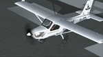
Branded Tail of the GRU Airwing Jabiru.
Game Reserves United GRU) is a grouping of both private and provincial reserves on the western boundary of the Kruger National Park that have come together as a united front, working collaboratively to stop rhino poaching. GRU is a coordinated effort to proactively combat rhino poaching across 25 private and provincial nature reserves (200 000ha). The project has been up and running since early 2013 but has thus far been lacking aerial support.
In a unique and generous gesture Jabiru S.A. and Jabiru Australia have jointly made available a brand new Jabiru J170 aircraft to launch the GRU-Jabiru Airwing. Len en Les Alford of Jabiru SA felt compelled to contribute towards the anti-rhino poaching campaign and chose GRU to manage the operational side for the aircraft that they are making available. It is also their wish that the aircraft provides an opportunity for professional pilots to gain flying time towards their higher qualifications. Five Hoedspruit pilots were chosen for the roster. Jaco Scheepers and Wynand Uys will collect the aircraft from the Jabiru Factory in George in middle September. The “Rhino-Jab†as the aircraft has become known, is generously fitted with communications and navigational equipment to facilitate the pilots in their task to support the ground forces of the various member reserves. Appropriately, its registration is ZU-OPS.
| Filename: | Jabiru_J170_ZUOPS.zip |
| License: | Freeware |
| Added: | 29th April 2018, 16:27:49 |
| Downloads: | 129 |
| Author: | Eberhard Haberkorn / IRIS Simulations |
| Size: | 18.44 MB |
| Category: Flight Simulator 2004 - Scenery | |
| VVCR Cam Ranh Airport |
|
Images related to this file:
File Description:
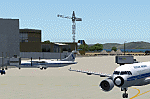
Cam Ranh is currently a fast-growing beauty spot and tourist area on the Vietnamese coast. In May 2004, Cam Ranh airport (VVCR) opened to commercial traffic, initially only serving domestic traffic but international flights will commence in 2005. The airport was once a massive US Air Force base, but was later used as a base for Russion spy plane activities.
This scenery adds this "missing" airport to Flight Simulator, but much is based around satellite views of the airport when the US were spying on the Russian base and other historical information and it may not accurately reflect the airport as it is today. Furthermore, my capabilities at scenery design are limited and restricted to scenery objects available through the Rwy12 scenery creation programme.
You do NOT need to download and install the full 45 MB Rwy 12 Object Placer programme, which is for the designers and not the end user.
Some of the scenery objects will appear without any extra downloads, but to get the greatest benefit from this scenery, you may optionally download following files, which should be installed according to the instructions within this download and not as described in their own download archive:
Level 2 objects
rwy12-lvl2.zip (Israel Roth and Seev Kahn/John Hinson),
Level 3 objects
jw_rwy12.zip (Shehryar Ansari),
tl_rwy12.zip (Todd Lucas) ,
ford_transit_collection.zip (S Legg),
hgrrwy12.zip (ESDG), and
ga-hangers_lib_for_rwy12.zip (S Legg)
Also included with this scenery are two EditVoicepack files which may be imported to that programme so that the controllers will be heard referring to "Cam Ranh".
[File re-uploaded at request of AVSIM] See also file vvcru11.zip.
| Filename: | VVCR_Cam_Ranh_Airport.zip |
| License: | Freeware |
| Added: | 15th May 2010, 01:13:46 |
| Downloads: | 4,180 |
| Author: | John Hinson |
| Size: | 21.36 KB |
| Category: Flight Simulator X - AFCAD Files | |
| RPVM - Mactan Cebu International, Lapu Lapu, Philippines |
|
File Description:
This Afcad for RPVM - Mactan, Cebu International Airport in Lapu-Lapu City, Mactan, Cebu Philippines was made with ADE V1.35 and is for the default RPVM airport in FSX. The civil/military dual use airport was changed primarily based on Google Earth images.
Mactan Cebu International currently receives flights from Cathay Pacific, Asiana, Korean, Malaysian, Mandarin, Qatar Airways, Silkair and Fedex, in addition to the domestic flights of PAL, Cebu Pacific, Air Philippines and South East Asian Airlines. Cebu Pacific also operate international flights from here and the airport is home to much of the Philippines Air Force C130 fleet.
The aprons and taxiways have been re-designed, jetways added, gates and parking spaces coded for the airlines and aircraft types visiting - including the addition of MIL_CARGO spaces for the C130's. The default airport lacks coding and the radius of gates is inadequate for the larger commercial jets coming to RPVM, so use of this file significantly increases traffic. Tested with WOAI, MAIW Exotic Alberts Philippines package and custom AI.
| Filename: | RPVM__Mactan_Cebu_International_Lapu_Lapu_Philippi.zip |
| License: | Freeware |
| Added: | 28th July 2008, 17:49:49 |
| Downloads: | 2,578 |
| Author: | Matthew Brooks |
| Size: | 10.79 KB |
| Category: Flight Simulator 2004 - Scenery | |
| Terrace CYXT in BC Canada Updated |
|
Images related to this file:
File Description:
This version of Terrace has night textures that work, good news for the 319 downloaders who did not tell the author that the ones already posted did not work. Why? Terrace is fifteen miles east and inland from Prince Rupert, which is 500 miles north of Vancouver up the BC coast. It is at the point in the mountains where two fjords meet, one coming from Prince Rupert and the other from Kitimat. There are two runways, the main one is a recently-extended 7,500 feet long and lighted 33/15 and the second is 5,373 feet of unlit 03/21. The apron has been enlarged to be able to accomodate a Boeing 737; though I don't think there is an airline using a 737 for flights to Terrace I have parked an Air Canada jet and the pics show the planes that do fly to Terrace, Air Canada and Hawk Air Dash 8-300's. The aircraft and the textures are down-loadable and and can be used for AI.
| Filename: | Terrace_CYXT_in_BC_Canada_Updated.zip |
| License: | Freeware, limited distribution |
| Added: | 3rd July 2010, 03:28:31 |
| Downloads: | 1,068 |
| Author: | Roger Wensley |
| Size: | 3.72 MB |
| Category: Flight Simulator 2004 - Scenery | |
| Koyuk PAKK in Alaska |
|
Images related to this file:
File Description:
Koyuk is a coastal village around 125 miles east of Nome at the mouth of the Koyuk River, with a population just under 400 living from fishing and the land. The airfield is close by and has a gravel runway aligned 18-36, 3,300 feet long with VASI at both ends. Apart from the airfield itself, and it's buildings, this scenery modifies the local land class, adds village buildings while reducing the village size to reality, and creates a new airfield background. Bering Air and ERA both fly into Deering and are included in the AI. A note here about my scenery making. This is post number 506 and there will not be many more to follow this as I am almost at the end of the photos I either took or found for scenery purposes. There is a limit to what can be located online and I have already been making use of the little there is; eg Unalakleet. So, if you are near an airport (preferably Canadian or Alaskan) and have a camera..... Let me know.
| Filename: | Koyuk_PAKK_in_Alaska.zip |
| License: | Freeware, limited distribution |
| Added: | 15th August 2019, 17:56:50 |
| Downloads: | 144 |
| Author: | Roger Wensley |
| Size: | 3.88 MB |


© 2001-2026 AVSIM Online
All Rights Reserved
Privacy Policy |