
Where Flight Simulation Enthusiasts Gather from Around the World!
AVSIM Library - Search Results

| Category: Flight Simulator 2004 - Scenery | |
| Lismore Regional Airport (YLIS) |

|
File Description:
A very attractive small airport approximately 130 nautical miles from Coffs Harbour and a slightly shorter distance to Grafton and Ballina. This makes a good stopover for hopping down the east coast of Australia. The airport handles around 7 flight a day from Sydney and is also a busy GA aiport. A new terminal is a major feature of the airport with a very modern design. This terminal was opened on Dec 9 2000 and replaces an older style building to be found in the general aviation area. The terminal is at the northern end of the aiport and the GA area the furthest south.
The size of the airport has allowed me to put in that extra detail which makes the terminal and surrounds very much "as in real life". Photographic textures are used throughout for the buildings, trees and shrubs. Thanks to the cooperation of the airport manager and Lismore Council, the owners of the airport, a very accurate model of the airport has been produced from over 250 photographs taken on site. AFCAD and Traffic Tools files are included to add extra AI traffic. For that reason and because of limited apron space few static planes have been used. In addition a landclass is included to make the airport ground texture resemble the real thing and also to widen the river and show the lake to the east of the airport..
The scenery concentrates on adding a realistic terminal to the airport and hangars which are as close as possible to the real thing. Many other details have been added all authentically Lismore.
Some night lighting is included including some very distinctive airport lights in the car park.
| Filename: | Lismore_Regional_Airport_YLIS.zip |
| License: | Freeware |
| Added: | 11th April 2004, 06:31:42 |
| Downloads: | 3,678 |
| Author: | John Ross |
| Size: | 4.21 MB |
| Category: Flight Simulator 2004 - Scenery | |
| Fort Good Hope CZGH - Northwest Territories, Canada |
|
Images related to this file:
File Description:
This is the second in a series of airfields that follow that early access route to the Canadian northern shore, the Mackenzie River. At the far northern end of the river there are Tuktoyaktuk, Inuvik, and Fort McPherson, all posted. Fort Good Hope is at 268 feet ASL and on the east bank of the Mackenzie, 180 miles southeast of Fort McPherson and 100 miles west of Great Bear Lake. The town has a population of around 560, and the main sources of income are from the traditional trapping and hunting. The airport is a mile south of the town, and has almost 4,000 feet of gravel runway. There are scheduled flights to the town by North Wright; I also have two AI GA flights and a Buffalo Airways delivery trip that hops north and south from field to field.
| Filename: | Fort_Good_Hope_CZGH__Northwest_Territories_Canada.zip |
| License: | Freeware, limited distribution |
| Added: | 4th July 2014, 21:03:03 |
| Downloads: | 278 |
| Author: | Roger Wensley |
| Size: | 3.08 MB |
| Category: Flight Simulator 2004 - AFCAD Files | |
| Memphis Intl - KMEM V1.1 |
|
File Description:
AFCAD2 file for the Memphis International Airport (KMEM) V1.1. Adds many gates, also has correct concourses A, B and C. Contains current gate assignments for Northwest and other airlines. Also added the Fedex World Hub, Tennessee Air Guard, Signature Flight Support, and Wilson Air Charter parking. Runway 35 removed, taxiway P2 unavailable, and taxiway east of runway 36R/18L under contruction as it is today. Modelled after current airport approach plates (airport diagram also included for user reference) and author's flying experience. Also updates local airports. M01 corrected runway to new numbers, and added the new ASOS installed to KAWM. New version 1.1 fixes details on KMEM gate numbering, and taxiway procedures, added real parking at KDYR, KFCY, KPGR, KTKX, M04, M36, and M05. Previous version had over 1,200 downloads, pretty good to be an afcad2 file.
| Filename: | Memphis_Intl__KMEM_V11.zip |
| License: | Freeware |
| Added: | 4th November 2003, 18:42:17 |
| Downloads: | 3,980 |
| Author: | Diego Tellez |
| Size: | 258.5 KB |
| Category: Flight Simulator 2004 - Flight Plans | |
| OB-53 Minneapolis Minnesota |
|
Images related to this file:
File Description:
FS2004 Flight Plan for OB-53 Minneapolis Minnesota IFR high speed low altitude military training route. This is the fourteenth in a series of FS2004 flight plans I have uploaded. This route goes through mostly flat and rolling terrain in Minnesota, North Dakota and South Dakota. This route has three different sets of targets. These are great routes for B-52, F-111, B-1B, B-2 A6, A4, Vulcan and any fighter or bomber enthusiasts. Of course you can fly the route with any aircraft of your choice. Included in this package is a gauge by Karol Chlebowski for TFR flying at very low altitude. This gauge will greatly enhance your ability to fly these challenging routes and is a great companion of the flight plans. Another option to download Version 2.0 of my FS2004 mini panel which has all this functionality and more.
| Filename: | OB53_Minneapolis_Minnesota.zip |
| License: | Freeware |
| Added: | 27th July 2011, 23:10:27 |
| Downloads: | 77 |
| Author: | Bill McClellan |
| Size: | 366.29 KB |
| Category: Flight Simulator 2004 - Flight Plans | |
| OB-96 Fort Worth Texas |
|
Images related to this file:
File Description:
FS2004 Flight Plan for OB-96 Fort Worth Texas IFR high speed low altitude military training route. This is the fifteenth in a series of FS2004 flight plans I have uploaded. This route goes through mostly flat and rolling terrain in Texas, Oklahoma and Louisiana. This route has two different sets of targets. These are great routes for B-52, F-111, B-1B, B-2 A6, A4, Vulcan and any fighter or bomber enthusiasts. Of course you can fly the route with any aircraft of your choice. Included in this package is a gauge by Karol Chlebowski for TFR flying at very low altitude. This gauge will greatly enhance your ability to fly these challenging routes and is a great companion of the flight plans. Another option to download Version 2.0 of my FS2004 mini panel which has all this functionality and more.
| Filename: | OB96_Fort_Worth_Texas.zip |
| License: | Freeware |
| Added: | 27th July 2011, 23:11:17 |
| Downloads: | 94 |
| Author: | Bill McClellan |
| Size: | 466.75 KB |
| Category: Flight Simulator 2004 - Flight Plans | |
| OB-97 Fayetteville Arkansas |
|
Images related to this file:
File Description:
FS2004 Flight Plan for OB-97 Fayetteville Arkansas IFR high speed low altitude military training route. This is the sixteenth in a series of FS2004 flight plans I have uploaded. This route goes through mostly flat and rolling terrain in Arkansas, Texas, Oklahoma and Kansas. This route has two different sets of targets. These are great routes for B-52, F-111, B-1B, B-2 A6, A4, Vulcan and any fighter or bomber enthusiasts. Of course you can fly the route with any aircraft of your choice. Included in this package is a gauge by Karol Chlebowski for TFR flying at very low altitude. This gauge will greatly enhance your ability to fly these challenging routes and is a great companion of the flight plans. Another option to download Version 2.0 of my FS2004 mini panel which has all this functionality and more.
| Filename: | OB97_Fayetteville_Arkansas.zip |
| License: | Freeware |
| Added: | 28th July 2011, 09:22:42 |
| Downloads: | 64 |
| Author: | Bill McClellan |
| Size: | 489.81 KB |
| Category: Flight Simulator 2004 - Scenery | |
| USA Landclass AddOn - Vegetation Part 1 UPDATE 1.5 |
|
Images related to this file:
File Description:
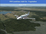
Complete Update, please delete all the old scenery folders. Compatible with Ultimate Terrain, incl. some fixes for UT. Sorry for the update 1.4 called final. Pleas note the readme file. Udate V1.5 concerns mainly British Columbia, the boring LC from CYLW to CYKA to CYWL to CYQZ and to CYXS. Now it is varied, made again with satellite maps. Also change the wrong green LC from KASE (Aspen) to KRIL (Glenwood Springs) and some LC Border correction. BC requires for one LC good replacement textures(026b2.bmp) to enjoy the changes or do it by yourself. Birds Eye View textures includes a good texture. For GEpro Users there is a example picture how to make it with texture 024b2 and 052b2 and a Paintshop Software. For a fast Textureswitch, Batch files are included, also inf and raw files for changing for your according to your taste.
| Filename: | USA_Landclass_AddOn__Vegetation__Part_1_UPDATE_15.zip |
| License: | Freeware |
| Added: | 5th March 2015, 19:32:31 |
| Downloads: | 295 |
| Author: | Markus Balz |
| Size: | 4.01 MB |
| Category: Flight Simulator X - Gauges | |
| A330/A340 Gauge Upgrade v2 |
|
File Description:
This is v2 of the OVERLAND SMS gauges upgrade pack.
It fixes several problems found on the first package and adds a few more features.
NEW FEATURES
1. It adds TERRAIN ON ND function, i.e. you can see the map at the ND (see screenshots). It is not very realistic, compered to the real thing, however it does add more realism and eliminates the use of the GPS for ground reference.
2. It adds a complete ILS CAT II & III autoland function to the aircraft. The original file belongs to Stefan Liebe, being modified by Francois
Dore, and finally being fine tuned for use with SMS A330 and A340 by me. It has been tested many times and this is the closest it can get
to the real thing. Now you can have a completely zero visibility landing performed automatically.
3. It provides new style square monitor 2d panels.
| Filename: | A330A340_Gauge_Upgrade_v2.zip |
| License: | Freeware |
| Added: | 9th June 2012, 06:29:25 |
| Downloads: | 3,146 |
| Author: | Dimitrios Moschos |
| Size: | 6.06 MB |
| Category: Flight Simulator 2004 - Scenery | |
| City of Edmonton |
|
File Description:
Addon scenery project for City of Edmonton, Alberta, Canada, for FS2004. This is a FREEWARE project, created by Brian Sturton, and with special thanks to Joel Gill and Her Majesty the Queen for the included rail.bgl file. Transforms the generic dull scenery around CYXD airport, into a detailed replica of the actual city. Features include a detailed representation of the downtown area, along with most other major structures that would be visible from the air; reflective "glass" buildings; more accurate rendition of West Edmonton Mall (compared to my earlier offering); reworked landclass and elevation values, which permit a nicer rendition of the river valley, as well as the urban areas south of the river; repositioned river sections; bridges; refineries to the east of the city; outlying towns; major roads, and modifications to CYEG and CYYC.
| Filename: | City_of_Edmonton.zip |
| License: | Freeware, limited distribution |
| Added: | 7th May 2006, 03:03:44 |
| Downloads: | 6,418 |
| Author: | Brian Sturton |
| Size: | 5.65 MB |
| Category: Flight Simulator 2004 - Scenery | |
| Leadville (KLXV), Mt. Elbert, Colorado, Photo-Scenery (FS9 & FSX) |
|
Images related to this file:
File Description:
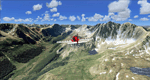
Extends my Aspen scenery to the east and contains more gorgeous Continental Divide area of the Rocky Mountains. Covers Leadville Lake County Airport (KLXV), which is the highest airport in North America (9.927 ft) and Mt. Elbert, which is the highest peak in the Rocky Mountains (14.443 ft). Aircraft performance deteriorates
with altitude, so many companies use the Leadville Airport as a base for high altitude performance testing. This scenery brings you another 3.500 sq km of beautiful Colorado in 4.7m/pix quality.
High resolution versions of this scenery for FS9 and FSX (much sharper, but larger and multiple downloads) are available at www.blueskyscenery.com/GNB_South2West.html . The screenies are taken from the high-res versions, so expect this version to be slightly more blurry. YourDonation@Work: Dedicated to Daniel, Art and Rotui.
| Filename: | Leadville_KLXV_Mt_Elbert_Colorado_PhotoScenery_FS9.zip |
| License: | Freeware |
| Added: | 1st February 2010, 19:06:58 |
| Downloads: | 1,713 |
| Author: | Gottfried Razek - blueskyscenery.com |
| Size: | 94.68 MB |


© 2001-2026 AVSIM Online
All Rights Reserved
Privacy Policy |