
Where Flight Simulation Enthusiasts Gather from Around the World!
AVSIM Library - Search Results

| Category: Flight Simulator X - Scenery | |
| FSX EDDM München Airport |

|
File Description:
Here comes my newly designed Munich Airport EDDM with many details
up to date 2019 with associated parking rights Lufthansa Terminal 2 and satellite terminal were also assigned to the A380 parking.
Roads and terrain have been rebuilt, as well as the visitor hill and the Cargoplätze let you surprise and the whole course as freeware.
Installation:
Simply place and activate the Scenery folder EDDM in Addon Scenery.
To see people you need to download the 3dpeople_lib file from Avsim or Flightsim and copy and paste them into your addon Scenery folder.
All roads have been assigned and AI traffic is working properly.
If you have any questions, please send an e-mail to [email protected]
| Filename: | FSX_EDDM_Mnchen_Airport.zip |
| License: | Freeware |
| Added: | 7th May 2019, 17:09:16 |
| Downloads: | 633 |
| Author: | Ewald Wagner |
| Size: | 802.38 KB |
| Category: Flight Simulator X - Gauges | |
| V-One Gauge for Captain Sim L-1011/F V1.3 Update |
|
File Description:
The following changes / updates are in this update release:
1) Corrected 'Current Trim' XML code error.
2) Corrected placement of sound.ini file folder in ZIP file.
3) Changed take-off call-out V2+15 to V2+10.
4) Added %N3 toggle via 'Opt EPR' display.
5) Added barometric pressure toggle for 'Inches of Mercury' / 'Millibars'.
6) Added auto setting of weight, (LB / KG), pressure (inMg / MB) and temperature (F / C) based of FSX units.
7) Added Headwind / Tailwind toggle via 'Maneuvering Speed'.
8) 'Re-Set Fuel Burned / Re-Initialize Data Card' will re-set fuel used on engineer panel.
9) Added 'Aircraft (reload)' middle mouse button click on 'Fuel Used' display.
| Filename: | VOne_Gauge_for_Captain_Sim_L1011F_V13_Update.zip |
| License: | Freeware, limited distribution |
| Added: | 11th October 2016, 23:38:24 |
| Downloads: | 1,247 |
| Author: | Paul Tally, Stefan Liebe, Jimmy Foong |
| Size: | 3.91 MB |
| Category: Flight Simulator 2004 - Scenery | |
| 8AK7 - Bullen Point - Alaska North Slope 7 |
|
Images related to this file:
File Description:
The town of Barrow is in the far north of Alaska, and these are coastal villages or radar installations to the west, south, and now east of Barrow. There will be further additions. Bullen Point is a DEW station Air Force base 240 miles east of Barrow and 75 miles east of Oliktok. The runway is just under 4,000 feet of gravel and aligned 05-23; this is approximately at right angles to the default FS9 alignment and how that came about is something I doubt Bill Gates could explain. Most of the DEW buildings have now been removed (including the large hangar, which is unusual) but as I had a layout I made the whole site as it was originally, way back in the days when the north slope was still a wilderness. The AI is one day a C-130, on another a Cessna, and on a third a DC3. When I started this North Slope series it was my intention to create the full monty and make all the oil and gas installations and Deadhorse airport etc. I have come to realise that the oil side is impossible to make. There is so much of it and each bit is as time consuming as Heathrow while the actual airfields are more like Rockcliffe CYRO, so a lot of effort for what is just background to an adjoining airfield. But at the same time, if I make the new airstrips it is impossible NOT to make the oil installations as they are the dominating feature. So no new airstrips, and this is going to be just the 1960's or 1970's, when the oil business was only exploratory and the airfields were for villages or DEW stations, and Harmon Helmerick had his dirt strip on the Colville River estuary and was guiding hunters and fishermen and had just started to help out Sinclair Oil with oil exploration in 1966. Read his book. Download my previous post of his field.
| Filename: | 8AK7__Bullen_Point__Alaska_North_Slope_7.zip |
| License: | Freeware, limited distribution |
| Added: | 15th July 2016, 17:46:54 |
| Downloads: | 280 |
| Author: | Roger Wensley |
| Size: | 2.5 MB |
| Category: Flight Simulator X - Miscellaneous Files | |
| Easysatpix 0.9 |
|
Images related to this file:
File Description:

This is a update of our version published at avsim.com on 31st of March 2011.
The regional coverage has been extended. In addition to Europe you can now retrieve weather-maps for the North America and North Atlantic. Other regions (Asia, Australia, Middle Eat, South & Central America such as Africa coming soon).
Easysatpix retrieves free and public data from the Internet such as:
* Satellite Images (IR, VIS, SAT Analysis)
* Weather Analysis Charts (Surface Weather, Significant Weather, Temperatures, Precipitation, Weather Depiction)
* Wind and Hazards Charts (Upper Winds Charts, Jetstream, Icing, Turbulence, Storm Prediction & Warning)
* METAR & TAF (latest & last 4 houres)
* SIGMETS (for several regions)
* NATS (North Atlantic tracks (Maps 6 raw)
* NOTAMS
* Briefing Video for Europe, Asia, N America (Aviation Weather today)
| Filename: | Easysatpix_09.zip |
| License: | Freeware |
| Added: | 28th June 2011, 09:36:21 |
| Downloads: | 721 |
| Author: | Wilhelm Drotleff |
| Size: | 198.78 KB |
| Category: Orbiter - Miscellaneous Files | |
| Edwards AFB Upgrade 1.1 |
|
File Description:
This upgrade replaces Edwards Air Force Base upgrade 1.0. This is an upgrade to, and requires, Slat's Edwards AFB add-on.
Included in this release:
• Five new high-definition surface tiles (for a total of eleven!), covering the area around Rogers Dry Lake, the main base and the north and south bases, including the town of Boron, CA.
• Edwards AFB ILS and VOR frequencies
• Several main flightline hangars
• Edwards tower camera view
• Mesh resolution increased 800%!
• Scenarios to fly several previously-released X-planes at Edwards AFB
• Support for X-33 VentureStar; placement of the VentureStar base in the correct place, just north of Haystack Butte.
Scenarios are included for the following aircraft, all tested/flown at the real Edwards AFB:
• X-15 rocketplane and B-52 dropship
• SR-71 "Blackbird"
• SR-71 with drone
• X-34 lifting body and Lockheed L-1011 Stargazer dropship
• X-36 thrust vector prototype
• X-38 Crew Recovery Vehicle
• X-33 VentureStar
• Shuttle Training Aircraft
(STA control surfaces patch)
• Space Shuttle Enterprise
| Filename: | Edwards_AFB_Upgrade_11.zip |
| License: | Freeware |
| Added: | 18th November 2003, 16:32:31 |
| Downloads: | 4,492 |
| Author: | John Wilson |
| Size: | 2.81 MB |
| Category: Flight Simulator 2004 - Scenery | |
| Lutselk'e CYLK in the Northwest Territories, Canada |
|
Images related to this file:
File Description:
Lutselk'e is a village on the southern shore of the Great Slave Lake, at the eastern end and about 120 miles east of Yellowknife. The Hudson Bay trading company established a post there in 1925, and the current school opened in 1960. The population is in the region of 330. There is no road access, but the government runs a freight shipping service during the ice-free period of the Summer. The airfield is a mile or so east of the village, with a runway of around 3,500 feet of gravel aligned 08-26 with PAPI at both ends and lit, with lights atop traffic cones. There are scheduled flights from Yellowknife by Air Tindi, included in the AI, as is a once a week freight flight by Buffalo Airways. You will need to have downloaded and installed my runway and taxiway lighting library from recent posts. A note here about my scenery making. There will not be many more to follow this as I am almost at the end of the photos I either took or found for scenery purposes, plus I expect to move on from FS9 at some point during next year.
| Filename: | Lutselke_CYLK_in_the_Northwest_Territories_Canada.zip |
| License: | Freeware, limited distribution |
| Added: | 9th December 2019, 18:04:52 |
| Downloads: | 107 |
| Author: | Roger Wensley |
| Size: | 3.25 MB |
| Category: Prepar3D V1-4 - Aircraft Repaints, Textures and Modifications | |
| A2A Spitfire "Silver Spitfire" |
|
Images related to this file:
File Description:
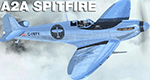
"In 2019 two intrepid aviators will attempt to fly a Silver Spitfire around the world, taking in some of the most famous landmarks on the planet from the Grand Canyon in the West to the snow-capped peak of Mount Fuji in the East." - this is a skin representing it made for the A2A Spitfire add on
| Filename: | A2A_Spitfire_Silver_Spitfire.zip |
| License: | Freeware |
| Added: | 13th August 2019, 16:42:38 |
| Downloads: | 137 |
| Author: | Tom Weiss |
| Size: | 26.76 MB |
| Category: Flight Simulator 2002 - AFCAD Files | |
| Nice LFMN Fictional (!) AI traffic gates |
|
File Description:
Fictional AFCAD file for the airport Nice LFMN wich is located in the south east of France. Great for use with Project AI or other flight plans. 40+ parking positions/gates. Including 3 heavy parkings. For use only with DEFAULT FS2002.
4L/22R for take off, 4R/22L for landing (ILS).
Most parking positions are fictional!
| Filename: | Nice_LFMN_Fictional__AI_traffic_gates.zip |
| License: | Freeware |
| Added: | 23rd July 2007, 02:41:33 |
| Downloads: | 69 |
| Author: | Bart Ruijs |
| Size: | 5.66 KB |
| Category: Flight Simulator X - Aircraft Repaints, Textures and Modifications | |
| Seair / Tiger Airways BAe ATP (RP-C6317) |
|
Images related to this file:
File Description:
FSX BAe ATP freeware repaint textures for a Tiger Airways influenced
South East Asian Airlines RP-C6317 'Fun Philippines' livery For the freeware
Enigma Simulations BAe ATP (enigma_atp_basepack.zip), which you must have
previously installed in FSX. Also includes FSX engine smoke [SMOKESYSTEM]
coordinates for your 'aircraft.cfg' file if you wish. Easy installation.
Screenshots enclosed. Repaint by Tom Tiedman.
| Filename: | Seair__Tiger_Airways_BAe_ATP_RPC6317.zip |
| License: | Freeware |
| Added: | 15th April 2014, 08:15:42 |
| Downloads: | 95 |
| Author: | Enigma Simulations / Tom Tiedman |
| Size: | 10.09 MB |
| Category: Flight Simulator X - Scenery | |
| DIAP - Port Bouet Airport - Abidjan, Côte d'Ivoire |
|
File Description:
Port Bouet Airport (IATA: ABJ, ICAO: DIAP), also known as Felix Houphouet-Boigny International Airport, is located 10 miles (16 kilometres) south east of Abidjan, Cote d'Ivoire. It is the largest airport in the country for air traffic. The airport is the main hub of the national airline Air Cote d'Ivoire
This work is dedicated to West Wind Airlines.
| Filename: | DIAP__Port_Bouet_Airport__Abidjan_Cte_dIvoire.zip |
| License: | Freeware |
| Added: | 20th April 2013, 20:15:20 |
| Downloads: | 4,776 |
| Author: | Anwar Gonzalez |
| Size: | 1.06 MB |


© 2001-2026 AVSIM Online
All Rights Reserved
Privacy Policy |