
Where Flight Simulation Enthusiasts Gather from Around the World!
AVSIM Library - Search Results

| Category: Flight Simulator X - Scenery | |
| Formosa X RCTP Taiwan Taoyuan International Airport (2/2) |

|
Images related to this file:
File Description:
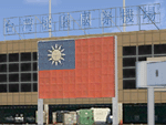
This project improves the default FSX scenery to better represent the appearance of Taoyuan International Airport as it is in 2011. All airport buildings and nearby landmarks were were custom-made using gMax, including animated radars and People Movers. Runways, taxiways, and aprons have been repositioned based on satellite imagery. Aircraft parking had been updated using the latest real-world AIP. A photoreal terrain of the Taoyuan area, plus landclass improvements, is also included. Part 1 of this package contains the airport scenery. Part 2 contains background photoreal textures and landclass files.
| Filename: | Formosa_X_RCTP_Taiwan_Taoyuan_International_Airpor.zip |
| License: | Freeware |
| Added: | 17th May 2011, 03:00:04 |
| Downloads: | 14,111 |
| Author: | Houting Chiang, Rudolf Liu, Jack Su, Mike Huang |
| Size: | 96.79 MB |
| Category: Flight Simulator 2004 - Scenery | |
| Idaho County S80 Airport |
|
File Description:
Another small airport in beautiful Idaho. Near the mountains but not in them, this airport offers easy access and 24 hour operation. The airport NOTAM mentions skydiving activity, so I'm guessing the large circular dirt area is a landing target for the skydivers. All aprons were redrawn and buildings replaced according to better match Google Earth images. The landclass was modified to reduce the nearby city to a more realistic size and replace the farmland surrounding the airport.
This scenery was designed for Ultimate Terrain and may or may not work with the default scenery.
| Filename: | Idaho_County_S80__Airport.zip |
| License: | Freeware |
| Added: | 27th July 2008, 11:51:45 |
| Downloads: | 495 |
| Author: | Sidney Schwartz |
| Size: | 651.96 KB |
| Category: Flight Simulator 2004 - Scenery | |
| Rankin Inlet CYRT scenery |
|
Images related to this file:
File Description:
Located on the western shore of Hudson bay in northern Canada, Rankin Inlet is the second largest settlement in the Nunavut province, behind Iqaluit. This is a complete and much more accurate rebuild of the default scenery. It features a custom made, photo textured terminal, and missing lakes, roads and the village have been restored. Military hanger by Roger Wensley. Instrument approach plates are included. This scenery was designed for use with Ultimate Terrain and was not tested in the default scenery. It may or may not work in FSX.
| Filename: | Rankin_Inlet_CYRT_scenery.zip |
| License: | Freeware |
| Added: | 23rd March 2011, 08:16:12 |
| Downloads: | 1,206 |
| Author: | Sidney Schwartz & Peter Ham |
| Size: | 2.56 MB |
| Category: Flight Simulator X - Scenery | |
| Cardiff International Airport (EGFF) for FSX |
|
File Description:
Cardiff International Airport (EGFF) designed for FSX using FSX specific code. Two versions are included, one for default scenery users and the other for photographic scenery users. The photographic scenery version blends in with the surrounding terrain and the cliff effects are removed. Also included in this version are scenery files to remove the cliff effect and correctly align the runways for nearby R.A.F. St Athan. Both versions of the scenery contain many custom built Gmax models which are based on photographs, working jetways and Visual Reporting Points.
| Filename: | Cardiff_International_Airport_EGFF_for_FSX.zip |
| License: | Freeware |
| Added: | 1st January 2008, 10:51:53 |
| Downloads: | 4,279 |
| Author: | Terry Shields |
| Size: | 2.14 MB |
| Category: Flight Simulator X - Scenery | |
| Formosa X RCTP Taiwan Taoyuan International Airport (1/2) |
|
Images related to this file:
File Description:
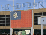
This project improves the default FSX scenery to better represent the appearance of Taoyuan International Airport as it is in 2011. All airport buildings and nearby landmarks were were custom-made using gMax, including animated radars and People Movers. Runways, taxiways, and aprons have been repositioned based on satellite imagery. Aircraft parking had been updated using the latest real-world AIP. A photoreal terrain of the Taoyuan area, plus landclass improvements, is also included. Part 1 of this package contains the airport scenery. Part 2 contains background photoreal textures and landclass files.
| Filename: | Formosa_X_RCTP_Taiwan_Taoyuan_International_Airpor.zip |
| License: | Freeware |
| Added: | 17th May 2011, 02:59:37 |
| Downloads: | 16,744 |
| Author: | Houting Chiang, Rudolf Liu, Jack Su, Mike Huang |
| Size: | 15.39 MB |
| Category: Flight Simulator 2004 - Scenery | |
| FS2004 Flymex Aftershave - Centro (1 of 2) |
|
File Description:
A hand made shaving work over the FlyMex scenery for FS2004. This package will improve your flying experience by "shaving" every satellite airport background image and adjusting its color to better match the default terrain textures with an absolutely new night environment, it will fix every AFCAD and add some missing navaids, taxi signs and windsocks, also this package includes some landclass enhancements. Fixed airports in this pack: Acapulco, Leon, Colima, Cuernavaca, Guadalajara, Atizapan and Mexico City. PRIOR TO APPLY THIS PATCH YOU MUST HAVE INSTALLED "Aeropuertos de Mexico Edicion Centro" by FlyMex.
| Filename: | FS2004_Flymex_Aftershave__Centro_1_of_2.zip |
| License: | Check within download |
| Added: | 6th February 2010, 02:30:31 |
| Downloads: | 2,887 |
| Author: | Angel Salazar Estrada |
| Size: | 56.18 MB |
| Category: Flight Simulator X - AFCAD Files | |
| LNMC - Principality of Monaco Heliport |
|
File Description:
I dedicate this to all virtual pilots for FSX scenery who fly at night and during the day, thist is the scenario of the Principality of Monaco (Principato di Monaco) with its heliport (LNMC). For a better representation/experience I suggest using Ultimate Terrain Europe for FSX.
The installation of this scenario is very simple, the file goes placed in the folder Addon Scenery for FSX and you do not even add it as a scenario because it will be added automatically.
| Filename: | LNMC__Principality_of_Monaco_Heliport.zip |
| License: | Freeware |
| Added: | 25th May 2013, 19:45:02 |
| Downloads: | 1,600 |
| Author: | Pasquale Marrulli |
| Size: | 11.97 KB |
| Category: Flight Simulator 2004 - Scenery | |
| Grand Junction Regional |
|
File Description:
FS2004 - Scenery Grand Junction Regional Airport (Walker Field) (IATA: GJT, ICAO: KGJT, FAA LID: GJT) is a public airport located three miles (5 km) northeast of the central business district of Grand Junction, a city in Mesa County, Colorado, United States. The airport covers 2,357 acres (9.5 km²) and has two runways. It is the largest airport in western Colorado. This Scenery is compatible with both FS9 default and Ultimate Terrain. Created using Instant Scenery by John B. Loney, Jr.
| Filename: | Grand_Junction_Regional.zip |
| License: | Freeware, limited distribution |
| Added: | 11th September 2008, 00:10:25 |
| Downloads: | 1,685 |
| Author: | John B. Loney, Jr. |
| Size: | 1.14 MB |
| Category: Flight Simulator 2004 - Panels | |
| Revised panel of Super King Air B200 |
|
Images related to this file:
File Description:
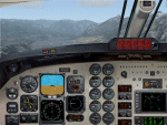
Re-upload. These panel bitmaps require the commercial software package of "Aeroworx X-treme King Air B200" Version 2.0.1 for FS2004. You can get this wonderful bird at http://www.aeroworx.com/. The changed 2D-bitmaps are copyright protected and published with permission of Aeroworx.
The modifications are limited to a different perspective design of the middle pole from the PIC's and well the FO's view. You will find as well included in this package a description of the necessary modifications of the panel.cfg files if you want to see a working "Bendix/King KLN 90B TSO" in all views (where applicable), including the VC.
Thanks and credits are given to Aeroworx.
| Filename: | Revised_panel_of_Super_King_Air_B200.zip |
| License: | Check within download |
| Added: | 24th May 2010, 01:43:07 |
| Downloads: | 3,558 |
| Author: | Axel Birsul |
| Size: | 3.49 MB |
| Category: Fly! II - Aircraft | |
| Moving Map ROTW 230 PA 28 |
|
File Description:
Moving Map ROTW 230 PA 28 by Laurent Claudet and TJ (ROTW).
The ROTW PA 28 is now equipped with the new ROTW 230 moving map GPS.
Other improvements :
* Improved instruments : airspeed indicator, altimeter, artificial horizon, ADF
* A master switch for the avionics (no more small white switches)
* Improved pilot position : the yoke is now in the middle of the field of view.
* Improved precision of the fuel level, oil pressure and fuel pressure gauges.
* Bugfix for the rheostat : it now changes the level of the instrument lighting and not of the whole cockpit
* Improved sideviews
Make sure that you already have the original PA 28
| Filename: | Moving_Map_ROTW_230_PA_28.zip |
| License: | Freeware, limited distribution |
| Added: | 9th January 2004, 13:40:37 |
| Downloads: | 461 |
| Author: | Laurent Claudet and TJ (ROTW) |
| Size: | 7.62 MB |


© 2001-2026 AVSIM Online
All Rights Reserved
Privacy Policy |