
Where Flight Simulation Enthusiasts Gather from Around the World!
AVSIM Library - Search Results

| Category: Flight Simulator X - AI Flight Plans | |
| FLN Frisia-Luftverkehr - Winter 2019/2020 |

|
Images related to this file:
File Description:

Current flight plan of FLN Frisia-Luftverkehr for winter 2019/2020.
FLN FRISIA-Luftverkehr GmbH Norddeich, usually shortened to FLN, is a small airline from Germany based in Norden, Lower Saxony, which was founded on 14 June 1969. Nowadays, FLN operates scheduled flights between Norden and Juist, as well as on-demand charter flights to the other East Frisian Islands.
| Filename: | FLN_FrisiaLuftverkehr__Winter_20192020.zip |
| License: | Freeware |
| Added: | 7th January 2020, 18:11:33 |
| Downloads: | 265 |
| Author: | Frank Drebing |
| Size: | 18 KB |
| Category: Flight Simulator 2004 - Scenery | |
| Humber Bridge and BAe Aircraft Factory Brough. |
|
File Description:
The following GMax scenery is compatible with systems with or without the VFR Photographic Scenery - East and South-East England.
FS2004 doesn't seem to have the Humber Bridge unlike FS2002 which did have it, albeit a rather a poor representation. I therefore took it on myself to rectify this ommission. Included with the bridge is the contol room, toll booths, Country Park Inn, Humber Rescue and some local cottages. At the same time I decided to add the British Aerospace factory buildings at Brough aligned with the aid of the VFR Photographic Scenery package. I used what photographic textures I could legally obtain for many of the buildings. I don't profess it to be totally acurate but it is a fair representation. At least you can now try the tricky approach to runway 12 over the old design offices.
| Filename: | Humber_Bridge_and_BAe_Aircraft_Factory_Brough.zip |
| License: | Freeware |
| Added: | 24th February 2004, 23:12:56 |
| Downloads: | 5,466 |
| Author: | Barry Wells |
| Size: | 4.26 MB |
| Category: Flight Simulator 2004 - Scenery | |
| KLBB - Preston Smith Intl. - Lubbock, Texas Version 2.0 |
|
Images related to this file:
File Description:

Thank you for downloading this scenery. Lubbock is another one of those little known, neglected airports that populate the
FS world. Avery simple airport, LBB somewhat feels like a little DFW. There is a very DFW-ish main terminal with fewer than
10 gates and plenty of space to grow. The only mainline service is courtesy Southwest, but several RJ's freqent Lubbock
several times per day along with the big freighters. This airport was built from the ground up with excellent detail,
and because of the sparse traffic, frame rates are excellent as well.
Update:
Recently, Lubbock has moved their east-west runway 8/26 roughly 1000 feet to the East so as to eliminate runway incursions
by separation from the north-south runway 17R-35L. Version 2.0 reflects this modificaton. Several taxiways have been removed
or modified, and airport fencing has been altered to reflect the change.
| Filename: | KLBB__Preston_Smith_Intl__Lubbock_Texas__Version_2.zip |
| License: | Freeware |
| Added: | 30th September 2012, 07:38:45 |
| Downloads: | 847 |
| Author: | FRFstudio.net / William Morgan |
| Size: | 8.09 MB |
| Category: Flight Simulator X - Aircraft Repaints, Textures and Modifications | |
| "Miss Helen" P-51D Mustang (G-BIXL) V.2 |
|
Images related to this file:
File Description:
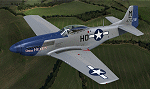
This is a repaint for the payware Warbirdsim P-51D "Mustang Tales" product. This is a new and vastly improved/updated version of my previous repaint, depicting the restored P-51D 44-72216, owned by Robert Tyrrell, based at Chichester/Goodwood Airport, England and operated with the Boultbee Flight Academy. The aircraft is painted in its original WWII markings as "Miss Helen", which was originally assigned to the 487th FS, 352nd FG, 8th AF, piloted by Capt. Raymond Littge. After WWII, the aircraft saw service in the Swedish AF and Israeli AF, eventually being purchased and brought out of Israel by Robs Lamplough in 1976. Following restoration, the aircraft first flew again in 1987 and can be seen in the 1990 movie "Memphis Belle", painted as "Miss L". This repaint is stand-alone and does not require my previous version to be installed. New bump maps and modified cockpit textures included.
| Filename: | Miss_Helen_P51D_Mustang__GBIXL_V2.zip |
| License: | Freeware |
| Added: | 7th July 2017, 17:06:43 |
| Downloads: | 157 |
| Author: | John Terrell |
| Size: | 32.75 MB |
| Category: Flight Simulator 2004 - Scenery | |
| Cordova Smith PACV & Municipal CKU in Alaska US |
|
Images related to this file:
File Description:
Cordova is on the south coast of Alaska, around 150 miles east of Anchorage and 45 miles south of Valdez. The town is mainly built on a small but relatively flat area between the east side of Prince William Sound and Eyak Lake, and has a population of around 2,350 in 2010, the approximate date of this scenery.
The Municipal Airfield CKU is on the north side of Eyak Lake to the east of Cordova, with the runway that is 1,800 feet of unlit gravel squeezed between the lake and the road that runs around the lake. The hangars and parking aprons are reached by taxiing across, and to some extent along, the road. Float planes are also taken from the lake to an apron to the west of the runway.
Cordova Airport PACV (named in the real world "Merle K. (Mudhole) Smith", and I will leave you to research this) is known as Cordova Smith in FS9 and is 10 miles to the east of the town on relatively flat ground between mountains to the north and the sea to the south. The runway is 8,080 feet of lit asphalt aligned 09-27 with ILS on runway 27 and VASI on both ends. The aprons are to the north side of the runway and are reached by back-taxiing; there are no taxiways parallel to the runway. The main apron serves Alaska Air via the western of two taxiways. The GA parking and hangars are mainly reached by using the eastern taxiway, though there is in fact a connecting taxiway between the two (for GA, but definitely not for airliner use). The taxiway further to the west serves the separated Alaska Coastguard apron and hangar, which is mainly for helicopter use. There is a nominally grass runway 1,900 feet long and aligned 16-34 to the south of the main runway; in fact it appears to be more gravel than grass. I have left this inactive as otherwise AI Alaska Air planes would be attempting to use this when the wind made it seem like a good idea.
The AI includes Alaska Air (twice a day) and also Coastguard helicopters, along with GA.
| Filename: | Cordova_Smith_PACV__Municipal_CKU_in_Alaska_US.zip |
| License: | Freeware, limited distribution |
| Added: | 22nd January 2022, 21:53:03 |
| Downloads: | 148 |
| Author: | Roger Wensley |
| Size: | 16.93 MB |
| Category: Flight Simulator 2004 - AI Aircraft | |
| McDonnell Douglas F-4C Phantom II (AI Phantoms Phorever Part 1) |
|
Images related to this file:
File Description:
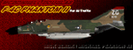
McDonnell Douglas F-4C Phantom II (AI Phantoms Phorever Part 1). This is one of the most iconic military aircraft of all time, ushering in the modern age of air combat; from Asia to the Middle East; and many of the 5,057 manufactured airframes are still in active use today, after over five decades of excellent service. This model set utilized FSDS source files for Nick Black's original F-4E Phantom II 8-LOD AI model, and has been heavily modified for this project. Numerous changes are listed in the extensive documentation with this file. This file contains early and late F-4C base models, as well as the EF-4C Wild Weasel variant. The three main aircraft variants include a total of 24 loadout options, and numerous paints representing these aircraft in service. I have also included a layered Photoshop paint kit for eager repainters. Of particular note, for the F-4C late model, is a large collection of 58th Tactical Fighter Training Wing repaints from my hometown Luke AFB from the 1970s. This project is the first part of what will hopefully be a comprehensive and fairly complete (AI traffic) history of this aircraft. I did not do this alone by any means, and all contributors that I can think of are listed in the documentation. This is the complete aircraft, with all main FS textures and effects included. Original FSDS source and paint kit by Nick Black; FDE by Mike MacIntyre, all model/paint kit modifications and repaints by Michael Pearson.
| Filename: | McDonnell_Douglas_F4C_Phantom_II_AI_Phantoms_Phore.zip |
| License: | Freeware |
| Added: | 9th January 2012, 17:42:48 |
| Downloads: | 1,189 |
| Author: | Michael Pearson |
| Size: | 18.98 MB |
| Category: Flight Simulator 2004 - Scenery | |
| Alaska North Slope 4: Lonely Air Force Station (AK71) |
|
Images related to this file:
File Description:
The town of Barrow is in the far north of Alaska, and these are coastal villages or radar installations to the west, south, and now east of Barrow. There will be further additions. Lonely Air Force Station AK71 is 80 miles east of Barrow and on the coast. It was, and at first sight appears still to be, a DEW station until you are close enough to see that the gravel apron is deteriorating. There is a gravel runway around 5,000 feet long, a large hangar, the DEW buildings, radar under the domes, the remains of huge line-of-sight communications reflectors, and oil tanks. Some DEW sites are not worth a visit; others are surprisingly intact and this is one of those. The AI takes place three days a week and is a C130, in which case the DEW site is still functioning or under mothball maintenance, a chartered Reeve Aleutian in which case the site is closed and they are documenting wildlife, and a Cessna with a group of the curious.
| Filename: | Alaska_North_Slope_4_Lonely_Air_Force_Station_AK71.zip |
| License: | Freeware, limited distribution |
| Added: | 20th June 2016, 08:02:18 |
| Downloads: | 309 |
| Author: | Roger Wensley |
| Size: | 2.32 MB |
| Category: Flight Simulator X - Scenery | |
| Margarita Airport (SVMG)-Venezuela |
|
Images related to this file:
File Description:
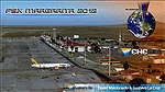
This scenery includes terminal building with realistic textures from images obtained from Internet.
In addition, corrects the erroneous position of the runway to the real-life coordinates.
With photo-terrain scenery from satellite imagery of Google Earth.Not compatible with versions prior to FSX. Also includes a friendly Auto-Install. Requires installation of FSX-SP2 or FSX-Acceleration
| Filename: | Margarita_Airport_SVMGVenezuela.zip |
| License: | Freeware |
| Added: | 6th December 2012, 02:24:23 |
| Downloads: | 4,223 |
| Author: | David Maldonado & Gustavo La Cruz |
| Size: | 80.59 MB |
| Category: Orbiter - Spaceships | |
| KH1 Reconnaisance Satellite c. 1960 w/ Thor DM19 / Agena A Booster |
|
File Description:
This is a correction on the original file. I accidentally left two cfg and ini files out of the zip.
Launch a KH1 Reconnaisance Satellite circa 1960. These used a Thor DM19 / Agena A booster in the U.S. 'Corona' Project between 1959 and 1960. The first photo intelligence satellite, these provided data on activities in the Soviet Union and East Bloc nations. Now you have your own, go spy on your neighbor.
| Filename: | KH1_Reconnaisance_Satellite_c_1960_w_Thor_DM19__Ag.zip |
| License: | Freeware |
| Added: | 8th June 2003, 12:12:52 |
| Downloads: | 790 |
| Author: | Jim Clem aka Travmind |
| Size: | 616.5 KB |
| Category: Flight Simulator X - Scenery | |
| St. Helena, Ascension, and Tristan da Cunha Islands |
|
Images related to this file:
File Description:
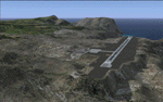
This project was begun to add the new airport (FHSH) to St. Helena Island and eventually was expanded to include a complete remake of Ascension Island (FHAW) and Tristan da Cunha (with an optional airport FHTC) and Gough Island with the actual weather station heliport (FHGH). Tested in both the default FSX/Acceleration and with FTX Global/Vector, accurate coastlines, lakes, road data, and SRTMGL1 (30m) mesh, as well as corrected landclass are provided based on the latest available satellite imagery. Flight plans are provided for the proposed commercial service to St. Helena, and some additional GA and military flights to the island are added as well.
The FSX St. Helena (FHSH) airport was created by aligning master plans for the airport with current satellite data and by studying many of the pictures that have been posted as the airport has taken shape. The official opening of the real airport on May 21, 2016, has been pushed back for more field tests due to challenging crosswinds. The Ascension Island (FHAW) airport was updated after I realized that Ascension could receive commercial service as a result of the new St. Helena airport. The entire airfield is redesigned to allow the volcanic terrain to display properly. The airbase, towns, BBC Atlantic relay station, and numerous satellite dishes, radomes, and wind turbines now appear in their real-world locations. Since I was already in the region, I added the Tristan da Cunha Islands (including Inaccessible, Nightingale and Gough Islands) and the Gough Island weather station maintained by the South African National Antarctic Programme. I also added an optional airport (and flight plans) to Tristan da Cunha (FHTC), which can be easily enabled/disabled. The FHTC airport is placed on the only part of the island that appears to be free of people or farmland, and the area is just long enough to accommodate a pared-down version of the St. Helena airport.
Updates were created or rebuilt in a manner which carefully aligns airport data with current satellite imagery. Scenery was created using Airport Design Editor X v1.67.5684, SBuilderX 3.13, and the FSX Object Placement Tool. Scenery objects were added and modified from stock FSX scenery to resemble as closely as possible the actual airports. The animated flag model is by Dietmar Loleit, the FSX apron lights included are from the set created by Jim Dhaenens, and the animated wind turbines and radomes are from the freeware package by Ray Porter.
| Filename: | St_Helena_Ascension_and_Tristan_da_Cunha_Islands.zip |
| License: | Freeware |
| Added: | 1st May 2016, 11:23:05 |
| Downloads: | 6,090 |
| Author: | Carlyle Sharpe |
| Size: | 10.52 MB |


© 2001-2026 AVSIM Online
All Rights Reserved
Privacy Policy |