
Where Flight Simulation Enthusiasts Gather from Around the World!
AVSIM Library - Search Results

| Category: Flight Simulator 2004 - Scenery | |
| Humber Bridge and BAe Aircraft Factory Brough. |

|
File Description:
The following GMax scenery is compatible with systems with or without the VFR Photographic Scenery - East and South-East England.
FS2004 doesn't seem to have the Humber Bridge unlike FS2002 which did have it, albeit a rather a poor representation. I therefore took it on myself to rectify this ommission. Included with the bridge is the contol room, toll booths, Country Park Inn, Humber Rescue and some local cottages. At the same time I decided to add the British Aerospace factory buildings at Brough aligned with the aid of the VFR Photographic Scenery package. I used what photographic textures I could legally obtain for many of the buildings. I don't profess it to be totally acurate but it is a fair representation. At least you can now try the tricky approach to runway 12 over the old design offices.
| Filename: | Humber_Bridge_and_BAe_Aircraft_Factory_Brough.zip |
| License: | Freeware |
| Added: | 24th February 2004, 23:12:56 |
| Downloads: | 5,466 |
| Author: | Barry Wells |
| Size: | 4.26 MB |
| Category: Flight Simulator X - Aircraft Repaints, Textures and Modifications | |
| "Miss Helen" P-51D Mustang (G-BIXL) V.2 |
|
Images related to this file:
File Description:
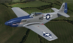
This is a repaint for the payware Warbirdsim P-51D "Mustang Tales" product. This is a new and vastly improved/updated version of my previous repaint, depicting the restored P-51D 44-72216, owned by Robert Tyrrell, based at Chichester/Goodwood Airport, England and operated with the Boultbee Flight Academy. The aircraft is painted in its original WWII markings as "Miss Helen", which was originally assigned to the 487th FS, 352nd FG, 8th AF, piloted by Capt. Raymond Littge. After WWII, the aircraft saw service in the Swedish AF and Israeli AF, eventually being purchased and brought out of Israel by Robs Lamplough in 1976. Following restoration, the aircraft first flew again in 1987 and can be seen in the 1990 movie "Memphis Belle", painted as "Miss L". This repaint is stand-alone and does not require my previous version to be installed. New bump maps and modified cockpit textures included.
| Filename: | Miss_Helen_P51D_Mustang__GBIXL_V2.zip |
| License: | Freeware |
| Added: | 7th July 2017, 17:06:43 |
| Downloads: | 157 |
| Author: | John Terrell |
| Size: | 32.75 MB |
| Category: Flight Simulator X - Scenery | |
| RAF Great Massingham - Norfolk, England |
|
File Description:
RAF Great Massingham is a former Royal Air Force station located 8.1 miles (13.0 km) southwest of Fakenham, Norfolk and 11.7 miles (18.8 km) east of King's Lynn, Norfolk, England.
The airfield was built as a satellite airfield of RAF West Raynham in 1940. The airfield closed in 1945, although remained in use for storage until the 1950s. Source: Wikipedia.
| Filename: | RAF_Great_Massingham__Norfolk_England.zip |
| License: | Freeware |
| Added: | 19th December 2015, 23:58:54 |
| Downloads: | 259 |
| Author: | Terry Boissel |
| Size: | 2.25 MB |
| Category: Flight Simulator X - Aircraft Repaints, Textures and Modifications | |
| Spitfire Mk IIa P7665 |
|
Images related to this file:
File Description:

This repaint is for the A2A Wings of Power III Spitfire MkIIa. Representing P7665 of 65 Squadron, "East India Squadron", Tangmere, West Sussex, February 1941. Flown by Pilot Officer Geoffrey Hill, who was shot down and captured near St. Omer France.
After escaping from Stalag Luft 111 three times, he was sent to Colditz prison where he remained until released in May 1945.
| Filename: | Spitfire_Mk_IIa_P7665.zip |
| License: | Freeware |
| Added: | 1st November 2016, 21:23:04 |
| Downloads: | 136 |
| Author: | Steve Landau |
| Size: | 34.12 MB |
| Category: Flight Simulator 2002 - AFCAD Files | |
| Selfridge Air National Guard Base, Mt. Clemens, MI |
|
File Description:
AFCAD file for KMTC (Selfridge Air National Guard base, Mt. Clemens, MI).This will properly name all of the open taxiways as well as both runways at KMTC. Ramp parking is provided in the form of large and medium ramp parking on the East Parking area as well as additional large areas in the West parking area.Requires AFCAD by Lee Swordy.
| Filename: | Selfridge_Air_National_Guard_Base_Mt_Clemens_MI.zip |
| License: | Freeware |
| Added: | 7th July 2002, 00:57:08 |
| Downloads: | 311 |
| Author: | B. Stockwell |
| Size: | 8.38 KB |
| Category: Flight Simulator 2002 - Scenery | |
| Cajun Building |
|
File Description:
This "Cajun Building" is located on our Toledo Bend airfield down in south-east Texas,right near Cajun country. The building is used as a storage facility and is not climate controlled. The results of the high humidity can be seen on the walls of the building. But you got to have these type buildings on the old grass roots airfields.
| Filename: | Cajun_Building.zip |
| License: | Freeware |
| Added: | 26th December 2002, 23:21:43 |
| Downloads: | 295 |
| Author: | DL Thompson |
| Size: | 350.21 KB |
| Category: Flight Simulator 2002 - Aircraft Repaints, Textures and Modifications | |
| EuroManx Beech 1900D |
|
File Description:
FS2002 Beechcraft 1900D repaint EuroManx
Repaint of the Beech1900D by Mike Stone.
EuroManx was formed early in 2002 in the Isle of Man by Woodgate Executive Air Charter Ltd. EuroManx fly scheduled services to Dublin, Edinburgh, East Midlands and Liverpool. The services are flown with Beech 1900 aircraft leased from Rossair, Rotterdam of which PH-RAR is flying in EuroManx colours.
| Filename: | EuroManx_Beech_1900D.zip |
| License: | Freeware, limited distribution |
| Added: | 7th January 2003, 01:23:32 |
| Downloads: | 653 |
| Author: | John Woodside |
| Size: | 90.38 KB |
| Category: Flight Simulator 2004 - Aircraft Repaints, Textures and Modifications | |
| Viscount Polar Airways |
|
File Description:
Many short term leases saw BAF Viscounts flyng in basic livery with the operators titles. G-AOHT was one of two leased during the winter of 1982/3 to Polar Airways of Teeside. Mainly carrying parcels between East Midlands and Maastrict, Polar ceased trading in April 1983. Requires the FSDS Viscount 800 model by Rick Piper http://www.btinternet.com/~rick.piper/index.htm
| Filename: | Viscount_Polar_Airways.zip |
| License: | Freeware |
| Added: | 30th November 2004, 03:19:55 |
| Downloads: | 198 |
| Author: | Garry Russell |
| Size: | 442.1 KB |
| Category: Flight Simulator X - Aircraft Repaints, Textures and Modifications | |
| P-40E Kittyhawk Royal Netherlands EastIndies Air Force "Snafu" |
|
File Description:
This is a repaint for the IRIS P-40E Kittyhawk, representing P-40N 44-7195, which flew with 120 squadron of the Royal Netherlands East Indies Air Force from Biak in New Guinea between may 1944 and february 1945. Among it's pilots was the squadron commander, major Maurenbrecher. "Snafu" stands for "Situation Normal, All F***ed Up". Repaint by Jan Kees Blom.
| Filename: | P40E_Kittyhawk_Royal_Netherlands_EastIndies_Air_Fo.zip |
| License: | Freeware |
| Added: | 5th October 2008, 13:44:42 |
| Downloads: | 179 |
| Author: | Jan Kees Blom |
| Size: | 5.22 MB |
| Category: Flight Simulator 2004 - AI Flight Plans | |
| Pamir Airways Summer 2009v2 |
|
File Description:
These are Summer 2009 Flightplans for Pamir Airways. Pamir Airways is a private airline in Afghanistan. The Hub of the Airline is the Kabul Airport in Afghanistan. The Fleet consits of 3 aircrafts (1x Boeing 737-200 / 1x Antonov An-24RV /new 1x Boeing 737-400 leased East Air). Now thery have 2 international destinations: Dubai (3x daily) and Delhi (2x weekly)
| Filename: | Pamir_Airways_Summer_2009v2.zip |
| License: | Freeware |
| Added: | 14th April 2009, 12:13:32 |
| Downloads: | 763 |
| Author: | Max Habighorst |
| Size: | 2.64 KB |


© 2001-2026 AVSIM Online
All Rights Reserved
Privacy Policy |