
Where Flight Simulation Enthusiasts Gather from Around the World!
AVSIM Library - Search Results

| Category: Flight Simulator 2004 - Original Aircraft | |
| Royal Hellenic Air Force, Gloster Gladiator Mk 2 V.2.1 |

|
Images related to this file:
File Description:
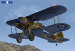
The Gloster Gladiator Mk 2 was the last British biplane fighter, a development of the Gladiator Mk 1 with a 3 blade fixed pitch propeller. The Mark 2 had a 830 hp Bristol Mercury VIIIA engine. During the December of 1940 the R.H.A.F. (E.B.A.) received eight Mk 2 from Egypt based R.A.F. Squadrons and six Mk 2 from Greece based R.A.F. Squadrons. All these fighters armed the E.B.A.'s 21st Fighter Squadron and operated from Ioannina's airport.
Complete aircraft. The original model, created by Thicko Bielat and Morton (panel), features the usual moving parts, such as all flight controls, spinning wheels and so on; navlights added by M.Villa. Two R.H.A.F. (E.B.A.) liveries. Completely new weathered textures by Manuele Villa.
| Filename: | Royal_Hellenic_Air_Force_Gloster_Gladiator_Mk_2_V2.zip |
| License: | Freeware |
| Added: | 7th June 2010, 11:09:28 |
| Downloads: | 3,713 |
| Author: | Manuele Villa, Thicko Bielat |
| Size: | 7.36 MB |
| Category: Flight Simulator 2004 - Scenery | |
| Nikolski (IKO), Nelson Lagoon (Z73), & Perryville (AK5) - Alaska, USA |
|
Images related to this file:
File Description:
These are villages in Alaska, spread out east and west of Dutch Harbor in the Aleutians and the peninsula, served by Grant Aviation regional flights from Dutch Harbor, Cold Bay, or King Salmon.
Nikolski is 115 miles west of Dutch Harbor at the western end of Umnak Island, which is just west of Unalaska, the large island adjacent to Dutch Harbor. Nikolski is small, with a population of perhaps only 20 now, and the main claim to fame is the wrecked Reeve Aleutian DC3 at the end of the runway. The runway is 3,500 feet of gravel aligned 08-26. Nelson Lagoon is on the north shore of the peninsula, 55 miles north of Sand Point and on a long spit of land that curves around to make the lagoon. There is no access except by boat or plane for the population of around 50. The airfield is a mile east of the village with a gravel runway 08-26, 4,000 feet long. Perryville is on the south shore of the peninsula, 65 miles east of Sand Point. The population is around 115, and the airfield is southwest of the town with the 3,500 feet of gravel runway aligned 02-20 beside the shore. There is a hangar on the apron, but no terminal building.
| Filename: | Nikolski_IKO_Nelson_Lagoon_Z73__Perryville_AK5__Al.zip |
| License: | Freeware, limited distribution |
| Added: | 14th March 2015, 13:27:53 |
| Downloads: | 258 |
| Author: | Roger Wensley |
| Size: | 11.45 MB |
| Category: Flight Simulator X - Scenery | |
| Pigs Down Under |
|
Images related to this file:
File Description:
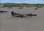
This is a simple upgrade to Australian Airbases Amberly and East Sales. It adds Military Combat and Cargo parking spots, Static F-111G aircraft, AI F-111C, F-111G and EF-111A aircraft and flight plans. Each AI aircraft has it's own tail number and is addressed by ATC with that tail number. Installer has option to add AI aircraft only if you already have an add-on scenery package for these airbases.
| Filename: | Pigs_Down_Under.zip |
| License: | Freeware |
| Added: | 26th August 2011, 16:45:19 |
| Downloads: | 247 |
| Author: | Steve Hess |
| Size: | 4.27 MB |
| Category: Flight Simulator X - Scenery | |
| Governor's Harbour International Airport (MYEM) - The Bahamas |
|
Images related to this file:
File Description:
Central of three airports on Eleuthera Island in the Bahamas just east of Nassau. An abandoned watch tower existing at this airport, and familiar to those who have flown in, has been torn down recently and is not included. The scenery includes custom scenery objects; placement of library objects and landclass changes. Scenery is based on Bing Maps, Google Earth and photos taken locally, and it is optimized for use with UTX-TAC.
| Filename: | Governors_Harbour_International_Airport_MYEM__The_.zip |
| License: | Freeware |
| Added: | 28th June 2013, 00:15:08 |
| Downloads: | 1,266 |
| Author: | Art Poole |
| Size: | 1.61 MB |
| Category: Flight Simulator X - Scenery | |
| KNHK - NAS Patuxent River - Patuxent River, MD |
|
Images related to this file:
File Description:

By request, here is an improved version of the stock NAS Patuxent River. I added Military_Cargo and Military_Combat parking spaces. I added the fire station and fire trucks. I removed and replaced many default buildings, added additional buildings, and added the control tower. Added static fuel trucks, static airplanes and helicopters, parking lots with cars and light poles. Added, removed, or adjusted taxiways and aprons as needed. I moved one apron to be compatible with the Ultimate Terrain coastline, but it should also be fine with default scenery.
| Filename: | KNHK__NAS_Patuxent_River__Patuxent_River_MD.zip |
| License: | Freeware |
| Added: | 10th June 2010, 00:52:06 |
| Downloads: | 2,596 |
| Author: | Jim Cook |
| Size: | 17.37 KB |
| Category: Flight Simulator 2004 - Scenery | |
| Portugal - LPFC Figueira de Cavaleiros |
|
Images related to this file:
File Description:
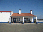
LPFC_FIGUEIRA DE CAVALEIROS (FERREIRA DO ALENTEJO) SCENERY 1.0
Figueira de Cavaleiros Airfield. LPFC is a fake I create, once it has no published ICAO.
This scenery is fully compatible with freeware Portugal Terrain from PTSIM (http://www.ptsim.com) and is based on digital pictures taken at the place, accurate real measures by Aerodromos de Portugal (http://www.pelicano.com.pt/zmapa.html).
Freeware. For Microsoft FS2004. NOT tested for FSX.
By Joao A. G. Ferreira.
| Filename: | Portugal__LPFC_Figueira_de_Cavaleiros.zip |
| License: | Freeware |
| Added: | 3rd December 2010, 15:23:56 |
| Downloads: | 523 |
| Author: | Joao Antonio Graca Ferreira |
| Size: | 1.54 MB |
| Category: Fly! II - Scenery | |
| Base Aerea Gen. Francisco de Miranda La Carlota Venezuela |
|
File Description:
TerraModels Scenery Development System by Allen Kriesman was used to create the scenery for Base Aerea Francisco de Miranda La Carlota's Airport (SVFM), Venezuela. Biber Salsa models were also used to create this scenery and ROTW Models. The taxiways were added using the program by Peter Jacobson.The Elevation of terrain has been fixed to easy land, tks to Alejandro Amigorena. No custom models were created for this scenery.
| Filename: | Base_Aerea_Gen_Francisco_de_Miranda_La_Carlota_Ven.zip |
| License: | Freeware |
| Added: | 21st February 2003, 20:29:16 |
| Downloads: | 224 |
| Author: | Cesar Cedraro |
| Size: | 564.97 KB |
| Category: Flight Simulator 2004 - Scenery Design | |
| Zig Zag Trenches - Military |
|
File Description:
FS2004/FS2002 API macro--Zig Zag Trenches
in 5 different lengths for scenery designers.
These military trenches are constructed
partially above ground as they sometimes were
in muddy terrain as in Vietnam. They are also
above ground because flight simulator does
not allow digging holes in the ground. They
have a sloped dirt front and the inside is
sandbags with a dark bottom to simulate depth.
By Al Simms
| Filename: | Zig_Zag_Trenches__Military.zip |
| License: | Freeware |
| Added: | 21st May 2006, 02:02:31 |
| Downloads: | 408 |
| Author: | Albert E Simms Jr |
| Size: | 133.39 KB |
| Category: Flight Simulator X - Gauges | |
| Generic Stand-Alone HUD |
|
Images related to this file:
File Description:
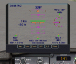
A generic stand-alone HUD, which can be used for any aircraft. Some of the displays can be toggled on or off, as desired, by clicking on the buttons at the base of the HUD. The Color button provides a choice of three colors to suit various terrain or weather backgrounds, and for night flight. Written in the old FS 9 xml. Not tested on FS 9, but should work.
| Filename: | Generic_StandAlone_HUD.zip |
| License: | Freeware |
| Added: | 20th August 2011, 19:58:43 |
| Downloads: | 1,226 |
| Author: | Robert Picht |
| Size: | 213.69 KB |
| Category: Flight Simulator X - Scenery | |
| MTPP - Toussaint Louverture Airport, Haiti |
|
File Description:
This is an enhanced airport scenery for MTPP Toussaint Louverture Airport in Haiti. In addition to the airport facility data, airport photo scenery is provided. The following other airports' facility data are updated: MTCA Cayes, MTCH Cap Haitien Intl, MTJA Jacmel, MTJE Jeremie, and MTPX Port De Paix. A modified season file is provided to show summer terrain textures in central Haiti vice the default fall/winter textures.
| Filename: | MTPP__Toussaint_Louverture_Airport_Haiti.zip |
| License: | Freeware, limited distribution |
| Added: | 26th January 2010, 19:46:48 |
| Downloads: | 5,681 |
| Author: | Scott Smart |
| Size: | 12.01 MB |


© 2001-2026 AVSIM Online
All Rights Reserved
Privacy Policy |