
Where Flight Simulation Enthusiasts Gather from Around the World!
AVSIM Library - Search Results

| Category: Flight Simulator X - Scenery | |
| Brittas House Airfield, Ireland |

|
Images related to this file:
File Description:
Brittas House Airfield is a small private airstrip in east Co. Limerick Ireland. It is home to a narrow grass runway, 700 by 15 meters in size. With it's close proximity to Coonagh (EICN) and Shannon (EINN), it is a great location for VFR flying. The scenery was made using ADE and has been tested in both FSX and P3D and is also compatible with ORBX Global.
| Filename: | Brittas_House_Airfield_Ireland.zip |
| License: | Freeware |
| Added: | 31st August 2018, 22:35:50 |
| Downloads: | 364 |
| Author: | Nathan Gray |
| Size: | 5.68 KB |
| Category: Flight Simulator 2004 - Scenery | |
| Tok Junction 6K8 in Alaska, USA |
|
Images related to this file:
File Description:
Tok Junction is a village, or small town, on the Alaska Highway some 180 miles east of Fairbanks and 60 miles west of the Alaska-Canada border. The town is spread over a wide area on the flat terrain and barely registers among the trees, and as such is not shown in FS9 except as a grid of roads as there is no town terrain texture like it used in FS9. The airfield is at the eastern end of the town and adjacent to the Alaska Highway and I have included some surrounding houses, workshops, shops, lodges, etc. The single runway is 3,000 feet of 50 feet wide asphalt aligned 07-25 and lit. There is a small airline based on the airfield called 40-Mile Air. Their hangar is red and the name written large and 100LL fuel is available beside it at all times. Jet A-1 is available by a telephoned pre-arangement. They are, I believe, no longer flying scheduled flights but they do still function as an air taxi and they have a contract to deliver mail to surrounding villages that are not served by all-weather roads. The airfield now has a new icao "PFTO" but in FS9 it remains as the original FAA LID, 6K8. The FS9 roads are not accurately placed, and the grass airfield background is not really appropriate as the reality is more like gravel mixed with earth; it is however difficult to replicate this with the available textures and still prevent bushes or trees appearing. But, in the winter and with snow on the ground it looks as it should. A note here about my scenery making. There will not be many more to follow this as I am almost at the end of the photos I either took or found for scenery purposes, plus I expect to move on from FS9 at some point during next year.
| Filename: | Tok_Junction_6K8_in_Alaska_USA.zip |
| License: | Freeware, limited distribution |
| Added: | 14th January 2020, 17:49:21 |
| Downloads: | 176 |
| Author: | Roger Wensley |
| Size: | 25.47 MB |
| Category: Flight Simulator X - Aircraft Repaints, Textures and Modifications | |
| FSX/P3D Thomas Ruth Air Leisure Egypt SU-GBM Airbus A340-212 |
|
Images related to this file:
File Description:
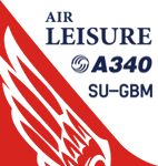
(TEXTURES ONLY)
(ONLY TESTED IN FSX: STEAM EDITION)
This was requested by Ahmed Fouad on the Facebook as well as in Flightsim. This has been requested by him for a while so I decided to do it.
Happy New Years guys! This is my first livery for the year. Sadly, as of writing this, Flightsim just went offline for renovation and may stay like that for who knows how long. Could be days, weeks, or even months.
I used the placards from Joey_C's Dragonair A330-300 Livery for the Bulk Cargo Doors as well as the Cargo Door Levers. He is the same user I asked permission from to use his decals and door placards for my Dragonair Cargo 747-300SF Livery, so thanks to him again for letting me borrow his textures with his permission! You should also check out his page if you like flying with X-Plane!
I spent a few hours on this livery just by doing the logo alone. Since I needed a high quality photo of the tail logo, I used OpenAI's ChatGPT to upscale the logo and it did, though the edges still look very pixelated. So I spent a few hours trying to re-draw every line so it could be the highest quality as possible.
I further spent the entire day trying to find photos of the cargo door placards, specifically the "CARGO DOOR OPERATIONS" Instructions text. In real life, it included both in English and Arabic. I tried looking for a photo of the instructions for hours until I found it on a YouTube Shorts video. Then I used that as a reference which also took me a few hours trying to make lines, outlines, and text for it. I didn't want to spend more time doing the same thing for the Arabic text, so I used ChatGPT to translate all of the text and I just remove the background using DXTBMP.
Instructions and more information are included in the readme file.
| Filename: | FSXP3D_Thomas_Ruth_Air_Leisure_Egypt_SUGBM_Airbus_.zip |
| License: | Freeware |
| Added: | 3rd January 2026, 14:44:37 |
| Downloads: | 37 |
| Author: | Ryubunao |
| Size: | 79.81 MB |
| Category: Flight Simulator 2004 - Miscellaneous Files | |
| HESH (Sharm El Sheikh, Egypt) Procedures for the Level-d Simulations 767. |
|
File Description:
All HESH procedures created with the latest DAFIF charts
| Filename: | HESH_Sharm_El_Sheikh_Egypt_Procedures_for_the_Leve.zip |
| License: | Freeware |
| Added: | 6th April 2005, 13:48:50 |
| Downloads: | 685 |
| Author: | Ramon Kemmerling |
| Size: | 1016 B |
| Category: Flight Simulator X - Aircraft Repaints, Textures and Modifications | |
| Cessna C172R (PH-EAM) |
|
Images related to this file:
File Description:
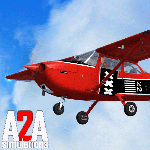
Repaint of PH-EAM formerly based at Schiphol East ( EHAM ) hence the registration , for A2A's C172R trainer . I have also included DDS 32bit textures for owners of more powerful computers as an extra , the texture file is DXT5 as standard . Visit the A2A forums for information on alternative panel and interior colours .
| Filename: | Cessna_C172R_PHEAM.zip |
| License: | Freeware |
| Added: | 15th October 2013, 09:54:06 |
| Downloads: | 123 |
| Author: | John Glanville / A2A |
| Size: | 50.66 MB |
| Category: Flight Simulator 2004 - Scenery | |
| OASG - Sheberghan Airfield - Jowzjan, Afghanistan |
|
File Description:
Sheberghan Airfield (ICAO: OASG) is located in the Jowzjan Province in the northwest part of Afghanistan. The airfield is located in a plain adjacent to a river, 17 nautical miles (31 km) northeast of Sheberghan, 12 nautical miles (22 km) west of Aqchah, and 40 nautical miles (74 km) east of Andkhoy.
| Filename: | OASG__Sheberghan_Airfield__Jowzjan_Afghanistan.zip |
| License: | Freeware |
| Added: | 11th November 2014, 18:02:50 |
| Downloads: | 273 |
| Author: | Billy Guo |
| Size: | 222.96 KB |
| Category: Flight Simulator X - Aircraft Repaints, Textures and Modifications | |
| "Blue and white" Piper PA-28-181 Archer II (ZS-LVX) |
|
Images related to this file:
File Description:
FSX blue and white Piper PA-28-181 Archer II ZS-LVX textures.
Based on the real world Border Aviation Club Archer II ZS-LVX at East London Airport
in South Africa. For the payware Carenado Archer II for FSX, which you must
have previously installed in FSX. Repaint by Tom Tiedman.
| Filename: | Blue_and_white_Piper_PA28181_Archer_II_ZSLVX.zip |
| License: | Freeware |
| Added: | 8th January 2016, 12:44:36 |
| Downloads: | 187 |
| Author: | Tom Tiedman / Carenado |
| Size: | 63.79 MB |
| Category: Flight Simulator 2004 - Scenery Design | |
| FS2004 Toll Booth And Park Headquarters Macros |
|
File Description:
Fs2004 Scenery Design Macros
From Bobs Hangar, Park Headquarters macro and Toll
Booth macro. These macros are typical macros such as you
see at many national parks. These were made from digital
photos taken at Saguaro National Park East, Tucson AZ.
Highly detailed macros created using Matthias Breuckner's
EOD, Easy Object Designer.
| Filename: | FS2004_Toll_Booth_And_Park_Headquarters_Macros.zip |
| License: | Freeware, limited distribution |
| Added: | 19th November 2003, 01:37:42 |
| Downloads: | 825 |
| Author: | Robert Palmer |
| Size: | 448.78 KB |
| Category: Flight Simulator 2004 - Scenery | |
| Ste Lucie-de-Beauregard Airfield & Scenery === Québec Short Hops |
|
File Description:
Ste Lucie-de-Beauregard is situated in the beautiful Beauce region of Québec, South-East of Montmagny almost on the border with the US. You will find a cozy airfield, Jerry in his cantine making all that good greasy non fatening stuff, a couple fishing and a nice traditional covered wood bridge.
| Filename: | Ste_LuciedeBeauregard__Airfield__Scenery__Qubec_Sh.zip |
| License: | Freeware |
| Added: | 13th December 2003, 06:09:27 |
| Downloads: | 2,000 |
| Author: | .Léon Louis |
| Size: | 3.29 MB |
| Category: Prepar3D V1-4 - Scenery | |
| Andado Cattle Airstrip, Northern Territory. |
|
Images related to this file:
File Description:
Andado is the largest privately owned cattle station, supported by the dirt airstrip of 1100m, located in Northern Territory, Australia. The closest town with air-service is Alice Springs, 150 miles to the north-east. Included in the scenery is a photo-real base, custom runway edge models and surrounding auto-gen.
| Filename: | Andado_Cattle_Airstrip_Northern_Territory.zip |
| License: | Freeware |
| Added: | 11th September 2019, 01:05:08 |
| Downloads: | 324 |
| Author: | Pheonix Taylor |
| Size: | 4.28 MB |


© 2001-2026 AVSIM Online
All Rights Reserved
Privacy Policy |