
Where Flight Simulation Enthusiasts Gather from Around the World!
AVSIM Library - Search Results

| Category: Flight Simulator 2004 - Aircraft Repaints, Textures and Modifications | |
| US Airways "Pittsburgh Steelers" Airbus A319-112 (N733UW) |

|
Images related to this file:
File Description:

US Airways is a major U.S. airline owned by the US Airways Group, headquartered in Tempe, Arizona. It operates an extensive international and domestic network, with 198 destinations throughout North America, South America, Europe, and the Middle East. The airline is a member of the Star Alliance Network and utilizes a fleet of 346 mainline jet aircraft and 285 regional jet and turbo-prop aircraft. The carrier operates the US Airways Shuttle, a US Airways brand which provides hourly service between Boston, New York and Washington, D.C. Regional airline service is branded as US Airways Express, operated by contract and subsidiary airline companies. American Airlines and US Airways announced plans to merge, creating the largest airline in the world.
US Airways P.S. livery is painted on Project Airbus's Airbus A319-112 model (included). The textures are saved in 32bit format for quality graphics. Textures are also characterized by HD (High Definition). Its features are idle-reverser animation, animated pack vents and pressurisation outflow valve, detailed textures, accurate paint, dynamic shine & effects, dynamic flexing wings that respond to turbulence, fully independent suspension, trim animation, gear steering, accurate flight dynamics, spoiler animation, reflective cockpit windows, improved wingflex code with input from several new parameters including ground spoilers, fuel load, and angle of attack, transparent navigation light lenses and many more. Visit my facebook page "Aviation Art Paintings by Giacomo Tomasini" for news, updates and previews on my future repaint projects: https://www.facebook.com/AviationArtPaintings . Thanks for downloading & Happy flying.
| Filename: | US_Airways_Pittsburgh_Steelers_Airbus_A319112_N733.zip |
| License: | Freeware |
| Added: | 24th October 2013, 19:29:25 |
| Downloads: | 692 |
| Author: | Giacomo Tomasini | Aviation Art Paintings |
| Size: | 21.54 MB |
| Category: Flight Simulator X - Scenery | |
| YMBE Mooliabeenie Siding, Western Australia (closed) |
|
File Description:
YMBE Mooliabeenie Siding is a disused 1,500 m (4,900 ft) long satelite airstrip which was used by the United States Army Air Corps during World War II and associated with the Caversham Airfield at Middle Swan. Like the Caversham Airfield, the Mooliabeenee Airfield was later used an auto racetrack. Local car clubs regularly use the site for motorkhana events. REQUIRES Blencowe_LibraryKit.zip
REQUIRES blencowe_librarykit_309494.zip (Available HERE)
| Filename: | YMBE_Mooliabeenie_Siding_Western_Australia_closed.zip |
| License: | Freeware |
| Added: | 28th February 2013, 13:56:01 |
| Downloads: | 195 |
| Author: | Alan Blencowe |
| Size: | 5.98 MB |
| Category: Flight Simulator 2004 - Aircraft Repaints, Textures and Modifications | |
| DCC`s P-38H Lightning |
|
File Description:
This is a repaint of the FS9 DC-3 in my virtue airlines "Yankee Air" and I have included the NEW prop textures that are avaliable for download here at AVSIM,these have just the yellow tips instead of the yucky blue in the middle of the prop, to say the least these are much, much better.
These were done by Trev Morson at "The DC-3 Hangar" at http://douglasdc3.com, thank you Trev for the great add on.
| Filename: | DCCs_P38H_Lightning.zip |
| License: | Freeware |
| Added: | 15th October 2003, 04:56:09 |
| Downloads: | 232 |
| Author: | Yankee Troup |
| Size: | 173.75 KB |
| Category: Flight Simulator 2004 - Aircraft Repaints, Textures and Modifications | |
| Hellenic Navy Air Force, Sopwith Pup |
|
File Description:
The Sopwith Pup was a British rotary-engined fighter of the middle period of WWI. The 'ÍáõôéêÞ ÁåñïðïñéêÞ Õðçñåóßá' (N.A.Y./ Hellenic Navy Air Force) received, during 1917, four planes of this type and, based on Moudro's Airport, they were the first Hellenic fighters used over the Aegean Sea.
Texture set only for an aircraft belonged to the N.A.Y. during the period 1917/18. These textures require the original FS9 Sopwith Pup package by Stephen O'Leary. Repaint by Manuele Villa, February 2008.
| Filename: | Hellenic_Navy_Air_Force_Sopwith_Pup.zip |
| License: | Freeware |
| Added: | 19th February 2008, 09:44:08 |
| Downloads: | 146 |
| Author: | Manuele Villa |
| Size: | 664.12 KB |
| Category: Flight Simulator 2004 - Flight Plans | |
| Kish Air flightplans - and More |
|
File Description:
This is a bunch of flightplans made either by me (African Express, Best Air Bangladesh, Flying Carpet and Marsland Aviation) or by Matthew Ministry. Use some, or all, as you wish.
The plans are Winter 08 schedules for : Air Arabia. Aegean. African Express. Best Air Bangladesh. Caspian. Flying Carpet - Lebanon. Iran Air Tours. Kish Air. Marsland Aviation. Arik Air Niger. Phoebus Apollo opf Mistral. Shaheen Air. Siam General Aviation Co. Saratov. Sudan Airways. Yakutia. Tatarstan. Tajikair. United Airways Bangladesh. Windrose Aviation.
Some schedules are "thin", the Russian carriers, Shaheen and Windrose in particular. The others are better. Kish Air is listed as Winter 08 but is in fact a hybrid of summer data and some winter flights. Kish Air also operates most of the Windrose fleet at present, and one aircraft from UM Air.
There are notes to accompany the plans with some idea of how confident we are with the source data.
| Filename: | Kish_Air_flightplans__and_More.zip |
| License: | Freeware |
| Added: | 28th December 2008, 19:42:33 |
| Downloads: | 1,005 |
| Author: | Morello Ciliegia |
| Size: | 89.8 KB |
| Category: Prepar3D V1-4 - Aircraft Repaints, Textures and Modifications | |
| Lockheed L-049 Constellation (5Y-ABF) Britair |
|
Images related to this file:
File Description:
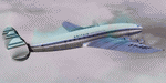
This folder contains two repaints for the A2A Lockheed L049 Constellation in the colors of 5Y-ABF of Britair. British East Africa Airways was formed by Captain Marian Kozubski in November 1964, formerly owner of Falcon Airways, as a charter company to operate IT charters from Europe to East Africa. One L-049 (G-AHEL) was bought from Euravia and registered 5Y-ABF. It operated every thee weeks on schedules from Rotterdam to Nairobi and Mombasa via Malta staring 20 December 1964. A fleet of four 049's were planned, but the airline suspended operations at the end of the summer of 1965, and only operated that aircraft. 5Y-ABF was finally scrapped in Shannon in 1966. Repaint by Jan Kees Blom, based on the paintkit by A2A.
| Filename: | Lockheed_L049_Constellation_5YABF_Britair.zip |
| License: | Freeware |
| Added: | 9th December 2018, 17:05:26 |
| Downloads: | 118 |
| Author: | Jan Kees Blom |
| Size: | 19.73 MB |
| Category: Prepar3D V1-4 - Aircraft Repaints, Textures and Modifications | |
| Lockheed L-049 Constellation (G-AHEL) |
|
Images related to this file:
File Description:
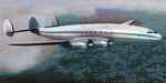
This folder contains two repaints for the A2A Lockheed L049 Constellation in the colors of G-AHEL, before it went to Britair. British East Africa Airways was formed by Captain Marian Kozubski in November 1964, formerly owner of Falcon Airways, as a charter company to operate IT charters from Europe to East Africa. One L-049 (G-AHEL) was bought from Euravia and registered 5Y-ABF. It operated every thee weeks on schedules from Rotterdam to Nairobi and Mombasa via Malta staring 20 December 1964. A fleet of four 049's were planned, but the airline suspended operations at the end of the summer of 1965, and only operated that aircraft. 5Y-ABF/G-AHEL was finally scrapped in Shannon in 1966. Repaint by Jan Kees Blom, based on the paintkit by A2A.
| Filename: | Lockheed_L049_Constellation_GAHEL.zip |
| License: | Freeware |
| Added: | 9th December 2018, 17:05:35 |
| Downloads: | 145 |
| Author: | Jan Kees Blom |
| Size: | 20.9 MB |
| Category: Flight Simulator 2004 - AI Flight Plans | |
| Russian Charters Summer 2005 |
|
File Description:
Flightplans Russian Charters Aircompany on Summer 2005. The complete set includes schedules of the leading Russian airlines specializing on charter aviatransportations: VIM Airlines, Russian Sky Airlines (Ex East Line), VASO Airlines, Continental Airways, Atlant-Soyuz Airlines, Airlines 400.
| Filename: | Russian_Charters_Summer_2005.zip |
| License: | Freeware |
| Added: | 3rd September 2005, 15:46:09 |
| Downloads: | 2,207 |
| Author: | Denis Gromov aka DEN SU817 |
| Size: | 90.98 KB |
| Category: Prepar3D V1-4 - Scenery | |
| SDOB - FAZENDA SÃO JOSÉ ´´OB`` |
|
Images related to this file:
File Description:
P3Dv4.5 - FAZENDA SÃO JOSÉ ´´OB``, ICAO: SDOB
Version 1.0
by Eduardo Puelker
General information
Coordinates: S21°25'31" - W46°45'16".
Elevation is 2634 feet MSL.
Magnetic variation is -21° East.
This scenario was only tested on P3Dv4.5.
| Filename: | SDOB__FAZENDA_SO_JOS_OB.zip |
| License: | Freeware |
| Added: | 13th March 2023, 20:43:05 |
| Downloads: | 92 |
| Author: | Eduardo Puelker |
| Size: | 11.53 MB |
| Category: Flight Simulator X - Scenery | |
| USA Landclass Vegetation Part I ** UPDATE ** |
|
Images related to this file:
File Description:
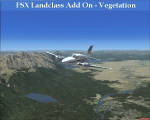
UPDATE:
Some small Cities, the Area around KAOC, Uinta Mountains.
Landclass Improvements for the USA, specialy the western Part of the USA:
Colorado, Yellow Stone, Little Part of Idaho, Montana and from LA to Seattle, also some Testscenery's for the eastern Part of the USA.
Compatible with Ultimate Terrain.
The LC Scenery's are for further devolpment, including the *.inf & *raw files of the folder USA_SBX1.
| Filename: | USA_Landclass_Vegetation_Part_I____UPDATE_.zip |
| License: | Freeware |
| Added: | 13th February 2015, 10:02:54 |
| Downloads: | 613 |
| Author: | Markus Balz |
| Size: | 4.56 MB |


© 2001-2026 AVSIM Online
All Rights Reserved
Privacy Policy |