
Where Flight Simulation Enthusiasts Gather from Around the World!
AVSIM Library - Search Results

| Category: Flight Simulator 2004 - Scenery | |
| Phoenix, Arizona 30 Meter Terrain Mesh Scenery |

|
File Description:
Mesh Scenery for Microsoft Flight Simulator 2004 and 2002.USGS NED 30 meter (1 arc-second), resampled to LOD10 (38.2 meters). This terrain mesh is centered at Phoenix, Arizona. Coverage area: From about West 111° to West 113° and North 33° to North 34°.
| Filename: | Phoenix_Arizona_30_Meter_Terrain_Mesh_Scenery.zip |
| License: | Freeware |
| Added: | 3rd January 2004, 19:53:36 |
| Downloads: | 3,718 |
| Author: | Phil Cruikshank |
| Size: | 4.66 MB |
| Category: Fly! II - Scenery | |
| Austria Mesh West |
|
File Description:
Elevation mesh based on 3° SRTM elevation-data from 46°N 09°E to 49°N 14°E. The Area around my Austrian Airports is manually corrected.
| Filename: | Austria_Mesh_West.zip |
| License: | Freeware |
| Added: | 14th January 2004, 20:21:21 |
| Downloads: | 461 |
| Author: | Harald Kraft |
| Size: | 6.49 MB |
| Category: Flight Simulator 2004 - Scenery Design | |
| FSDEM 1.1 |
|
File Description:
FSDEM is a graphical tool designed to help on the editing and correction of NASA SRTM (Shuttle Radar Topography Mission) terrain elevation meshes, and to create terrain mesh scenery to be used in Microsoft Flight Simulator 2002/2004.
Program main features:
This version fixes some bugs and adds minor improvements. See the included file history.htm for details.
| Filename: | FSDEM_11.zip |
| License: | Freeware, limited distribution |
| Added: | 4th August 2004, 20:51:02 |
| Downloads: | 5,125 |
| Author: | Emerson de Oliveira |
| Size: | 377.03 KB |
| Category: Flight Simulator 2004 - Aircraft Repaints, Textures and Modifications | |
| Middle East Airlines Boeing 707 |
|
File Description:
Middle East Airlines (MEA),with the logo they now have on their airbus, MEA never had its 707s with these colors, registration OD-AFE, part of the Lebanon Ultimate Collection for the Captain Sim Legendary B707
| Filename: | Middle_East_Airlines_Boeing_707.zip |
| License: | Freeware, limited distribution |
| Added: | 9th September 2005, 03:50:24 |
| Downloads: | 500 |
| Author: | Jad Abizeid, LEBOR / Captain Sim |
| Size: | 1.6 MB |
| Category: Flight Simulator X - Scenery | |
| Mesh for Northern Africa, Base Grid 0603 - Part 1 |
|
Images related to this file:
File Description:
Highly detailed 76m SRTM mesh for Africa using the latest release of STRM Data V2.1. This file covers the Africa Area of base file 0603 (N01 and E00), North of the Equator. You need to download all two parts to restore the mesh bgl file. DO NOT DISABLE THE DEFAULT DEM 603 FILE.
| Filename: | Mesh_for_Northern_Africa_Base_Grid_0603__Part_1.zip |
| License: | Freeware |
| Added: | 8th February 2014, 22:03:34 |
| Downloads: | 2,529 |
| Author: | Martin du Preez, Hannes Steyn, Aeroworx |
| Size: | 307.22 MB |
| Category: Flight Simulator X - Scenery | |
| Mesh for Northern Africa, Base Grid 0603 - Part 2 |
|
Images related to this file:
File Description:

Highly detailed 76m SRTM mesh for Africa using the latest release of STRM Data V2.1. This file covers the Africa Area of base file 0603 (N01 and E00), North of the Equator. You need to download all two parts to restore the mesh bgl file. DO NOT DISABLE THE DEFAULT DEM 603 FILE.
| Filename: | Mesh_for_Northern_Africa_Base_Grid_0603__Part_2.zip |
| License: | Freeware |
| Added: | 8th February 2014, 22:03:46 |
| Downloads: | 2,156 |
| Author: | Martin du Preez, Hannes Steyn, Aeroworx |
| Size: | 296.72 MB |
| Category: Flight Simulator 2004 - Scenery | |
| Azores Islands SRTM Terrain Mesh Fix for Sao Miguel Island Lakes |
|
File Description:
A set of flatten files that corrects the elevation of the five lakes on Sao Miguel island to make them fit better into Andreas Trawny's Azores mesh terrain.
| Filename: | Azores_Islands_SRTM_Terrain_Mesh_Fix_for_Sao_Migue.zip |
| License: | Freeware |
| Added: | 7th June 2004, 22:33:24 |
| Downloads: | 3,613 |
| Author: | Thomas Klink |
| Size: | 2.71 KB |
| Category: Flight Simulator 2004 - Scenery | |
| Turkey Mesh SRTM V2, Part II |
|
Images related to this file:
File Description:
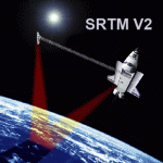
SRTM Version 2 is the result of a substantial editing effort by the National Geospatial Intelligence Agency and exhibits well-defined water bodies and coastlines and the absence of spikes and wells.
| Filename: | Turkey_Mesh_SRTM_V2_Part_II.zip |
| License: | Freeware |
| Added: | 25th January 2011, 14:32:45 |
| Downloads: | 2,882 |
| Author: | Tuncer Celik |
| Size: | 79.06 MB |
| Category: Flight Simulator 2004 - Scenery | |
| Turkey Mesh SRTM V2, Part I |
|
Images related to this file:
File Description:

SRTM Version 2 is the result of a substantial editing effort by the National Geospatial Intelligence Agency and exhibits well-defined water bodies and coastlines and the absence of spikes and wells.
| Filename: | Turkey_Mesh_SRTM_V2_Part_I.zip |
| License: | Freeware |
| Added: | 25th January 2011, 14:32:24 |
| Downloads: | 3,444 |
| Author: | Tuncer Celik |
| Size: | 88.4 MB |
| Category: Flight Simulator 2004 - Scenery | |
| Chin Mon & Matsu Island SRTM Mesh |
|
File Description:
Patch up two missing islands mesh, ChinMon & Matsu, for Stefan Braunewell's Taiwan Mesh (AVSIM, taiwanmesh.zip).
It is inculding 3 global tiles: N24E118, N26E119, and N26E120.
| Filename: | Chin_Mon__Matsu_Island_SRTM_Mesh.zip |
| License: | Freeware |
| Added: | 6th January 2004, 23:00:09 |
| Downloads: | 2,759 |
| Author: | Rudolf Liu |
| Size: | 2.35 MB |
© 2001-2026 AVSIM Online
All Rights Reserved
Privacy Policy |