
Where Flight Simulation Enthusiasts Gather from Around the World!
AVSIM Library - Search Results

| Category: Flight Simulator X - Scenery | |
| Detailed Terrain Features for Southern Africa, Update 7 |

|
Images related to this file:
File Description:
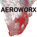
Scenery consist of Updated Terrain Vector data concerning Coastlines, rivers, dams, streams, roads, traffic, railroads, power lines and extrusion bridges for Southern Africa countries South of the Equator. A few minor changes was done to the vector data around Moogkgophong and Inhambane were updated by utilizing Satellite image backgrounds. This scenery is important and will be needed with release of Inhambane Airport and Flamingo Bay Resort by Aeroworx. Important to install the previous release fsxWorx01 and updates 1 to 6 before this file.
| Filename: | Detailed_Terrain_Features_for_Southern_Africa_Upda.zip |
| License: | Freeware |
| Added: | 19th September 2013, 21:31:13 |
| Downloads: | 2,809 |
| Author: | Hannes Steyn / Aeroworx |
| Size: | 4.51 MB |
| Category: Flight Simulator X - Scenery | |
| Detailed Terrain Features for Southern Africa, Update 5 |
|
Images related to this file:
File Description:
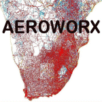
Scenery consists of Updated Terrain Vector data concerning Coastlines, rivers, dams, streams, roads, traffic, railroads, power lines and extrusion bridges for Southern Africa countries South of the Equator. The data around Kroonstad, Welkom, Kitty Hawk Aerodrome, Middelburg, Ermelo (South Africa) and smaller detail in other parts of Africa was updated by utilizing Satellite image backgrounds. This scenery is important and will be needed with release of future scenery by Aeroworx. Please install the previous release fsxWorx01 and updates 1 to 4 before this file.
| Filename: | Detailed_Terrain_Features_for_Southern_Africa_Upda.zip |
| License: | Freeware |
| Added: | 12th April 2013, 20:29:01 |
| Downloads: | 3,336 |
| Author: | Hannes Steyn, Aeroworx |
| Size: | 7.18 MB |
| Category: Flight Simulator X - Scenery | |
| Detailed Terrain Features for Southern Africa, Update 3 |
|
Images related to this file:
File Description:
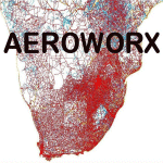
Scenery consist of Updated Terrain Vector data concerning Coastlines, rivers, dams, streams, roads, traffic, railroads, power lines and extrusion bridges for Southern Africa countries South of the Equator. The Bree River, Robertson, Arnot, Witbank, Middelburg (South Africa) and Areas around Beira (Mozambique) was updated by utilizing Satellite image backgrounds.
This scenery is important and will be needed with release of future scenery by Aeroworx. Please install the previous release fsxWorx01.zip and updates before this file.
| Filename: | Detailed_Terrain_Features_for_Southern_Africa_Upda.zip |
| License: | Freeware |
| Added: | 2nd December 2012, 18:47:40 |
| Downloads: | 4,192 |
| Author: | Hannes Steyn, Aeroworx |
| Size: | 7.92 MB |
| Category: Flight Simulator X - Scenery | |
| Detailed Terrain Features for Southern Africa, Update 4 |
|
Images related to this file:
File Description:

Scenery consists of Updated Terrain Vector data concerning Coastlines, rivers, dams, streams, roads, traffic, railroads, power lines and extrusion bridges for Southern Africa countries South of the Equator. The Zambezi River and Areas around Arnot, Ermelo (South Africa) was updated by utilizing Satellite image backgrounds. This scenery is important and will be needed with release of future scenery by Aeroworx. Please install the previous release fsxWorx01.zip and updates before this file.
| Filename: | Detailed_Terrain_Features_for_Southern_Africa_Upda.zip |
| License: | Freeware |
| Added: | 27th January 2013, 18:39:21 |
| Downloads: | 3,807 |
| Author: | Hannes Steyn, Aeroworx |
| Size: | 9.84 MB |
| Category: Flight Simulator X - Scenery | |
| Detailed Terrain Features for Southern Africa, Update 10 |
|
Images related to this file:
File Description:
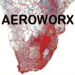
Scenery consist of Updated Terrain Vector data concerning Coastlines, rivers, dams, lakes, streams, roads, traffic, railroads, power lines and extrusion bridges for Southern African countries South of the Equator. Work was done around FAVG (Virginia), FALL (Lydenburg) Airfields and in the areas around Durban, Western Cape and Eastern Cape, With this scenery it is important to install the previous release of "fsxWorx01" and updates 1 to 9 before this file.
| Filename: | Detailed_Terrain_Features_for_Southern_Africa_Upda.zip |
| License: | Freeware |
| Added: | 25th May 2014, 13:07:44 |
| Downloads: | 2,825 |
| Author: | Hannes Steyn, Aeroworx |
| Size: | 4.72 MB |
| Category: Flight Simulator 2004 - Scenery | |
| Alaska South Slope 7; Kobuk OBU & Dahl Creek DCK |
|
Images related to this file:
File Description:
There are four main northwestern Alaska towns which are serviced by Alaska Airlines, and from which local flights spread out. The northernmost is Barrow. Southwest of Barrow is Kotzebue, then Nome, and the furthest south is Bethel (not yet made). This is a continuation of the series for the flights from Kotzebue, 170 miles to the east where Kobuk is on the bank of the Kobuk River, and Dahl Creek is 2 miles to the north. Kobuk is a small village on the Kobuk River, like Ambler and Shungnak, but with a population of only around 150. The river is the reason for the existance of the villages as it served (and still does) as both a source of food and a transport route. The airfield is just beside the village, with a runway around 4,500 feet of lit gravel and aligned 09-27, with PAPI on both ends. There are scheduled flights by Era (now renamed Ravn) and by Bering Air, both of them originating in Kotzebue and routing east to Ambler, Shungnak, Kobuk, and then back again. The AI includes these flights along with Everts Air and GA. The FS9 airfield has been relocated by approximately a mile to the correct position, and the elevation accordingly adjusted. The Dahl Creek strip is publicly owned, with no maintenance and a deteriorating gravel runway that has not long to survive. This probably does not work properly without Ultimate Terrain Alaska Canada as the village is now on the river bank. I am presuming that you have downloaded and installed Nome PAOM, along with the instructions on how to adjust Ultimate Terrain Alaska Canada to get the most realistic results. If you are not making the UT adjustments then you may be seeing duplicated roads, as I am including new local dirt or gravel roads to connect village to airfield etc to get the best overall result; I will not be making alternate versions.
| Filename: | Alaska_South_Slope_7_Kobuk_OBU__Dahl_Creek_DCK.zip |
| License: | Freeware, limited distribution |
| Added: | 13th October 2016, 18:10:08 |
| Downloads: | 235 |
| Author: | Roger Wensley |
| Size: | 2.94 MB |
| Category: Flight Simulator 2004 - Scenery | |
| Flymex Aftershave - Norte FIX |
|
File Description:
This patch will fix a memory leak caused by landclass, a visible apron in Mexicali AFCAD, MMAN terrain textures were updated and add missing default ATC approaches. PRIOR TO THIS PATCH YOU NEED TO HAVE INSTALLED "FLYMEX AFTERSHAVE NORTE"
| Filename: | Flymex_Aftershave__Norte_FIX.zip |
| License: | Check within download |
| Added: | 3rd March 2010, 03:43:03 |
| Downloads: | 1,687 |
| Author: | Angel Salazar Estrada |
| Size: | 4.43 MB |
| Category: Flight Simulator 2004 - Scenery | |
| LPCB Castelo Branco, Portugal |
|
File Description:
Castelo Branco Aeroclub ULM certified runway. Based on digital pictures I took at the place. This airfield have a lot of activity during weekends and holidays. This scenery is to be used with freeware PTSIM Portugal Terrain (http://www.ptsim.com).
| Filename: | LPCB_Castelo_Branco_Portugal.zip |
| License: | Freeware |
| Added: | 11th December 2009, 12:23:47 |
| Downloads: | 706 |
| Author: | Joao A. Graca Ferreira |
| Size: | 1.54 MB |
| Category: Flight Simulator 2002 - Scenery | |
| Drakelow Power Station |
|
File Description:
Drakelow Power Station, Burton on Trent. A well known landmark to the west of East Midlands Airport (UK).
| Filename: | Drakelow_Power_Station.zip |
| License: | Freeware |
| Added: | 9th February 2003, 12:57:06 |
| Downloads: | 1,736 |
| Author: | Kim Humphreys |
| Size: | 139.22 KB |
| Category: Flight Simulator 2004 - Scenery | |
| Suisse Wangen-Lachen |
|
File Description:
A small airfield East of Switzerland, South of Zurich. Over there, the problem is simple : Fly or Swim!
| Filename: | Suisse_WangenLachen.zip |
| License: | Freeware, limited distribution |
| Added: | 18th October 2003, 17:41:13 |
| Downloads: | 5,872 |
| Author: | Daniel Gauthier |
| Size: | 2.39 MB |


© 2001-2026 AVSIM Online
All Rights Reserved
Privacy Policy |