
Where Flight Simulation Enthusiasts Gather from Around the World!
AVSIM Library - Search Results

| Category: Flight Simulator X - Scenery | |
| Mesh South America / MeSA E03 |

|
File Description:
FSX Mesh South America Project:
This terrain mesh file is a part of a whole project covering all the Continent
of South America and some islands, divided in tiles identified in a map by its
column (letters) and rows (numbers).
Those files were multi-LOD compiled from 90m SRTM2 source data, reprocessed
with 3DEM to remove voids and spikes, providing a 76.4m (LOD9) horizontal
resolution topography intended for use only in FSX updated with SP1.
Although not well documented, to improve performance, the updated FSX loads DEM
files in threads and only the closer terrain (about 5-10 NM from the point of view)
is rendered in high detail, while at far distances FSX shows up its default low
resolution mesh, when there is not a third part terrain mesh compiled in all
others intermediate level of details (multi-LOD).
THIS FILE:
FSX_MeSA_E03 (Column E x Row 03)
covers the area inside the boundaries:
N = 5º 37,5' N; S = 0º 0' S;
W = 60º 0' W; E = 52º 30' W;
| Filename: | Mesh_South_America__MeSA_E03.zip |
| License: | Freeware |
| Added: | 13th June 2007, 21:41:26 |
| Downloads: | 1,256 |
| Author: | Hely Heck Jr. and José Lôbo |
| Size: | 83.82 MB |
| Category: Flight Simulator X - Scenery | |
| FSX_MeSA_G08 |
|
File Description:
FSX Mesh South America Project:
This terrain mesh file is a part of a whole project covering all the Continent
of South America and some islands, divided in tiles identified in a map by its
column (letters) and rows (numbers).
Those files were multi-LOD compiled from 90m SRTM2 source data, reprocessed
with 3DEM to remove voids and spikes, providing a 76.4m (LOD9) horizontal
resolution topography intended for use only in FSX updated with SP1.
Although not well documented, to improve performance, the updated FSX loads DEM
files in threads and only the closer terrain (about 5-10 NM from the point of view)
is rendered in high detail, while at far distances FSX shows up its default low
resolution mesh, when there is not a third part terrain mesh compiled in all
others intermediate level of details (multi-LOD).
THIS FILE:
FSX_MeSA_G08 (Column G x Row 08)
covers the area inside the boundaries:
N = 22º 30' S; S = 28º 7.5' S;
W = 45º 0' W; E = 37º 30' W;
AUTHORS:
Hely Heck Junior - Magrao ( [email protected] )
and Jose Lobo ( [email protected] )
| Filename: | FSX_MeSA_G08.zip |
| License: | Freeware |
| Added: | 15th June 2007, 15:04:47 |
| Downloads: | 1,138 |
| Author: | Hely Heck Jr. and José Lôbo |
| Size: | 12 MB |
| Category: Flight Simulator X - Scenery | |
| FSX_MeSA_H04 |
|
File Description:
FSX Mesh South America Project:
This terrain mesh file is a part of a whole project covering all the Continent
of South America and some islands, divided in tiles identified in a map by its
column (letters) and rows (numbers).
Those files were multi-LOD compiled from 90m SRTM2 source data, reprocessed
with 3DEM to remove voids and spikes, providing a 76.4m (LOD9) horizontal
resolution topography intended for use only in FSX updated with SP1.
Although not well documented, to improve performance, the updated FSX loads DEM
files in threads and only the closer terrain (about 5-10 NM from the point of view)
is rendered in high detail, while at far distances FSX shows up its default low
resolution mesh, when there is not a third part terrain mesh compiled in all
others intermediate level of details (multi-LOD).
THIS FILE:
FSX_MeSA_H04 (Column H x Row 04)
covers the area inside the boundaries:
N = 0º 0' S; S = 5º 37.5' S;
W = 37º 30' W; E = 30º 0' W;
AUTHORS:
Hely Heck Junior - Magrao ( [email protected] )
and Jose Lobo ( [email protected] )
| Filename: | FSX_MeSA_H04.zip |
| License: | Freeware |
| Added: | 15th June 2007, 15:07:51 |
| Downloads: | 946 |
| Author: | Hely Heck Jr. and José Lôbo |
| Size: | 3.56 MB |
| Category: Flight Simulator X - Scenery | |
| FSX_MeSA_H05 |
|
File Description:
FSX Mesh South America Project:
This terrain mesh file is a part of a whole project covering all the Continent
of South America and some islands, divided in tiles identified in a map by its
column (letters) and rows (numbers).
Those files were multi-LOD compiled from 90m SRTM2 source data, reprocessed
with 3DEM to remove voids and spikes, providing a 76.4m (LOD9) horizontal
resolution topography intended for use only in FSX updated with SP1.
Although not well documented, to improve performance, the updated FSX loads DEM
files in threads and only the closer terrain (about 5-10 NM from the point of view)
is rendered in high detail, while at far distances FSX shows up its default low
resolution mesh, when there is not a third part terrain mesh compiled in all
others intermediate level of details (multi-LOD).
THIS FILE:
FSX_MeSA_H05 (Column H x Row 05)
covers the area inside the boundaries:
N = 5º 37.5' S; S = 11º 15' S;
W = 37º 30' W; E = 30º 0' W;
AUTHORS:
Hely Heck Junior - Magrao ( [email protected] )
and Jose Lobo ( [email protected] )
| Filename: | FSX_MeSA_H05.zip |
| License: | Freeware |
| Added: | 15th June 2007, 15:08:10 |
| Downloads: | 945 |
| Author: | Hely Heck Jr. and José Lôbo |
| Size: | 22.93 MB |
| Category: Flight Simulator X - Scenery | |
| FSX_MeSA_H06 |
|
File Description:
FSX Mesh South America Project:
This terrain mesh file is a part of a whole project covering all the Continent
of South America and some islands, divided in tiles identified in a map by its
column (letters) and rows (numbers).
Those files were multi-LOD compiled from 90m SRTM2 source data, reprocessed
with 3DEM to remove voids and spikes, providing a 76.4m (LOD9) horizontal
resolution topography intended for use only in FSX updated with SP1.
Although not well documented, to improve performance, the updated FSX loads DEM
files in threads and only the closer terrain (about 5-10 NM from the point of view)
is rendered in high detail, while at far distances FSX shows up its default low
resolution mesh, when there is not a third part terrain mesh compiled in all
others intermediate level of details (multi-LOD).
THIS FILE:
FSX_MeSA_H06 (Column H x Row 06)
covers the area inside the boundaries:
N = 11º 15' S; S = 16º 52.5' S;
W = 37º 30' W; E = 30º 0' W;
AUTHORS:
Hely Heck Junior - Magrao ( [email protected] )
and Jose Lobo ( [email protected] )
| Filename: | FSX_MeSA_H06.zip |
| License: | Freeware |
| Added: | 15th June 2007, 15:19:51 |
| Downloads: | 998 |
| Author: | Hely Heck Jr. and José Lôbo |
| Size: | 1.61 MB |
| Category: Flight Simulator X - Flight Plans | |
| When The Land Trembles |
|
File Description:
At 8:46 A.M. a 6.2 in the Richter Scale Earthquake hit the western mountains of Guatemala, Central America.
Two Flight Routes have been set up by the Civil Defence and SAR authorities. They use
two airports to reconnoiter their respective areas. It has been reported that two mines
in the western Pine Mountains have been heavely hit and in Mine 1( Socrates Fer Coal Ltd ) there are some
wounded miners which must be picked up. Mine 2 (Ductil Ltd.Mine No.33) has been totally abandoned and
must be looked at for important documentation pertaining to security (?)
You can choose RED FLIGHT, where you will use a good transport aircraft, since you must pick up
the wounded and others---- or BLUE FLIGHT which is a " reconnaissance" flight out to a lake area and access
the damage as well as land and bring radio communications equipment to the communities.
Either way, this is dangerous stuff-----are your wits ready for such flying tasks?????----By the way, Dr. Lalita
Mazsis is counting on you to fly her safely....OH Boy!!!!!!!!------
| Filename: | When_The_Land_Trembles.zip |
| License: | Freeware, limited distribution |
| Added: | 19th October 2007, 21:11:11 |
| Downloads: | 675 |
| Author: | Gera Godoy C |
| Size: | 449.4 KB |
| Category: Flight Simulator 2004 - AI Aircraft | |
| TAM Airbus A330-200 / PT-MVG and PT-MVO |
|
File Description:
TAM is now known by "TAM Airlines". In the early of 2008, the company has changed its visual scheme, adding more curves and blue into the livery. Mostly focused over the Airbus A330-200 aircraft for the international market, the emprise is currently the flag carrier of Brazil aviation. The majority of these airplanes are powered by Pratt & Whitney engines, but there are some others using the General Eletric powerplant, wich are, also, the ones featuring the old and taller vertical stablizer. In this pack you will find textures for the A332 GE, old tail (PT-MVG) and the A332 PW, new tail (PT-MVO). Hand-made textures carefully compared to photographic sources, tailnumber along the fuselage and under/over the wings and more features are included in these Repaint-G DXT3 quality textures, with proper alpha channel on the lightmaps for correct illumination at night. TEXTURES ONLY for the The-Fruit-Stand A330-200 models. Conventional readme and "Read-G" included for very detailed instructions about installation.
| Filename: | TAM_Airbus_A330200__PTMVG_and_PTMVO.zip |
| License: | Freeware, limited distribution |
| Added: | 10th April 2009, 20:35:30 |
| Downloads: | 837 |
| Author: | Germano Sarmento Cavalcanti |
| Size: | 695.39 KB |
| Category: Flight Simulator 2004 - Original Aircraft | |
| Airtourer 115 'Miss Jacy' |
|
File Description:
Kiwis are a bird that can't fly -- but in 1969 Cliff Tait showed the world that one Kiwi could fly. Setting out as a one-man mission to publicize New Zealand to the world, Cliff and his New Zealand made plane ended up making history. No one had ever attempted to fly solo around the world in such a tiny one-engine plane before.
Cliff's book "Flight of the Kiwi" recounts every detail of the flight that captured the attention of the whole world. On the human side, it tells of the warm generosity of those that helped Cliff, especially the world-wide brotherhood of radio "hams" operators and of the maddening obstruction of others -- particularly the Russian officials who denied Cliff permission to land forcing him to break his flight. Above all, this is a stirring story of one man's bravery facing immense odds and winning. Visit Cliffs web site and read his history making book ... and now you can also download the aircraft (Miss Jacy) itself here or at http://www.flightofthekiwi.co.nz/
| Filename: | Airtourer_115_Miss_Jacy.zip |
| License: | Freeware, limited distribution |
| Added: | 18th March 2010, 09:03:11 |
| Downloads: | 498 |
| Author: | Frat Bros Design |
| Size: | 4.49 MB |
| Category: Flight Simulator 2004 - Scenery | |
| SPHZ Anta/Comandante German Arias Grazz, Peru |
|
Images related to this file:
File Description:
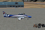
Googly scenery for SPHZ Anta/Comandante German Arias Grazz, Peru - a small
domestic airport for which nothing more than a runway is provided in Flight
Simulator 2004. These scenery files add the apron, taxiways, buildings and
other airport features so that you and your "AI" traffic can land, taxi, park
and take off in a realistic manner.
The airport is served daily by domestic operator L C Busre and perhaps also
others using small aircraft, but little information has been found on activity
in this area.
The scenery does not purport to be ultra-accurate. Based on high-detail satellite
imagery from Google Earth, the layout is proportionally correct but the added
airport features, such as buildings, are built from default Microsoft objects
and add-on libraries so will not look like the real thing.
You are not obliged to download and install any additional scenery libraries,
but to enjoy this scenery in its entirety, you may wish to. It will work fine,
with or without.
[File re-uploaded at request of AVSIM]
| Filename: | SPHZ_AntaComandante_German_Arias_Grazz_Peru.zip |
| License: | Freeware |
| Added: | 23rd May 2010, 01:24:24 |
| Downloads: | 1,224 |
| Author: | John Hinson |
| Size: | 65.15 KB |
| Category: Flight Simulator 2004 - AFCAD Files | |
| EGNM AFCAD v2.5 |
|
Images related to this file:
File Description: Can be used with the following on AVSIM:

Peter Slater's FS9 AFCAD for EGNM (2009 v2.5). This is the AFCAD (updated and tweaked) for:
Default Scenery Users (Default FS2004 Scenery)
EGNM Extreme Freeware Scenery Package v1.0 (Package by Peter Slater - found here on AVSIM)
UK2000 Part 7 (which includes EGNM) by Gary Summons
British Airports Vol.6 (which includes EGNM) by Justflight
BA and UK2000 AFCAD updated only but the v1 for the others are included. Please make sure you read the readme.txt before installing. You have the choice to configure which runway is used if not both (i.e. 14, 32 or both). By Peter Slater, uploaded by Gareth Abbott. Those who downloaded v2 please re-download this version. Visit his web site for his other projects at www.fsprojects.co.nr or search 'peter slater' here on AVSIM.
| Filename: | EGNM_AFCAD_v25.zip |
| License: | Freeware |
| Added: | 12th January 2012, 19:39:10 |
| Downloads: | 906 |
| Author: | Peter Slater, Gareth Abbott |
| Size: | 1.34 MB |


© 2001-2026 AVSIM Online
All Rights Reserved
Privacy Policy |